Rivers

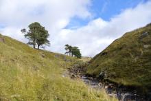
The world famous rivers Tyne, Wear and Tees all have the birthplace high in the North Pennines.

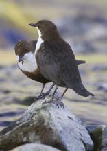
Our rivers are home to  otter, water vole, brown trout and Atlantic salmon. Birdlife found here includes dipper, common sandpiper, kingfisher and grey wagtail, with gossander where woodland provides opportunities for nesting.

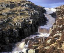
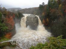
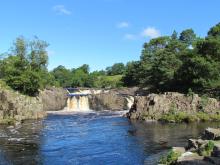
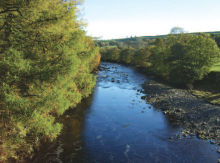
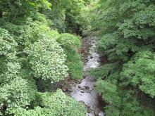
The rivers also have a diverse range of features, such as riffles, shingle banks and pools, which each support a range of plants and animals.  Several North Pennine rivers have attractive and sometimes dramatic waterfalls, notably High Force, Low Force, Cauldron Snout and Ashgill Force. As well as being of considerable geological interest, they make an important contribution to a sense of place and are popular places to visit.


Allen Banks & Staward Gorge: North Pennine Birdwalks - Walk 3
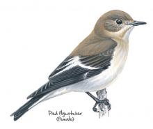
Pied flycatcher © NPAP
In spring and early summer the ancient woodland at Allen Banks and Staward Gorge bursts with the songs of birds such as the wood warbler and willow warbler, song thrush and wren. At quieter times of year these woods are still well worth a visit. In autumn the trees are a blaze of orange and yellow while rich clusters of fungi decorate the woodland floor. Even in winter, the activity of resident woodland birds provides a welcome contrast to the comparative quiet of the surrounding countryside.
Location:
The National Trust car park at Allen Banks and Staward Gorge (NY797641).
Distance:
5 km
Terrain:
Off road sections, Steep sections
Facilities nearby
Recreation opportunities:

Allendale: Hay Time Walk 1

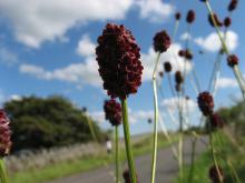
Great burnet © NPAP/Rebecca Barrett
Take a 2 hour walk around South Wooley Farm in Allendale and get close to one of the world’s rarest and most endangered habitats, Upland Hay Meadows. There are only about 11 square kilometres of upland hay meadows left in the whole of the UK. Just under half of these are here in the North Pennines Area of Oiutstanding Natural Beauty (AONB) and UNESCO Global Geopark. This walk takes you along country lanes and public footpaths through, or alongside, several hay meadows on the farm. Please keep to the paths, leave gates as you find them and keep dogs under close control, preferably on a short lead.
Location:
Starting from the car park in Allendale Town (NY837558).
Distance:
5 km
Terrain:
Boggy ground, Off road sections, On road sections
Recreation opportunities:

Allenheads Geotrail

Above Allenheads © NPAP
The landscape around Allenheads has been over 300 million years in the making. From tropical seas and deltas to minerals and miners – all have played their part in shaping this beautiful landscape. This 5km circular walk will introduce you to some of the special features of the landscape around Allenheads. By spotting clues in the moors, fields and buildings you’ll find out how to read the landscape and discover more about its fascinating past.
Location:
Starting from Allenheads car park (NY859453 / NE47 9HJ) in the East Allen Valley.
Distance:
5 km
Terrain:
Boggy ground, Off road sections, On road sections
Facilities nearby
Recreation opportunities:

Alston Training and Adventure Centre

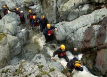
The Alston Training and Adventure Centre is a family run centre offering a range of options from a full package of outdoor activities based at our residential centre. These are led by our highly skilled, experienced and qualified staff and are ideal for school and youth groups. The vast majority of the activities are carried out in the natural environment of the North Pennines. These activities include climbing, abseiling, canoeing, mine exploration, gorge walking, problem solving and team building. Alston Training and Adventure Centre offer facilities for ski hire and accommodation for those travelling further and wishing to stay for a weekend or mid-week break when the slopes are open. We stock a range of skies from children’s (100) to adult (190) These can be hired on a daily or weekend basis. We also offer accommodation only for groups who wish to carry out their own programme of activities be it a mine exploration group, university canoe club or a walking group wishing to explore new areas. The centre is also highly popular for cyclists on the C2C route and walkers on the Pennine Way.
Location:
Garrigill, Alston

Ashgill Force Waterfall

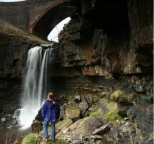
Ashgill Force © NPAP/K. Gibson
This spectacular waterfall is reached by footpath from Ashgill Bridge and is well worth the short walk down into the wooded gorge. Framed by the soaring arch of the bridge, peaty water tumbles over a lip of hard limestone. Under the limestone are black shales and thin sandstone beds which are easily eroded away by the water. This causes undercutting of the limestone, which will eventually break off. Over thousands of years this as happened many times causing the waterfall to move upstream, creating a gorge as it goes.
Location:
The waterfall can be accessed from a path from Ashgill bridge on the B 6277. Alternatively you can follow the South Tyne Trail from Garrigill.
Terrain:
Boggy ground, Off road sections, Steep sections
Facilities nearby
Recreation opportunities:
Interests:

Baybridge Picnic Area

The River Derwent runs alongside this small picnic area. The river used to be the boundary between County Durham and Northumberland. Hundreds of years ago the river changed its course but the boundary stayed the same and this is why the picnic site, although north of the river, belongs to Durham County Council. The sound of the flowing water is very peaceful and this is a nice place to stop and have a picnic. While sitting, look out for dippers and kingfishers by the water and buzzards flying overhead. Baybridge is an ideal starting point for local walks. Within easy reach are moorland walks, woodland walks through places such as Deborah Wood and Gibraltar, wonderful riverside walks to Derwent Reservoir and an easy access route to the historic village of Blanchland.
Location:
Baybridge is located near the B6306 near Blanchland. From Blanchland head west for 0.5 mile. The site is signposted from the road. The nearest postcode for GPS navigation is DH8 9UB,
Access:
Recreation opportunities:
Interests:

Blackton Reservoir: North Pennine Birdwalks - Walk 14
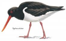
Oystercatcher © NPAP
The meadows, pastures and allotments of Baldersdale support large numbers of breeding waders which make an impressive sight during the spring and summer months. Like all areas of open water in the North Pennines, Blackton Reservoir also provides a refuge for wildfowl during the harsh winter months. This area is therefore worth a visit at any time of year.
Location:
Starting from the small car park at the road end (NY935176).
Distance:
6 km
Terrain:
Boggy ground, Off road sections, On road sections
Area:
Access:
Recreation opportunities:

Blanchland

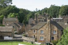
Blanchland © NPAP/Shane Harris
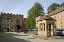
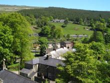
The small village of Blanchland, with its honey-coloured cottages, is perhaps the most attractive settlement in the North Pennines. Blanchland means 'white lands' - almost certainly a reference to the white habits (cloaks) of the Premonstratesian monks of the Abbey. The village has a tea room, shop, pub, childrens' playground and easy access walks.
Location:
Blanchland in the Upper Derwent Valley (NY966504).
Access:
Facilities nearby
Recreation opportunities:

Blanchland Geotrail

Blanchland © NPAP/Shane Harris
The landscape around Blanchland has been over 300 million years in the making. From tropical seas and deltas to glaciers, minerals and miners – all have played their part in shaping this beautiful landscape. This 6km circular walk will introduce you to some of the special features of the landscape around Blanchland. By spotting clues in the moors, fields and buildings you’ll find out how to ‘read’ the landscape and discover more about its fascinating past. The sections opposite give some background information about how the local rocks and minerals formed, and tell you a bit about the area’s mining heritage.
Location:
Starting from Blanchland car park (NY964504 / DH8 9TA - nearest).
Distance:
6 km
Terrain:
Boggy ground, Off road sections, On road sections, Steep sections
Recreation opportunities:

Blanchland: Along the river bank (A trail of three tails!)
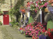
Blanchland in bloom © NPAP/Shane Harris
This short walk takes you from the village of Blanchland along the River Derwent to the hamlet of Baybridge and back. You'll walk back to Blanchland through lovely mixed woodlands and perhaps get a glimpse of the elusive Water Vole - if you're really, really lucky! The path may be wet and muddy in places and you will come across exposed tree roots.
Location:
Staring from Blanchland car park (NY964505).
Distance:
2 km
Terrain:
Boggy ground, Off road sections, On road sections
Facilities nearby
Recreation opportunities:

Blanchland: North Pennine Birdwalks - Walk 5
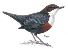
Dipper © NPAP
This short walk from the attractive and historic village of Blanchland combines both woodland and river habitats. Birds such as coal tit, goldcrest and dipper are active throughout the year. During the breeding season, more elusive species such as the pied flycatcher and spotted flycatcher can also be seen. Blanchland is sited within the remains of a monastery founded by Premonstratensian Monks in the 12th century. The Lord Crewe Arms hotel was originally built as the Abbot’s lodge, guest house and kitchens of the Abbey.
Location:
Starting from the car park in Blanchland (NY964505).
Distance:
3 km
Terrain:
Boggy ground, Off road sections, On road sections
Access:
Facilities nearby
Recreation opportunities:

Bowlees Visitor Centre

Bowlees Visitor Centre    © NPAP
Bowlees Visitor Centre, run by the North Pennines AONB Partnership, is a fantastic base for exploring Upper Teesdale, with footpath links to Low Force, High Force, Newbiggin and the Pennine Way. The Centre provides information and displays on the geology and landscape, wildlife and people of Upper Teesdale and the wider North Pennines. You'll find a delicious range of food and drinks and our shop stocks nature inspired gifts and books. You'll find a range of special events are running at the Centre throughout the year. You can also hire the venue for family get-togethers, parties and meetings. We have a range of outdoor cooking facilities which can be pre-booked. The Centre is dog-friendly and you'll find free Wi-Fi access, an iGlass (24-hour information touch screen) and an electric car-charging point. Follow the Richard Watson Trail from the Centre - a 2¾-mile circular route exploring the life and times of Richard Watson, Victorian lead miner and poet. The most popular walk is probably the High Force-Low Force Round. The Centre is also an official Dark Sky Discovery Site.
Location:
Newbiggin, Bowlees, Middleton-in-Teesdale, Co. Durham, DL12 0XE (grid ref - NY906281). 01833 622145.
Area:
Facilities nearby

Coatenhill Canoes

Coatenhill Canoes © Coatenhill Canoes
Canoe Building Courses Coatenhill Canoes run courses in the Allen Valleys where participants can construct an open timber canoe from scratch. All materials are provided for the courses. After four days building you can take away your canoe ready to paddle!
Location:
Sinderhope and Ninebanks Youth Hostel
Access:
Recreation opportunities:
Interests:

Cow Green Geological Trail

Cauldron Snout on the River Tees © Natural England/Charlie Hedley
The trail will introduce many of the rocks which make the Teesdale landscape so special and which make the dale a haven for rare and interesting plants. This trail is within Moor House-Upper Teesdale National Nature Reserve (NNR), an internationally important place for wildlife and earth heritage. The NNR is managed by Natural England in partnership with Raby and Strathmore Estates and local farmers. Do examine the rocks, minerals and plants you will see along the way but please do not collect them: leave them for others to enjoy.
Location:
Starting from Wheelhead Sike car park at Cow Green.
Distance:
8 km
Terrain:
Boggy ground, Off road sections, On road sections, Steep sections
Area:
Access:
Recreation opportunities:

Derwent Gorge: North Pennine Birdwalks - Walk 6

Redstart © NPAP
The upland oak woodland of the Derwent Gorge is a dramatic relic of the once extensive forests of the North Pennines. Now a National Nature Reserve managed by Natural England, this woodland contains many interesting and unusual plants such as sweet woodruff, enchanters’ nightshade and wood bitter-cress as well as a great range of resident and migratory birds. Views across the woodland canopy from the gorge sides are impressive and are excellent for bird watching. The walk begins on the edge of the wood in an area of arable farmland, offering opportunities for you to see both farmland and woodland birds.
Location:
Starting from the grassy parking area at the crossroad between Wallish Walls and Crooked Oak (NZ057500).
Distance:
2 km
Terrain:
Boggy ground, Off road sections, On road sections, Steep sections
Access:
Recreation opportunities:

Dufton Pike Open Access Walk

Dufton Pike © NPAP/Elizabeth Pickett
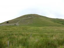
The picturesque village of Dufton nestles quietly on the western flank of the North Pennines overlooked by the pyramidal Dufton Pike, which is the focus of this walk. Despite the relatively short distance, this is a mountain walk in miniature and is perfect for when you have al lout a few hours to spare. The short sharp climb is ample payment for the reward at the summit: an extensive panorama across the Eden Valley to the distant Lakeland Fells, and unique view of the main Pennine Scarp lying close by.
Location:
Starting from the village green in Dufton village which is approx 3½ miles north of Appleby-in-Westmorland. Parking available in the small car park just off the village green (NY689249).
Distance:
8 km
Terrain:
Boggy ground, Off road sections, On road sections, Steep sections
Facilities nearby
Recreation opportunities:
Download GPX file:

Dufton Pike: North Pennine Birdwalks - Walk 11
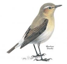
Wheatear © NPAP
Soaring above the Eden Valley, the North Pennine escarpment is a striking feature above Dufton. This walk circumnavigates Dufton Pike, offering dramatic views of the limestone crags of Great Rundale. Ideal habitat for buzzards, these birds are regularly seen in this area. More elusive, the ring ouzel may also be found, singing from one of the gnarled hawthorn trees that dot the hillside.
Location:
Starting from the car park in Dufton (NY689249).
Distance:
7 km
Terrain:
Boggy ground, Off road sections, On road sections
Facilities nearby
Recreation opportunities:

East Allen Valley Wildflower Walk

Allenheads © © NPAP & Elizabeth Pickett
A lovely 5.5 mile (9km) walk from Allenheads exploring the wonderful wildlife of wildflowers in the East Allen Valley. This circular walk will introduce you to some of the special plants of the North Pennines and the creatures that depend on them. Along the way you'll discover plants that are adapted to the harsh conditions of the area and get a bee's-eye view of finding food.
Location:
Allenheads parking area
Distance:
9 km
Terrain:
Boggy ground, Off road sections, On road sections
Facilities nearby
Recreation opportunities:

Eden Outdoor Adventures

Gyhll scrambling © Eden Outdoor Adventures
Eden Outdoor Adventures is a small, friendly, family company run by Ian and Melanie. We provide tailor made courses for individuals, families and groups. We believe that by tailor making your course we can offer quality instruction and guiding with the personal touch, allowing people to get the most out of their time with us. We work hard to understand your needs and to design days to offer a challenge and to make your dreams come true. To help do this, Eden Outdoor Adventures draw upon a great deal of knowledge and experience from working in the outdoors and the areas in which we operate. They also hold National Qualifications in the activities we offer to ensure you the highest standards. We offer half day to multiple day trips in the Lake District, Eden Valley, Northern Pennines, Scotland and Wales as well as further afield. From guided tours, low level family walks through wooded valleys, introductory climbing and canoeing to demanding mountain and river trips in wild places. Wherever your dreams take you, let Eden Outdoor Adventures help make them come true.
Location:
Ousby, Penrith, Cumbria.

Egglesburn Wood

Dipper © www.northeastwildlife.co.uk
This woodland came into Durham County Council ownership when the sand and gravel quarry closed in the mid 1960s. Since that time the trees have seeded into the quarry and we now have mixed broadleaved woodland. Eggleston Burn runs along the western edge beside the old sand quarry. In the summer sand martins nest in the cliff face and can be seen from the bottom path. Other birds to watch out for are dippers and birds of prey such as red kite and buzzard. Deer and badger occasionally stray through the wood and many rabbits burrow through the soft sandy soil. Every now and then an otter is sighted on its journey along the river. There are fantastic views over Teesdale and Mickle Fell, which, standing at 788m, is the highest hill in County Durham.
Location:
1 mile west of Eggleston on the B6282 between Eggleston and Middleton-in-Teesdale. The entrance is next to Egglesburn bridge. Nearest postcode for GPS navigation is DL12 0BD. There is limited parking at the entrance.
Terrain:
Off road sections, Steep sections
Area:
Recreation opportunities:
Interests:
Download:

Eggleton to Romaldkirk - Silver Challenge Walk 3
 ©
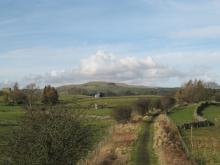
This cracking route takes in parts of the Teesdale Way and Tees Railway Path. Part of the Silver Challenge developed by the Upper Teesdale Tourism Network (UTTN). The Challenge Walks (www.teesdalechallengewalks.net) are a series of walks produced by the UTTN to help visitors and local people to explore this spectacular part of the North Pennines Area of Outstanding Natural Beauty and UNESCO Global Geopark. For detailed walk directions click the link below.
Location:
Start from the fountain in the centre of Middleton-in-Teesdale.
Distance:
15 km
Terrain:
Off road sections, On road sections, Steep sections
Area:
Recreation opportunities:
Interests:

Epiacum Roman Fort (aka Whitley Castle): Alston through the ages
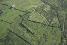
Epiacum from the air © English Heritage
This historic walk takes you from Alston along the Pennine Way up to the Roman Fort at Whitley Castle (Epiacum Roman Fort). If you are keen to walk and discover more, the route continues past Kirkhaugh church to Alston. After the church you can: Carry on the full route to Alston. Go back to Kirkhaugh station and walk back along the railway; Have a cup of tea on board and ride the train to Alston
Location:
Starting from the South Tynedale railway car park in Alston (NY716467).
Distance:
12 km
Terrain:
Off road sections, On road sections
Access:
Recreation opportunities:

Garrigill Round

Moorland above the South Tyne Valley © NPAP/Gearoid Murphy
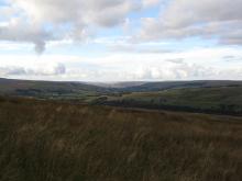
This is an easy circular afternoon walk along the banks of the River South Tyne between the small village of Garrigill and the market town of Alston in the North Pennines Area of Outstanding Natural Beauty. The area is rich in mineral and in particular lead deposits, and mining over the centuries has heavily influenced the landscape. At its peak Garrigill was home to 1000 people mainly employed in the lead mining industry. Now its population is around 200. The village name was originally Gerard’s Gill (gill being the Norse word for a steep sided valley).
Location:
Starting from the green in Garrigill.
Distance:
14 km
Terrain:
Boggy ground, Off road sections, On road sections
Facilities nearby
Recreation opportunities:
Download:

Garrigill: North Pennine Birdwalks - Walk 10
Common sandpiper © NPAP
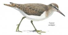
The South Tyne is a narrow, fast flowing river as it tumbles north from the village of Garrigill. Travelling along its bank, this walk offers you the chance to see species such as common sandpiper, oystercatcher and grey wagtail. The surrounding fields abound with breeding waders during spring and summer and during winter large flocks of fieldfare and redwing may be seen.
Location:
Starting from a small parking area in Garrigill next to the red phone box (NY745416)
Distance:
9 km
Terrain:
Boggy ground, Off road sections, On road sections
Facilities nearby
Recreation opportunities:

Harwood Beck and Widdybank: North Pennine Birdwalks - Site 3
Redshank © NPAP
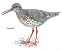
The meadows and pastures around Harwood Beck and Widdybank are some of the best places to see breeding waders and black grouse. If you sit quietly in your car you may be rewarded with the sight of a snipe shepherding its chicks through the vegetation or a precocious young lapwing chick pecking for food in the short turf.
Location:
Static viewing from a grassy verge on the road to Cow Green Reservoir.
Terrain:
On road sections
Area:
Facilities nearby
Recreation opportunities:

High Force and Bowlees Geotrail

High Force ©
This 8km circular walk, from Bowlees Visitor Centre or High Force car park, will introduce you to some of the special features of the landscape around High Force and Low Force waterfalls. You'll discover rocks with dramatic origins, ice age features, ancient settlements, lead mining heritage and wonderful wildlife.
Location:
Circular walk which can be started from Bowlees Visitor Centre (NY906282 / DL12 0XE) or High Force car park (NY885286 / DL12 0XH) in Upper Teesdale.
Distance:
8 km
Terrain:
Off road sections, Steep sections
Area:
Facilities nearby
Recreation opportunities:

Howden Burn (Weardale): North Pennine Birdwalks - Walk 13
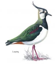
Lapwing © NPAP
Passing through grassland and up onto heather moorland, this walk provides splendid views across the open uplands and down to the Bollihope Burn. It is a fine area to watch wading birds during the breeding season when the air is filled with their songs and displays. Redstart, great spotted woodpecker, tits and warblers can also be seen or heard in the riverside woodland.
Location:
Starting on short turf at roadside beside the Bollihope Burn (NZ005349).
Distance:
3 km
Terrain:
Boggy ground, Off road sections, On road sections
Area:
Access:
Recreation opportunities:

Ireshopeburn (Weardale): Hay Time Walk 2
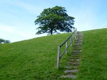
Path to the hay meadows in Ireshopeburn © NPAP/Gearoid Murphy
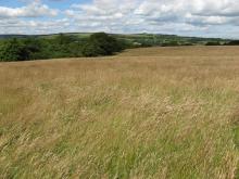
Take a 2 hour walk in Weardale, a landscape that has been farmed and mined for centuries. This five kilometre walk close to Ireshopeburn crosses some beautiful meadows, with superb views of the surrounding moorland and villages in the dale below. The best time to go is between April and August to catch the wildflowers in full bloom. It is still a worthwhile walk outside of these times due to presence of late blooming flowers can be seen in mid Autumn and wading birds in the Spring.
Location:
The walk starts in the village of Ireshopeburn in Weardale (NY866386).
Distance:
5 km
Terrain:
Boggy ground, Off road sections, On road sections
Area:
Recreation opportunities:

Isaacs Tea Trail

 © Roger Morris
Isaac's Tea Trail is a long distance path inspired by the tale of Isaac Holden. Not only a tea seller, Isaac was a local philanthropist and the trail takes you past many legacies of Isaac's fundraising.
Location:
The circular walk can be accessed from many locations, 4 sections have been suggested: Section 1: Allendale Section 2: Nenthead Section 3: Alston Section 4: Ninebanks
Distance:
58 km
Terrain:
Boggy ground, Off road sections, On road sections
Facilities nearby
Recreation opportunities:

Low Force Geotrail

Low Force in Teesdale © NPAP/Simon Wilson
A 2 ½ mile (4km) walk exploring landscape, rocks, fossils and mines in Upper Teesdale. This landscape, which has been 300 million years in the making, has been shaped by tropical seas, molten rock, glacial movement and more recently by people. This circular walk will introduce you to some of the special features of this landscape associated with these processes. By spotting clues in the fields, walls, crags and River Tees you'll find out how to read the landscape and discover more about its fascinating past.
Location:
Starting from Bowlees Visitor Centre (NY906282 / DL12 0XE) in Upper Teesdale
Distance:
4 km
Terrain:
Off road sections, On road sections
Area:
Access:
Facilities nearby
Recreation opportunities:
Download:

Low Force River Access Code of Conduct
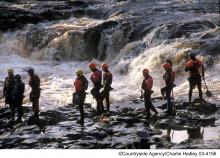
Canoeists at Low Force © Natural England/Charlie Hedley
Code of conduct which aims to ensure that water sports enthusiasts enjoy Low Force responsibly.
Location:
Low Force in Upper Teesdale (NY903279).
Area:
Access:
Facilities nearby
Recreation opportunities:
Interests:

Mickleton to Middleton

River Tees © NPAP
This 8.5km circular walk is a great circuit from Mickleton in Teesdale, using the Teesdale Railway Path. It was published as route 2 in the Discover mid Teesdale leaflet (2007).
Location:
The route starts from the Mickleton Station car park (NY967233 / DL12 0JN).
Distance:
9 km
Terrain:
Boggy ground, Off road sections, On road sections, Steep sections
Area:
Access:
Facilities nearby
Recreation opportunities:

Middleton to Mickleton - Bronze Challenge Walk 3
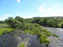
 ©
Fantastic circuit from Middleton-in-Teesdale following parts of the Teesdale Way and the Tees Railway Path. Part of the Bronze Challenge developed by the Upper Teesdale Tourism Network (UTTN). The Challenge Walks (www.teesdalechallengewalks.net) are a series of walks produced by the UTTN to help visitors and local people to explore this spectacular part of the North Pennines Area of Outstanding Natural Beauty and UNESCO Global Geopark. For detailed walk directions click the link below.
Location:
Start in the middle of Middleton-in-Teesdale from the Market Place.
Distance:
9 km
Terrain:
Off road sections, On road sections, Steep sections
Area:
Recreation opportunities:
Interests:

Open access walks in Cumbria: Geltsdale
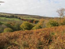
Binney Bank wood below Tarnmonath Fell © NPAP/Gearoid Murphy
A good walk for days when the cloud is low, favouring a lower level circuit of the picturesque Geltsdale without the need to venture too high up. Discover remnants of the valley’s industrial past, whilst savouring the delights of her wildlife and scenery of this now tranquil Valley.
Location:
Starting from the parking verge at Jockey Shield near Castle Carrock.
Distance:
10 km
Terrain:
Off road sections
Facilities nearby
Recreation opportunities:

Open access walks in Cumbria: Great Knipe

It's hard to imagine that this short, but thoroughly rewarding, 'away from it all' moorland walk lies so close to a major trans-Pennine road link. Seldom does this land attract a second glance from the thousands that pass below it each day. Contained within a Ministry of Defence ‘dry range’, this walk focuses upon an amphitheatre scarp culminating with the headland of Great Knipe, with its commanding views over the Stainmore Pass and across the upper realms of the greater Eden valley.
Location:
Starting off the A66, approx 3.5 miles to the east of Brough. Roadside parking is available on a minor road just off the A66 east-bound carriageway, at Slapestone Bridge
Distance:
8 km
Terrain:
Boggy ground, Off road sections, On road sections
Recreation opportunities:

Open access walks in Cumbria: Talkin Fell
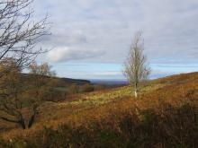
View down the River Gelt Valley © NPAP/Gearoid Murphy
This short walk is ideal for those with a few hours to spare, and serves as a perfect introduction to open access. The route follows excellent public rights of way, and distinct desire lines once you venture onto the access land. On a clear day the panorama from the top of Talkin Fell is probably one of the best you’ll get for the effort involved in getting there.
Location:
Starting from the parking verge at Jockey Shield near Castle Carrock.
Distance:
7 km
Terrain:
Off road sections
Facilities nearby
Recreation opportunities:

Open access walks in Cumbria: Thack Moor and Black Fell
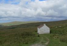
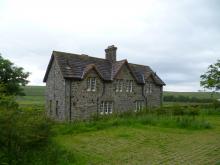
Cottage near Hartside summit © NPAP/Simon Wilson
One of the more serious undertakings, this routes ventures onto the main North Pennine ridge, via the outlying top of Thack Moor. Tranquillity, solitude and a sense of moorland grandeur is guaranteed on the first section. A much deserved break at Hartside Café is recommended, before the return leg to Renwick following public rights of way on good tracks and paths.
Location:
Starting from Townhead, at the northern end of Renwick village towards the parish church. Roadside parking is available at the church.
Distance:
17 km
Terrain:
Boggy ground, Off road sections, On road sections
Facilities nearby
Recreation opportunities:

Over the hill to Cowbyre Farm

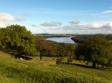
Derwent Reservoir from above Blanchland © NPAP
This is a varied walk that begins with a climb up from the village of Blanchland. The walk passes through woodland and pasture with magnificent views of the Derwent Valley and Edmundbyers Common, finally dropping down to the river and returning to the village.
Location:
Staring from Blanchland car park.
Distance:
6 km
Terrain:
Off road sections, On road sections
Facilities nearby
Recreation opportunities:

River Wear fishing

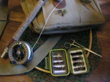
Fly fishing tackle © NPAP/Simon Wilson
Fishing for brown trout, sea trout and salmon between Eastgate and Stanhope Guaging Station is available with a day ticket from the Weardale Fly Fishers Club. Permits from Stanhope Newsagents, Stanhope, Weardale. Don't forget your Environment Agency rod licence.
Location:
Stanhope
Terrain:
Boggy ground, Off road sections, Steep sections
Area:
Access:
Recreation opportunities:
Interests:

RSPB Geltsdale Walking Trails

Stagsike Cottage at RSPB Geltsdale © NPAP/Gearoid Murphy
Set in the beautiful North Pennines AONB, Geltsdale is home to black grouse, birds of prey and breeding wading birds and is ideal for walking. There are 4 way marked trails leading from the car park of Howgill. The Stagsike trail will take 1-2 hours to walk and the other trails a little longer. Stagsike Cottages are approximately a 40 minute walk from the parking area and provide an information point and toilets. Many of the trails are on existing tracks but boots are essential for much of the year and waterproofs are recommended. There is no general vehicle access to Stagsike Cottages but disabled access can be pre-arranged by phoning the reserve (01697 746717). Trails are open at all times and the information point is open between 9am and 5pm. Dogs are welcome but they should be kept on a lead as the reserve is a working farm. A bus services the village of Hallbankgate, which is approximately a mile away.
Location:
Starting from Clesketts car park (NY588584), near Hallbankgate.
Terrain:
Boggy ground, Off road sections, On road sections
Facilities nearby
Recreation opportunities:

Slitt Wood and West Rigg Geotrail

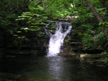
Slitt Wood waterfall © NPAP/Elizabeth Pickett
This route reveals much about the area’s geology, which is strongly linked to this little valley’s industrial past. You will see where lead and iron ores were mined and processed and how the ores were transported out of the valley. Slitt Wood and West Rigg Opencut are legally protected as Sites of Special Scientific Interest (SSSI). Slitt Wood is designated for its variety of habitats including woodland, lime-rich grassland, fen, open water and the revegetated workings of Slitt and Middlehope Mines. Many different types of plants and birds can be spotted at different times of year, including metal tolerant plants known as metallophytes. West Rigg is designated for its geological importance. It provides an excellent illustration of the formation of iron ore and the opencast ironstone workings which expose the structure of a lead vein. Many of the industrial remains also have legal protection as scheduled monuments of national archaeological importance.
Location:
Starting from the lay-by in Westgate.
Distance:
5 km
Terrain:
Boggy ground, Off road sections, On road sections
Area:
Facilities nearby
Recreation opportunities:

Spring Gentian

Spring gentian © NPAP/Elizabeth Pickett
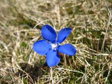
Teesdale is a botanist’s paradise, but one plant stands out: the spring gentian. Spring gentians are best seen on warm, bright days, from April to early June. A sun worshipper, this little flower closes as the weather becomes dull, leaving nothing to see but small, dark-blue spikes. However the flowers quickly open again when the sun emerges from behind the clouds. Hidden among the short vegetation, spring gentians often go unnoticed, but when you do find them they stop you in your tracks with their startling deep-blue flowers. The flowers are typically 15 to 30mm across. Look out for a delicate plant with a solitary, intense-blue flower, like a tiny, five-pointed star. It is surprisingly small for a flower with such a big reputation! You can see gentians in flower from many public footpaths in Upper Teesdale. Please stick to the paths to protect these and other rare plants.
Location:
Car park at Forest-in-Teesdale.
Distance:
11 km
Terrain:
Boggy ground, Off road sections, On road sections
Area:
Access:
Facilities nearby
Recreation opportunities:
Download:

St John's Chapel: Farming, Mining and Methodism
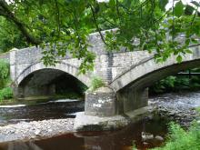
Coronation Bridge in Ireshopeburn, Weardale © NPAP/Gearoid Murphy
This walk traces the history of three neighbouring villages Daddry Shield, St Johns Chapel and Ireshopeburn. From their origins as farming settlements, through to the expansion of the mining industry in the mid 19th Century and the associated rises in population and conversion of locals to Methodism, this region has witnessed dramatic changes which have left their mark on the landscape of the upper dale. This walk tells the story of these developments while pointing out historic buildings and events associated with them.The walk was devised and described by volunteers of The Weardale Museum (www.weardalemuseum.co.uk), Ireshopeburn, where much more information can be found.
Location:
Starting from the Weardale Inn or St John Chapel Cattle Market car park.
Distance:
11 km
Terrain:
Boggy ground, Off road sections, On road sections, Steep sections
Area:
Facilities nearby
Recreation opportunities:

Take a walk in the woods…

Walker at Allen Banks and Staward Gorge © NPAP/Elizabeth Pickett
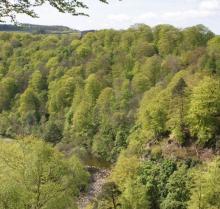
The North Pennines conjures up images of purple heather covered moors, lead mining remains and remote dales where traditional ways of farming still survive. But there are delightful pockets of woodland to explore too. At the National Trust property at Allen Banks and Staward Gorge you’ll find the largest concentration of woodlands in the North Pennines AONB. This woodland has 5 trails of varying length allowing you to experience the wonders of this woodland whatever your level of fitness.
Location:
Starting from either the National Trust car park at Allen Banks or Haydon Bridge.
Terrain:
Off road sections, On road sections, Steep sections
Facilities nearby
Recreation opportunities:

Taste Trails: Allendale to Whitfield Circular

Allendale Bakery © NPAP/Shane Harris
This route takes you from Allendale Town past Allen Mill and through the nearby village of Catton before crossing the valley of the River East Allen to Whitfield. The walk then returns to Allendale along Isaac’s Tea Trail. The route includes riverside walking and takes you through pleasant farmland and scenic wooded valleys. The Allendale landscape has been shaped by a long history of farming, estate management and minerals extraction.
Location:
Starting from Allendale Town in the East Allen Valley
Distance:
18 km
Terrain:
Boggy ground, Off road sections, On road sections
Facilities nearby
Recreation opportunities:

Tees Bank Flowers: Flowers and Ferns Holwick Head Bridge to High Force

This 0.45km (1/4 mile) walk beside the River Tees enters the Upper Teesdale National Nature Reserve and has a wealth of wildlife, including numerous plant species. Many are common British species and some belong to the ‘Teesdale Assemblage’ – a uniquely rich association of plants for which Upper Teesdale is famous. The plants included here are the larger flowering ones, trees and ferns that can be seen, at the appropriate time of the year (when they are flowering), from this well-used path. Not all will be in flower on one visit. The flowering times indicated are for the peak period. To prevent trampling on inconspicuous and perhaps rare plants it is advisable to keep to the path and already trampled areas; please do not extend them.
Location:
Starting from Bowlees Visitor Centre.
Distance:
0 km
Area:
Facilities nearby
Recreation opportunities:
Interests:

Tees Bank Flowers: Flowers and Ferns Wynch Bridge to Scorberry Bridge

This 0.9km (1/2 mile) walk beside the River Tees has a wealth of wildlife, including over 200 plant species. Many are common British species and twelve belong to the ‘Teesdale Assemblage’ — a uniquely rich association of plants for which Teesdale is famous. The plants included here are the larger flowering ones, trees and ferns that can be seen, at the appropriate time of the year (when they are flowering), from this well used path. Not all will be in flower on one visit. The flowering times indicated are for the peak period. To prevent trampling on inconspicuous and perhaps rare plants it is advisable to keep to the path and already trampled areas; please do not extend them.
Location:
Starting from Bowlees Visitor Centre.
Distance:
1 km
Terrain:
Off road sections, On road sections
Area:
Facilities nearby
Recreation opportunities:
Interests:

Tees Bank Flowers: Flowers between Wynch Bridge and Holwick Head Bridge

This 1.6km (1 mile) walk beside the River Tees has a wealth of wildlife, including over 200 plant species. Many are common British species and twelve belong to the ‘Teesdale Assemblage’ — a uniquely rich association of plants for which Upper Teesdale is famous. The plants included here are the larger flowering ones which can be seen, at the appropriate time of year (when they are flowering), from this well used path. Not all will be in flower on one visit. The flowering times indicated are for the peak period. To prevent trampling on inconspicuous and perhaps rareplants it is advisable to keep to the path and already trampled areas; please do not extend them.
Location:
Starting from Bowlees Visitor Centre.
Distance:
2 km
Terrain:
Off road sections, On road sections
Area:
Access:
Recreation opportunities:
Interests:

The National Trust - Allen Banks and Staward Gorge woodland walk
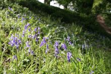
Bluebells at Allen Banks © NPAP/Shane Harris
Set on the steep valley sides of the river Allen, a tributary of the south Tyne, explore the woods and see what wildlife you can spot on this gentle riverside walk. It's the largest area of ancient woodland in Northumberland and has been here since at least medieval times. This long history has helped make it a fantastic home for flora, fauna and fungi.
Location:
Starting from Allen Banks car park.
Distance:
4 km
Terrain:
Boggy ground, Off road sections, Steep sections
Facilities nearby
Recreation opportunities:

Tyne Train Trails -Corbridge to Hexham

This 9km walk between the stations of Corbridge and Hexham is along riverside and woodland paths and tracks, with some road walking mainly in Hexham. The walk crosses the railway line and is not boarded. Please take care! Note Corbridge town centre is over the bridge across the River Tyne.
Location:
Starting from Corbridge train station.
Distance:
9 km
Terrain:
Off road sections, On road sections
Recreation opportunities:
Interests:

Tyne Train Trails: Bardon Mill to Haltwhistle

This 9.5km walk between the stations of Bardon Mill and Haltwhistle is largely along field paths with some road walking mainly in Haltwhistle. This walk crosses the busy A69 - please take care. Bardon Mill has a general store and a pub while Haltwhistle has a full range of shops and facilities.
Location:
Starting from Bardon Mill Station.
Distance:
10 km
Terrain:
Off road sections, On road sections
Recreation opportunities:
Interests:

Tyne Train Trails: Hexham to Haydon Bridge

This 17km walk between the stations of Hexham and Haydon Bridge includes field and woodland paths with some sections on minor roads. This is a long walk with some steep climbs. Hexham has a full range of shops and services while Haydon Bridge has some shops, a post office and pubs.
Location:
Starting from Hexham train station.
Distance:
17 km
Terrain:
Off road sections, On road sections, Steep sections
Recreation opportunities:

Upper Teesdale (Hanging Shaw): North Pennine Birdwalks Walk 12
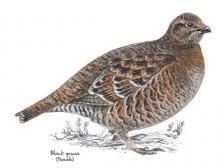
Black grouse © NPAP
Upper Teesdale is one of the best places to see waders in the breeding season and black grouse throughout the year. The wide expanse of the upper dale offers stunning views of the meadows and allotments and the imposing fells of Cronkley Scar and Widdybank. The River Tees is always impressive and there’s a chance of seeing birds such as dipper, goosander and oystercatcher.
Location:
Starting from the car park at Hanging Shaw, Forest-in-Teesdale (NY867297).
Distance:
7 km
Terrain:
Boggy ground, Off road sections, On road sections, Steep sections
Area:
Facilities nearby
Recreation opportunities:

Upper Teesdale Wildflower Walk

Upper Teesdale walk  © The North Pennines AONB Partnership
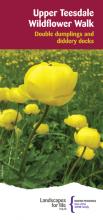
A beautifully capturing circular walk from the parking area at Hanging Shaw will introduce you to some of the special plants of Teesdale in the North Pennines AONB and UNESCO Global Geopark and the wildlife that depend on them. Along the way you will discover plants that dance and others that keep insects captive. You might even see rare bees and long-distance visitors from Africa. The spring and summer months are the best time to enjoy this walk. May and June are the time of peak activity for wading birds with June to August being the prime time for wild Flowers.
Location:
The Start and finish is the Hanging Shaw Parking area in Upper Teesdale (NY867297).
Distance:
6 km
Terrain:
Off road sections
Area:
Access:
Recreation opportunities:
Interests:

Walking around Wolsingham

Hay meadow in Wolsingham © NPAP/Rebecca Barrett
There are many interesting walks leading from the historic town of Wolsingham. These lead to quarries, farms, shafts, mills, and mark out an intricate pattern of journeys to work made over hundreds of years by generations of the people working in Weardale.
Location:
Starting from Wolsingham Railway Station.
Terrain:
Off road sections, On road sections
Area:
Facilities nearby
Recreation opportunities:

Walks from Allendale Caravan Park

River East Allen © NPAP/Shane Harris
This set of 3 walks from Allendale Caravan Park showcase the distinct beauty and character of Allendale. On the walks you will pass through pretty hay meadows, see remnants of the areas lead mining past, encounter the abundant wildlife of the region and be exposed to the dramatic moorland landscapes on the fell above the town.
Location:
Starting from Allendale Caravan Park.
Terrain:
Boggy ground, Off road sections, On road sections
Recreation opportunities:

Waterfalls and wildlife walk: Moor House-Upper Teesdale NNR
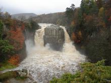
High Force © DCC/Mike Ogden
This walk follows the banks of the River Tees from Low Force, through the juniper woods up to High Force waterfall. Here you can turn round and follow the same route back or continue further upriver and follow the lower slopes of Holwick Fell to return. On the backbone of England, around the headwaters of the River Tees, 8,800 hectares of upland country forms the Moor House–Upper Teesdale National nature Reserve (NNR). The reserve encompasses an almost complete range of upland habitats typical of the North Pennines, from lower lying hay meadows, rough grazing and juniper woods to limestone grassland, blanket bogs and the summit heaths of the high fells. Nowhere else in Britain is there such a diversity of rare habitats in one location. The remote and dramatic landscape of the reserve can be enjoyed from the Pennine Way National Trail, the Public Rights of Way network and on Open Access land.
Location:
Starting from Bowlees Visitor Centre car park (NY906282) in Upper Teesdale.
Terrain:
Off road sections, On road sections, Steep sections
Area:
Facilities nearby
Recreation opportunities:

Weardale Adventure Centre

Climbing with the Weardale Adventure Centre team © Weardale Adventure Centre
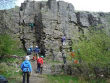
The Centre – Functioning around a 80-bed, fully catered residential centre, Weardale Adventure Centre offers a multitude of high-quality, outdoor and adventure education, activities. Founded in 1978, the centre has been an integral part of the local community and as such utilises local venues alongside on-site activities to provide groups with a thoroughly enjoyable experience. As such, the centre regularly welcomes back groups that have been utilising the facilities, in some cases for over 20 years! The centre can cater for just about any group, with any needs, however we tend to spend much of our time delivering high quality educational programmes to school groups between the ages of 8 and 18. Whilst these groups may be the staple of centre life, we have a wealth of experience delivering activities to just about any range of clients. We offer a multitude of activities and packages as well as being in the fortunate position of being able to offer bespoke and custom programmes to prospective clients, these can take place on-site, locally within the Weardale area, or further afield.
Location:
Ireshopeburn, Co. Durham, DL131HB.
Area:
Facilities nearby

Weardale Way - Cowshill to Westgate

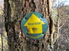
Weardale Way marker © NPAP/Gearoid Murphy
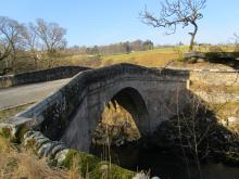
This walk starts in high North Pennine village of Cowshill and travels down Weardale to Westgate following the course of the River Wear. Along the way you will pass the pretty villages of Wearhead, Ireshopeburn, St Johns Chapel and Daddry Shield. Some of the highlights of the walk include Coronation Bridge, built to commemorate the crowning of Queen Victoria, and the upland hay meadows at East Blackdene.
Location:
Starting from the car park at Cowshill.
Distance:
8 km
Terrain:
Boggy ground, Off road sections, On road sections
Area:
Facilities nearby
Recreation opportunities:
Interests:

Weardale Way - Eastgate to Stanhope

Stanhope Bridge © NPAP/Gearoid Murphy
This is a short walk which is sandwiched between the Weardale Railway line and the River Wear. If you are not pressed for time the walk could be extended by doing a loop of Ashes Quarry which has commanding views of Stanhope. Also of interest is the fossilised remains of an ancient tree which can be found in front of St Thomas's Church in Stanhope. The tree was brought to Stanhope in 1962 from a quarry in Edmundbyers and it is believed to be 320 million years old.
Location:
Starting at crossroads in Eastgate.
Distance:
4 km
Terrain:
Off road sections
Area:
Recreation opportunities:
Interests:

Weardale Way - Stanhope to White Kirkley
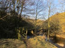
Footbridge over the Bollihope Burn © NPAP/Gearoid Murphy
Beginning in Stanhope the walk takes you across several burns and through a number of disused limestone quarries to reach the small hamlet of White Kirkley which sits above Frosterley. Limestone has been quarried from the valley sides around Frosterley since the 12th century but it was in the 1800s that the village became an important centre for limestone quarrying. Limestone has many uses - as a road stone, agricultural lime, for flux in the iron and steel industry and for cement. A special type of limestone is found in Frosterley; this fossil-rich stone, known as Frosterley marble, can be polished to a high shine. The most famous use of Frosterley marble is in Durham Cathedral. Here, the ceiling of the Chapel of the Nine Altars is supported by slender columns of this unusual stone.
Location:
Starting from the lay-by, near Unthank Farm, in Stanhope.
Distance:
7 km
Terrain:
Off road sections
Area:
Recreation opportunities:

Weardale Way - Westgate to Eastgate via Rookhope
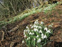
Wildflowers in Ashy Bank wood near Eastgate © NPAP/Gearoid Murphy
The second section of the Weardale Way involves a fairly steep climb up Heights Pasture, above Westgate, before dropping down into the old mining village of Rookhope. The famed poet WH Auden once visited Rookhope as a child and he drew inspiration for many of his works from the North Pennine landscape. From Rookhope the trail heads back down into the Wear Valley following the Rookhope Burn all the way to small village of Eastgate. Eastgate marks the boundary of the former woodland where the Prince Bishops of Durham hunted deer.
Location:
Starting from the car park at Haswicks in Westgate.
Distance:
13 km
Terrain:
Boggy ground, Off road sections, On road sections, Steep sections
Area:
Facilities nearby
Recreation opportunities:

Weardale Way - White Kirkley to Wolsingham
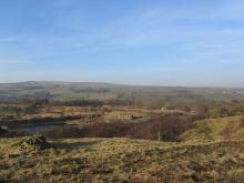
View over Harehope Quarry © NPAP/Gearoid Murphy
From White Kirkley the walk takes you above Harehope Quarry, which is now run as a workers co-operative offering environmental education and rural skills training. The path then climbs up over Harvey Hill to the edge of the grouse moors where you may see Red Grouse among the heather. The trail then drops down towards Wolsingham passing through a patch of ancient woodland at Ashes Beck. Note there are no facilities or parking spaces at White Kirkley, these are available in either Frosterley or Wolsingham.
Location:
Starting from White Kirkley.
Terrain:
Boggy ground, Off road sections, On road sections
Area:
Facilities nearby
Recreation opportunities:

Wearhead: The River Wear starts here

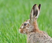
Brown Hare © Brian Rafferty/www.brianraffertywildlifephotographer.blogspot.co.uk/
Wearhead sits at the confluence of Burnhope Burn and Killhope Burn, which combine to create the River Wear. The first people here were probably farmers who leased their land from the Prince Bishops of Durham and as the century's past more families moved into the area to mine the rich seams of lead ore, creating the modern village. This walk takes you around this pretty part of Weardale and it can be extended, if you wish, by doing a loop around Burnhope Reservoir.
Location:
Starting from Wearhead Bridge.
Distance:
1 km
Terrain:
Off road sections, On road sections
Area:
Facilities nearby
Recreation opportunities:

Wellhope Moor (Nent Valley): North Pennine Birdwalks - Walk 9
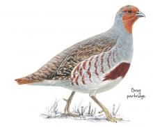
Grey partridge © NPAP
This walk offers both stunning views across the Nent Valley and the opportunity to experience a mix of typical North Pennines upland habitats: hay meadow, pasture and allotment, heather moorland, blanket bog and upland stream. Passing a derelict mine and many old mine shafts, it also typifies the historic lead mining landscape of the area.
Location:
Starting from a small road side lay-by (NY769453).
Distance:
5 km
Terrain:
Boggy ground, Off road sections, On road sections, Steep sections
Access:
Recreation opportunities:

Whitesyke and Bentyfield Mine

Whitsyke and Bentyfield mine © NPAP/Beck Baker
The remains of this 19th century lead mine complex lie on the Garrigill Burn in the South Tyne Valley above Alston. They once formed part of an extensive complex of more than 100 lead mines operating in the area during the 18th and 19th centuries. The remains include a mine shop, a dressing floor and several mine level entrances. You can view the remaining structures from a flagstone path which follows the line of an old tramway and there are interpretative panels in place which detail the processes that occurred here. Facilities are available off site in Garrigill.
Location:
On a hairpin bend on the B 6277 above Garrigill.
Terrain:
Boggy ground, Off road sections
Access:
Facilities nearby
Recreation opportunities:

Widdybank Fell Nature Trail: Moor House-Upper Teesdale NNR
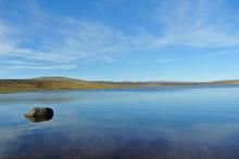
Cow Green Reservoir © NPAP/Beck Baker
This walk takes you over Widdybank Fell, along the track to Cow Green dam and Cauldron Snout waterfall. The walk follows a tarmac track with 1 large kissing gate and 3 steep sections. Suitable for pushchairs and wheelchairs with strong pushers! However for the last 100m section, to view Cauldron Snout waterfall, the track is rocky and uneven. On the backbone of England, around the headwaters of the River Tees, 8,800 hectares of upland country forms the Moor House–Upper Teesdale National Nature Reserve (NNR). The reserve encompasses an almost complete range of upland habitats typical of the North Pennines, from lower lying hay meadows, rough grazing and juniper woods to limestone grassland, blanket bogs and the summit heaths of the high fells. Nowhere else in Britain is there such a diversity of rare habitats in one location. The remote and dramatic landscape of the reserve can be enjoyed from the Pennine Way National Trail, the Public Rights of Way network and on Open Access land.
Location:
Starting from the Cow Green Reservoir car park (NY811309)
Distance:
5 km
Terrain:
Off road sections, On road sections, Steep sections
Area:
Recreation opportunities:

Wild Brown Trout - Balderhead Reservoir
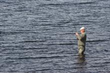
Fly fisherman © NPAP/Shane Harris
Balderhead Reservoir in Teesdale is one of best wild brown trout fisheries in the country. It is full of fighting fit trout, providing excellent sport. Surrounded by the fantastic scenery of the North Pennines grouse moors, there are few more tranquil and relaxing ways to spend a day’s fishing than roaming the banks of these waters, and even fewer places where you can catch truly wild browns. The trout in these reservoirs are 100% native, having descended from the original upland brownies which lived in the streams before the dams were built. Lightning quick and very hard fighting with unique colours and markings, these fish are a joy to catch. Please note, from Wednesday 5 September 2012, day permits for Cow Green, Balderhead and Selset are available to buy in person from Grassholme Reservoir, by calling 0845 155 02366 or online at www.fishpal.com.
Location:
Car park on the north east side of the reservoir.
Terrain:
Off road sections
Area:
Access:
Recreation opportunities:
Interests:

Wild Brown Trout - Cow Green Reservoir
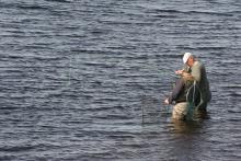
Preparing the net © NPAP/Shane Harris
Cow Green Reservoir in Teesdale is one of best wild brown trout fisheries in the country. It is full of fighting fit trout, providing excellent sport. Surrounded by the fantastic scenery of the North Pennines grouse moors, there are few more tranquil and relaxing ways to spend a day’s fishing than roaming the banks of these waters, and even fewer places where you can catch truly wild browns. The trout in these reservoirs are 100% native, having descended from the original upland brownies which lived in the streams before the dams were built. Lightning quick and very hard fighting with unique colours and markings, these fish are a joy to catch. Please note, from Wednesday 5 September 2012, day permits for Cow Green, Balderhead and Selset are available to buy in person from Grassholme Reservoir, by calling 0845 155 02366 or online at www.fishpal.com.
Location:
Starting from the Cow Green car park
Terrain:
Off road sections
Area:
Access:
Recreation opportunities:

Wild North Discovery

Wild North Discovery © Wild North Discovery
Activities centred on discovery and exploration of the natural world. We offer bushcraft and survival skills (30 years experience and qualified to teach bushcrafts to groups through the Institute for Outdoor Learning), wild food foraging (as seen on TV with Robson Green), bird watching tours, wildlife & nature exploration activities including animal tracking, pond dipping and minibeast hunts for families, and greenwood crafts including pole lathe and willow basket weaving. Activities can be booked for a half or full day for two or more people either adult or family groups. Weekend and full week activities are also available.
Location:
Harehope Quarry Project - near Frosterley in Weardale. Activities are available at other sites in Weardale and Teesdale - see website for details
Terrain:
Boggy ground, Off road sections, Steep sections
Area: