Picnicking

There are many great spots to enjoy a picnic in the North Pennines with great views you can savour while you enjoy a bite to eat. Why not make your picnic extra special and sample some of the exquisite produce from our local food producers while you’re at it?

Enjoying good food outdoors is one of those rare pleasures in life. If you are in the mood for some alfresco dining you’ll be spoiled for choice in the North Pennines. There is one accredited Country Park, with picnic facilities, at Talkin Tarn. Elsewhere in the AONB picnic sites can be found in the historic market town of Alston, overlooking Cow Green, Tunstall and the other Teesdale reservoirs, and in numerous woodland locations like at Bowlees Visitor Centre and Hamsterley Forest. All of these sites provide parking, picnic tables, interpretation, with walking trails nearby and many have additional facilities like accessible toilets, shops


Ashes Quarry Geotrail
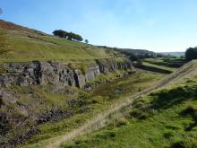
Ashes Quarry above Stanhope in Weardale © NPAP/Neil Diment
Here, for 70 years and more, hundreds of men toiled by hand with simple tools to dig the Great Limestone out of the Weardale fells, just a short distance from the centre of Stanhope. They left behind a huge, mile-long hole in the ground which today, over 60 years since they downed tools, nature is slowly reclaiming. This 2-mile circular route follows the paths the quarrymen would have once taken to work. It rewards a bit of a climb at the start with fantastic views over Stanhope and a fascinating insight into Weardale's industrial past.
Location:
Starting from the Durham Dales Centre car park in Stanhope (NY996392 / DL13 2FJ).
Distance:
3 km
Terrain:
Boggy ground, Off road sections, On road sections, Steep sections
Area:
Recreation opportunities:

Baybridge Picnic Area

The River Derwent runs alongside this small picnic area. The river used to be the boundary between County Durham and Northumberland. Hundreds of years ago the river changed its course but the boundary stayed the same and this is why the picnic site, although north of the river, belongs to Durham County Council. The sound of the flowing water is very peaceful and this is a nice place to stop and have a picnic. While sitting, look out for dippers and kingfishers by the water and buzzards flying overhead. Baybridge is an ideal starting point for local walks. Within easy reach are moorland walks, woodland walks through places such as Deborah Wood and Gibraltar, wonderful riverside walks to Derwent Reservoir and an easy access route to the historic village of Blanchland.
Location:
Baybridge is located near the B6306 near Blanchland. From Blanchland head west for 0.5 mile. The site is signposted from the road. The nearest postcode for GPS navigation is DH8 9UB,
Access:
Recreation opportunities:
Interests:

Blanchland

Blanchland © NPAP/Shane Harris
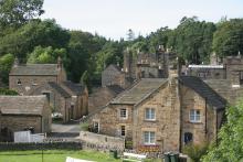
The small village of Blanchland, with its honey-coloured cottages, is perhaps the most attractive settlement in the North Pennines. Blanchland means 'white lands' - almost certainly a reference to the white habits (cloaks) of the Premonstratesian monks of the Abbey. The village has a tea room, shop, pub, childrens' playground and easy access walks.
Location:
Blanchland in the Upper Derwent Valley (NY966504).
Access:
Facilities nearby
Recreation opportunities:

Bowlees Picnic Area

Gibsons cave © NPAP/Beck Baker
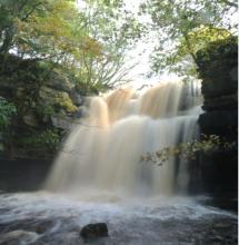
Bowlees picnic area is found is located in a beautiful part of Upper Teesdale. There are four small waterfalls and a riverside footpath leading to Summerhill Force and Gibson’s Cave; Gibson was a 16th century outlaw who lived behind the waterfall to stay hidden from the law. There are plenty of places to sit in quiet contemplation surrounded by the sound of cascading water. Look for the white breast of the dipper bobbing in and out of the water searching for food or the buzzard soaring above your head. The old limestone quarry contains many limestone-loving wildflowers, including seven species of orchids, knapweed and wild thyme. These plants attract butterflies and other insects, which are prey for magnificent dragonflies.
Location:
The picnic area is located in the car park behind Bowlees Visitor Centre off the B 6277.
Terrain:
Off road sections, Steep sections
Area:
Facilities nearby
Recreation opportunities:

Bowlees Visitor Centre

Bowlees Visitor Centre    © NPAP
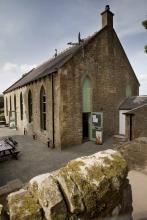
Bowlees Visitor Centre, run by the North Pennines AONB Partnership, is a fantastic base for exploring Upper Teesdale, with footpath links to Low Force, High Force, Newbiggin and the Pennine Way. The Centre provides information and displays on the geology and landscape, wildlife and people of Upper Teesdale and the wider North Pennines. You'll find a delicious range of food and drinks and our shop stocks nature inspired gifts and books. You'll find a range of special events are running at the Centre throughout the year. You can also hire the venue for family get-togethers, parties and meetings. We have a range of outdoor cooking facilities which can be pre-booked. The Centre is dog-friendly and you'll find free Wi-Fi access, an iGlass (24-hour information touch screen) and an electric car-charging point. Follow the Richard Watson Trail from the Centre - a 2¾-mile circular route exploring the life and times of Richard Watson, Victorian lead miner and poet. The most popular walk is probably the High Force-Low Force Round. The Centre is also an official Dark Sky Discovery Site.
Location:
Newbiggin, Bowlees, Middleton-in-Teesdale, Co. Durham, DL12 0XE (grid ref - NY906281). 01833 622145.
Area:
Facilities nearby

Derwent Reservoir - Walks, rides and wildlife
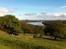
Derwent Reservoir © NPAP/Shane Harris
Derwent Reservoir is within the North Pennines AONB and, after Kielder, is the second largest reservoir in the region. There is a multi-user path from Pow Hill Country Park (south shore) to the dam at the eastern end of the reservoir and then round the north shore to Millshield Picnic Area. You can find out more about the reservoir, its wildlife and its history as you go, on foot or by bike. Cyclists can make a longer circular route around the reservoir by combining the shore path with local roads.
Location:
Derwent Reservoir is in the north-eastern part of the North Pennines AONB, between Blanchland and Edmundbyers - the south shore is in County Durham and the north shore is in Northumberland. Start from Pow Hill Country Park (NZ011517 / DH8 9NU - nearest) or Millshield Picnic Area (NZ013532 / DH8 9PT - nearest).
Distance:
3 km
Facilities nearby
Interests:

Hamsterley Forest

Hamsterley Forest © NPAP/Louise Taylor
County Durham's largest forest is a mixture of woodland, meadows and forest. There are excellent walking, cycling and horse riding trails for all abilities. The forest also has a childrens' adventure playground, tea room, cycle hire, shop and downhill mountain bike course.
Location:
Hamsterley Forest (NZ091312 / DL13 3QH).
Terrain:
Boggy ground, Off road sections, On road sections, Steep sections
Area:

High Force and Bowlees Geotrail

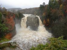
High Force ©
This 8km circular walk, from Bowlees Visitor Centre or High Force car park, will introduce you to some of the special features of the landscape around High Force and Low Force waterfalls. You'll discover rocks with dramatic origins, ice age features, ancient settlements, lead mining heritage and wonderful wildlife.
Location:
Circular walk which can be started from Bowlees Visitor Centre (NY906282 / DL12 0XE) or High Force car park (NY885286 / DL12 0XH) in Upper Teesdale.
Distance:
8 km
Terrain:
Off road sections, Steep sections
Area:
Facilities nearby
Recreation opportunities:

Killhope Lead Mining Museum

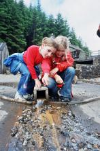
Washing Floor at Killhope © Killhope Museum
A visit to Killhope, the award winning North of England Lead Mining Museum, is a unique and unforgettable experience. Killhope is a fully restored nineteenth century Victorian lead mine, where you can experience for yourself the life and work of the lead mining families of the Pennine dales. Our enthusiastic and knowledgeable staff are here to help you get the most from your visit; they are what make Killhope a multi award wining venue. Killhope is famous for its huge working waterwheel, but there is much more to Killhope. You can experience the mineshop where miners lived. You can work as a 'washerboy' looking for minerals and galena (which is the lead ore). You can see the working machinery (which Fred Dibnah admired so much) in the 'jigger house'. But above all, Killhope's award-winning mine tour is unique. From the moment you put on your hard hats, cap-lamps and wellingtons, your visit becomes an unforgettable adventure! Killhope holds the largest collection of Spar Boxes which sits alongside Magnificent Minerals and the Pennine Jewels. Two permanent commissions, Letters of Lead and Language of Lead, part of museumaker, a prestigious national project. We also have an array of art works and installations which adorn our visitor centre and site. You can stroll round Killhope's woodland paths (maybe with a nature backpack). You will see some wildlife and red squirrels. Take a break in Killhope Cafe and sample our wonderful home made soups, pasties and cakes. Our gift shop stocks a wide range of books, maps, keepsakes and souvenirs. Killhope - a great day out in the country for all the family!
Location:
Near Cowshill, Upper Weardale, Co. Durham, DL13 1AR.
Terrain:
Steep sections
Area:

Teesdale Reservoir Walk

Hury Reservoir © NPAP/Beck Baker
This interesting walk takes in 3 of Northumbrian Waters reservoirs in Teesdale, with the opportunity to view another 3 reservoirs from the walks highpoint. The walk follows the Pennine Way from Grassholme Reservoir over moorland to reach the rocky flat-topped summit of Goldsborough Hill. Afterward you will descend to follow the shores of Hury and Blackton Reservoirs where you may see wigeon, common sandpiper and tufted duck. You will also pass by Meres beck meadow and Hannah’s meadow, which during the summer will be filled with beautiful wildflowers.
Location:
Car parks at the Northern end of the Balderhead Reservoir dam wall.
Distance:
13 km
Terrain:
Boggy ground, Off road sections, On road sections
Area:
Access:
Facilities nearby
Recreation opportunities:

The National Trust - Allen Banks and Staward Gorge woodland walk
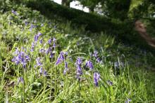
Bluebells at Allen Banks © NPAP/Shane Harris
Set on the steep valley sides of the river Allen, a tributary of the south Tyne, explore the woods and see what wildlife you can spot on this gentle riverside walk. It's the largest area of ancient woodland in Northumberland and has been here since at least medieval times. This long history has helped make it a fantastic home for flora, fauna and fungi.
Location:
Starting from Allen Banks car park.
Distance:
4 km
Terrain:
Boggy ground, Off road sections, Steep sections
Facilities nearby
Recreation opportunities:

Tunstall Reservoir Walk

Backstone Bank wood beside Tunstall Reservoir © NPAP/Ruth Starr-Keddle
Tunstall reservoir is located within the North Pennines Area of Outstanding Natural Beauty and has an excellent walk along its eastern edge through a semi-natural ancient broadleaved woodland, known as Blackstone Wood. The Tunstall reservoir walk is not only a very scenic and relaxing walk but once in the woodland offers the chance to view a variety of wildlife, including several species of waterfowl and butterflies.
Location:
At the picnic site on Leazes Lane on the western side of the reservoir.
Distance:
3 km
Terrain:
Boggy ground, Off road sections, On road sections, Steep sections
Area:
Access:
Facilities nearby
Recreation opportunities:
Interests:

Upper Teesdale (Hanging Shaw): North Pennine Birdwalks Walk 12
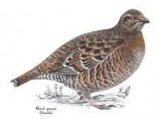
Black grouse © NPAP
Upper Teesdale is one of the best places to see waders in the breeding season and black grouse throughout the year. The wide expanse of the upper dale offers stunning views of the meadows and allotments and the imposing fells of Cronkley Scar and Widdybank. The River Tees is always impressive and there’s a chance of seeing birds such as dipper, goosander and oystercatcher.
Location:
Starting from the car park at Hanging Shaw, Forest-in-Teesdale (NY867297).
Distance:
7 km
Terrain:
Boggy ground, Off road sections, On road sections, Steep sections
Area:
Facilities nearby
Recreation opportunities:

Waskerley Way Railway Path

Waskerley Reservoir © NPAP/Shane Harris
The Waskerley Way is a 16km route running from Parkhead Station above Stanhope in Weardale to Lydgetts Junction, Consett (where is joins with the Lanchester Valley Railway Path, the Derwent Walk Railway Path and the Consett to Sunderland cycle route). It's a beautiful route passing through a varied landscape; from urban fringe through to upland sheep farms and then on to glorious heather moorland. It's suitable for walkers, cyclists, horse riders and wheelchair users. Hownsgill Viaduct towers 46m above the tree canopy of Knitsley and High House Woods near Lydgetts Junction. This is one of the most impressive railway structures in North East England. From further up the Railway Path there are stunning views across Smiddy Shaw, Waskerley and Hisehope Reservoirs.
Location:
The routes runs from Park Head Station, above Stanhope, Weardale (NZ002431 / DL13 2ES) to Lydgetts Junction, Consett (NZ098492 / DH8 9AA).
Distance:
16 km
Terrain:
On road sections
Area:
Facilities nearby
Recreation opportunities:
Interests:

Waterfalls and wildlife walk: Moor House-Upper Teesdale NNR
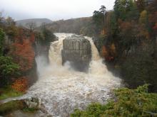
High Force © DCC/Mike Ogden
This walk follows the banks of the River Tees from Low Force, through the juniper woods up to High Force waterfall. Here you can turn round and follow the same route back or continue further upriver and follow the lower slopes of Holwick Fell to return. On the backbone of England, around the headwaters of the River Tees, 8,800 hectares of upland country forms the Moor House–Upper Teesdale National nature Reserve (NNR). The reserve encompasses an almost complete range of upland habitats typical of the North Pennines, from lower lying hay meadows, rough grazing and juniper woods to limestone grassland, blanket bogs and the summit heaths of the high fells. Nowhere else in Britain is there such a diversity of rare habitats in one location. The remote and dramatic landscape of the reserve can be enjoyed from the Pennine Way National Trail, the Public Rights of Way network and on Open Access land.
Location:
Starting from Bowlees Visitor Centre car park (NY906282) in Upper Teesdale.
Terrain:
Off road sections, On road sections, Steep sections
Area:
Facilities nearby
Recreation opportunities:

Widdybank Fell Nature Trail: Moor House-Upper Teesdale NNR
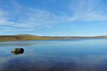
Cow Green Reservoir © NPAP/Beck Baker
This walk takes you over Widdybank Fell, along the track to Cow Green dam and Cauldron Snout waterfall. The walk follows a tarmac track with 1 large kissing gate and 3 steep sections. Suitable for pushchairs and wheelchairs with strong pushers! However for the last 100m section, to view Cauldron Snout waterfall, the track is rocky and uneven. On the backbone of England, around the headwaters of the River Tees, 8,800 hectares of upland country forms the Moor House–Upper Teesdale National Nature Reserve (NNR). The reserve encompasses an almost complete range of upland habitats typical of the North Pennines, from lower lying hay meadows, rough grazing and juniper woods to limestone grassland, blanket bogs and the summit heaths of the high fells. Nowhere else in Britain is there such a diversity of rare habitats in one location. The remote and dramatic landscape of the reserve can be enjoyed from the Pennine Way National Trail, the Public Rights of Way network and on Open Access land.
Location:
Starting from the Cow Green Reservoir car park (NY811309)
Distance:
5 km
Terrain:
Off road sections, On road sections, Steep sections
Area:
Recreation opportunities: