Reservoirs
The North Pennines provides waters from its reservoirs for many surrounding towns and cities; these reservoirs have become home to a range of bird and animal life, including otters and an important breeding population of wigeon.
Our reservoirs are also great places for fishing and sailing and their banks are popular with walkers and cyclists. There are some natural lakes found in the North Pennines such as Great Rundale Tarn and Tindale Tarn.
Allenheads Geotrail
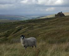
The landscape around Allenheads has been over 300 million years in the making. From tropical seas and deltas to minerals and miners – all have played their part in shaping this beautiful landscape. This 5km circular walk will introduce you to some of the special features of the landscape around Allenheads. By spotting clues in the moors, fields and buildings you’ll find out how to read the landscape and discover more about its fascinating past.
Location:
Starting from Allenheads car park (NY859453 / NE47 9HJ) in the East Allen Valley.
Distance:
5 km
Terrain:
Boggy ground, Off road sections, On road sections
Area:
Access:
Facilities nearby
Recreation opportunities:
Interests:
Link:
Download:
Balderhead Reservoir Dark Sky Discovery Site
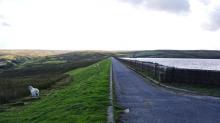
Designated as a Dark Sky Discovery Site, Balderhead Reservoir has been recognised for the quality of the night time skies. This is a great place for professional and amateur astronomers to stargaze in the North Pennines AONB. It is also one of best wild brown trout fisheries in the country.
Location:
From Barnard Castle follow the B6277 to Romaldkirk and then follow the Balderhead road via Hunderthwaite. The reservoir is signposted at the entrance to the car park approximately 4.5 miles along this road. Car park on the NE side of the reservoir.
Area:
Access:
Recreation opportunities:
Interests:
Link:
Baldersdale: Hay Time Walk 3
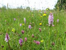
This short walk in Baldersdale visits some of the most spectacular hay meadows in the North Pennines. It also passes close to Hury Reservoir, a popular site for over-wintering wildfowl such as mallard, teal, tufted duck and goosander. The best time to see the flowers is between April and August. Meadows are great for water voles as they favour stream sides with a wide range of flowering plants. The North Pennines is one of their last strongholds
Location:
Starting from the small car park at Fiddler House (NY971189).
Distance:
6 km
Terrain:
Boggy ground, Off road sections, On road sections
Area:
Access:
Facilities nearby
Recreation opportunities:
Interests:
Link:
Blackton Reservoir: North Pennine Birdwalks - Walk 14
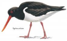
The meadows, pastures and allotments of Baldersdale support large numbers of breeding waders which make an impressive sight during the spring and summer months. Like all areas of open water in the North Pennines, Blackton Reservoir also provides a refuge for wildfowl during the harsh winter months. This area is therefore worth a visit at any time of year.
Location:
Starting from the small car park at the road end (NY935176).
Distance:
6 km
Terrain:
Boggy ground, Off road sections, On road sections
Area:
Access:
Recreation opportunities:
Interests:
Link:
Burnhope Head: North Pennine Birdwalks - Walk 7
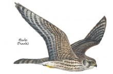
Even in the depths of winter the heather moorland at Burnhope Head is home to large numbers of red grouse. Seeming to catapult from the heather in display whilst giving their loud “get back, get back” call, red grouse are a dramatic sight. During spring and summer their numbers are swelled by a multitude of breeding waders and the moorland seems to burst with life. With sweeping views all around, this is always an impressive walk.
Location:
Starting from the large lay-by near Dead Friars Stone (NY973453).
Distance:
5 km
Terrain:
Boggy ground, Off road sections, On road sections
Access:
Recreation opportunities:
Interests:
Link:
Burnhope Reservoir Dark Sky Discovery Site
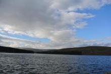
Designated as a Dark Sky Discovery Site, Burnhope Reservoir has been recognised for the quality of the night time skies. This is a great place for professional and amateur astronomers to stargaze in the North Pennines AONB. Burnhope Reservoir is one of the smaller reservoirs in the area. It's found in Upper Weardale just west of Ireshopeburn. This is a quiet spot and great for wildlife. Permissive paths around the reservoir edge pass though plantations and woods with fantastic views across moorlands.
Location:
Follow the A689 westwards up Weardale. Take the second left hand turn in Ireshopeburn. After a mile, turn right down a gated lane
Area:
Access:
Recreation opportunities:
Interests:
Link:
Cardunneth Pike Open Access Walk
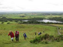
A classic ridge walk following the spine of Cumrew Fell, taking in two of the best viewpoints in the area. The route uses low level right of way for the outward journey, with a range of occupational tracks and desire lines tracks being used for the high level return leg. Part of return leg crosses open access land on a managed grouse moor, over which dogs are not allowed.
Location:
Starting from Castle Carrock village in the vicinity of The Weary Inn.
Distance:
18 km
Terrain:
Boggy ground, Off road sections
Access:
Recreation opportunities:
Interests:
Download GPX file:
Coatenhill Canoes

Canoe Building Courses
Coatenhill Canoes run courses in the Allen Valleys where participants can construct an open timber canoe from scratch.
All materials are provided for the courses. After four days building you can take away your canoe ready to paddle!
Location:
Sinderhope and Ninebanks Youth Hostel
Area:
Access:
Recreation opportunities:
Interests:
Link:
Cow Green Geological Trail
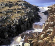
The trail will introduce many of the rocks which make the Teesdale landscape so special and which make the dale a haven for rare and interesting plants. This trail is within Moor House-Upper Teesdale National Nature Reserve (NNR), an internationally important place for wildlife and earth heritage. The NNR is managed by Natural England in partnership with Raby and Strathmore Estates and local farmers. Do examine the rocks, minerals and plants you will see along the way but please do not collect them: leave them for others to enjoy.
Location:
Starting from Wheelhead Sike car park at Cow Green.
Distance:
8 km
Terrain:
Boggy ground, Off road sections, On road sections, Steep sections
Area:
Access:
Recreation opportunities:
Interests:
Download:
Cow Green Reservoir Dark Sky Discovery Site
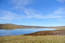
Designated as a Dark Sky Discovery Site, Cow Green Reservoir has been recognised for the fantastic quality of its night time skies. This is a great place for professional and amateur astronomers to stargaze in the North Pennines AONB. Cow Green Reservoir is also one of best wild brown trout fisheries in the country.
Location:
From Middleton-in-Teesdale head up the dale to Langdon Beck on the B6277. Turn left onto a small road (signposted Cow Green Reservoir) and continue along here for approximately 2 miles to a car park.
Area:
Access:
Recreation opportunities:
Interests:
Link:
Derwent Reservoir - Walks, rides and wildlife
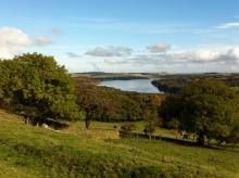
Derwent Reservoir is within the North Pennines AONB and, after Kielder, is the second largest reservoir in the region. There is a multi-user path from Pow Hill Country Park (south shore) to the dam at the eastern end of the reservoir and then round the north shore to Millshield Picnic Area. You can find out more about the reservoir, its wildlife and its history as you go, on foot or by bike. Cyclists can make a longer circular route around the reservoir by combining the shore path with local roads.
Location:
Derwent Reservoir is in the north-eastern part of the North Pennines AONB, between Blanchland and Edmundbyers - the south shore is in County Durham and the north shore is in Northumberland. Start from Pow Hill Country Park (NZ011517 / DH8 9NU - nearest) or Millshield Picnic Area (NZ013532 / DH8 9PT - nearest).
Distance:
3 km
Access:
Recreation opportunities:
Interests:
Link:
Derwent Reservoir and Pow Hill Country Park

Welcome to Derwent Reservoir and Pow Hill Country Park! This leaflet is one of a number of ways in which you can find out about the wildlife and history of Derwent Reservoir and Pow Hill Country Park. The heathland around the reservoir is a haven for reptiles like Adders, Slow Worms and Common Lizards. The reservoir is also important to many species of birds which use it as a migratory stop over and breeding site.
Location:
Routes starting from either Derwent Reservoir car park or Pow Hill Country Park car park.
Distance:
2 km
Terrain:
Off road sections
Access:
Facilities nearby
Recreation opportunities:
Interests:
Derwent Reservoir: North Pennine Birdwalks - Site 1
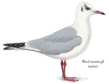
Derwent Reservoir can be an interesting place to watch birds at any time of year. Wildfowl such as greylag goose, mallard, teal and tufted duck may be seen year-round, their numbers being swelled during autumn and winter by wigeon, pochard and goldeneye. Large flocks of gulls also congregate on the reservoir during the winter, most notably black headed, common and herring gull. Other species of interest include grey heron, goosander, cormorant and great crested grebe.
Location:
Multiple viewing points around the reservoir.
Terrain:
Off road sections, On road sections
Access:
Facilities nearby
Recreation opportunities:
Interests:
Link:
Derwent Sailing Club
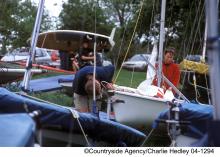
Located at Derwent reservoir, the Derwent Sailing Club has excellent facilities including a two storey club house with bar and restaurant. The club is a RYA training centre.
Location:
Derwent Reservoir
Access:
Recreation opportunities:
Interests:
Link:
Eden Outdoor Adventures
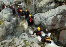
Eden Outdoor Adventures is a small, friendly, family company run by Ian and Melanie. We provide tailor made courses for individuals, families and groups. We believe that by tailor making your course we can offer quality instruction and guiding with the personal touch, allowing people to get the most out of their time with us.
We work hard to understand your needs and to design days to offer a challenge and to make your dreams come true. To help do this, Eden Outdoor Adventures draw upon a great deal of knowledge and experience from working in the outdoors and the areas in which we operate. They also hold National Qualifications in the activities we offer to ensure you the highest standards. We offer half day to multiple day trips in the Lake District, Eden Valley, Northern Pennines, Scotland and Wales as well as further afield. From guided tours, low level family walks through wooded valleys, introductory climbing and canoeing to demanding mountain and river trips in wild places. Wherever your dreams take you, let Eden Outdoor Adventures help make them come true.
Location:
Ousby, Penrith, Cumbria.
Recreation opportunities:
Interests:
Link:
Grassholme Reservoir - Silver Challenge Walk 4
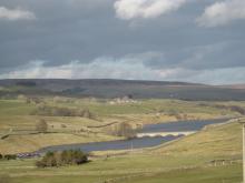
This walk is a grand circuit of Grassholme Reservoir starting from Middleton-in-Teesdale. Part of the Silver Challenge developed by the Upper Teesdale Tourism Network (UTTN). The Challenge Walks (www.teesdalechallengewalks.net) are a series of walks produced by the UTTN to help visitors and local people to explore this spectacular part of the North Pennines Area of Outstanding Natural Beauty and UNESCO Global Geopark. For detailed walk directions click the link below.
Location:
Starting from the Market Place in the centre of Middleton-in-Teesdale.
Terrain:
Off road sections, On road sections, Steep sections
Area:
Access:
Facilities nearby
Recreation opportunities:
Interests:
Download GPX file:
Grassholme Reservoir Dark Sky Discovery Site
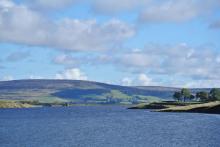
Designated as a Dark Sky Discovery Site, Grassholme Reservoir has been recognised for the stunning quality of its night skies. This is a great place for professional and amateur astronomers to stargaze in the North Pennines AONB. Access to the reservoir for stargazing is only available during organised events (see www.northpennines.org.uk for details). Grassholme is also firmly established as one of the top 'any method fisheries' in the country.
Location:
Take the B6277 from Barnard Castle towards Mickleton. Turn off at the western end of the village, signposted Grassholme Reservoir. The main car park is roughly a mile up the road on the right.
Area:
Access:
Recreation opportunities:
Interests:
Link:
Hannah's Meadow Nature Reserve
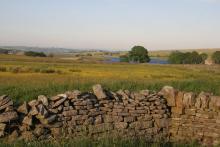
Hannah's Meadow Nature Reserve has some of the least improved and species rich upland hay meadows in upper Durham. The meadows were previously farmed by Hannah Hauxwell, who managed the meadows using traditional methods that avoided adding artificial fertilizers or reseeding. By doing so the species rich habitat hay meadow habitat that evolved over centuries was maintained. When Hannah retired in 1988 Durham Wildlife Trust purchased her farm and they now manage it as a nature reserve. An unmanned visitor centre at the site provides information about Hannah and her special meadows. Note facilities are located at Balderhead Reservoir car park.
Location:
From Barnard Castle follow the B6277 to Romaldkirk and then follow the Balderhead road via Hunderthwaite. The reserve is adjacent to the public road a 1.5 mile east of the Balderhead Reservoir car park. The Pennine Way footpath runs through the reserve. The grid reference refers to the Balderhead Reservoir car park.
Distance:
2 km
Terrain:
Off road sections, On road sections
Area:
Access:
Recreation opportunities:
Interests:
Howden Burn (Weardale): North Pennine Birdwalks - Walk 13
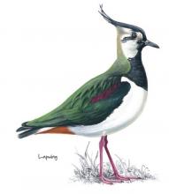
Passing through grassland and up onto heather moorland, this walk provides splendid views across the open uplands and down to the Bollihope Burn. It is a fine area to watch wading birds during the breeding season when the air is filled with their songs and displays. Redstart, great spotted woodpecker, tits and warblers can also be seen or heard in the riverside woodland.
Location:
Starting on short turf at roadside beside the Bollihope Burn (NZ005349).
Distance:
3 km
Terrain:
Boggy ground, Off road sections, On road sections
Area:
Access:
Recreation opportunities:
Interests:
Link:
Over the hill to Cowbyre Farm
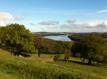
This is a varied walk that begins with a climb up from the village of Blanchland. The walk passes through woodland and pasture with magnificent views of the Derwent Valley and Edmundbyers Common, finally dropping down to the river and returning to the village.
Location:
Staring from Blanchland car park.
Distance:
6 km
Terrain:
Off road sections, On road sections
Access:
Facilities nearby
Recreation opportunities:
Interests:
Download:
Pow Hill Country Park Dark Sky Discovery Site

Pow Hill is a country park owned by Durham County Council and was one of the first five Dark Sky Discovery Sites to be designated in the North Pennines. Recognised for the quality of its dark night skies, set away from the nearby small settlements of Blanchland and Edmundbyers, this is a brilliant spot for astronomers to stargaze. Its position on the edge of Derwent Reservoir offers a large, uninterrupted view of the northern sky. Under a clear winter nights sky, the main stellar constellations can be seen and on good nights, the Milky Way can also be seen with the naked eye. Good quality surface in the car park and an easy access trail route (on the shore of the reservoir) offers the opportunities for disabled people to stargaze.
Location:
Located off the B6306 Blanchland road on the south shore of Derwent Reservoir - 1 mile north of Edmundbyers, signposted from the road.
Access:
Recreation opportunities:
Interests:
Link:
Download:
RSPB Geltsdale Walking Trails
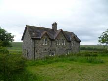
Set in the beautiful North Pennines AONB, Geltsdale is home to black grouse, birds of prey and breeding wading birds and is ideal for walking. There are 4 way marked trails leading from the car park of Howgill. The Stagsike trail will take 1-2 hours to walk and the other trails a little longer. Stagsike Cottages are approximately a 40 minute walk from the parking area and provide an information point and toilets. Many of the trails are on existing tracks but boots are essential for much of the year and waterproofs are recommended. There is no general vehicle access to Stagsike Cottages but disabled access can be pre-arranged by phoning the reserve (01697 746717). Trails are open at all times and the information point is open between 9am and 5pm. Dogs are welcome but they should be kept on a lead as the reserve is a working farm. A bus services the village of Hallbankgate, which is approximately a mile away.
Location:
Starting from Clesketts car park (NY588584), near Hallbankgate.
Terrain:
Boggy ground, Off road sections, On road sections
Access:
Facilities nearby
Recreation opportunities:
Interests:
Link:
Download:
Selset Reservoir Dark Sky Discovery Site
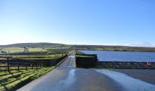
Designated as a Dark Sky Discovery Site, Selset Reservoir has been recognised for the outstanding quality of its dark skies. This is a great place for astronomers to stargaze in the North Pennines AONB. Access to Selset Reservoir is only available for stargazing during organised events (see www.northpennines.org.uk). Selset is also one of best wild brown trout fisheries in the country.
Location:
About 4 miles west of Middleton-in-Teesdale, along the B6276. The reservoir is signposted from the road.
Area:
Access:
Recreation opportunities:
Interests:
Link:
Teesdale Reservoir Walk

This interesting walk takes in 3 of Northumbrian Waters reservoirs in Teesdale, with the opportunity to view another 3 reservoirs from the walks highpoint. The walk follows the Pennine Way from Grassholme Reservoir over moorland to reach the rocky flat-topped summit of Goldsborough Hill. Afterward you will descend to follow the shores of Hury and Blackton Reservoirs where you may see wigeon, common sandpiper and tufted duck. You will also pass by Meres beck meadow and Hannah’s meadow, which during the summer will be filled with beautiful wildflowers.
Location:
Car parks at the Northern end of the Balderhead Reservoir dam wall.
Distance:
13 km
Terrain:
Boggy ground, Off road sections, On road sections
Area:
Access:
Facilities nearby
Recreation opportunities:
Interests:
Link:
Teesdale Sailing Club
Teesdale Sailing Club has been established on the Teesdale Reservoirs since
1981 and currently sails on Grassholme Reservoir with a club house near the Northumbrian Water visitor centre.
Location:
Grassholme Reservoir
Area:
Recreation opportunities:
Interests:
Link:
Tindale Tarn: North Pennine Birdwalks Walk 2
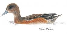
Located in the far north west of the AONB, Tindale Tarn is a good place to bird watch at any time of year in a highly scenic setting. A rich variety of breeding birds can be seen during spring and summer, including waders and black grouse. During the winter months, the Tarn attracts a range of wildfowl including wigeon and whooper swans. Heavily worked for zinc in the past, this area is also rich in industrial archaeology, including the remains of a quarry and smelter. The RSPB manages this site as part of their reserve at Geltsdale. An information centre is located at Stagsike Cottage which is accessible on foot. Disabled access by vehicle can be prearranged by phoning the reserve on 01697 746 717.
Location:
Small car park in Tindale (NY616594).
Distance:
9 km
Terrain:
Boggy ground, Off road sections, On road sections
Access:
Facilities nearby
Recreation opportunities:
Interests:
Link:
Download:
Tunstall Reservoir Walk
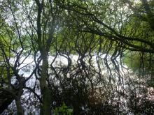
Tunstall reservoir is located within the North Pennines Area of Outstanding Natural Beauty and has an excellent walk along its eastern edge through a semi-natural ancient broadleaved woodland, known as Blackstone Wood. The Tunstall reservoir walk is not only a very scenic and relaxing walk but once in the woodland offers the chance to view a variety of wildlife, including several species of waterfowl and butterflies.
Location:
At the picnic site on Leazes Lane on the western side of the reservoir.
Distance:
3 km
Terrain:
Boggy ground, Off road sections, On road sections, Steep sections
Area:
Access:
Facilities nearby
Recreation opportunities:
Interests:
Download:
Wearhead: The River Wear starts here
Wearhead sits at the confluence of Burnhope Burn and Killhope Burn, which combine to create the River Wear. The first people here were probably farmers who leased their land from the Prince Bishops of Durham and as the century's past more families moved into the area to mine the rich seams of lead ore, creating the modern village. This walk takes you around this pretty part of Weardale and it can be extended, if you wish, by doing a loop around Burnhope Reservoir.
Location:
Starting from Wearhead Bridge.
Distance:
1 km
Terrain:
Off road sections, On road sections
Area:
Access:
Facilities nearby
Recreation opportunities:
Interests:
Download:
Widdybank Fell Nature Trail: Moor House-Upper Teesdale NNR
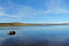
This walk takes you over Widdybank Fell, along the track to Cow Green dam and Cauldron Snout waterfall. The walk follows a tarmac track with 1 large kissing gate and 3 steep sections. Suitable for pushchairs and wheelchairs with strong pushers! However for the last 100m section, to view Cauldron Snout waterfall, the track is rocky and uneven. On the backbone of England, around the headwaters of the River Tees, 8,800 hectares of upland country forms the Moor House–Upper Teesdale National Nature Reserve (NNR). The reserve encompasses an almost complete range of upland habitats typical of the North Pennines, from lower lying hay meadows, rough grazing and juniper woods to limestone grassland, blanket bogs and the summit heaths of the high fells. Nowhere else in Britain is there such a diversity of rare habitats in one location. The remote and dramatic landscape of the reserve can be enjoyed from the Pennine Way National Trail, the Public Rights of Way network and on Open Access land.
Location:
Starting from the Cow Green Reservoir car park (NY811309)
Distance:
5 km
Terrain:
Off road sections, On road sections, Steep sections
Area:
Access:
Recreation opportunities:
Interests:
Wild Brown Trout - Balderhead Reservoir
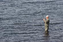
Balderhead Reservoir in Teesdale is one of best wild brown trout fisheries in the country. It is full of fighting fit trout, providing excellent sport. Surrounded by the fantastic scenery of the North Pennines grouse moors, there are few more tranquil and relaxing ways to spend a day’s fishing than roaming the banks of these waters, and even fewer places where you can catch truly wild browns. The trout in these reservoirs are 100% native, having descended from the original upland brownies which lived in the streams before the dams were built. Lightning quick and very hard fighting with unique colours and markings, these fish are a joy to catch. Please note, from Wednesday 5 September 2012, day permits for Cow Green, Balderhead and Selset are available to buy in person from Grassholme Reservoir, by calling 0845 155 02366 or online at www.fishpal.com.
Location:
Car park on the north east side of the reservoir.
Terrain:
Off road sections
Area:
Access:
Recreation opportunities:
Interests:
Link:
Download:
Wild Brown Trout - Cow Green Reservoir
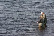
Cow Green Reservoir in Teesdale is one of best wild brown trout fisheries in the country. It is full of fighting fit trout, providing excellent sport. Surrounded by the fantastic scenery of the North Pennines grouse moors, there are few more tranquil and relaxing ways to spend a day’s fishing than roaming the banks of these waters, and even fewer places where you can catch truly wild browns. The trout in these reservoirs are 100% native, having descended from the original upland brownies which lived in the streams before the dams were built. Lightning quick and very hard fighting with unique colours and markings, these fish are a joy to catch. Please note, from Wednesday 5 September 2012, day permits for Cow Green, Balderhead and Selset are available to buy in person from Grassholme Reservoir, by calling 0845 155 02366 or online at www.fishpal.com.
Location:
Starting from the Cow Green car park
Terrain:
Off road sections
Area:
Access:
Recreation opportunities:
Interests:
Link:
Download:
Wild Brown Trout -Selset Reservoir
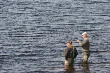
Selset Reservoir in Teesdale is one of best wild brown trout fisheries in the country. It is full of fighting fit trout, providing excellent sport. Surrounded by the fantastic scenery of the North Pennines grouse moors, there are few more tranquil and relaxing ways to spend a day’s fishing than roaming the banks of these waters, and even fewer places where you can catch truly wild browns. The trout in these reservoirs are 100% native, having descended from the original upland brownies which lived in the streams before the dams were built. Lightning quick and very hard fighting with unique colours and markings, these fish are a joy to catch. Please note, from Wednesday 5 September 2012, day permits for Cow Green, Balderhead and Selset are available to buy in person from Grassholme Reservoir, by calling 0845 155 02366 or online at www.fishpal.com.
Location:
Car park on the north east side of the reservoir off the B 6276.
Terrain:
Off road sections
Area:
Access:
Recreation opportunities:
Interests:
Download:
Wild North Discovery
Activities centred on discovery and exploration of the natural world. We offer bushcraft and survival skills (30 years experience and qualified to teach bushcrafts to groups through the Institute for Outdoor Learning), wild food foraging (as seen on TV with Robson Green), bird watching tours, wildlife & nature exploration activities including animal tracking, pond dipping and minibeast hunts for families, and greenwood crafts including pole lathe and willow basket weaving. Activities can be booked for a half or full day for two or more people either adult or family groups. Weekend and full week activities are also available.
Location:
Harehope Quarry Project - near Frosterley in Weardale. Activities are available at other sites in Weardale and Teesdale - see website for details
Terrain:
Boggy ground, Off road sections, Steep sections
Area:
Access:
Recreation opportunities:
Interests:
Link:


