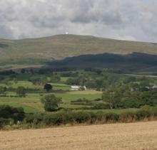
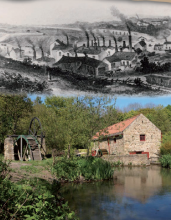
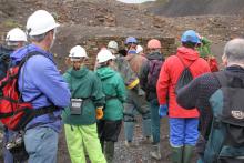
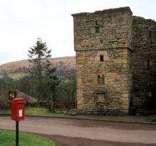
Industrial heritage

From medieval times, the North Pennines became one of Britain’s most important lead mining areas.

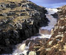
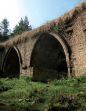
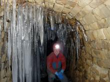
Mining was on a relatively small scale until the mid-18th century, but from this time until the early 20th century much of the area was dominated by lead mining and the landscape was transformed. Levels were driven miles underground to exploit the lead veins and the ground surface became stubbed with mine complexes, dressing floors and smelt mills. The hills were crisscrossed with leats providing water power to various sites, flues taking noxious gases away from the smelt mill to chimneys high up on the hills, and tracks and railways providing access to all the different sites. Aside from lead iron, coal and later fluorspar were also mined here. Elsewhere quarrymen extracted limestone, sandstone and whinstone from the ground.

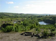
After these industries went into decline in the late 19th and early 20th century these mines and quarries were closed, often leaving all their buildings and structures and equipment in situ. As a result the North Pennines has been left with a rich industrial heritage which is best appreciated at sites like Killhope Lead Mining Museum, Shildon Engine House and Ashes Quarry.


Allen Banks Geotrail

A 4km circular walk at Allen Banks, exploring landscape, rocks, plants and evidence of an industrial past.
Location:
Starts from the National Trust car park at Allen Banks (NY798640). Pay and display for non-National Trust members.
Distance:
4 km
Terrain:
Off road sections, Steep sections
Facilities nearby
Recreation opportunities:

Allenheads - Family Trail Guide

 ©
Family-friendly trail around Allenheads. Developed as part of the Dukesfield Smelters and Carriers Project (www.dukesfield.org.uk).
Location:
Allenheads in the East Allen Valley.
Terrain:
On road sections
Facilities nearby
Recreation opportunities:
Interests:

Allenheads Geotrail

Above Allenheads © NPAP
The landscape around Allenheads has been over 300 million years in the making. From tropical seas and deltas to minerals and miners – all have played their part in shaping this beautiful landscape. This 5km circular walk will introduce you to some of the special features of the landscape around Allenheads. By spotting clues in the moors, fields and buildings you’ll find out how to read the landscape and discover more about its fascinating past.
Location:
Starting from Allenheads car park (NY859453 / NE47 9HJ) in the East Allen Valley.
Distance:
5 km
Terrain:
Boggy ground, Off road sections, On road sections
Facilities nearby
Recreation opportunities:

Alston Packhorse Trail - Horse

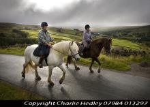
Riding the Alston Packhorse Trail © NPAP/Charlie Hedley
This 29km (912m of ascent) circular horse riding route (30% off-road) starts and finishes in Nenthead. You’ll travel through a landscape rich with echoes of the area’s lead mining past. Passing through the small town of Alston and the villages of Nenthead and Garrigill, as well as over the high moors, it’s a route of contrasts.
Location:
Starts and finishes at Nenthead Mines car park (NY781436 / CA9 3NR - nearest).
Distance:
29 km
Terrain:
Boggy ground, Off road sections, On road sections, Steep sections
Facilities nearby
Recreation opportunities:

Alston Packhorse Trail - Mountain Biking
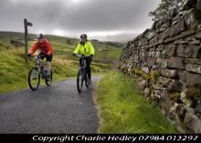
Alston Packhorse Trail © NPAP/Charlie Hedley
This 29km (912m of ascent) circular mountain biking route (30% off-road) starts and finishes in Nenthead. You’ll travel through a landscape rich with echoes of the area’s lead mining past. Passing through the small town of Alston and the villages of Nenthead and Garrigill, as well as over the high moors, it’s a route of contrasts.
Location:
Starts and finishes at Nenthead Mines car park (NY781436 / CA9 3NR - nearest).
Distance:
29 km
Terrain:
Boggy ground, Off road sections, On road sections, Steep sections
Facilities nearby
Recreation opportunities:

Alston Training and Adventure Centre

The Alston Training and Adventure Centre is a family run centre offering a range of options from a full package of outdoor activities based at our residential centre. These are led by our highly skilled, experienced and qualified staff and are ideal for school and youth groups. The vast majority of the activities are carried out in the natural environment of the North Pennines. These activities include climbing, abseiling, canoeing, mine exploration, gorge walking, problem solving and team building. Alston Training and Adventure Centre offer facilities for ski hire and accommodation for those travelling further and wishing to stay for a weekend or mid-week break when the slopes are open. We stock a range of skies from children’s (100) to adult (190) These can be hired on a daily or weekend basis. We also offer accommodation only for groups who wish to carry out their own programme of activities be it a mine exploration group, university canoe club or a walking group wishing to explore new areas. The centre is also highly popular for cyclists on the C2C route and walkers on the Pennine Way.
Location:
Garrigill, Alston

Ashes Quarry Geotrail

Ashes Quarry above Stanhope in Weardale © NPAP/Neil Diment
Here, for 70 years and more, hundreds of men toiled by hand with simple tools to dig the Great Limestone out of the Weardale fells, just a short distance from the centre of Stanhope. They left behind a huge, mile-long hole in the ground which today, over 60 years since they downed tools, nature is slowly reclaiming. This 2-mile circular route follows the paths the quarrymen would have once taken to work. It rewards a bit of a climb at the start with fantastic views over Stanhope and a fascinating insight into Weardale's industrial past.
Location:
Starting from the Durham Dales Centre car park in Stanhope (NY996392 / DL13 2FJ).
Distance:
3 km
Terrain:
Boggy ground, Off road sections, On road sections, Steep sections
Area:
Recreation opportunities:

Baldersdale Packhorse Trail - Horse

Baldersdale Packhorse Trail © Natural England/Charlie Hedley
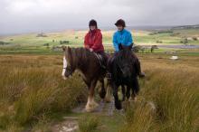
This circular 18km (60% off-road) horse riding trail has 370m of ascent and starts from the south side of Hury Reservoir. It initially follows the banks of Hury and Blackton Reservoirs in remote Baldersdale, before striking off over the moors on the Pennine Way.
Location:
Starts and finishes from the Northumbrian Water car park on the south side of Hury Reservoir (NY966192 / DL12 9UP - nearest).
Distance:
18 km
Terrain:
Boggy ground, Off road sections, On road sections, Steep sections
Area:
Access:
Recreation opportunities:

Baldersdale Packhorse Trail - Mountain Biking
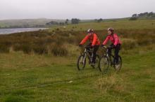
Baldersdale Packhorse Trail © NPAP/Charlie Hedley
This circular 18km (60% off-road) mountain biking trail has 370m of ascent and starts from the south side of Hury Reservoir. It initially follows the banks of Hury and Blackton Reservoirs in remote Baldersdale, before striking off over the moors on the Pennine Way.
Location:
Starts and finishes from the Northumbrian Water car park on the south side of Hury Reservoir (NY966192 / DL12 9UP - nearest).
Terrain:
Boggy ground, Off road sections, On road sections, Steep sections
Area:
Access:
Recreation opportunities:

Blackton Reservoir: North Pennine Birdwalks - Walk 14
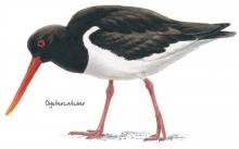
Oystercatcher © NPAP
The meadows, pastures and allotments of Baldersdale support large numbers of breeding waders which make an impressive sight during the spring and summer months. Like all areas of open water in the North Pennines, Blackton Reservoir also provides a refuge for wildfowl during the harsh winter months. This area is therefore worth a visit at any time of year.
Location:
Starting from the small car park at the road end (NY935176).
Distance:
6 km
Terrain:
Boggy ground, Off road sections, On road sections
Area:
Access:
Recreation opportunities:

Blanchland Geotrail

Blanchland © NPAP/Shane Harris
The landscape around Blanchland has been over 300 million years in the making. From tropical seas and deltas to glaciers, minerals and miners – all have played their part in shaping this beautiful landscape. This 6km circular walk will introduce you to some of the special features of the landscape around Blanchland. By spotting clues in the moors, fields and buildings you’ll find out how to ‘read’ the landscape and discover more about its fascinating past. The sections opposite give some background information about how the local rocks and minerals formed, and tell you a bit about the area’s mining heritage.
Location:
Starting from Blanchland car park (NY964504 / DH8 9TA - nearest).
Distance:
6 km
Terrain:
Boggy ground, Off road sections, On road sections, Steep sections
Recreation opportunities:

Blanchland Packhorse Trail - Horse

Blanchland Packhorse Trail © NPAP/Charlie Hedley
This 21km circular horse riding route is 70% off-road and enjoys 1,027m of ascent. It starts at Baybridge, close to the village of Blanchland. You’ll follow the Carriers’ Way across Bulbeck Common, alive with the evocative calls of wading birds in the spring and early summer.
Location:
Starts and finishes in the Baybridge car park (NY957499 / DH8 9UB - nearest).
Distance:
21 km
Terrain:
Boggy ground, Off road sections, On road sections, Steep sections
Access:
Recreation opportunities:

Blanchland Packhorse Trail - Mountain Biking
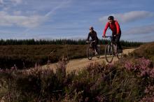
Blanchland Packhorse Trail © NPAP/Charlie Hedley
This 21km circular mountain biking route is 70% off-road and enjoys 1,027m of ascent. It starts at Baybridge, close to the village of Blanchland. You’ll follow the Carriers’ Way across Bulbeck Common, alive with the evocative calls of wading birds in the spring and early summer.
Location:
Starts and finishes in the Baybridge car park (NY957499 / DH8 9UB - nearest).
Distance:
21 km
Terrain:
Boggy ground, Off road sections, On road sections, Steep sections
Access:
Recreation opportunities:

Bowlees Visitor Centre

Bowlees Visitor Centre    © NPAP
Bowlees Visitor Centre, run by the North Pennines AONB Partnership, is a fantastic base for exploring Upper Teesdale, with footpath links to Low Force, High Force, Newbiggin and the Pennine Way. The Centre provides information and displays on the geology and landscape, wildlife and people of Upper Teesdale and the wider North Pennines. You'll find a delicious range of food and drinks and our shop stocks nature inspired gifts and books. You'll find a range of special events are running at the Centre throughout the year. You can also hire the venue for family get-togethers, parties and meetings. We have a range of outdoor cooking facilities which can be pre-booked. The Centre is dog-friendly and you'll find free Wi-Fi access, an iGlass (24-hour information touch screen) and an electric car-charging point. Follow the Richard Watson Trail from the Centre - a 2¾-mile circular route exploring the life and times of Richard Watson, Victorian lead miner and poet. The most popular walk is probably the High Force-Low Force Round. The Centre is also an official Dark Sky Discovery Site.
Location:
Newbiggin, Bowlees, Middleton-in-Teesdale, Co. Durham, DL12 0XE (grid ref - NY906281). 01833 622145.
Area:
Facilities nearby

Burnhope Head: North Pennine Birdwalks - Walk 7
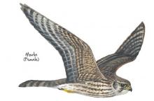
Merlin © NPAP
Even in the depths of winter the heather moorland at Burnhope Head is home to large numbers of red grouse. Seeming to catapult from the heather in display whilst giving their loud “get back, get back” call, red grouse are a dramatic sight. During spring and summer their numbers are swelled by a multitude of breeding waders and the moorland seems to burst with life. With sweeping views all around, this is always an impressive walk.
Location:
Starting from the large lay-by near Dead Friars Stone (NY973453).
Distance:
5 km
Terrain:
Boggy ground, Off road sections, On road sections
Access:
Recreation opportunities:

Canoes, Mountains and Caves

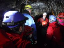
Mine exploration in the North Pennines © Canoes, Mountains and Caves
Canoes, Mountains & Caves is run by husband and wife team: Mal & Marion Tabb. Based in Carlisle, Cumbria they offer outdoor activities across northern England. In the North Pennines they offer mine exploration trips as well as climbing. The under world is a speciality - from a gentle introductory half day/evening to more challenging vertical trips in the area. Adventurer or mine historian - make use of our local knowledge and up to date gear to enjoy your underground adventure.
Location:
Canoes, Mountains and Caves are based in Carlisle. Their mine exploration trips are often in the mines around Nenthead on Alston Moor in the Cumbrian North Pennines. Contact Mal and Marion on 01228 319894 / 07539 733681 / cmcmmt1@gmail.com for details and advice.
Terrain:
Boggy ground, Off road sections, On road sections, Steep sections
Access:
Facilities nearby

Cow Green Geological Trail

Cauldron Snout on the River Tees © Natural England/Charlie Hedley
The trail will introduce many of the rocks which make the Teesdale landscape so special and which make the dale a haven for rare and interesting plants. This trail is within Moor House-Upper Teesdale National Nature Reserve (NNR), an internationally important place for wildlife and earth heritage. The NNR is managed by Natural England in partnership with Raby and Strathmore Estates and local farmers. Do examine the rocks, minerals and plants you will see along the way but please do not collect them: leave them for others to enjoy.
Location:
Starting from Wheelhead Sike car park at Cow Green.
Distance:
8 km
Terrain:
Boggy ground, Off road sections, On road sections, Steep sections
Area:
Access:
Recreation opportunities:

Derwent Gorge: North Pennine Birdwalks - Walk 6

Redstart © NPAP
The upland oak woodland of the Derwent Gorge is a dramatic relic of the once extensive forests of the North Pennines. Now a National Nature Reserve managed by Natural England, this woodland contains many interesting and unusual plants such as sweet woodruff, enchanters’ nightshade and wood bitter-cress as well as a great range of resident and migratory birds. Views across the woodland canopy from the gorge sides are impressive and are excellent for bird watching. The walk begins on the edge of the wood in an area of arable farmland, offering opportunities for you to see both farmland and woodland birds.
Location:
Starting from the grassy parking area at the crossroad between Wallish Walls and Crooked Oak (NZ057500).
Distance:
2 km
Terrain:
Boggy ground, Off road sections, On road sections, Steep sections
Access:
Recreation opportunities:

Derwent Reservoir and Pow Hill Country Park

Couple walking at Pow Hill Country Park © NPAP
Welcome to Derwent Reservoir and Pow Hill Country Park! This leaflet is one of a number of ways in which you can find out about the wildlife and history of Derwent Reservoir and Pow Hill Country Park. The heathland around the reservoir is a haven for reptiles like Adders, Slow Worms and Common Lizards. The reservoir is also important to many species of birds which use it as a migratory stop over and breeding site.
Location:
Routes starting from either Derwent Reservoir car park or Pow Hill Country Park car park.
Distance:
2 km
Terrain:
Off road sections
Facilities nearby
Recreation opportunities:

Derwent Reservoir: North Pennine Birdwalks - Site 1

Black headed gull © NPAP
Derwent Reservoir can be an interesting place to watch birds at any time of year. Wildfowl such as greylag goose, mallard, teal and tufted duck may be seen year-round, their numbers being swelled during autumn and winter by wigeon, pochard and goldeneye. Large flocks of gulls also congregate on the reservoir during the winter, most notably black headed, common and herring gull. Other species of interest include grey heron, goosander, cormorant and great crested grebe.
Location:
Multiple viewing points around the reservoir.
Terrain:
Off road sections, On road sections
Facilities nearby
Recreation opportunities:

Discovering the Lead Mining Heritage of the North Pennines
 ©
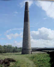
This guide provides information (and a map) on the many and varied and fascinating places in the North Pennines where signs of the area's industrial past can still be seen, including: Langley Smelt Mill Chimney, Nenthead, Killhope Museum, Allenheads, Rookhope Arch, Weardale Museum, Shildon Engine House, West Rigg Opencut and Eggleston Saddle House. An interesting map also shows the historical lead routes to Blaydon.
Location:
The leaflet details 14 locations across the North Pennines AONB.
Terrain:
Off road sections, On road sections
Area:
Access:
Recreation opportunities:
Interests:

Dukesfield Arches & Devil's Water

 ©
A 10km walk uncovering the lead industry heritage of this hidden part of Hexhamshire. Developed as part of the Dukesfield Smelters and Carriers Project (www.dukesfield.org.uk).
Location:
Travel south from Hexham towards Slaley on the B6306 road take the minor road on the right before Travellers Rest Inn (signed Whitley Chapel, Juniper, Dukesfield). Head towards Whitley Chapel and as the road drops down to the bridge, slow down and look for the parking area and gate on your left (NY943581). Nearest post code is NE46 1SG. Please do not obstruct the gate when leaving your car.
Distance:
10 km
Terrain:
Off road sections, On road sections
Access:
Recreation opportunities:
Interests:

Dukesfield Arches - Family Trail Guide
 ©
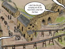
Family-friendly trail at Dukesfield Arches. Developed as part of the Dukesfield Smelters and Carriers Project (www.dukesfield.org.uk).
Location:
Travel south from Hexham towards Slaley on the B6306 road take the minor road on the right before Travellers Rest Inn (signed Whitley Chapel, Juniper, Dukesfield). Head towards Whitley Chapel and as the road drops down to the bridge, slow down and look for the parking area and gate on your left (NY943581). Nearest post code is NE46 1SG. Please do not obstruct the gate when leaving your car.
Terrain:
Off road sections
Access:
Recreation opportunities:
Interests:

East Allen Valley Wildflower Walk

Allenheads © © NPAP & Elizabeth Pickett
A lovely 5.5 mile (9km) walk from Allenheads exploring the wonderful wildlife of wildflowers in the East Allen Valley. This circular walk will introduce you to some of the special plants of the North Pennines and the creatures that depend on them. Along the way you'll discover plants that are adapted to the harsh conditions of the area and get a bee's-eye view of finding food.
Location:
Allenheads parking area
Distance:
9 km
Terrain:
Boggy ground, Off road sections, On road sections
Facilities nearby
Recreation opportunities:

Eden Outdoor Adventures

Gyhll scrambling © Eden Outdoor Adventures
Eden Outdoor Adventures is a small, friendly, family company run by Ian and Melanie. We provide tailor made courses for individuals, families and groups. We believe that by tailor making your course we can offer quality instruction and guiding with the personal touch, allowing people to get the most out of their time with us. We work hard to understand your needs and to design days to offer a challenge and to make your dreams come true. To help do this, Eden Outdoor Adventures draw upon a great deal of knowledge and experience from working in the outdoors and the areas in which we operate. They also hold National Qualifications in the activities we offer to ensure you the highest standards. We offer half day to multiple day trips in the Lake District, Eden Valley, Northern Pennines, Scotland and Wales as well as further afield. From guided tours, low level family walks through wooded valleys, introductory climbing and canoeing to demanding mountain and river trips in wild places. Wherever your dreams take you, let Eden Outdoor Adventures help make them come true.
Location:
Ousby, Penrith, Cumbria.

Epiacum Roman Fort

Ramparts at Epiacum Roman Fort © Epiacum Heritage Ltd
At 330m (1050ft) above sea level, Epiacum (Whitley Castle) is the highest stone-built Roman fort in Britain. It housed a garrison of about 500 men, and was probably built to control mining for lead and silver. Although we have yet to discover evidence for Roman mining in the North Pennines, archaeologists agree that it must have taken place here. The Roman road known as the Maiden Way (between the forts at Kirkby Thore, in the Eden Valley, and Carvoran, on Hadrian’s Wall) passes close by the Fort. A trail leaflet is available at the car park (1 hour, rough terrain)
Location:
Epiacum Roman Fort is in the South Tyne Valley three miles north of Alston / 3 miles south of Slaggyford. It can be accessed either from the Pennine Way which passes alongside it or from a small car parking area (honesty box donations) below the Fort on the A689.
Terrain:
Off road sections, Steep sections
Access:
Recreation opportunities:

Hamsterley Packhorse Trail - Horse

Hamsterley Packhorse Trail © NPAP/Charlie Hedley
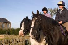
This 26km horse riding route is 75% off-road and you'll climb 846m. It's a ride of contrasts - in the forest and out over the open moor. You’ll follow an old drove road on the return to the forest from Eggleston.
Location:
Starts and finishes from the Grove car park in Hamsterley Forest (NZ064297).
Distance:
26 km
Terrain:
Boggy ground, Off road sections, On road sections, Steep sections
Area:
Access:
Facilities nearby
Recreation opportunities:

Hamsterley Packhorse Trail - Mountain Biking

Hamsterley Packhorse Trail © NPAP/Charlie Hedley
This 26km mountain biking route is 75% off-road and you'll climb 846m. It's a ride of contrasts - in the forest and out over the open moor. You’ll follow an old drove road on the return to the forest from Eggleston.
Location:
Starts and finishes from the Grove car park in Hamsterley Forest (NZ064297).
Distance:
26 km
Terrain:
Boggy ground, Off road sections, On road sections, Steep sections
Area:
Access:
Facilities nearby
Recreation opportunities:

Hartside Packhorse Trail - Horse Riding
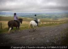
Hartside Packhorse Trail © NPAP/Charlie Hedley
This 11km horse riding route starts and finishes from Hartside Top Cafe - it's 75% off-road and packs in 458m of ascent! A dramatic ride from the Pennine escarpment down into the Eden Valley and back up to the top again!
Location:
Starts and finishes from Hartside Top car park (NY646418 / CA9 3BW - nearest).
Distance:
11 km
Terrain:
Boggy ground, Off road sections, On road sections, Steep sections
Access:
Facilities nearby
Recreation opportunities:

Hartside Packhorse Trail - Mountain Biking
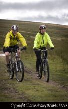
Hartside Packhorse Trail © NPAP/Charlie Hedley
This 11km mountain bike ride starts and finishes from Hartside Top Cafe - it's 75% off-road and packs in 458m of ascent! A dramatic ride from the Pennine escarpment down into the Eden Valley and back up to the top again!
Location:
Starts and finishes from Hartside Top car park (NY646418 / CA9 3BW - nearest).
Distance:
11 km
Terrain:
Boggy ground, Off road sections, On road sections, Steep sections
Facilities nearby
Recreation opportunities:

In the footsteps of the Allen Valley lead miners

An 8-mile walk discovering the lead mining heritage of the beautiful East Allen Valley. Developed as part of the Dukesfield Smelters and Carriers Project (www.dukesfield.org.uk).
Location:
Smelt Mill Bridge, near Allenheads (NY852464). Nearest post code for sat navs NE47 9HG.
Distance:
13 km
Terrain:
Off road sections, On road sections
Access:
Facilities nearby
Recreation opportunities:
Interests:

Isaacs Tea Trail

 © Roger Morris
Isaac's Tea Trail is a long distance path inspired by the tale of Isaac Holden. Not only a tea seller, Isaac was a local philanthropist and the trail takes you past many legacies of Isaac's fundraising.
Location:
The circular walk can be accessed from many locations, 4 sections have been suggested: Section 1: Allendale Section 2: Nenthead Section 3: Alston Section 4: Ninebanks
Distance:
58 km
Terrain:
Boggy ground, Off road sections, On road sections
Facilities nearby
Recreation opportunities:

Killhope Lead Mining Museum

Washing Floor at Killhope © Killhope Museum
A visit to Killhope, the award winning North of England Lead Mining Museum, is a unique and unforgettable experience. Killhope is a fully restored nineteenth century Victorian lead mine, where you can experience for yourself the life and work of the lead mining families of the Pennine dales. Our enthusiastic and knowledgeable staff are here to help you get the most from your visit; they are what make Killhope a multi award wining venue. Killhope is famous for its huge working waterwheel, but there is much more to Killhope. You can experience the mineshop where miners lived. You can work as a 'washerboy' looking for minerals and galena (which is the lead ore). You can see the working machinery (which Fred Dibnah admired so much) in the 'jigger house'. But above all, Killhope's award-winning mine tour is unique. From the moment you put on your hard hats, cap-lamps and wellingtons, your visit becomes an unforgettable adventure! Killhope holds the largest collection of Spar Boxes which sits alongside Magnificent Minerals and the Pennine Jewels. Two permanent commissions, Letters of Lead and Language of Lead, part of museumaker, a prestigious national project. We also have an array of art works and installations which adorn our visitor centre and site. You can stroll round Killhope's woodland paths (maybe with a nature backpack). You will see some wildlife and red squirrels. Take a break in Killhope Cafe and sample our wonderful home made soups, pasties and cakes. Our gift shop stocks a wide range of books, maps, keepsakes and souvenirs. Killhope - a great day out in the country for all the family!
Location:
Near Cowshill, Upper Weardale, Co. Durham, DL13 1AR.
Terrain:
Steep sections
Area:

Knock Geological Trail

Great Dun Fell © NPAP/Shane Harris
This different rocks and landscape features along this trail tells the story of the events and geological processes that have created this landscape over nearly 500 million years of Earth history. Stout boots, warm clothing and good waterproofs are advised as even in summer the climate of the North Pennine escarpment can be harsh and cloud can descend quickly. Allow a full day for the complete walk. Use of an Ordnance Survey map and compass is recommended for this route. In places the route passes old mine workings, parts of which may be unstable. Please keep to footpaths and do not attempt to enter old tunnels or any old surface excavations. Do examine the rocks and minerals you will see along the way but please do not collect them: leave them for others to enjoy.
Location:
At the end of a minor road west of Knock (NY686288).
Distance:
10 km
Terrain:
Boggy ground, Off road sections
Access:
Recreation opportunities:

Lambley and the South Tyne: North Pennine Birdwalks - Walk 1
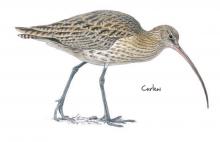
Curlew © NPAP
This walk combines a number of different North Pennine habitats to dramatic effect. You will pass through an expansive area of rushy allotment adjacent to heather moorland where in spring and summer the air is alive with the sounds and sights of numerous breeding waders. The views across the South Tyne Valley are similarly impressive. By contrast, the second leg of the walk passes along the route of a disused railway line that is largely clothed in woodland, offering tantalising glimpses of the surrounding countryside and excellent opportunities to see and hear woodland birds. The walk centres on Lambley Viaduct, a stunning landscape and architectural feature from where the River South Tyne and its wildlife can be viewed from on high.
Location:
Lambley Viaduct – South Tyne Trail car park (NY679595).
Distance:
13 km
Terrain:
Boggy ground, Off road sections, On road sections
Recreation opportunities:

Lost industrial Blaydon

 ©
A three mile walk of contrasts between urban streets and rural woods and views, exploring traces of the lost lead industry and other remains in the Blaydon area. Developed as part of the Dukesfield Smelters and Carriers Project (www.dukesfield.org.uk).
Location:
Start either from Blaydon Railway Station or the Blaydon Shopping Centre car park.
Distance:
5 km
Terrain:
On road sections
Facilities nearby
Recreation opportunities:
Interests:

Nenthead Mines

Nenthead Mines ©
Nenthead Mines is an important historic place at Nenthead, near Alston, in Cumbria, UK. This remote valley is covered by remains from the lead and zinc mining industry of the North Pennines, including mine entrances, dumps and old buildings. The site includes a geology Site of Special Scientific Importance and is notable for rare lichens and plants growing on the metal-rich mine dumps. Most of the valley is a National Ancient Monument. The conserved buildings on the site include a small museum and interpretation display and there is a network of paths and trackways. Carrs Mine is an old lead and zinc mine which is open to visitors on special days. Guided trips into the mine are arranged on Open Days. The Nenthead Mines Conservation Society is working with Cumbria County Council to care for, manage and maintain this historic site. Most of the valley is owned by Cumbria County Council and is managed on their behalf by the Society.
Location:
Nenthead Mines is located in the village of Nenthead in the Cumbrian North Pennines
Terrain:
Boggy ground, Off road sections, Steep sections
Facilities nearby
Recreation opportunities:

Newbiggin and the Carriers’ Way

Walkers on the heather moors © NPAP/Shane Harris
This leaflet is one of a series designed to help you discover the treasures of Blanchland - both natural and man-made. This attractive walk takes you from Blanchland, along the River Derwent, up on to open moorland. The moorland is exposed and can experience harsh weather. The wild landscape surrounding Blanchland bustles with evidence of people, from Mesolithic hunters to lead miners and modern land managers. Everywhere you look you see the imprint of our ancestors. Many landscape scars have been hidden by nature and it is hard to believe that in the not-so-distant past this quiet landscape was once home to major industry.
Location:
The walk starts from Blanchland car park (NY964505)
Distance:
14 km
Terrain:
Boggy ground, Off road sections, On road sections
Facilities nearby
Recreation opportunities:

Ninebanks Tower

Ninebanks Tower © Natural England/Charlie Headley
The turbulent days of the Border Reivers are evoked by Ninebanks Tower. The sandstone tower is all that remains above ground of a large medieval house, to which the tower seems to have been added in about 1520. The four storey tower has inverted shields on a second floor window lintel which possibly relate to Sir Thomas Dacre (1515 – 1526), the ruler of Hexhamshire. Ninebanks is not classed as a defensible structure because the walls are considered too thin; it may have served as a lookout.
Location:
Ninebanks village.
Terrain:
On road sections
Access:
Recreation opportunities:

Open access walks in Cumbria: Cold Fell
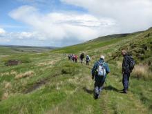
Walkers on Gairs track © NPAP/Elizabeth Pickett
Marking the northern end of the Pennine Chain, the aptly named Cold Fell is also the most northerly mountain in Cumbria. Although this route is relatively short, it is a serious undertaking with a steep ascent and descent, coupled with terrain that is usually wet and hard going throughout the year. Nevertheless it’s still a fine walk which is full of interest with excellent views across the Border region.
Location:
Starting from car park beyond Clesketts near Hallbankgate.
Distance:
11 km
Terrain:
Boggy ground, Off road sections, On road sections, Steep sections
Facilities nearby
Recreation opportunities:

Open access walks in Cumbria: Geltsdale
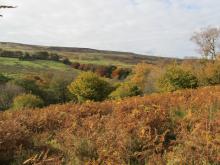
Binney Bank wood below Tarnmonath Fell © NPAP/Gearoid Murphy
A good walk for days when the cloud is low, favouring a lower level circuit of the picturesque Geltsdale without the need to venture too high up. Discover remnants of the valley’s industrial past, whilst savouring the delights of her wildlife and scenery of this now tranquil Valley.
Location:
Starting from the parking verge at Jockey Shield near Castle Carrock.
Distance:
10 km
Terrain:
Off road sections
Facilities nearby
Recreation opportunities:

Open access walks in Cumbria: North Pennine Ridge (Southern Section)
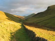
View of Pikes from Knock Fell © NPAP/Elizabeth Pickett
Following the spine of the Pennine ridge from Dufton to Hartside Pass this linear walk passes over Cross Fell which is the highest point in England outside of the Lake District. Partly following the Pennine Way National Trail and partly on pathless moorland this route rewards with stunning views throughout, especially those across the Eden valley to the distant Lakeland Fells. This linear route is a serious undertaking in any weather, and to help with navigation it is described in both directions.
Location:
Starting from the village green in Dufton village which is approx 3½ miles north of Appleby-in-Westmorland. Parking available in the small car park just off the village green.
Distance:
23 km
Terrain:
Boggy ground, Off road sections, On road sections
Facilities nearby
Recreation opportunities:

Open access walks in Cumbria: Talkin Fell
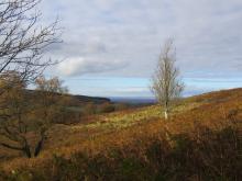
View down the River Gelt Valley © NPAP/Gearoid Murphy
This short walk is ideal for those with a few hours to spare, and serves as a perfect introduction to open access. The route follows excellent public rights of way, and distinct desire lines once you venture onto the access land. On a clear day the panorama from the top of Talkin Fell is probably one of the best you’ll get for the effort involved in getting there.
Location:
Starting from the parking verge at Jockey Shield near Castle Carrock.
Distance:
7 km
Terrain:
Off road sections
Facilities nearby
Recreation opportunities:

Open access walks in Cumbria: Thack Moor and Black Fell
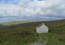
Cottage near Hartside summit © NPAP/Simon Wilson
One of the more serious undertakings, this routes ventures onto the main North Pennine ridge, via the outlying top of Thack Moor. Tranquillity, solitude and a sense of moorland grandeur is guaranteed on the first section. A much deserved break at Hartside Café is recommended, before the return leg to Renwick following public rights of way on good tracks and paths.
Location:
Starting from Townhead, at the northern end of Renwick village towards the parish church. Roadside parking is available at the church.
Distance:
17 km
Terrain:
Boggy ground, Off road sections, On road sections
Facilities nearby
Recreation opportunities:

Pinpoint Adventure

Mine exploration in the North Pennines © Pinpoint Adventure
Pinpoint Adventure is an adventure activities company run by father son Ian and Tom Hopper based in Northumberland, the North East of England and Cumbria. They run a wide selection of adventure activities using their experience and knowledge to help create 'days to remember'. In the North Pennines they offer amazing underground journeys through one of the old lead mines at Nenthead; this truly is an adventure in all respects and a visit to a very different ‘lost world’. There will be ample opportunity to look at the skills and determination of our ancestors and try to empathise with their working conditions. There are three main trips available: Smallcleugh Mine, Nenthead: Smallcleugh provides a wonderful 4/5 hour underground adventure, with a visit to The Ballroom for a candlelit dinner – well, bacon sandwiches anyway! Tyne Bottom Mine, Garrigill: Tyne Bottom is a super half day trip, with some interesting crawls and wetter sections; we often combine Tyne Bottom with a canyoning adventure in the afternoon. Rampgill Mine, Nenthead: Rampgill provides a very wet couple of hour’s underground, with some wonderful calcite formations. Ian and Tom also offer the following activities: walking, trekking, snowshoeing, climbing, Forest Schools and bushcraft.
Location:
Pinpoint Adventure can provide activities at a variety of locations in the North Pennines. Their mine trips are at Nenthead and at other mines in the Cumbrian North Pennines. Contact Ian Hopper on 07786 872060 (ian@pinpointadventure.com) for details.
Terrain:
Boggy ground, Off road sections
Facilities nearby
Recreation opportunities:

Rookhope: Fields and Fells

Rookhope © NPAP/Shane Harris
The town of Rookhope and its surrounding environs are littered with the remains of its once prosperous mining industry such as the Rookhope arch and Bolts Law engine house. This austere landscape inspired poet W H Auden to write some of his earliest work. Nowadays Rookhope supports fascinating upland flora and fauna and a small tourist industry as a stop off on the C2C cycle route. You can discover these and more interesting facets of Rookhope in this series of circular walks.
Location:
Starting from Rookhope Village Hall.
Distance:
8 km
Terrain:
Boggy ground, Off road sections, On road sections
Area:
Access:
Facilities nearby
Recreation opportunities:

RSPB Geltsdale Walking Trails

Stagsike Cottage at RSPB Geltsdale © NPAP/Gearoid Murphy
Set in the beautiful North Pennines AONB, Geltsdale is home to black grouse, birds of prey and breeding wading birds and is ideal for walking. There are 4 way marked trails leading from the car park of Howgill. The Stagsike trail will take 1-2 hours to walk and the other trails a little longer. Stagsike Cottages are approximately a 40 minute walk from the parking area and provide an information point and toilets. Many of the trails are on existing tracks but boots are essential for much of the year and waterproofs are recommended. There is no general vehicle access to Stagsike Cottages but disabled access can be pre-arranged by phoning the reserve (01697 746717). Trails are open at all times and the information point is open between 9am and 5pm. Dogs are welcome but they should be kept on a lead as the reserve is a working farm. A bus services the village of Hallbankgate, which is approximately a mile away.
Location:
Starting from Clesketts car park (NY588584), near Hallbankgate.
Terrain:
Boggy ground, Off road sections, On road sections
Facilities nearby
Recreation opportunities:

Slitt Wood and West Rigg Geotrail

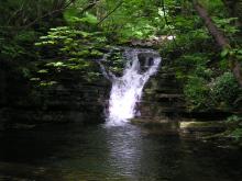
Slitt Wood waterfall © NPAP/Elizabeth Pickett
This route reveals much about the area’s geology, which is strongly linked to this little valley’s industrial past. You will see where lead and iron ores were mined and processed and how the ores were transported out of the valley. Slitt Wood and West Rigg Opencut are legally protected as Sites of Special Scientific Interest (SSSI). Slitt Wood is designated for its variety of habitats including woodland, lime-rich grassland, fen, open water and the revegetated workings of Slitt and Middlehope Mines. Many different types of plants and birds can be spotted at different times of year, including metal tolerant plants known as metallophytes. West Rigg is designated for its geological importance. It provides an excellent illustration of the formation of iron ore and the opencast ironstone workings which expose the structure of a lead vein. Many of the industrial remains also have legal protection as scheduled monuments of national archaeological importance.
Location:
Starting from the lay-by in Westgate.
Distance:
5 km
Terrain:
Boggy ground, Off road sections, On road sections
Area:
Facilities nearby
Recreation opportunities:

St John's Chapel: Farming, Mining and Methodism
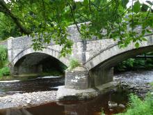
Coronation Bridge in Ireshopeburn, Weardale © NPAP/Gearoid Murphy
This walk traces the history of three neighbouring villages Daddry Shield, St Johns Chapel and Ireshopeburn. From their origins as farming settlements, through to the expansion of the mining industry in the mid 19th Century and the associated rises in population and conversion of locals to Methodism, this region has witnessed dramatic changes which have left their mark on the landscape of the upper dale. This walk tells the story of these developments while pointing out historic buildings and events associated with them.The walk was devised and described by volunteers of The Weardale Museum (www.weardalemuseum.co.uk), Ireshopeburn, where much more information can be found.
Location:
Starting from the Weardale Inn or St John Chapel Cattle Market car park.
Distance:
11 km
Terrain:
Boggy ground, Off road sections, On road sections, Steep sections
Area:
Facilities nearby
Recreation opportunities:

Taste Trails: Allendale to Whitfield Circular

Allendale Bakery © NPAP/Shane Harris
This route takes you from Allendale Town past Allen Mill and through the nearby village of Catton before crossing the valley of the River East Allen to Whitfield. The walk then returns to Allendale along Isaac’s Tea Trail. The route includes riverside walking and takes you through pleasant farmland and scenic wooded valleys. The Allendale landscape has been shaped by a long history of farming, estate management and minerals extraction.
Location:
Starting from Allendale Town in the East Allen Valley
Distance:
18 km
Terrain:
Boggy ground, Off road sections, On road sections
Facilities nearby
Recreation opportunities:

The Chimneys and Dryburn Moor (Allen Valleys): North Pennine Birdwalks - Walk 4
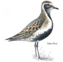
Golden plover © NPAP
This walk epitomises much that is characteristic of the North Pennines Area of Outstanding Natural Beauty (AONB) and UNESCO Global Geopark. High peaty moorland, the sweet melancholy call of the golden plover and the towering remains of chimneys from the area’s lead mining past. All this is surrounded by sweeping views of the dales and settlements below and can be reached without a strenuous climb!
Location:
Starting from a small road side lay-by (NY807531)
Distance:
2 km
Terrain:
Boggy ground, Off road sections
Access:
Recreation opportunities:

The Harehope Quarry Project

A view of Harehope Quarry © Tom Mercer
The Harehope Quarry Project promotes a more sustainable way of living and is a Gold Award holder in the Green Tourism Business Scheme (GTBS). Within a former limestone quarry, the project has developed a fish farm and smallholding, a nature reserve with public access and an eco-classroom built entirely by volunteers. The project has a community events programme and delivers environmental education, field studies and education for sustainable development. The eco-classroom can also be booked for meetings, green birthday parties and other events. In addition there walks ranging from 1km to 4km using permissive paths and Rights of Way around the quarry. Story walk leaflets are available as well as information about the Harehope Quarry Project. Note on site parking is limited, however the quarry is a short walk from Frosterley where additional parking is available.
Location:
Frosterley, Bishop Auckland, Co. Durham, DL13 2SG.
Terrain:
Off road sections, On road sections, Steep sections
Area:

The Lead Road Cycle Route

 ©
A 40-mile loop along the Tyne Valley, returning on the old Lead Road from Hexhamshire to Blaydon. Developed as part of the Dukesfield Smelters and Carriers Project (www.dukesfield.org.uk).
Location:
The cycle ride can be joined at Blaydon, Corbridge or Hexham.
Distance:
66 km
Terrain:
On road sections
Recreation opportunities:
Interests:

The National Trust - Allen Banks and Staward Gorge woodland walk

Bluebells at Allen Banks © NPAP/Shane Harris
Set on the steep valley sides of the river Allen, a tributary of the south Tyne, explore the woods and see what wildlife you can spot on this gentle riverside walk. It's the largest area of ancient woodland in Northumberland and has been here since at least medieval times. This long history has helped make it a fantastic home for flora, fauna and fungi.
Location:
Starting from Allen Banks car park.
Distance:
4 km
Terrain:
Boggy ground, Off road sections, Steep sections
Facilities nearby
Recreation opportunities:

Tynehead Geological Trail

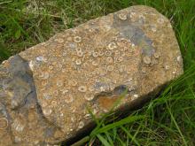
Crinoid fossils © NPAP/Elizabeth Pickett
This trail will introduce many of the rocks that give the landscape of the North Pennines its unique character. The route crosses a number of mineral veins that were once worked commercially and the remnants of mining operations can be seen in several places. Many of the old workings may be unstable - please keep to the footpaths and do not attempt to enter old tunnels or surface excavations. Do examine the rocks and minerals you will see along the route, but please do not collect them: leave them for others to enjoy.
Location:
At the end of a minor road south of Garrigill (Don't block access)
Distance:
4 km
Terrain:
Boggy ground, Off road sections
Access:
Recreation opportunities:

Up on the ridge: Moor House-Upper Teesdale NNR
Knock Pike and the Eden Valley © NPAP/Gearoid Murphy
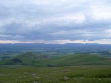
This walk takes you right up along the summit ridge of the Pennines. You’ll be able to see evidence of the area’s mining and quarrying history, take in some stunning views over the high Pennines, and look across the Eden Valley to the Lake District fells. On the backbone of England, around the headwaters of the River Tees, 8,800 hectares of upland country forms the Moor House–Upper Teesdale National Nature Reserve (NNR). The reserve encompasses an almost complete range of upland habitats typical of the North Pennines, from lower lying hay meadows, rough grazing and juniper woods to limestone grassland, blanket bogs and the summit heaths of the high fells. Nowhere else in Britain is there such a diversity of rare habitats in one location. The remote and dramatic landscape of the reserve can be enjoyed from the Pennine Way National Trail, the Public Rights of Way network and on Open Access land.
Location:
Start point at the end of the public road from Knock village, past Knock Christian Centre (NY686288).
Distance:
12 km
Terrain:
Boggy ground, Off road sections, Steep sections
Access:
Recreation opportunities:

Walking around Wolsingham

Hay meadow in Wolsingham © NPAP/Rebecca Barrett
There are many interesting walks leading from the historic town of Wolsingham. These lead to quarries, farms, shafts, mills, and mark out an intricate pattern of journeys to work made over hundreds of years by generations of the people working in Weardale.
Location:
Starting from Wolsingham Railway Station.
Terrain:
Off road sections, On road sections
Area:
Facilities nearby
Recreation opportunities:

Weardale Adventure Centre

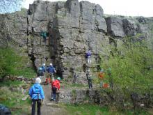
Climbing with the Weardale Adventure Centre team © Weardale Adventure Centre
The Centre – Functioning around a 80-bed, fully catered residential centre, Weardale Adventure Centre offers a multitude of high-quality, outdoor and adventure education, activities. Founded in 1978, the centre has been an integral part of the local community and as such utilises local venues alongside on-site activities to provide groups with a thoroughly enjoyable experience. As such, the centre regularly welcomes back groups that have been utilising the facilities, in some cases for over 20 years! The centre can cater for just about any group, with any needs, however we tend to spend much of our time delivering high quality educational programmes to school groups between the ages of 8 and 18. Whilst these groups may be the staple of centre life, we have a wealth of experience delivering activities to just about any range of clients. We offer a multitude of activities and packages as well as being in the fortunate position of being able to offer bespoke and custom programmes to prospective clients, these can take place on-site, locally within the Weardale area, or further afield.
Location:
Ireshopeburn, Co. Durham, DL131HB.
Area:
Facilities nearby

Weardale Railway

Steam train, Stanhope Station, Weardale Railway ©
The Weardale Railway runs from Stanhope to Bishop Auckland and stations in between. The railway runs a heritage timetable and has a number of special events through the year, including steam services. There is a ticket office, café and shop at Stanhope Station.
Location:
Stanhope
Area:
Recreation opportunities:

Weardale Way - Stanhope to White Kirkley

Footbridge over the Bollihope Burn © NPAP/Gearoid Murphy
Beginning in Stanhope the walk takes you across several burns and through a number of disused limestone quarries to reach the small hamlet of White Kirkley which sits above Frosterley. Limestone has been quarried from the valley sides around Frosterley since the 12th century but it was in the 1800s that the village became an important centre for limestone quarrying. Limestone has many uses - as a road stone, agricultural lime, for flux in the iron and steel industry and for cement. A special type of limestone is found in Frosterley; this fossil-rich stone, known as Frosterley marble, can be polished to a high shine. The most famous use of Frosterley marble is in Durham Cathedral. Here, the ceiling of the Chapel of the Nine Altars is supported by slender columns of this unusual stone.
Location:
Starting from the lay-by, near Unthank Farm, in Stanhope.
Distance:
7 km
Terrain:
Off road sections
Area:
Recreation opportunities:

Weardale Way - White Kirkley to Wolsingham
View over Harehope Quarry © NPAP/Gearoid Murphy
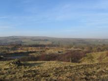
From White Kirkley the walk takes you above Harehope Quarry, which is now run as a workers co-operative offering environmental education and rural skills training. The path then climbs up over Harvey Hill to the edge of the grouse moors where you may see Red Grouse among the heather. The trail then drops down towards Wolsingham passing through a patch of ancient woodland at Ashes Beck. Note there are no facilities or parking spaces at White Kirkley, these are available in either Frosterley or Wolsingham.
Location:
Starting from White Kirkley.
Terrain:
Boggy ground, Off road sections, On road sections
Area:
Facilities nearby
Recreation opportunities:

Wellhope Moor (Nent Valley): North Pennine Birdwalks - Walk 9
Grey partridge © NPAP
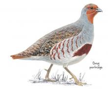
This walk offers both stunning views across the Nent Valley and the opportunity to experience a mix of typical North Pennines upland habitats: hay meadow, pasture and allotment, heather moorland, blanket bog and upland stream. Passing a derelict mine and many old mine shafts, it also typifies the historic lead mining landscape of the area.
Location:
Starting from a small road side lay-by (NY769453).
Distance:
5 km
Terrain:
Boggy ground, Off road sections, On road sections, Steep sections
Access:
Recreation opportunities:

Whitesyke and Bentyfield Mine

Whitsyke and Bentyfield mine © NPAP/Beck Baker
The remains of this 19th century lead mine complex lie on the Garrigill Burn in the South Tyne Valley above Alston. They once formed part of an extensive complex of more than 100 lead mines operating in the area during the 18th and 19th centuries. The remains include a mine shop, a dressing floor and several mine level entrances. You can view the remaining structures from a flagstone path which follows the line of an old tramway and there are interpretative panels in place which detail the processes that occurred here. Facilities are available off site in Garrigill.
Location:
On a hairpin bend on the B 6277 above Garrigill.
Terrain:
Boggy ground, Off road sections
Access:
Facilities nearby
Recreation opportunities: