


Alston and the Cumbrian North Pennines
The countryside around Alston, England’s highest market town, provides some of the finest walking country in the North Pennines. Here you'll find the the lofty Cross Fell the highest English hill outside of the Lake District. To the west the striking North Pennines escarpment is a dramatic backdrop to the attractive, red sandstone-built, fell foot villages.
Discover more in Alston and the Cumbrian North Pennines
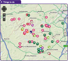
with the interactive map
Railway enthusiasts can hop on the South Tyndale Railway in Alston and enjoy a scenic ride alongthe South Tyne Valley. Nearby are the remains of Epiacum, one of the best preserved examples of a Roman fort in Europe. While further north, the RSPB Geltsdale Nature Reserve is a good place to see the rare Black grouse. This area is also home to Cumbria’s only commercial winery; High Cup Winery. To discover what else this area has to offer click on the map and start exploring!

This 32km cycle route starts in Alston and explores the glorious South Tyne Valley. Note that this electric bike route was originally devised in 2015. It is still valid but some of the information (e.g. hire/charge points) may have changed.
Location:
This route starts and finishes at the South Tynedale Railway/the Hub Museum in Alston (NY716467 / CA9 3HN).
Distance:
32 km
Access:
Car parking, Cycle parking, Public transport
Accessible toilets, Cafe, Playground, Pub, Shop, Toilets
Recreation opportunity:
Cycling
Interests:
Panoramic views
External link:
North Pennines Electric Bike Network

Alston Moor Walkers are Welcome has been part of the UK Walkers are Welcome Network since July 2013. One of its aims is to promote Alston Moor as a destination for walkers for both visitors and local people by providing information on local walks, the area in general and the facilities available. It also leads monthly walks and is involved with the Greg’s Hut Association, who maintain Greg’s Hut, an old lead-mining building high up on Cross Fell now a mountain bothy.
A second aim is to work with the local council regarding the maintenance, improvement and signposting of the footpaths and facilities for walkers on Alston Moor. We would therefore welcome feedback from walkers on any walks they have undertaken in the area, in particular on any problems they may have encountered.
Location:
Based in Alston in the Cumbrian North Pennines. Visit website or call Guy Harmer on 07515 881548.
Access:
Car parking
Accessible toilets, Cafe, Pub, Shop, Toilets
Recreation opportunity:
Walking
External link:

This 29km (912m of ascent) circular horse riding route (30% off-road) starts and finishes in Nenthead. You’ll travel through a landscape rich with echoes of the area’s lead mining past. Passing through the small town of Alston and the villages of Nenthead and Garrigill, as well as over the high moors, it’s a route of contrasts.
Location:
Starts and finishes at Nenthead Mines car park (NY781436 / CA9 3NR - nearest).
Distance:
29 km
Access:
Car parking, Public transport
Playground, Pub, Shop, Toilets
Recreation opportunity:
Horse riding
Interests:
Industrial heritage, Panoramic views
External link:
Packhorse Trails for Horse Riders

This 29km (912m of ascent) circular mountain biking route (30% off-road) starts and finishes in Nenthead. You’ll travel through a landscape rich with echoes of the area’s lead mining past. Passing through the small town of Alston and the villages of Nenthead and Garrigill, as well as over the high moors, it’s a route of contrasts.
Location:
Starts and finishes at Nenthead Mines car park (NY781436 / CA9 3NR - nearest).
Distance:
29 km
Access:
Car parking, Public transport
Playground, Pub, Shop, Toilets
Recreation opportunity:
Cycling
Interests:
Industrial heritage, Panoramic views
External link:
Packhorse Trails for Mountain Bikers
The Alston Training and Adventure Centre is a family run centre offering a range of options from a full package of outdoor activities based at our residential centre. These are led by our highly skilled, experienced and qualified staff and are ideal for school and youth groups. The vast majority of the activities are carried out in the natural environment of the North Pennines. These activities include climbing, abseiling, canoeing, mine exploration, gorge walking, problem solving and team building. Alston Training and Adventure Centre offer facilities for ski hire and accommodation for those travelling further and wishing to stay for a weekend or mid-week break when the slopes are open.
We stock a range of skies from children’s (100) to adult (190)
These can be hired on a daily or weekend basis.
We also offer accommodation only for groups who wish to carry out their own programme of activities be it a mine exploration group, university canoe club or a walking group wishing to explore new areas.
The centre is also highly popular for cyclists on the C2C route and walkers on the Pennine Way.
Location:
Garrigill, Alston
Access:
Car parking, Cycle parking
Recreation opportunity:
Bushcraft and adventure, Canoeing and kayaking, Climbing, Outdoor education, Winter sports
Interests:
Geology, Industrial heritage, Rivers
External link:
Alston Training and Adventure Centre

This 24km cycle route starts in Alston and is essentially a grand tour of the South Tyne and Nenthead Valleys. Note that this electric bike route was originally devised in 2015. It is still valid but some of the information (e.g. hire/charge points) may have changed.
Location:
The route starts and finishes at the South Tynedale Railway/the Hub Museum in Alston (NY716467 / CA9 3HN).
Distance:
24 km
Access:
Car parking, Cycle parking, Public transport
Accessible toilets, Cafe, Playground, Pub, Shop, Toilets
Recreation opportunity:
Cycling
Interests:
Panoramic views
External link:
North Pennines Electric Bike Network

Starting from Alston this cycle route explores the West Allen Valley before returning along the Nent Valley to the start. Note that this electric bike route was originally devised in 2015. It is still valid but some of the information (e.g. hire/charge points) may have changed.
Location:
Starts and finishes at the South Tynedale Railway/the Hub Museum in Alston (NY716467 / CA9 3HN).
Distance:
32 km
Access:
Car parking, Cycle parking, Public transport
Accessible toilets, Cafe, Playground, Pub, Shop, Toilets
Recreation opportunity:
Cycling
Interests:
Panoramic views
External link:
North Pennines Electric Bike Network

This major, 56km-long, road cycling circuit will take most people a full day to complete as it tackles a number of major hills and a good level of fitness is needed. With lots of steep ups and lots of steep downs on a route which offers fantastic panoramic views of the wild and wonderful North Pennines AONB and UNESCO Global Geopark. Strenuous grade requiring fitness and stamina but what a circuit! Alston developed at the cross roads of major trans-Pennine routes - as a service centre and busy lead mining town. Many of its cobbled streets and the market cross still survive. Distinctive ‘bastle’ derived houses can be seen throughout the town with stone steps up to first floor level. Today the parish of Alston Moor is a thriving community of 2,000 people. When it was at the heart of the world’s largest lead producing area, however, its population was five times greater! Please note that the original leaflet was produced and printed in 2005. The routes are still valid but some of the information (e.g. refreshments and facilities) might be out of date.
Location:
Starting from the centre of Alston (NY718465 / CA9 3QN) in the Cumbrian North Pennines.
Distance:
56 km
Access:
Car parking, Cycle parking, Public transport
Accessible toilets, Cafe, Playground, Pub, Shop, Toilets
Recreation opportunity:
Cycling
Interests:
Panoramic views
External link:
Cycling in the North Pennines

This 27km road route is an anti-clockwise circuit which joins the C2C Cycle Route at Leadgate and follows its road option to Nenthead. This involves the very steep ascent and descent of Flinty Fell for which walking the steepest section is often the best option! The return to Alston varies slightly from the latter stage of Alston Cycle Route 1. Alston to Garrigill has some uphill sections matched with descents; the last third being generally easy. Alston developed at the cross roads of major trans-Pennine routes - as a service centre and busy lead mining town. Many of its cobbled streets and the market cross still survive. Distinctive ‘bastle’ derived houses can be seen throughout the town with stone steps up to first floor level. Today the parish of Alston Moor is a thriving community of 2,000 people. When it was at the heart of the world’s largest lead producing area, however, its population was five times greater! Please note that the original leaflet was produced and printed in 2005. The routes are still valid but some of the information (e.g. refreshments and facilities) might be out of date.
Location:
Starting from the centre of Alston (NY718465 / CA9 3QN) in the Cumbrian North Pennines.
Distance:
27 km
Access:
Car parking, Cycle parking, Public transport
Accessible toilets, Cafe, Playground, Pub, Shop, Toilets
Recreation opportunity:
Cycling
Interests:
Panoramic views
External link:
Cycling in the North Pennines

This 28km mountain bike route is broadly an off-road version of Alston Cycle Route 2 as it shadows the circuit wherever there are suitable sections of off-road available. Fairly strenuous but with several alternatives to shorten. Alston developed at the cross roads of major trans-Pennine routes - as a service centre and busy lead mining town. Many of its cobbled streets and the market cross still survive. Distinctive ‘bastle’ derived houses can be seen throughout the town with stone steps up to first floor level. Today the parish of Alston Moor is a thriving community of 2,000 people. When it was at the heart of the world’s largest lead producing area, however, its population was five times greater! Please note that the original leaflet was produced and printed in 2005. The routes are still valid but some of the information (e.g. refreshments and facilities) might be out of date.
Location:
Starting from the centre of Alston (NY718465 / CA9 3QN) in the Cumbrian North Pennines.
Distance:
28 km
Access:
Car parking, Cycle parking, Public transport
Accessible toilets, Cafe, Playground, Pub, Shop, Toilets
Recreation opportunity:
Cycling
Interests:
Panoramic views
External link:
Cycling in the North Pennines

This 29km mountain bike route links available off-road sections with quiet country roads (as well as one unavoidable stretch of the A686). This figure-8 route permits either loops to be used as a single circuit which together make up a superb tour of some of Alston’s historical access routes. It's a fairly strenuous ride but is always scenic! Alston developed at the cross roads of major trans-Pennine routes - as a service centre and busy lead mining town. Many of its cobbled streets and the market cross still survive. Distinctive ‘bastle’ derived houses can be seen throughout the town with stone steps up to first floor level. Today the parish of Alston Moor is a thriving community of 2,000 people. When it was at the heart of the world’s largest lead producing area, however, its population was five times greater! Please note that the original leaflet was produced and printed in 2005. The routes are still valid but some of the information (e.g. refreshments and facilities) might be out of date.
Location:
Starting from the centre of Alston (NY718465 / CA9 3QN) in the Cumbrian North Pennines.
Distance:
29 km
Access:
Car parking, Cycle parking, Public transport
Accessible toilets, Cafe, Playground, Pub, Shop, Toilets
Recreation opportunity:
Cycling
Interests:
Panoramic views
External link:
Cycling in the North Pennines

Arragon's Cycle Centre is an established business, having traded for over 40 years. We believe our team is equipped with the skill & experience to assist with all things bikes in the most professional manner. Between us, we ride and own tandems, single speed fixed wheels, folding bikes, mountain bikes, racers, touring bikes, time trial bikes… Our workshop facility is open to view. The rest of the room is home to mechanical accessories and practical bits. The second of our showrooms displays clothing and accessories and our two cycle showrooms offer a full range of industry leading cross country and road bikes, family cycles, leisure, fitness and touring bikes. If you are cycling one of the many routes that pass by our shop call in for spares, a speedy 'pitstop' service or a chat and you will be made very welcome.
Location:
2 Brunswick Road, Penrith, Cumbria, CA11 7LU.
Access:
Car parking, Public transport
Cafe, Pub, Shop, Toilets
Recreation opportunity:
Cycling
External link:

This spectacular waterfall is reached by footpath from Ashgill Bridge and is well worth the short walk down into the wooded gorge. Framed by the soaring arch of the bridge, peaty water tumbles over a lip of hard limestone. Under the limestone are black shales and thin sandstone beds which are easily eroded away by the water. This causes undercutting of the limestone, which will eventually break off. Over thousands of years this as happened many times causing the waterfall to move upstream, creating a gorge as it goes.
Location:
The waterfall can be accessed from a path from Ashgill bridge on the B 6277. Alternatively you can follow the South Tyne Trail from Garrigill.
Access:
Pub, Shop, Toilets
Recreation opportunity:
Walking
Interests:
Geology, Rivers

This cycle tour heads north from Alston exploiting the breach in the Pennines cut by the River South Tyne to explore the stretch of Hadrian's Wall between Brampton and Haltwhistle. It is a full on cycle tour that covers some busy sections of road as well as quiet fell lanes. The height gain and distance covered are fairly substantial, so to enjoy it you need to be an experienced cyclist. The rewards this challenging route are plentiful and range from outstanding views of classic Pennine landscapes, through to fascinating Roman Remains. Originally published as Route 1 in the Biking around Alston: 5 do-in-a-day rides in the North Pennines AONB (2012).
Location:
Starting from the centre of Alston (NY718465 / CA9 3QN) in the Cumbrian North Pennines.
Distance:
75 km
Access:
Car parking, Cycle parking, Public transport
Accessible toilets, Cafe, Playground, Pub, Shop, Toilets
Recreation opportunity:
Cycling
Interests:
Panoramic views
External link:
Cycle Routes - Alston & the North Pennines

Brough Scar is the name given to the limestone escarpment near Brough. The Main Buttress gives by far the best climbing offering very steep and fingery routes through bulging rock. This crag was first developed by Robin Curley and his gang from Appleby in 1984.
Location:
Park near the quarry above Brough and follow the main track up the fellside to a small quarry. Follow a path along the fellside to below the crag. The crag is on Access Land. There are 8 routes here ranging from E1 to E4.
Access:
Car parking
Accessible toilets, Cafe, Pub, Shop, Toilets
Recreation opportunity:
Climbing
Interests:
Geology, Panoramic views

Canoes, Mountains & Caves is run by husband and wife team: Mal & Marion Tabb. Based in Carlisle, Cumbria they offer outdoor activities across northern England. In the North Pennines they offer mine exploration trips as well as climbing. The under world is a speciality - from a gentle introductory half day/evening to more challenging vertical trips in the area. Adventurer or mine historian - make use of our local knowledge and up to date gear to enjoy your underground adventure.
Location:
Canoes, Mountains and Caves are based in Carlisle. Their mine exploration trips are often in the mines around Nenthead on Alston Moor in the Cumbrian North Pennines. Contact Mal and Marion on 01228 319894 / 07539 733681 / [email protected] for details and advice.
Access:
Car parking
Playground, Pub, Shop, Toilets
Recreation opportunity:
Bushcraft and adventure, Canoeing and kayaking, Climbing, Walking
Interests:
Geology, Industrial heritage
External link:

A classic ridge walk following the spine of Cumrew Fell, taking in two of the best viewpoints in the area. The route uses low level right of way for the outward journey, with a range of occupational tracks and desire lines tracks being used for the high level return leg. Part of return leg crosses open access land on a managed grouse moor, over which dogs are not allowed.
Location:
Starting from Castle Carrock village in the vicinity of The Weary Inn.
Distance:
18 km
Access:
Car parking, Public transport
Pub, Toilets
Recreation opportunity:
Walking
Interests:
Built heritage, Moorlands, Panoramic views, Reservoirs, Wildlife
External link:

Cross Fell and its near neighbour Great Dun Fell are ringed by an amazing network of high level bridleways. They cross wild and exposed moorland and reach a considerable height making them the highest mountain biking routes in England outside of the Lake District. This route is not for the faint-hearted, particularly first timers to the area as it crosses high and exposed moorland and the distances and height gain involved are considerable. The best introduction to the style of riding they offer is to tackle the out and back ride up the bridleway that climbs the northern shoulder of Cross Fell from the Pennine village of Garrigill. There is a fair amount of height to gain on this route but it is achieved over 11 kilometres which gives most of the climbs a moderate and mostly cycle-able gradient. Originally published as Route 5 in the Biking around Alston: 5 do-in-a-day rides in the North Pennines AONB (2012).
Location:
Starting and finishing in Garrigill (NY744415 / CA9 3DS) in the South Tyne Valley.
Distance:
22 km
Access:
Car parking, Public transport
Accessible toilets, Pub, Shop, Toilets
Recreation opportunity:
Cycling
Interests:
Panoramic views
External link:
Cycle Routes - Alston & the North Pennines

This crag is a small part-quarried outcrop of generally compact limestone on the west side of Cumrew Fell, with a superb view over the Lower Eden Valley and Solway Firth beyond.
The crag was developed by members of the Eden Valley Mountaineering Club in the 1970’s and 1980’s and is comprised of 29 trad and bouldering routes. The trad routes range from V.Diff to E2 and the bouldering grades range from V0 to V5. Further details about this crag are featured in the FRCC Guidebook called Eden Valley and South Lakes Limestone.
Location:
The crag is approached from Newbiggin. At the head of the village a track leads up, just past the last bungalow on the left. Follow the track up onto the fellside and after passing the third gate follow the drystone wall leftwards through a gate and along a track to eventually reach the crag. The crag is on Access Land however no dogs are permitted.
Access:
Recreation opportunity:
Climbing
Interests:
Geology, Panoramic views

Welcome to a special landscape shaped by millions of years of natural processes and thousands of years of human activity. The landscape around Dufton has been nearly 500 million years in the making and contains some of the oldest rocks in the North Pennines. From explosive volcanoes and tropical seas to deserts, glaciers and miners — all have helped shape this beautiful landscape. This circular 6km walk around Dufton Pike will introduce you to some of the special features of the landscape. By spotting clues in the hills, valleys and buildings you’ll find out how to read the landscape and discover more about its fascinating past.
Location:
Starts and finishes from the car park in Dufton village (NY689249 / CA16).
Distance:
6 km
Access:
Car parking, Public transport, Tramper
Pub, Shop, Toilets
Recreation opportunity:
Walking
Interests:
Geology, Panoramic views
External link:
Alston & the Cumbrian North Pennines

The picturesque village of Dufton nestles quietly on the western flank of the North Pennines overlooked by the pyramidal Dufton Pike, which is the focus of this walk. Despite the relatively short distance, this is a mountain walk in miniature and is perfect for when you have al lout a few hours to spare. The short sharp climb is ample payment for the reward at the summit: an extensive panorama across the Eden Valley to the distant Lakeland Fells, and unique view of the main Pennine Scarp lying close by.
Location:
Starting from the village green in Dufton village which is approx 3½ miles north of Appleby-in-Westmorland. Parking available in the small car park just off the village green (NY689249).
Distance:
8 km
Access:
Car parking, Public transport
Pub, Shop, Toilets
Recreation opportunity:
Walking
Interests:
Moorlands, Panoramic views, Rivers, Wildlife
External link:

Soaring above the Eden Valley, the North Pennine escarpment is a striking feature above Dufton. This walk circumnavigates Dufton Pike, offering dramatic views of the limestone crags of Great Rundale. Ideal habitat for buzzards, these birds are regularly seen in this area. More elusive, the ring ouzel may also be found, singing from one of the gnarled hawthorn trees that dot the hillside.
Location:
Starting from the car park in Dufton (NY689249).
Distance:
7 km
Access:
Car parking, Public transport
Cafe, Playground, Pub, Toilets
Recreation opportunity:
Bird watching, Nature watching, Walking
Interests:
Geology, Moorlands, Panoramic views, Rivers, Wildlife, Woods
External link:
Birdwalks North Pennines

Eden Outdoor Adventures is a small, friendly, family company run by Ian and Melanie. We provide tailor made courses for individuals, families and groups. We believe that by tailor making your course we can offer quality instruction and guiding with the personal touch, allowing people to get the most out of their time with us.
We work hard to understand your needs and to design days to offer a challenge and to make your dreams come true. To help do this, Eden Outdoor Adventures draw upon a great deal of knowledge and experience from working in the outdoors and the areas in which we operate. They also hold National Qualifications in the activities we offer to ensure you the highest standards. We offer half day to multiple day trips in the Lake District, Eden Valley, Northern Pennines, Scotland and Wales as well as further afield. From guided tours, low level family walks through wooded valleys, introductory climbing and canoeing to demanding mountain and river trips in wild places. Wherever your dreams take you, let Eden Outdoor Adventures help make them come true.
Location:
Ousby, Penrith, Cumbria.
Access:
Recreation opportunity:
Bushcraft and adventure, Canoeing and kayaking, Climbing, Nature watching, Outdoor education, Walking, Winter sports
Interests:
Built heritage, Geology, Hay meadows, Industrial heritage, Moorlands, Panoramic views, Reservoirs, Rivers, Wildlife, Woods
External link:

At 330m (1050ft) above sea level, Epiacum (Whitley Castle) is the highest stone-built Roman fort in Britain. It housed a garrison of about 500 men, and was probably built to control mining for lead and silver. Although we have yet to discover evidence for Roman mining in the North Pennines, archaeologists agree that it must have taken place here. The Roman road known as the Maiden Way (between the forts at Kirkby Thore, in the Eden Valley, and Carvoran, on Hadrian’s Wall) passes close by the Fort. A trail leaflet is available at the car park (1 hour, rough terrain)
Location:
Epiacum Roman Fort is in the South Tyne Valley three miles north of Alston / 3 miles south of Slaggyford. It can be accessed either from the Pennine Way which passes alongside it or from a small car parking area (honesty box donations) below the Fort on the A689.
Access:
Car parking
Recreation opportunity:
Walking
Interests:
Built heritage, Industrial heritage, Panoramic views
External link:

This historic walk takes you from Alston along the Pennine Way up to the Roman Fort at Whitley Castle (Epiacum Roman Fort). If you are keen to walk and discover more, the route continues past Kirkhaugh church to Alston. After the church you can: Carry on the full route to Alston. Go back to Kirkhaugh station and walk back along the railway; Have a cup of tea on board and ride the train to Alston
Location:
Starting from the South Tynedale railway car park in Alston (NY716467).
Distance:
12 km
Access:
Car parking
Accessible toilets, Cafe, Playground, Pub, Shop, Toilets
Recreation opportunity:
Walking
Interests:
Built heritage, Panoramic views, Rivers, Wildlife
External link:

This is an easy circular afternoon walk along the banks of the River South Tyne between the small village of Garrigill and the market town of Alston in the North Pennines Area of Outstanding Natural Beauty. The area is rich in mineral and in particular lead deposits, and mining over the centuries has heavily influenced the landscape. At its peak Garrigill was home to 1000 people mainly employed in the lead mining industry. Now its population is around 200. The village name was originally Gerard’s Gill (gill being the Norse word for a steep sided valley).
Location:
Starting from the green in Garrigill.
Distance:
14 km
Access:
Car parking, Public transport
Cafe, Playground, Pub, Shop, Toilets
Recreation opportunity:
Walking
Interests:
Built heritage, Geology, Rivers, Woods
External link:

The South Tyne is a narrow, fast flowing river as it tumbles north from the village of Garrigill. Travelling along its bank, this walk offers you the chance to see species such as common sandpiper, oystercatcher and grey wagtail. The surrounding fields abound with breeding waders during spring and summer and during winter large flocks of fieldfare and redwing may be seen.
Location:
Starting from a small parking area in Garrigill next to the red phone box (NY745416)
Distance:
9 km
Access:
Car parking, Public transport
Pub, Toilets
Recreation opportunity:
Bird watching, Nature watching, Walking
Interests:
Built heritage, Rivers, Wildlife, Woods
External link:
Birdwalks North Pennines

This is a 6 metre high boulder which is situated on the side of the River Gelt, first climbed by Stewart Wilson in the 1970s. It is made of a fine grained quartzite and there are a total of 10 routes on the boulder ranging from V0 to V2. Further information about this route can be found in the Fell and Rock Climbing Club Guidebook called 'Eden Valley and South Lakes Limestone'.
Location:
From Castle Carrock a road leads east, past two pubs, then uphill, to Geltsdale. Park at the obvious bend in the road from where a track leads down to the river, then turn right and follow the east side of the river past a natural pool to the Boulder.
Access:
Car parking, Public transport
Pub, Toilets
Recreation opportunity:
Climbing
Interests:
Geology

This 11km horse riding route starts and finishes from Hartside Top Cafe - it's 75% off-road and packs in 458m of ascent! A dramatic ride from the Pennine escarpment down into the Eden Valley and back up to the top again!
Location:
Starts and finishes from Hartside Top car park (NY646418 / CA9 3BW - nearest).
Distance:
11 km
Access:
Car parking
Cafe, Toilets
Recreation opportunity:
Horse riding
Interests:
Industrial heritage, Panoramic views
External link:
Packhorse Trails for Horse Riders

This 11km mountain bike ride starts and finishes from Hartside Top Cafe - it's 75% off-road and packs in 458m of ascent! A dramatic ride from the Pennine escarpment down into the Eden Valley and back up to the top again!
Location:
Starts and finishes from Hartside Top car park (NY646418 / CA9 3BW - nearest).
Distance:
11 km
Access:
Car parking, Cycle parking
Cafe, Toilets
Recreation opportunity:
Cycling
Interests:
Industrial heritage, Panoramic views
External link:
Packhorse Trails for Mountain Bikers

This different rocks and landscape features along this trail tells the story of the events and geological processes that have created this landscape over nearly 500 million years of Earth history. Stout boots, warm clothing and good waterproofs are advised as even in summer the climate of the North Pennine escarpment can be harsh and cloud can descend quickly. Allow a full day for the complete walk. Use of an Ordnance Survey map and compass is recommended for this route. In places the route passes old mine workings, parts of which may be unstable. Please keep to footpaths and do not attempt to enter old tunnels or any old surface excavations. Do examine the rocks and minerals you will see along the way but please do not collect them: leave them for others to enjoy.
Location:
At the end of a minor road west of Knock (NY686288).
Distance:
10 km
Access:
Car parking
Recreation opportunity:
Nature watching, Walking
Interests:
Geology, Industrial heritage, Moorlands, Panoramic views, Wildlife
External link:
North Pennines Geology and Landscape

A single steep limestone wall banded by overhangs which occupies a prominent position overlooking the Upper Eden Valley. It offers few easy options and will appeal more to the lover of technical limestone. The crag was first developed in the mid-1970’s by members of the then newly formed Eden Valley Mountaineering Club, who picked the easier lines. In 1983 local young climbers from Appleby, led by Robin Curley, attacked and developed the hard lines. There are 19 routes in total ranging from HS to E3+. Further details about this crag are featured in the FRCC Guidebook called Eden Valley and South Lakes Limestone.
Location:
Park at Murton; set sights on the crag; head down and up you go. The crag is on Access Land.
Access:
Car parking
Recreation opportunity:
Climbing
Interests:
Geology

This 29km road and off-road cycle route provides a grand tour of the Nent and Upper South Tyne Valleys. The high rolling fells of Alston Moor are separated by two deep valleys, which hold the upper reaches of the River South Tyne and the waters of the River Nent. Both valleys display a classic North Pennine landscape that magical mixture of walled valley bottoms, pasture and hay meadows backed by rough open fell and interspersed by hamlets. They are both a delight to explore, particularly by bike, because they are endowed with quiet roads and lanes that traverse differing levels allowing intimate and far reaching views. Conveniently linking both valleys are ancient traffic free tracks. Originally published as Route 4 in the Biking around Alston: 5 do-in-a-day rides in the North Pennines AONB (2012).
Location:
Starting and Finishing at Nenthead Mines car park (NY780436 / CA9 3NR) in Nenthead.
Distance:
29 km
Access:
Car parking, Public transport
Cafe, Playground, Pub, Shop, Toilets
Recreation opportunity:
Cycling
Interests:
Panoramic views
External link:
Cycle Routes - Alston & the North Pennines

Nenthead Mines is an important historic place at Nenthead, near Alston, in Cumbria, UK. This remote valley is covered by remains from the lead and zinc mining industry of the North Pennines, including mine entrances, dumps and old buildings. The site includes a geology Site of Special Scientific Importance and is notable for rare lichens and plants growing on the metal-rich mine dumps. Most of the valley is a National Ancient Monument. The conserved buildings on the site include a small museum and interpretation display and there is a network of paths and trackways. Carrs Mine is an old lead and zinc mine which is open to visitors on special days. Guided trips into the mine are arranged on Open Days. The Nenthead Mines Conservation Society is working with Cumbria County Council to care for, manage and maintain this historic site. Most of the valley is owned by Cumbria County Council and is managed on their behalf by the Society.
Location:
Nenthead Mines is located in the village of Nenthead in the Cumbrian North Pennines
Access:
Car parking, Cycle parking
Playground, Pub, Shop, Toilets
Recreation opportunity:
Bushcraft and adventure, Walking
Interests:
Built heritage, Geology, Industrial heritage
External link:

This 36km road cycle route route climbs out of Alston and heads down to Nenthead before exploring the fascinating upper reaches of the West Allen Valley. It provides a solid days riding with a mix of valley lanes with some sizeable climbs on fell roads. On a misty or windy day the high points of Black Hill or Willyshaw Rigg will prove challenging to say the least, but given a blue sky and a fair breeze there can be few better spots to be on two wheels. As well as the stunning North Pennines landscape along the way there is plenty to see particularly if you are interested in industrial heritage. Originally published as Route 2 in the Biking around Alston: 5 do-in-a-day rides in the North Pennines AONB (2012).
Location:
Starting from the centre of Alston (NY718465 / CA9 3QN) in the Cumbrian North Pennines.
Distance:
36 km
Access:
Car parking, Cycle parking, Public transport
Accessible toilets, Cafe, Playground, Pub, Shop, Toilets
Recreation opportunity:
Cycling
Interests:
Panoramic views
External link:
Cycle Routes - Alston & the North Pennines

The turbulent days of the Border Reivers are evoked by Ninebanks Tower. The sandstone tower is all that remains above ground of a large medieval house, to which the tower seems to have been added in about 1520. The four storey tower has inverted shields on a second floor window lintel which possibly relate to Sir Thomas Dacre (1515 – 1526), the ruler of Hexhamshire. Ninebanks is not classed as a defensible structure because the walls are considered too thin; it may have served as a lookout.
Location:
Ninebanks village.
Access:
Car parking
Recreation opportunity:
Culture
Interests:
Built heritage, Industrial heritage

Whitfield Moor and Ouston Fell support large numbers of breeding waders and red grouse. This is a good place to watch displaying waders and, if you’re lucky, hunting birds of prey. It is also an excellent spot to simply enjoy the evocative calls and songs of moorland birds during spring and summer. Blocks of conifer woodland which surround the site often provide breeding sites for birds of prey. Look out for buzzards soaring overhead and listen for twittering flocks of siskins.
Location:
Static viewing from the large lay-by near the conifer plantation on the A686.
Access:
Car parking
Recreation opportunity:
Bird watching, Nature watching
Interests:
Moorlands

This bike shop has a fully equipped workshop and retail area. A variety of bikes are available to hire including mountain and kids bikes and tandems. The shop caters in particular for C2C Cycle Route riders and stocks a range of quality components and accessories including clothing, gel saddle covers, maps, guides, and essential cyclists’ drinks and nutrition. The shop is also ideal if you would like to upgrade parts or need a repair.
Location:
Nenthead, Alston, Cumbria, CA9 3PF (NY781437).
Access:
Car parking, Cycle parking, Public transport
Playground, Pub, Shop, Toilets
Recreation opportunity:
Cycling
External link:

Marking the northern end of the Pennine Chain, the aptly named Cold Fell is also the most northerly mountain in Cumbria. Although this route is relatively short, it is a serious undertaking with a steep ascent and descent, coupled with terrain that is usually wet and hard going throughout the year. Nevertheless it’s still a fine walk which is full of interest with excellent views across the Border region.
Location:
Starting from car park beyond Clesketts near Hallbankgate.
Distance:
11 km
Access:
Car parking, Public transport
Pub, Toilets
Recreation opportunity:
Walking
Interests:
Built heritage, Industrial heritage, Moorlands, Panoramic views
External link:

A good walk for days when the cloud is low, favouring a lower level circuit of the picturesque Geltsdale without the need to venture too high up. Discover remnants of the valley’s industrial past, whilst savouring the delights of her wildlife and scenery of this now tranquil Valley.
Location:
Starting from the parking verge at Jockey Shield near Castle Carrock.
Distance:
10 km
Access:
Car parking, Public transport
Pub, Toilets
Recreation opportunity:
Walking
Interests:
Built heritage, Industrial heritage, Moorlands, Panoramic views, Rivers, Woods
External link:
It's hard to imagine that this short, but thoroughly rewarding, 'away from it all' moorland walk lies so close to a major trans-Pennine road link. Seldom does this land attract a second glance from the thousands that pass below it each day. Contained within a Ministry of Defence ‘dry range’, this walk focuses upon an amphitheatre scarp culminating with the headland of Great Knipe, with its commanding views over the Stainmore Pass and across the upper realms of the greater Eden valley.
Location:
Starting off the A66, approx 3.5 miles to the east of Brough. Roadside parking is available on a minor road just off the A66 east-bound carriageway, at Slapestone Bridge
Distance:
8 km
Access:
Car parking, Public transport
Recreation opportunity:
Walking
Interests:
Geology, Moorlands, Panoramic views, Rivers
External link:

A classic moorland traverse across wild terrain with hardly a discernable path for most of the way makes this a true wilderness experience. The ridge-top fence serves as a comforting navigational aid whilst you savour the solitude, tranquillity and open grandeur of this seldom frequented part of the county. This linear route is a serious undertaking in any weather, and to help with navigation it is described in both directions.
Location:
Starting from Hartside Café off the A686 between Alston and Melmerby.
Distance:
21 km
Access:
Car parking, Public transport
Cafe, Toilets
Recreation opportunity:
Walking
Interests:
Built heritage, Moorlands, Panoramic views
External link:

Following the spine of the Pennine ridge from Dufton to Hartside Pass this linear walk passes over Cross Fell which is the highest point in England outside of the Lake District. Partly following the Pennine Way National Trail and partly on pathless moorland this route rewards with stunning views throughout, especially those across the Eden valley to the distant Lakeland Fells. This linear route is a serious undertaking in any weather, and to help with navigation it is described in both directions.
Location:
Starting from the village green in Dufton village which is approx 3½ miles north of Appleby-in-Westmorland. Parking available in the small car park just off the village green.
Distance:
23 km
Access:
Car parking, Public transport
Pub, Shop, Toilets
Recreation opportunity:
Walking
Interests:
Industrial heritage, Moorlands, Panoramic views
External link:

This short walk is ideal for those with a few hours to spare, and serves as a perfect introduction to open access. The route follows excellent public rights of way, and distinct desire lines once you venture onto the access land. On a clear day the panorama from the top of Talkin Fell is probably one of the best you’ll get for the effort involved in getting there.
Location:
Starting from the parking verge at Jockey Shield near Castle Carrock.
Distance:
7 km
Access:
Car parking, Public transport
Pub, Toilets
Recreation opportunity:
Walking
Interests:
Built heritage, Industrial heritage, Moorlands, Panoramic views, Rivers
External link:

One of the more serious undertakings, this routes ventures onto the main North Pennine ridge, via the outlying top of Thack Moor. Tranquillity, solitude and a sense of moorland grandeur is guaranteed on the first section. A much deserved break at Hartside Café is recommended, before the return leg to Renwick following public rights of way on good tracks and paths.
Location:
Starting from Townhead, at the northern end of Renwick village towards the parish church. Roadside parking is available at the church.
Distance:
17 km
Access:
Car parking, Public transport
Cafe, Toilets
Recreation opportunity:
Walking
Interests:
Built heritage, Industrial heritage, Moorlands, Panoramic views, Rivers
External link:

Pinpoint Adventure is an adventure activities company run by father son Ian and Tom Hopper based in Northumberland, the North East of England and Cumbria. They run a wide selection of adventure activities using their experience and knowledge to help create 'days to remember'.
In the North Pennines they offer amazing underground journeys through one of the old lead mines at Nenthead; this truly is an adventure in all respects and a visit to a very different ‘lost world’. There will be ample opportunity to look at the skills and determination of our ancestors and try to empathise with their working conditions.
There are three main trips available: Smallcleugh Mine, Nenthead: Smallcleugh provides a wonderful 4/5 hour underground adventure, with a visit to The Ballroom for a candlelit dinner – well, bacon sandwiches anyway! Tyne Bottom Mine, Garrigill: Tyne Bottom is a super half day trip, with some interesting crawls and wetter sections; we often combine Tyne Bottom with a canyoning adventure in the afternoon. Rampgill Mine, Nenthead: Rampgill provides a very wet couple of hour’s underground, with some wonderful calcite formations.
Ian and Tom also offer the following activities: walking, trekking, snowshoeing, climbing, Forest Schools and bushcraft.
Location:
Pinpoint Adventure can provide activities at a variety of locations in the North Pennines. Their mine trips are at Nenthead and at other mines in the Cumbrian North Pennines. Contact Ian Hopper on 07786 872060 ([email protected]) for details.
Access:
Car parking, Cycle parking
Playground, Pub, Shop, Toilets
Recreation opportunity:
Bushcraft and adventure, Climbing, Walking
Interests:
Geology, Industrial heritage
External link:

Tracing the course of the River South Tyne downstream from Alston, this 16km cycle route provides an excellent short introductory ride to the area. It first heads out along the fell lanes on the eastern side of the river steadily gaining height to Barhaugh Hall then descending by Blackcleugh Burn to the banks of the River South Tyne. The river bank makes an excellent spot for a rest or a picnic after which the road bridge just south of Slaggyford allows the other side of he river to be reached. The return to Alston involves another climb to start with but once height is gained glorious views open up across the fells and down to the valley where you might just spot steam trains on the South Tynedale Railway, England's highest narrow-gauge railway. Originally published as Route 3 in the Biking around Alston: 5 do-in-a-day rides in the North Pennines AONB (2012).
Location:
Starting and finishing in Alston (NY718465 / CA9 3QN).
Distance:
16 km
Access:
Car parking, Public transport
Accessible toilets, Cafe, Playground, Pub, Shop, Toilets
Recreation opportunity:
Cycling
Interests:
Panoramic views
External link:
Cycle Routes - Alston & the North Pennines
Designated as a Dark Sky Discovery Site, Clesketts Car Park has been recognised for the stunning quality of its night skies. This is a great place for professional and amateur astronomers to stargaze in the North Pennines AONB. RSPB Geltsdale is also home to black grouse, birds of prey and breeding wading birds and is great for walking. Stagsike Cottages are approximately a 40 minute walk from the parking area at Clesketts and provide an information point and toilets. Trails are open at all times and the information point is open between 9am and 5pm. Dogs are welcome but they should be kept on a lead as the reserve is a working farm. A bus services the village of Hallbankgate, which is approximately a mile away. More information - www.rspb.org.uk
Location:
From the A69 near Brampton, take the A689 to Hallbankgate and Alston. At Hallbankgate, take the minor road that runs in front of the Belted Will pub; follow this minor road to the reserve car park at end at Clesketts.
Access:
Car parking, Disabled, Public transport
Recreation opportunity:
Stargazing
External link:
Dark Sky Discovery Sites

Set in the beautiful North Pennines AONB, Geltsdale is home to black grouse, birds of prey and breeding wading birds and is ideal for walking. There are 4 way marked trails leading from the car park of Howgill. The Stagsike trail will take 1-2 hours to walk and the other trails a little longer. Stagsike Cottages are approximately a 40 minute walk from the parking area and provide an information point and toilets. Many of the trails are on existing tracks but boots are essential for much of the year and waterproofs are recommended. There is no general vehicle access to Stagsike Cottages but disabled access can be pre-arranged by phoning the reserve (01697 746717). Trails are open at all times and the information point is open between 9am and 5pm. Dogs are welcome but they should be kept on a lead as the reserve is a working farm. A bus services the village of Hallbankgate, which is approximately a mile away.
Location:
Starting from Clesketts car park (NY588584), near Hallbankgate.
Access:
Car parking, Disabled, Public transport
Accessible toilets, Pub, Toilets
Recreation opportunity:
Bird watching, Nature watching, Walking
Interests:
Built heritage, Industrial heritage, Panoramic views, Reservoirs, Rivers, Wildlife, Woods
External link:
RSPB Geltsdale

Located in the far north west of the AONB, Tindale Tarn is a good place to bird watch at any time of year in a highly scenic setting. A rich variety of breeding birds can be seen during spring and summer, including waders and black grouse. During the winter months, the Tarn attracts a range of wildfowl including wigeon and whooper swans. Heavily worked for zinc in the past, this area is also rich in industrial archaeology, including the remains of a quarry and smelter. The RSPB manages this site as part of their reserve at Geltsdale. An information centre is located at Stagsike Cottage which is accessible on foot. Disabled access by vehicle can be prearranged by phoning the reserve on 01697 746 717.
Location:
Small car park in Tindale (NY616594).
Distance:
9 km
Access:
Car parking
Accessible toilets, Toilets
Recreation opportunity:
Bird watching, Nature watching, Walking
Interests:
Moorlands, Reservoirs, Wildlife, Woods
External link:
Birdwalks North Pennines

This trail will introduce many of the rocks that give the landscape of the North Pennines its unique character. The route crosses a number of mineral veins that were once worked commercially and the remnants of mining operations can be seen in several places. Many of the old workings may be unstable - please keep to the footpaths and do not attempt to enter old tunnels or surface excavations. Do examine the rocks and minerals you will see along the route, but please do not collect them: leave them for others to enjoy.
Location:
At the end of a minor road south of Garrigill (Don't block access)
Distance:
4 km
Access:
Car parking
Recreation opportunity:
Walking
Interests:
Geology, Industrial heritage

This walk takes you right up along the summit ridge of the Pennines. You’ll be able to see evidence of the area’s mining and quarrying history, take in some stunning views over the high Pennines, and look across the Eden Valley to the Lake District fells. On the backbone of England, around the headwaters of the River Tees, 8,800 hectares of upland country forms the Moor House–Upper Teesdale National Nature Reserve (NNR). The reserve encompasses an almost complete range of upland habitats typical of the North Pennines, from lower lying hay meadows, rough grazing and juniper woods to limestone grassland, blanket bogs and the summit heaths of the high fells. Nowhere else in Britain is there such a diversity of rare habitats in one location. The remote and dramatic landscape of the reserve can be enjoyed from the Pennine Way National Trail, the Public Rights of Way network and on Open Access land.
Location:
Start point at the end of the public road from Knock village, past Knock Christian Centre (NY686288).
Distance:
12 km
Access:
Car parking
Recreation opportunity:
Bird watching, Nature watching, Walking
Interests:
Geology, Industrial heritage, Moorlands, Panoramic views, Wildlife
External link:

This walk offers both stunning views across the Nent Valley and the opportunity to experience a mix of typical North Pennines upland habitats: hay meadow, pasture and allotment, heather moorland, blanket bog and upland stream. Passing a derelict mine and many old mine shafts, it also typifies the historic lead mining landscape of the area.
Location:
Starting from a small road side lay-by (NY769453).
Distance:
5 km
Access:
Car parking
Recreation opportunity:
Bird watching, Nature watching, Walking
Interests:
Industrial heritage, Moorlands, Panoramic views, Rivers, Wildlife, Woods
External link:
Birdwalks North Pennines

This is a short steep limestone wall in a disused mine on the south side of Gasdale. Appleby’s finest, Leo Houlding and Robin Curley, teamed up in 2000 climbing the two routes here including the hardest route in the Eden Valley – Scrogbank Ravers (E7/8). The other route is graded E1.
Location:
Park at Murton and head to the valley of Gasdale where the crag is on the south flank. The crag is on Access Land.
Access:
Car parking
Recreation opportunity:
Climbing

The remains of this 19th century lead mine complex lie on the Garrigill Burn in the South Tyne Valley above Alston. They once formed part of an extensive complex of more than 100 lead mines operating in the area during the 18th and 19th centuries. The remains include a mine shop, a dressing floor and several mine level entrances. You can view the remaining structures from a flagstone path which follows the line of an old tramway and there are interpretative panels in place which detail the processes that occurred here. Facilities are available off site in Garrigill.
Location:
On a hairpin bend on the B 6277 above Garrigill.
Access:
Car parking
Pub, Shop, Toilets
Recreation opportunity:
Nature watching, Walking
Interests:
Geology, Industrial heritage, Rivers, Wildlife

A long escarpment of quarried limestone, just about the road from Brough to Middleton-in-Teesdale. Routes from boulder problems up to 13 metres with a huge spread of climbing. Unfortunately there is no access to the left hand section, which is owned by Stainmore Parish Council. There is access to the central and righthand sections, for which climbers are very grateful. Local climber Peter Day climbed here in the 1960’s and together with other developments an initial guidebook was produced by Kelvin Neal in 1976, detailing 50 – 60 routes. Over the years all its sections have been developed. There are a total of 125 accessible routes with trad and bouldering grades in the ranges of Diff to E5 and V0 to V3 respectively.
Location:
Park at a layby towards the righthand end of the crag and approach through a gate further right again – do not climb over any walls!
Access:
Car parking, Public transport
Accessible toilets, Cafe, Pub, Shop, Toilets
Recreation opportunity:
Climbing
Interests:
Moorlands, Panoramic views
