Panoramic views
There are several places to take in the stunning landscape of the North Pennines; either from a roadside viewpoint or from top of a fell.
From the viewpoint at the Hartside café there is a spectacular view over the Eden Valley and the Solway Coast and the mountains of the Lake District. The summit of Cross Fell offers expansive of the Eden Valley, while the moorland of Alston Moor can be seen from the Pennine Way leading from it eastern slopes to Garrigill. Stunning moorland views can be seen in Weardale and Teesdale from various points along the B6278 road between Stanhope and Middleton-in-Teesdale. There are also sublime views of Upper Teesdale and the Moor House National Nature Reserve from the viewpoint at Cow Green Reservoir.
Allendale Golf Club Dark Sky Discovery Site

Allendale Golf Club has been recognised as a great place for amateur and professional astronomers to stargaze. With wide open views of the horizon and a location away from the light pollution of towns and cities, the skies are incredibly dark. Under a clear night sky, the major constellations can be seen and the Milky Way is also visible to the naked eye. During organised stargazing events the club room is the perfect place to get warm and discuss the latest astronomical news and sightings. The facilities here are suitable for disabled visitors and there is good access to the viewing area from the car park. For more information on events, visit www.northpennines.org.uk. The golf course is popular due to its remote and quiet location and stunning views over the East Allen Valley, as well as some interesting and challenging holes - www.allendale-golf.co.uk
Location:
Located just off the B6295, approximately 1.5 miles south of Allendale Town.
Area:
Access:
Facilities nearby
Recreation opportunities:
Interests:
Link:
Dark Sky Discovery Sites
Allendale to Allen Banks: Electric Bike Route 1

A 20 mile circular route that takes you from the centre of Allendale, through rural Northumberland, to reach the spectacular ancient woodland at Allen Banks. Note that this electric bike route was originally devised in 2015. It is still valid but some of the information (e.g. hire/charge points) may have changed.
Location:
Circular route starting at Allendale Post Office (NY837558 / NE47 9BJ).
Terrain:
On road sections, Steep sections
Area:
Access:
Facilities nearby
Recreation opportunities:
Interests:
Link:
North Pennines Electric Bike Network
Download:
Allendale: Cycle Route 1

This 34-km cycle route is a circuit of the East and West Allen Valleys. It is best cycled anti-clockwise. The southern section is part of the C2C Cycle Route and provides an easy link to Allenheads.
A shorter circuit is possible, diverting from the main route at Hartleycleugh and crossing Dryburn Moor and continuing down into Allendale. Along this route two chimneys can be seen which are remnants of Allendale's mining heritage. Flues and chimneys formed part of the condensing process, and took fumes from the smelt mills up the valley. Valuable deposits of lead collected within the flues, and periodically small boys were sent through to collect it - not a pleasant job! Please note that the original leaflet was produced and printed in 2005. The routes are still valid but some of the information (e.g. refreshments and facilities) might be out of date.
Location:
Starting and finishing in Allendale in the East Allen Valley (NY837558 / NE47 9BJ).
Distance:
34 km
Terrain:
On road sections, Steep sections
Area:
Access:
Facilities nearby
Recreation opportunities:
Interests:
Link:
Cycling in the North Pennines
Download:
Allendale: Cycle Route 2

This 15-km route follows the upper valley roads but is generally less demanding than the other 3 Allendale routes, despite one very short and extremely steep hill at Acton Burn. This is followed by a series of generally upward undulations leading to a glorious descent back into Allendale. A longer alternative route takes in both Dryburn Moor and a part of the C2C Cycle Route across Swinhope Moor. The remains of an early 17th Century bastle house called Rowantree stob can be seen off the cycle route near Pry Hill Farm (NY839512). These fortified homes were built by landowners to protect their families and livestock from Border Reivers. You can visit the bastle ruins by following Isaacs Tea Trail - a public footpath. Please note that the original leaflet was produced and printed in 2005. The routes are still valid but some of the information (e.g. refreshments and facilities) might be out of date.
Location:
Starting and finishing in Allendale in the East Allen Valley (NY837558 / NE47 9BJ).
Distance:
15 km
Terrain:
On road sections, Steep sections
Area:
Access:
Facilities nearby
Recreation opportunities:
Interests:
Link:
Cycling in the North Pennines
Download:
Allendale: Cycle Route 3

This 14km route is for the more adventurous cyclist, with a steep ascent and descent to cross the River East Allen at Oakpool. Several continuation options are available at Keenley. Nearby is Keenley Chapel the oldest Methodist Chapel in the Allendale area and it is one of the first to be purpose-built in the North East. It was built in 1750, rebuilt in 1875 and is still in use. Many Methodist chapels, some now converted for domestic or other uses, can be seen throughout the AONB. Please note that the original leaflet was produced and printed in 2005. The routes are still valid but some of the information (e.g. refreshments and facilities) might be out of date.
Location:
Starting and finishing in Allendale in the East Allen Valley (NY837558 / NE47 9BJ).
Distance:
14 km
Terrain:
On road sections
Area:
Access:
Facilities nearby
Recreation opportunities:
Interests:
Link:
Cycling in the North Pennines
Download:
Allendale: Cycle Route 4

This 15km mountain bike route uses several sections of quiet minor roads as part of the itinerary. There are various options to extend or shorten the route according to time, energy and conditions. The route passes alongside several upland hay meadows which are a rare and internationally important habitat because of their high wildflower and grassland species diversity. Please note that the original leaflet was produced and printed in 2005. The routes are still valid but some of the information (e.g. refreshments and facilities) might be out of date.
Location:
Starting and finishing in Allendale in the East Allen Valley (NY837558 / NE47 9BJ).
Distance:
15 km
Terrain:
Boggy ground, Off road sections, On road sections, Steep sections
Area:
Access:
Facilities nearby
Recreation opportunities:
Interests:
Link:
Cycling in the North Pennines
Download:
Allendale: Hay Time Walk 1

Take a 2 hour walk around South Wooley Farm in Allendale and get close to one of the world’s rarest and most endangered habitats, Upland Hay Meadows. There are only about 11 square kilometres of upland hay meadows left in the whole of the UK. Just under half of these are here in the North Pennines Area of Oiutstanding Natural Beauty (AONB) and UNESCO Global Geopark. This walk takes you along country lanes and public footpaths through, or alongside, several hay meadows on the farm. Please keep to the paths, leave gates as you find them and keep dogs under close control, preferably on a short lead.
Location:
Starting from the car park in Allendale Town (NY837558).
Distance:
5 km
Terrain:
Boggy ground, Off road sections, On road sections
Area:
Access:
Facilities nearby
Recreation opportunities:
Interests:
Link:
Hay meadows
Allenheads, Cowshill & Middlehope Moor: Electric Bike Route 10

This 24km cycle route starts in Allenheads and takes you across to Weardale in a grand loop. Note that this electric bike route was originally devised in 2015. It is still valid but some of the information (e.g. hire/charge points) may have changed.
Location:
Starts and finishes in Allenheads in the East Allen Valley (NY859453 / NE47 9HJ)
Distance:
24 km
Terrain:
On road sections
Area:
Access:
Facilities nearby
Recreation opportunities:
Interests:
Link:
North Pennines Electric Bike Network
Alston & the South Tyne Valley: Electric Bike Route 6

This 32km cycle route starts in Alston and explores the glorious South Tyne Valley. Note that this electric bike route was originally devised in 2015. It is still valid but some of the information (e.g. hire/charge points) may have changed.
Location:
This route starts and finishes at the South Tynedale Railway/the Hub Museum in Alston (NY716467 / CA9 3HN).
Distance:
32 km
Terrain:
On road sections, Steep sections
Access:
Facilities nearby
Recreation opportunities:
Interests:
Link:
North Pennines Electric Bike Network
Alston Packhorse Trail - Horse
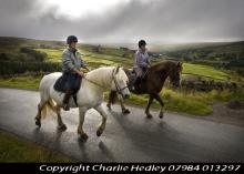
This 29km (912m of ascent) circular horse riding route (30% off-road) starts and finishes in Nenthead. You’ll travel through a landscape rich with echoes of the area’s lead mining past. Passing through the small town of Alston and the villages of Nenthead and Garrigill, as well as over the high moors, it’s a route of contrasts.
Location:
Starts and finishes at Nenthead Mines car park (NY781436 / CA9 3NR - nearest).
Distance:
29 km
Terrain:
Boggy ground, Off road sections, On road sections, Steep sections
Access:
Facilities nearby
Recreation opportunities:
Interests:
Link:
Packhorse Trails for Horse Riders
Download:
Alston Packhorse Trail - Mountain Biking
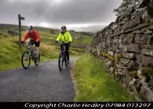
This 29km (912m of ascent) circular mountain biking route (30% off-road) starts and finishes in Nenthead. You’ll travel through a landscape rich with echoes of the area’s lead mining past. Passing through the small town of Alston and the villages of Nenthead and Garrigill, as well as over the high moors, it’s a route of contrasts.
Location:
Starts and finishes at Nenthead Mines car park (NY781436 / CA9 3NR - nearest).
Distance:
29 km
Terrain:
Boggy ground, Off road sections, On road sections, Steep sections
Access:
Facilities nearby
Recreation opportunities:
Interests:
Link:
Packhorse Trails for Mountain Bikers
Download:
Alston, Garrigill & Nenthead: Electric Bike Route 7

This 24km cycle route starts in Alston and is essentially a grand tour of the South Tyne and Nenthead Valleys. Note that this electric bike route was originally devised in 2015. It is still valid but some of the information (e.g. hire/charge points) may have changed.
Location:
The route starts and finishes at the South Tynedale Railway/the Hub Museum in Alston (NY716467 / CA9 3HN).
Distance:
24 km
Terrain:
On road sections
Access:
Facilities nearby
Recreation opportunities:
Interests:
Link:
North Pennines Electric Bike Network
Alston, Nenthead & Carrshield: Electric Bike Route 8

Starting from Alston this cycle route explores the West Allen Valley before returning along the Nent Valley to the start. Note that this electric bike route was originally devised in 2015. It is still valid but some of the information (e.g. hire/charge points) may have changed.
Location:
Starts and finishes at the South Tynedale Railway/the Hub Museum in Alston (NY716467 / CA9 3HN).
Distance:
32 km
Terrain:
On road sections
Access:
Facilities nearby
Recreation opportunities:
Interests:
Link:
North Pennines Electric Bike Network
Alston: Cycle Route 1

This major, 56km-long, road cycling circuit will take most people a full day to complete as it tackles a number of major hills and a good level of fitness is needed. With lots of steep ups and lots of steep downs on a route which offers fantastic panoramic views of the wild and wonderful North Pennines AONB and UNESCO Global Geopark. Strenuous grade requiring fitness and stamina but what a circuit! Alston developed at the cross roads of major trans-Pennine routes - as a service centre and busy lead mining town. Many of its cobbled streets and the market cross still survive. Distinctive ‘bastle’ derived houses can be seen throughout the town with stone steps up to first floor level. Today the parish of Alston Moor is a thriving community of 2,000 people. When it was at the heart of the world’s largest lead producing area, however, its population was five times greater! Please note that the original leaflet was produced and printed in 2005. The routes are still valid but some of the information (e.g. refreshments and facilities) might be out of date.
Location:
Starting from the centre of Alston (NY718465 / CA9 3QN) in the Cumbrian North Pennines.
Distance:
56 km
Terrain:
On road sections, Steep sections
Access:
Facilities nearby
Recreation opportunities:
Interests:
Link:
Cycling in the North Pennines
Download:
Alston: Cycle Route 2

This 27km road route is an anti-clockwise circuit which joins the C2C Cycle Route at Leadgate and follows its road option to Nenthead. This involves the very steep ascent and descent of Flinty Fell for which walking the steepest section is often the best option! The return to Alston varies slightly from the latter stage of Alston Cycle Route 1. Alston to Garrigill has some uphill sections matched with descents; the last third being generally easy. Alston developed at the cross roads of major trans-Pennine routes - as a service centre and busy lead mining town. Many of its cobbled streets and the market cross still survive. Distinctive ‘bastle’ derived houses can be seen throughout the town with stone steps up to first floor level. Today the parish of Alston Moor is a thriving community of 2,000 people. When it was at the heart of the world’s largest lead producing area, however, its population was five times greater! Please note that the original leaflet was produced and printed in 2005. The routes are still valid but some of the information (e.g. refreshments and facilities) might be out of date.
Location:
Starting from the centre of Alston (NY718465 / CA9 3QN) in the Cumbrian North Pennines.
Distance:
27 km
Terrain:
On road sections, Steep sections
Access:
Facilities nearby
Recreation opportunities:
Interests:
Link:
Cycling in the North Pennines
Download:
Alston: Cycle Route 3

This 28km mountain bike route is broadly an off-road version of Alston Cycle Route 2 as it shadows the circuit wherever there are suitable sections of off-road available. Fairly strenuous but with several alternatives to shorten. Alston developed at the cross roads of major trans-Pennine routes - as a service centre and busy lead mining town. Many of its cobbled streets and the market cross still survive. Distinctive ‘bastle’ derived houses can be seen throughout the town with stone steps up to first floor level. Today the parish of Alston Moor is a thriving community of 2,000 people. When it was at the heart of the world’s largest lead producing area, however, its population was five times greater! Please note that the original leaflet was produced and printed in 2005. The routes are still valid but some of the information (e.g. refreshments and facilities) might be out of date.
Location:
Starting from the centre of Alston (NY718465 / CA9 3QN) in the Cumbrian North Pennines.
Distance:
28 km
Terrain:
Boggy ground, Off road sections, On road sections, Steep sections
Access:
Facilities nearby
Recreation opportunities:
Interests:
Link:
Cycling in the North Pennines
Download:
Alston: Cycle Route 4

This 29km mountain bike route links available off-road sections with quiet country roads (as well as one unavoidable stretch of the A686). This figure-8 route permits either loops to be used as a single circuit which together make up a superb tour of some of Alston’s historical access routes. It's a fairly strenuous ride but is always scenic! Alston developed at the cross roads of major trans-Pennine routes - as a service centre and busy lead mining town. Many of its cobbled streets and the market cross still survive. Distinctive ‘bastle’ derived houses can be seen throughout the town with stone steps up to first floor level. Today the parish of Alston Moor is a thriving community of 2,000 people. When it was at the heart of the world’s largest lead producing area, however, its population was five times greater! Please note that the original leaflet was produced and printed in 2005. The routes are still valid but some of the information (e.g. refreshments and facilities) might be out of date.
Location:
Starting from the centre of Alston (NY718465 / CA9 3QN) in the Cumbrian North Pennines.
Distance:
29 km
Terrain:
Off road sections, On road sections, Steep sections
Access:
Facilities nearby
Recreation opportunities:
Interests:
Link:
Cycling in the North Pennines
Download:
Ashes Quarry Geotrail

Here, for 70 years and more, hundreds of men toiled by hand with simple tools to dig the Great Limestone out of the Weardale fells, just a short distance from the centre of Stanhope. They left behind a huge, mile-long hole in the ground which today, over 60 years since they downed tools, nature is slowly reclaiming. This 2-mile circular route follows the paths the quarrymen would have once taken to work. It rewards a bit of a climb at the start with fantastic views over Stanhope and a fascinating insight into Weardale's industrial past.
Location:
Starting from the Durham Dales Centre car park in Stanhope (NY996392 / DL13 2FJ).
Distance:
3 km
Terrain:
Boggy ground, Off road sections, On road sections, Steep sections
Area:
Access:
Facilities nearby
Recreation opportunities:
Interests:
Link:
Walking in the North Pennines
Download:
Balderhead Reservoir Dark Sky Discovery Site
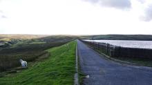
Designated as a Dark Sky Discovery Site, Balderhead Reservoir has been recognised for the quality of the night time skies. This is a great place for professional and amateur astronomers to stargaze in the North Pennines AONB. It is also one of best wild brown trout fisheries in the country.
Location:
From Barnard Castle follow the B6277 to Romaldkirk and then follow the Balderhead road via Hunderthwaite. The reservoir is signposted at the entrance to the car park approximately 4.5 miles along this road. Car park on the NE side of the reservoir.
Area:
Access:
Recreation opportunities:
Interests:
Link:
Dark Sky Discovery Sites
Baldersdale Packhorse Trail - Horse
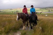
This circular 18km (60% off-road) horse riding trail has 370m of ascent and starts from the south side of Hury Reservoir. It initially follows the banks of Hury and Blackton Reservoirs in remote Baldersdale, before striking off over the moors on the Pennine Way.
Location:
Starts and finishes from the Northumbrian Water car park on the south side of Hury Reservoir (NY966192 / DL12 9UP - nearest).
Distance:
18 km
Terrain:
Boggy ground, Off road sections, On road sections, Steep sections
Area:
Access:
Recreation opportunities:
Interests:
Link:
Packhorse Trails for Horse Riders
Download:
Baldersdale Packhorse Trail - Mountain Biking
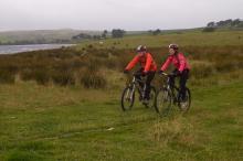
This circular 18km (60% off-road) mountain biking trail has 370m of ascent and starts from the south side of Hury Reservoir. It initially follows the banks of Hury and Blackton Reservoirs in remote Baldersdale, before striking off over the moors on the Pennine Way.
Location:
Starts and finishes from the Northumbrian Water car park on the south side of Hury Reservoir (NY966192 / DL12 9UP - nearest).
Terrain:
Boggy ground, Off road sections, On road sections, Steep sections
Area:
Access:
Recreation opportunities:
Interests:
Link:
Packhorse Trails for Mountain Bikers
Blackton Reservoir: North Pennine Birdwalks - Walk 14
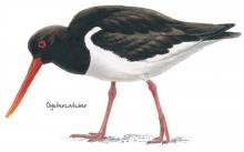
The meadows, pastures and allotments of Baldersdale support large numbers of breeding waders which make an impressive sight during the spring and summer months. Like all areas of open water in the North Pennines, Blackton Reservoir also provides a refuge for wildfowl during the harsh winter months. This area is therefore worth a visit at any time of year.
Location:
Starting from the small car park at the road end (NY935176).
Distance:
6 km
Terrain:
Boggy ground, Off road sections, On road sections
Area:
Access:
Recreation opportunities:
Interests:
Link:
Birdwalks North Pennines
Blanchland and Derwent Reservoir: Electric Bike Route 9
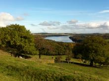
This 30km grand tour of Derwent Reservoir in the Upper Derwent Valley is a delight to ride. Note that this electric bike route was originally devised in 2015. It is still valid but some of the information (e.g. hire/charge points) may have changed.
Location:
Starts and finishes in Blanchland in the Upper Derwent Valley (NY965503 / DH8 9SP)
Distance:
30 km
Terrain:
On road sections, Steep sections
Access:
Facilities nearby
Recreation opportunities:
Interests:
Link:
North Pennines Electric Bike Network
Blanchland Packhorse Trail - Horse
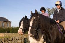
This 21km circular horse riding route is 70% off-road and enjoys 1,027m of ascent. It starts at Baybridge, close to the village of Blanchland. You’ll follow the Carriers’ Way across Bulbeck Common, alive with the evocative calls of wading birds in the spring and early summer.
Location:
Starts and finishes in the Baybridge car park (NY957499 / DH8 9UB - nearest).
Distance:
21 km
Terrain:
Boggy ground, Off road sections, On road sections, Steep sections
Access:
Recreation opportunities:
Interests:
Link:
Packhorse Trails for Horse Riders
Download:
Blanchland Packhorse Trail - Mountain Biking
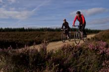
This 21km circular mountain biking route is 70% off-road and enjoys 1,027m of ascent. It starts at Baybridge, close to the village of Blanchland. You’ll follow the Carriers’ Way across Bulbeck Common, alive with the evocative calls of wading birds in the spring and early summer.
Location:
Starts and finishes in the Baybridge car park (NY957499 / DH8 9UB - nearest).
Distance:
21 km
Terrain:
Boggy ground, Off road sections, On road sections, Steep sections
Access:
Recreation opportunities:
Interests:
Link:
Packhorse Trails for Mountain Bikers
Bowlees Visitor Centre, Middleton-in-Teesdale & Grassholme Reservoir: Electric Bike Route 11

This 27km road route starts at Bowlees Visitor Centre and explores Upper Teesdale. Note that this electric bike route was originally devised in 2015. It is still valid but some of the information (e.g. hire/charge points) may have changed.
Location:
Starts and finishes at Bowlees Visitor Centre in Upper Teesdale (NY906282 / DL12 0XE)
Distance:
27 km
Terrain:
On road sections
Area:
Access:
Facilities nearby
Recreation opportunities:
Interests:
Link:
North Pennines Electric Bike Network
Download:
Brampton and Haltwhistle Cycle Tour

This cycle tour heads north from Alston exploiting the breach in the Pennines cut by the River South Tyne to explore the stretch of Hadrian's Wall between Brampton and Haltwhistle. It is a full on cycle tour that covers some busy sections of road as well as quiet fell lanes. The height gain and distance covered are fairly substantial, so to enjoy it you need to be an experienced cyclist. The rewards this challenging route are plentiful and range from outstanding views of classic Pennine landscapes, through to fascinating Roman Remains. Originally published as Route 1 in the Biking around Alston: 5 do-in-a-day rides in the North Pennines AONB (2012).
Location:
Starting from the centre of Alston (NY718465 / CA9 3QN) in the Cumbrian North Pennines.
Distance:
75 km
Terrain:
On road sections
Access:
Facilities nearby
Recreation opportunities:
Interests:
Link:
Cycle Routes - Alston & the North Pennines
Download:
Brough Scar

Brough Scar is the name given to the limestone escarpment near Brough. The Main Buttress gives by far the best climbing offering very steep and fingery routes through bulging rock. This crag was first developed by Robin Curley and his gang from Appleby in 1984.
Location:
Park near the quarry above Brough and follow the main track up the fellside to a small quarry. Follow a path along the fellside to below the crag. The crag is on Access Land. There are 8 routes here ranging from E1 to E4.
Access:
Facilities nearby
Recreation opportunities:
Interests:
Burnhope Head: North Pennine Birdwalks - Walk 7
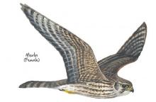
Even in the depths of winter the heather moorland at Burnhope Head is home to large numbers of red grouse. Seeming to catapult from the heather in display whilst giving their loud “get back, get back” call, red grouse are a dramatic sight. During spring and summer their numbers are swelled by a multitude of breeding waders and the moorland seems to burst with life. With sweeping views all around, this is always an impressive walk.
Location:
Starting from the large lay-by near Dead Friars Stone (NY973453).
Distance:
5 km
Terrain:
Boggy ground, Off road sections, On road sections
Access:
Recreation opportunities:
Interests:
Link:
Birdwalks North Pennines
Cardunneth Pike Open Access Walk
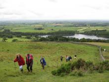
A classic ridge walk following the spine of Cumrew Fell, taking in two of the best viewpoints in the area. The route uses low level right of way for the outward journey, with a range of occupational tracks and desire lines tracks being used for the high level return leg. Part of return leg crosses open access land on a managed grouse moor, over which dogs are not allowed.
Location:
Starting from Castle Carrock village in the vicinity of The Weary Inn.
Distance:
18 km
Terrain:
Boggy ground, Off road sections
Access:
Recreation opportunities:
Interests:
Download GPX file:
Cow Green Geological Trail
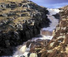
The trail will introduce many of the rocks which make the Teesdale landscape so special and which make the dale a haven for rare and interesting plants. This trail is within Moor House-Upper Teesdale National Nature Reserve (NNR), an internationally important place for wildlife and earth heritage. The NNR is managed by Natural England in partnership with Raby and Strathmore Estates and local farmers. Do examine the rocks, minerals and plants you will see along the way but please do not collect them: leave them for others to enjoy.
Location:
Starting from Wheelhead Sike car park at Cow Green.
Distance:
8 km
Terrain:
Boggy ground, Off road sections, On road sections, Steep sections
Area:
Access:
Recreation opportunities:
Interests:
Link:
North Pennines Geology and Landscape
Download:
Cow Green Reservoir Dark Sky Discovery Site
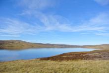
Designated as a Dark Sky Discovery Site, Cow Green Reservoir has been recognised for the fantastic quality of its night time skies. This is a great place for professional and amateur astronomers to stargaze in the North Pennines AONB. Cow Green Reservoir is also one of best wild brown trout fisheries in the country.
Location:
From Middleton-in-Teesdale head up the dale to Langdon Beck on the B6277. Turn left onto a small road (signposted Cow Green Reservoir) and continue along here for approximately 2 miles to a car park.
Area:
Access:
Recreation opportunities:
Interests:
Link:
Dark Sky Discovery Sites
Cowshill (Weardale): North Pennine Birdwalks - Walk 8
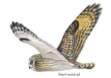
The pastures and allotments in Upper Weardale form a distinctive fringe around the edge of the heather moorland. Typically tussocky with clumps of rushes, these grasslands are an important nesting habitat for wading birds and large numbers can be seen and heard during the breeding season. The adjacent moorland is home to red grouse and golden plover and may sometimes be graced by the presence of a short-eared owl.
Location:
Starting from the car park at Cowshill (NY856406).
Distance:
2 km
Terrain:
Boggy ground, Off road sections, On road sections
Area:
Access:
Facilities nearby
Recreation opportunities:
Interests:
Link:
Birdwalks North Pennines
Cross Fell Mountain Bike Ride

Cross Fell and its near neighbour Great Dun Fell are ringed by an amazing network of high level bridleways. They cross wild and exposed moorland and reach a considerable height making them the highest mountain biking routes in England outside of the Lake District. This route is not for the faint-hearted, particularly first timers to the area as it crosses high and exposed moorland and the distances and height gain involved are considerable. The best introduction to the style of riding they offer is to tackle the out and back ride up the bridleway that climbs the northern shoulder of Cross Fell from the Pennine village of Garrigill. There is a fair amount of height to gain on this route but it is achieved over 11 kilometres which gives most of the climbs a moderate and mostly cycle-able gradient. Originally published as Route 5 in the Biking around Alston: 5 do-in-a-day rides in the North Pennines AONB (2012).
Location:
Starting and finishing in Garrigill (NY744415 / CA9 3DS) in the South Tyne Valley.
Distance:
22 km
Terrain:
Boggy ground, Off road sections, On road sections, Steep sections
Access:
Facilities nearby
Recreation opportunities:
Interests:
Link:
Cycle Routes - Alston & the North Pennines
Download:
Crossthwaite Common - Silver Challenge Walk 2

Fantastic walk starting in Middleton-in-Teesdale crossing the wilds of Crossthwaite Common. Part of the Silver Challenge developed by the Upper Teesdale Tourism Network (UTTN). The Challenge Walks (www.teesdalechallengewalks.net) are a series of walks produced by the UTTN to help visitors and local people to explore this spectacular part of the North Pennines Area of Outstanding Natural Beauty and UNESCO Global Geopark. For detailed walk directions click the link below.
Location:
Start from the Market Place in the centre of Middleton-in-Teesdale.
Distance:
16 km
Terrain:
Boggy ground, Off road sections, On road sections, Steep sections
Area:
Access:
Facilities nearby
Recreation opportunities:
Interests:
Download GPX file:
Cumrew crag
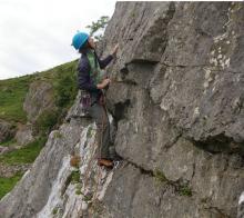
This crag is a small part-quarried outcrop of generally compact limestone on the west side of Cumrew Fell, with a superb view over the Lower Eden Valley and Solway Firth beyond.
The crag was developed by members of the Eden Valley Mountaineering Club in the 1970’s and 1980’s and is comprised of 29 trad and bouldering routes. The trad routes range from V.Diff to E2 and the bouldering grades range from V0 to V5. Further details about this crag are featured in the FRCC Guidebook called Eden Valley and South Lakes Limestone.
Location:
The crag is approached from Newbiggin. At the head of the village a track leads up, just past the last bungalow on the left. Follow the track up onto the fellside and after passing the third gate follow the drystone wall leftwards through a gate and along a track to eventually reach the crag. The crag is on Access Land however no dogs are permitted.
Recreation opportunities:
Interests:
Derwent Gorge: North Pennine Birdwalks - Walk 6
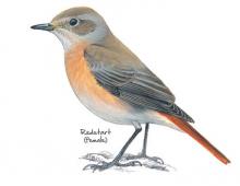
The upland oak woodland of the Derwent Gorge is a dramatic relic of the once extensive forests of the North Pennines. Now a National Nature Reserve managed by Natural England, this woodland contains many interesting and unusual plants such as sweet woodruff, enchanters’ nightshade and wood bitter-cress as well as a great range of resident and migratory birds. Views across the woodland canopy from the gorge sides are impressive and are excellent for bird watching. The walk begins on the edge of the wood in an area of arable farmland, offering opportunities for you to see both farmland and woodland birds.
Location:
Starting from the grassy parking area at the crossroad between Wallish Walls and Crooked Oak (NZ057500).
Distance:
2 km
Terrain:
Boggy ground, Off road sections, On road sections, Steep sections
Access:
Recreation opportunities:
Interests:
Link:
Birdwalks North Pennines
Derwent Reservoir and Pow Hill Country Park

Welcome to Derwent Reservoir and Pow Hill Country Park! This leaflet is one of a number of ways in which you can find out about the wildlife and history of Derwent Reservoir and Pow Hill Country Park. The heathland around the reservoir is a haven for reptiles like Adders, Slow Worms and Common Lizards. The reservoir is also important to many species of birds which use it as a migratory stop over and breeding site.
Location:
Routes starting from either Derwent Reservoir car park or Pow Hill Country Park car park.
Distance:
2 km
Terrain:
Off road sections
Access:
Facilities nearby
Recreation opportunities:
Interests:
Link:
Blanchland and the Upper Derwent
Derwent Reservoir: North Pennine Birdwalks - Site 1

Derwent Reservoir can be an interesting place to watch birds at any time of year. Wildfowl such as greylag goose, mallard, teal and tufted duck may be seen year-round, their numbers being swelled during autumn and winter by wigeon, pochard and goldeneye. Large flocks of gulls also congregate on the reservoir during the winter, most notably black headed, common and herring gull. Other species of interest include grey heron, goosander, cormorant and great crested grebe.
Location:
Multiple viewing points around the reservoir.
Terrain:
Off road sections, On road sections
Access:
Facilities nearby
Recreation opportunities:
Interests:
Link:
Birdwalks North Pennines
Dryburn Moor & East Allen: Electric Bike Route 3

This 33km route takes you from the mining village of Allenheads, over to the West Allen via the C2C and onto Dryburn Moor. From there you get stunning views of the East and West Allen, and looking north, the Scottish Boarders. Note that this electric bike route was originally devised in 2015. It is still valid but some of the information (e.g. hire/charge points) may have changed.
Location:
Circular route from The Hemmel Cafe, Allenheads (NY859453 / NE47 9HJ).
Distance:
33 km
Terrain:
On road sections
Area:
Access:
Facilities nearby
Recreation opportunities:
Interests:
Link:
Electric Bike Network
Download:
Dufton Geotrail
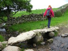
Welcome to a special landscape shaped by millions of years of natural processes and thousands of years of human activity. The landscape around Dufton has been nearly 500 million years in the making and contains some of the oldest rocks in the North Pennines. From explosive volcanoes and tropical seas to deserts, glaciers and miners — all have helped shape this beautiful landscape. This circular 6km walk around Dufton Pike will introduce you to some of the special features of the landscape. By spotting clues in the hills, valleys and buildings you’ll find out how to read the landscape and discover more about its fascinating past.
Location:
Starts and finishes from the car park in Dufton village (NY689249 / CA16).
Distance:
6 km
Terrain:
Boggy ground, Off road sections, On road sections
Access:
Recreation opportunities:
Interests:
Link:
Alston & the Cumbrian North Pennines
Download:
Dufton Pike Open Access Walk
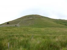
The picturesque village of Dufton nestles quietly on the western flank of the North Pennines overlooked by the pyramidal Dufton Pike, which is the focus of this walk. Despite the relatively short distance, this is a mountain walk in miniature and is perfect for when you have al lout a few hours to spare. The short sharp climb is ample payment for the reward at the summit: an extensive panorama across the Eden Valley to the distant Lakeland Fells, and unique view of the main Pennine Scarp lying close by.
Location:
Starting from the village green in Dufton village which is approx 3½ miles north of Appleby-in-Westmorland. Parking available in the small car park just off the village green (NY689249).
Distance:
8 km
Terrain:
Boggy ground, Off road sections, On road sections, Steep sections
Access:
Recreation opportunities:
Interests:
Download GPX file:
Dufton Pike: North Pennine Birdwalks - Walk 11
Soaring above the Eden Valley, the North Pennine escarpment is a striking feature above Dufton. This walk circumnavigates Dufton Pike, offering dramatic views of the limestone crags of Great Rundale. Ideal habitat for buzzards, these birds are regularly seen in this area. More elusive, the ring ouzel may also be found, singing from one of the gnarled hawthorn trees that dot the hillside.
Location:
Starting from the car park in Dufton (NY689249).
Distance:
7 km
Terrain:
Boggy ground, Off road sections, On road sections
Access:
Facilities nearby
Recreation opportunities:
Link:
Birdwalks North Pennines
East Allen Views: Electric Bike Route 2

A short route that takes you out of Allendale Town where you can get some of the best views of the East Allen Valley. Note that this electric bike route was originally devised in 2015. It is still valid but some of the information (e.g. hire/charge points) may have changed.
Location:
Circular route starting from Allendale Post Office (NY837558 / NE47 9BA).
Distance:
12 km
Area:
Access:
Facilities nearby
Recreation opportunities:
Interests:
Link:
Electric Bike Network
Download:
Eden Outdoor Adventures
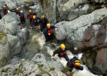
Eden Outdoor Adventures is a small, friendly, family company run by Ian and Melanie. We provide tailor made courses for individuals, families and groups. We believe that by tailor making your course we can offer quality instruction and guiding with the personal touch, allowing people to get the most out of their time with us.
We work hard to understand your needs and to design days to offer a challenge and to make your dreams come true. To help do this, Eden Outdoor Adventures draw upon a great deal of knowledge and experience from working in the outdoors and the areas in which we operate. They also hold National Qualifications in the activities we offer to ensure you the highest standards. We offer half day to multiple day trips in the Lake District, Eden Valley, Northern Pennines, Scotland and Wales as well as further afield. From guided tours, low level family walks through wooded valleys, introductory climbing and canoeing to demanding mountain and river trips in wild places. Wherever your dreams take you, let Eden Outdoor Adventures help make them come true.
Location:
Ousby, Penrith, Cumbria.
Recreation opportunities:
Interests:
Link:
Epiacum Roman Fort
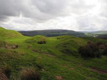
At 330m (1050ft) above sea level, Epiacum (Whitley Castle) is the highest stone-built Roman fort in Britain. It housed a garrison of about 500 men, and was probably built to control mining for lead and silver. Although we have yet to discover evidence for Roman mining in the North Pennines, archaeologists agree that it must have taken place here. The Roman road known as the Maiden Way (between the forts at Kirkby Thore, in the Eden Valley, and Carvoran, on Hadrian’s Wall) passes close by the Fort. A trail leaflet is available at the car park (1 hour, rough terrain)
Location:
Epiacum Roman Fort is in the South Tyne Valley three miles north of Alston / 3 miles south of Slaggyford. It can be accessed either from the Pennine Way which passes alongside it or from a small car parking area (honesty box donations) below the Fort on the A689.
Terrain:
Off road sections, Steep sections
Access:
Recreation opportunities:
Interests:
Link:
Epiacum Roman Fort (aka Whitley Castle): Alston through the ages

This historic walk takes you from Alston along the Pennine Way up to the Roman Fort at Whitley Castle (Epiacum Roman Fort). If you are keen to walk and discover more, the route continues past Kirkhaugh church to Alston. After the church you can: Carry on the full route to Alston. Go back to Kirkhaugh station and walk back along the railway; Have a cup of tea on board and ride the train to Alston
Location:
Starting from the South Tynedale railway car park in Alston (NY716467).
Distance:
12 km
Terrain:
Off road sections, On road sections
Access:
Facilities nearby
Recreation opportunities:
Interests:
Link:
Download:
Grassholme Reservoir Dark Sky Discovery Site
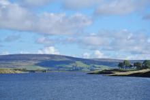
Designated as a Dark Sky Discovery Site, Grassholme Reservoir has been recognised for the stunning quality of its night skies. This is a great place for professional and amateur astronomers to stargaze in the North Pennines AONB. Access to the reservoir for stargazing is only available during organised events (see www.northpennines.org.uk for details). Grassholme is also firmly established as one of the top 'any method fisheries' in the country.
Location:
Take the B6277 from Barnard Castle towards Mickleton. Turn off at the western end of the village, signposted Grassholme Reservoir. The main car park is roughly a mile up the road on the right.
Area:
Access:
Recreation opportunities:
Interests:
Link:
Dark Sky Discovery Sites
Hamsterley Forest

County Durham's largest forest is a mixture of woodland, meadows and forest. There are excellent walking, cycling and horse riding trails for all abilities. The forest also has a childrens' adventure playground, tea room, cycle hire, shop and downhill mountain bike course.
Location:
Hamsterley Forest (NZ091312 / DL13 3QH).
Terrain:
Boggy ground, Off road sections, On road sections, Steep sections
Area:
Access:
Facilities nearby
Recreation opportunities:
Interests:
Link:
Hamsterley Forest
Hamsterley Forest - Doctors Gate

Doctors Gate is a 21.8 mile circular mountain bike route, starting from Hamsterley Forest, climbing 2821ft using quiet road sections to link the off road sections. The route should be tackled clockwise - start off by going along the Grove Link. There are more road miles on this route than ideal for a mountain bike ride but the blast down the Weardale Way and the descent into the forest make up for this.
Location:
Hamsterley Forest (NZ091312 / DL13 3QH).
Distance:
35 km
Terrain:
Boggy ground, Off road sections, On road sections, Steep sections
Area:
Access:
Facilities nearby
Recreation opportunities:
Interests:
Link:
Doctors Gate
Download GPX file:
Hamsterley Forest - Eggleston Moors

Starting in Hamsterley Forest this lollipop-shaped mountain bike route takes you across the moors to Eggleston and back. Best ridden on a dry day when there has been a dry spell beforehand!
Location:
Hamsterley Forest (NZ091312 / DL13 3QH).
Distance:
30 km
Terrain:
Boggy ground, Off road sections, On road sections, Steep sections
Area:
Access:
Facilities nearby
Recreation opportunities:
Interests:
Link:
Eggleston Moors - Hamsterley Forest
Download GPX file:
Hamsterley Forest - Red Trail

A mountain bike trail for real adventurers who want to spend the day exploring the further reaches of Hamsterley Forest. The route follows the Blue Trail to the Grove before heading into the wider forest on a mixture of forest road and singletrack. Superb views await at the top of the forest overlooking Eggleston Moor before returning to the Grove via the Euden Beck on breathtaking stretches of singletrack.
Location:
Hamsterley Forest (NZ091312 / DL13 3QH).
Distance:
22 km
Terrain:
Boggy ground, Off road sections, On road sections, Steep sections
Area:
Access:
Facilities nearby
Recreation opportunities:
Interests:
Link:
Red Trail - Hamsterley Forest
Download:
Hamsterley Half Century

The Hamsterley Half Century is a 50km (31.1 miles) circular mountain biking route within Hamsterley Forest, boasting a lung/leg busting 1300m (4300ft) of climbing (and descending).
Location:
Hamsterley Forest (NZ091312 / DL13 3QH).
Distance:
50 km
Terrain:
Boggy ground, Off road sections, On road sections, Steep sections
Area:
Access:
Facilities nearby
Recreation opportunities:
Interests:
Link:
The Hamsterley Half Century
Download GPX file:
Hamsterley Packhorse Trail - Horse

This 26km horse riding route is 75% off-road and you'll climb 846m. It's a ride of contrasts - in the forest and out over the open moor. You’ll follow an old drove road on the return to the forest from Eggleston.
Location:
Starts and finishes from the Grove car park in Hamsterley Forest (NZ064297).
Distance:
26 km
Terrain:
Boggy ground, Off road sections, On road sections, Steep sections
Area:
Access:
Facilities nearby
Recreation opportunities:
Interests:
Link:
Packhorse Trails for Horse Riders
Download:
Hamsterley Packhorse Trail - Mountain Biking

This 26km mountain biking route is 75% off-road and you'll climb 846m. It's a ride of contrasts - in the forest and out over the open moor. You’ll follow an old drove road on the return to the forest from Eggleston.
Location:
Starts and finishes from the Grove car park in Hamsterley Forest (NZ064297).
Distance:
26 km
Terrain:
Boggy ground, Off road sections, On road sections, Steep sections
Area:
Access:
Facilities nearby
Recreation opportunities:
Interests:
Link:
Packhorse Trails for Mountain Bikers
Hartside Packhorse Trail - Horse Riding
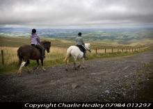
This 11km horse riding route starts and finishes from Hartside Top Cafe - it's 75% off-road and packs in 458m of ascent! A dramatic ride from the Pennine escarpment down into the Eden Valley and back up to the top again!
Location:
Starts and finishes from Hartside Top car park (NY646418 / CA9 3BW - nearest).
Distance:
11 km
Terrain:
Boggy ground, Off road sections, On road sections, Steep sections
Access:
Recreation opportunities:
Interests:
Link:
Packhorse Trails for Horse Riders
Download:
Hartside Packhorse Trail - Mountain Biking
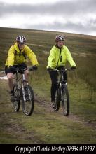
This 11km mountain bike ride starts and finishes from Hartside Top Cafe - it's 75% off-road and packs in 458m of ascent! A dramatic ride from the Pennine escarpment down into the Eden Valley and back up to the top again!
Location:
Starts and finishes from Hartside Top car park (NY646418 / CA9 3BW - nearest).
Distance:
11 km
Terrain:
Boggy ground, Off road sections, On road sections, Steep sections
Access:
Recreation opportunities:
Interests:
Link:
Packhorse Trails for Mountain Bikers
Harwood Beck and Widdybank: North Pennine Birdwalks - Site 3
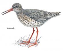
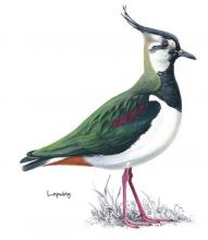
The meadows and pastures around Harwood Beck and Widdybank are some of the best places to see breeding waders and black grouse. If you sit quietly in your car you may be rewarded with the sight of a snipe shepherding its chicks through the vegetation or a precocious young lapwing chick pecking for food in the short turf.
Location:
Static viewing from a grassy verge on the road to Cow Green Reservoir.
Terrain:
On road sections
Area:
Access:
Facilities nearby
Recreation opportunities:
Interests:
Link:
Birdwalks North Pennines
Howden Burn (Weardale): North Pennine Birdwalks - Walk 13
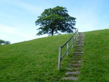
Passing through grassland and up onto heather moorland, this walk provides splendid views across the open uplands and down to the Bollihope Burn. It is a fine area to watch wading birds during the breeding season when the air is filled with their songs and displays. Redstart, great spotted woodpecker, tits and warblers can also be seen or heard in the riverside woodland.
Location:
Starting on short turf at roadside beside the Bollihope Burn (NZ005349).
Distance:
3 km
Terrain:
Boggy ground, Off road sections, On road sections
Area:
Access:
Recreation opportunities:
Interests:
Link:
Birdwalks North Pennines
Ireshopeburn (Weardale): Hay Time Walk 2
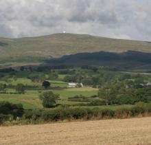
Take a 2 hour walk in Weardale, a landscape that has been farmed and mined for centuries. This five kilometre walk close to Ireshopeburn crosses some beautiful meadows, with superb views of the surrounding moorland and villages in the dale below. The best time to go is between April and August to catch the wildflowers in full bloom. It is still a worthwhile walk outside of these times due to presence of late blooming flowers can be seen in mid Autumn and wading birds in the Spring.
Location:
The walk starts in the village of Ireshopeburn in Weardale (NY866386).
Distance:
5 km
Terrain:
Boggy ground, Off road sections, On road sections
Area:
Access:
Recreation opportunities:
Interests:
Link:
Hay meadows
Isaacs Tea Trail

Isaac's Tea Trail is a long distance path inspired by the tale of Isaac Holden. Not only a tea seller, Isaac was a local philanthropist and the trail takes you past many legacies of Isaac's fundraising.
Location:
The circular walk can be accessed from many locations, 4 sections have been suggested:
Section 1: Allendale
Section 2: Nenthead
Section 3: Alston
Section 4: Ninebanks
Distance:
58 km
Terrain:
Boggy ground, Off road sections, On road sections
Area:
Access:
Facilities nearby
Recreation opportunities:
Interests:
Link:
Kirkcarrion - Bronze Challenge Walk 2

Short walk from Middleton-in-Teesdale exploring Kirkcarrion. Kirkcarrion was named after a Brigantean prince who was said to have been buried here in pre-Roman times, but it is thought much more likely that a Bronze-Age tribal chieftain was buried in the barrow. His or someone else’s ghost is still said to haunt the site on horseback. Part of the Bronze Challenge developed by the Upper Teesdale Tourism Network (UTTN). The Challenge Walks (www.teesdalechallengewalks.net) are a series of walks produced by the UTTN to help visitors and local people to explore this spectacular part of the North Pennines Area of Outstanding Natural Beauty and UNESCO Global Geopark. For detailed walk directions click the link below.
Location:
The walk starts from the Tourist Information Centre in the centre of Middleton-in-Teesdale.
Distance:
5 km
Terrain:
Boggy ground, Off road sections, On road sections, Steep sections
Area:
Access:
Facilities nearby
Recreation opportunities:
Interests:
Download GPX file:
Knock Geological Trail
This different rocks and landscape features along this trail tells the story of the events and geological processes that have created this landscape over nearly 500 million years of Earth history. Stout boots, warm clothing and good waterproofs are advised as even in summer the climate of the North Pennine escarpment can be harsh and cloud can descend quickly. Allow a full day for the complete walk. Use of an Ordnance Survey map and compass is recommended for this route. In places the route passes old mine workings, parts of which may be unstable. Please keep to footpaths and do not attempt to enter old tunnels or any old surface excavations. Do examine the rocks and minerals you will see along the way but please do not collect them: leave them for others to enjoy.
Location:
At the end of a minor road west of Knock (NY686288).
Distance:
10 km
Terrain:
Boggy ground, Off road sections
Access:
Recreation opportunities:
Interests:
Link:
North Pennines Geology and Landscape
Download:
Lambley and the South Tyne: North Pennine Birdwalks - Walk 1
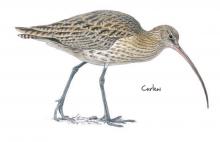
This walk combines a number of different North Pennine habitats to dramatic effect. You will pass through an expansive area of rushy allotment adjacent to heather moorland where in spring and summer the air is alive with the sounds and sights of numerous breeding waders. The views across the South Tyne Valley are similarly impressive. By contrast, the second leg of the walk passes along the route of a disused railway line that is largely clothed in woodland, offering tantalising glimpses of the surrounding countryside and excellent opportunities to see and hear woodland birds. The walk centres on Lambley Viaduct, a stunning landscape and architectural feature from where the River South Tyne and its wildlife can be viewed from on high.
Location:
Lambley Viaduct – South Tyne Trail car park (NY679595).
Distance:
13 km
Terrain:
Boggy ground, Off road sections, On road sections
Area:
Access:
Recreation opportunities:
Interests:
Link:
Birdwalks North Pennines
Mickelton - Grassholme Reservoir

This circular 10.5km walking route takes in a tour of Grassholme Reservoir. It was published as route 3 in the Discover mid Teesdale leaflet (2007).
Location:
The route starts from the Mickleton Station car park (NY967233 / DL12 0JN).
Distance:
11 km
Terrain:
Boggy ground, Off road sections, On road sections, Steep sections
Area:
Access:
Facilities nearby
Recreation opportunities:
Interests:
Link:
Teesdale
Download:
Micketon - Romaldkirk - Eggleston

This 7.5km moderate walk route takes you from Mickleton in Teesdale on a circuit incorporating visits to Romaldkirk and Eggleston. It was published as route 4 in the Discover mid Teesdale leaflet (2007).
Location:
The route starts from the Mickleton Station car park (NY967233 / DL12 0JN).
Distance:
8 km
Terrain:
Boggy ground, Off road sections, On road sections, Steep sections
Area:
Access:
Facilities nearby
Recreation opportunities:
Interests:
Link:
Teesdale
Download:
Mickleton - Romaldkirk - Cotherstone - Hury Reservoir
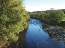
This 19km grand tour will really enable you to get to grips with mid-Teesdale. The route is suitable for walkers, horse riders and cyclists. It was published as route 6 in the Discover mid Teesdale leaflet (2007).
Location:
The route starts from the Mickleton Station car park (NY967233 / DL12 0JN).
Distance:
19 km
Terrain:
Boggy ground, Off road sections, On road sections, Steep sections
Area:
Access:
Facilities nearby
Recreation opportunities:
Interests:
Link:
Teesdale
Download:
Mickleton - Romaldkirk Moor

This 11km circuit from Mickleton is suitable for walkers, cyclists and horse riders. It was published as route 5 in the Discover mid Teesdale leaflet (2007).
Location:
The route starts from the Mickleton Station car park (NY967233 / DL12 0JN).
Distance:
11 km
Terrain:
Boggy ground, Off road sections, On road sections, Steep sections
Area:
Access:
Facilities nearby
Recreation opportunities:
Interests:
Link:
Teesdale
Download:
Mickleton to Middleton
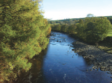
This 8.5km circular walk is a great circuit from Mickleton in Teesdale, using the Teesdale Railway Path. It was published as route 2 in the Discover mid Teesdale leaflet (2007).
Location:
The route starts from the Mickleton Station car park (NY967233 / DL12 0JN).
Distance:
9 km
Terrain:
Boggy ground, Off road sections, On road sections, Steep sections
Area:
Access:
Facilities nearby
Recreation opportunities:
Interests:
Link:
Teesdale
Download:
Middleton-in-Teesdale: Cycle Route 1

This 24km route is the main circuit (on the leaflet) with a choice of two shorter variations which can be selected at the appropriate junction. Each variation is worth doing in its own right for the superb scenery, the magnificent views and the stunning descents. The area is shaped by a long history of farming, lead mining and quarrying. Traditional management means that Teesdale is still awash with flower-rich hay meadows. The whitewashed farm buildings of the Raby Estate are a distinctive feature in the upper dale. Be warned the roads are narrow in places with some sharp gravel-covered corners. Please note that the original leaflet was produced and printed in 2005. The routes are still valid but some of the information (e.g. refreshments and facilities) might be out of date.
Location:
Starting from the intersection between the Market Place and Bridge Street in Middleton-in-Teesdale (NY947254 / DL12 0QB).
Distance:
24 km
Terrain:
On road sections, Steep sections
Area:
Access:
Facilities nearby
Recreation opportunities:
Interests:
Link:
Cycling in the North Pennines
Download:
Middleton-in-Teesdale: Cycle Route 2

This mountain bike route follows the first part of Middleton-in-Teesdale Cycle Route 1 but then follows an additional loop which can also be used to extend Route 1 which it re-joins. Route 2 then follows very narrow minor roads as well as off-road sections. It's memorable for its fine off-road sections although the narrow country lanes it otherwise uses are also a joy to cycle on. The gentle ascent from the valley, with the associated views and options, makes this route a good choice for a wide range of cyclists. The area is shaped by a long history of farming, lead mining and quarrying. Traditional management means that Teesdale is still awash with flower-rich hay meadows. The whitewashed farm buildings of the Raby Estate are a distinctive feature in the upper dale. Please note that the original leaflet was produced and printed in 2005. The routes are still valid but some of the information (e.g. refreshments and facilities) might be out of date.
Location:
Starting from the intersection between the Market Place and Bridge Street in Middleton-In-Teesdale (NY947254 / DL12 0QB).
Distance:
34 km
Terrain:
Off road sections, On road sections, Steep sections
Area:
Access:
Facilities nearby
Recreation opportunities:
Interests:
Link:
Cycling in the North Pennines
Download:
Middleton-in-Teesdale: Cycle Route 3

This 13km road route is a gently undulating ‘there and back’ linear ride along a quiet minor road parallel to the River Tees. The beautiful cliffs of Holwick Scar can be seen along this route. The area is shaped by a long history of farming, lead mining and quarrying. Traditional management means that Teesdale is still awash with flower-rich hay meadows. The whitewashed farm buildings of the Raby Estate are a distinctive feature in the upper dale. Please note that the original leaflet was produced and printed in 2005. The routes are still valid but some of the information (e.g. refreshments and facilities) might be out of date.
Location:
Starting from the intersection between the Market Place and Bridge Street in Middleton-In-Teesdale (NY947254 / DL12 0QB).
Distance:
13 km
Terrain:
On road sections
Area:
Access:
Facilities nearby
Recreation opportunities:
Interests:
Link:
Cycling in the North Pennines
Download:
Middleton-in-Teesdale: Cycle Route 4

This 10km route 4 follows a rectangle to the north of Middleton-in-Teesdale and is well worth doing for its scenery, views and descents - not to mention the heritage value! The area is shaped by a long history of farming, lead mining and quarrying. Traditional management means that Teesdale is still awash with flower-rich hay meadows. The whitewashed farm buildings of the Raby Estate are a distinctive feature in the upper dale. Please note that the original leaflet was produced and printed in 2005. The routes are still valid but some of the information (e.g. refreshments and facilities) might be out of date.
Location:
Starting from the intersection between the Market Place and Bridge Street in Middleton-In-Teesdale (NY947254 / DL12 0QB).
Distance:
10 km
Terrain:
On road sections, Steep sections
Area:
Access:
Facilities nearby
Recreation opportunities:
Interests:
Link:
Cycling in the North Pennines
Download:
Nenthead and Garrigill Cycle Route
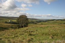
This 29km road and off-road cycle route provides a grand tour of the Nent and Upper South Tyne Valleys. The high rolling fells of Alston Moor are separated by two deep valleys, which hold the upper reaches of the River South Tyne and the waters of the River Nent. Both valleys display a classic North Pennine landscape that magical mixture of walled valley bottoms, pasture and hay meadows backed by rough open fell and interspersed by hamlets. They are both a delight to explore, particularly by bike, because they are endowed with quiet roads and lanes that traverse differing levels allowing intimate and far reaching views. Conveniently linking both valleys are ancient traffic free tracks. Originally published as Route 4 in the Biking around Alston: 5 do-in-a-day rides in the North Pennines AONB (2012).
Location:
Starting and Finishing at Nenthead Mines car park (NY780436 / CA9 3NR) in Nenthead.
Distance:
29 km
Terrain:
Off road sections, On road sections, Steep sections
Access:
Facilities nearby
Recreation opportunities:
Interests:
Link:
Cycle Routes - Alston & the North Pennines
Download:
Newbiggin and the Carriers’ Way

This leaflet is one of a series designed to help you discover the treasures of Blanchland - both natural and man-made. This attractive walk takes you from Blanchland, along the River Derwent, up on to open moorland. The moorland is exposed and can experience harsh weather. The wild landscape surrounding Blanchland bustles with evidence of people, from Mesolithic hunters to lead miners and modern land managers. Everywhere you look you see the imprint of our ancestors. Many landscape scars have been hidden by nature and it is hard to believe that in the not-so-distant past this quiet landscape was once home to major industry.
Location:
The walk starts from Blanchland car park (NY964505)
Distance:
14 km
Terrain:
Boggy ground, Off road sections, On road sections
Access:
Facilities nearby
Recreation opportunities:
Interests:
Link:
Blanchland and the Upper Derwent
Download:
Newshield and West Allendale Cycle Route

This 36km road cycle route route climbs out of Alston and heads down to Nenthead before exploring the fascinating upper reaches of the West Allen Valley. It provides a solid days riding with a mix of valley lanes with some sizeable climbs on fell roads. On a misty or windy day the high points of Black Hill or Willyshaw Rigg will prove challenging to say the least, but given a blue sky and a fair breeze there can be few better spots to be on two wheels. As well as the stunning North Pennines landscape along the way there is plenty to see particularly if you are interested in industrial heritage. Originally published as Route 2 in the Biking around Alston: 5 do-in-a-day rides in the North Pennines AONB (2012).
Location:
Starting from the centre of Alston (NY718465 / CA9 3QN) in the Cumbrian North Pennines.
Distance:
36 km
Terrain:
On road sections, Steep sections
Access:
Facilities nearby
Recreation opportunities:
Interests:
Link:
Cycle Routes - Alston & the North Pennines
Download:
Ninebanks & East Allen: Electric Bike Route 4

Enjoy this 35km cycle along the West and East Allen. Note that this electric bike route was originally devised in 2015. It is still valid but some of the information (e.g. hire/charge points) may have changed.
Location:
Circular route in the West and East Allen Valleys.
Distance:
35 km
Terrain:
On road sections, Steep sections
Area:
Access:
Facilities nearby
Recreation opportunities:
Interests:
Link:
Electric Bike Network
Download:
Open access walks in Cumbria: Cold Fell
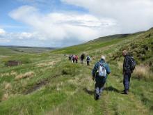
Marking the northern end of the Pennine Chain, the aptly named Cold Fell is also the most northerly mountain in Cumbria. Although this route is relatively short, it is a serious undertaking with a steep ascent and descent, coupled with terrain that is usually wet and hard going throughout the year. Nevertheless it’s still a fine walk which is full of interest with excellent views across the Border region.
Location:
Starting from car park beyond Clesketts near Hallbankgate.
Distance:
11 km
Terrain:
Boggy ground, Off road sections, On road sections, Steep sections
Access:
Recreation opportunities:
Interests:
Download GPX file:
Open access walks in Cumbria: Geltsdale
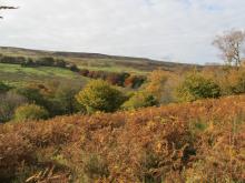
A good walk for days when the cloud is low, favouring a lower level circuit of the picturesque Geltsdale without the need to venture too high up. Discover remnants of the valley’s industrial past, whilst savouring the delights of her wildlife and scenery of this now tranquil Valley.
Location:
Starting from the parking verge at Jockey Shield near Castle Carrock.
Distance:
10 km
Terrain:
Off road sections
Access:
Recreation opportunities:
Interests:
Download GPX file:
Open access walks in Cumbria: Great Knipe
It's hard to imagine that this short, but thoroughly rewarding, 'away from it all' moorland walk lies so close to a major trans-Pennine road link. Seldom does this land attract a second glance from the thousands that pass below it each day. Contained within a Ministry of Defence ‘dry range’, this walk focuses upon an amphitheatre scarp culminating with the headland of Great Knipe, with its commanding views over the Stainmore Pass and across the upper realms of the greater Eden valley.
Location:
Starting off the A66, approx 3.5 miles to the east of Brough. Roadside parking is available on a minor road just off the A66 east-bound carriageway, at Slapestone Bridge
Distance:
8 km
Terrain:
Boggy ground, Off road sections, On road sections
Access:
Recreation opportunities:
Interests:
Open access walks in Cumbria: North Pennine Ridge (Northern Section)
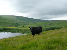
A classic moorland traverse across wild terrain with hardly a discernable path for most of the way makes this a true wilderness experience. The ridge-top fence serves as a comforting navigational aid whilst you savour the solitude, tranquillity and open grandeur of this seldom frequented part of the county. This linear route is a serious undertaking in any weather, and to help with navigation it is described in both directions.
Location:
Starting from Hartside Café off the A686 between Alston and Melmerby.
Distance:
21 km
Terrain:
Boggy ground, Off road sections
Access:
Recreation opportunities:
Interests:
Download GPX file:
Open access walks in Cumbria: North Pennine Ridge (Southern Section)
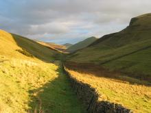
Following the spine of the Pennine ridge from Dufton to Hartside Pass this linear walk passes over Cross Fell which is the highest point in England outside of the Lake District. Partly following the Pennine Way National Trail and partly on pathless moorland this route rewards with stunning views throughout, especially those across the Eden valley to the distant Lakeland Fells. This linear route is a serious undertaking in any weather, and to help with navigation it is described in both directions.
Location:
Starting from the village green in Dufton village which is approx 3½ miles north of Appleby-in-Westmorland. Parking available in the small car park just off the village green.
Distance:
23 km
Terrain:
Boggy ground, Off road sections, On road sections
Access:
Recreation opportunities:
Interests:
Download GPX file:
Open access walks in Cumbria: Talkin Fell
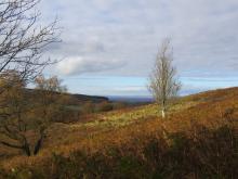
This short walk is ideal for those with a few hours to spare, and serves as a perfect introduction to open access. The route follows excellent public rights of way, and distinct desire lines once you venture onto the access land. On a clear day the panorama from the top of Talkin Fell is probably one of the best you’ll get for the effort involved in getting there.
Location:
Starting from the parking verge at Jockey Shield near Castle Carrock.
Distance:
7 km
Terrain:
Off road sections
Access:
Recreation opportunities:
Interests:
Download GPX file:
Open access walks in Cumbria: Thack Moor and Black Fell
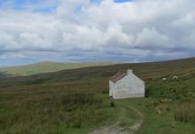
One of the more serious undertakings, this routes ventures onto the main North Pennine ridge, via the outlying top of Thack Moor. Tranquillity, solitude and a sense of moorland grandeur is guaranteed on the first section. A much deserved break at Hartside Café is recommended, before the return leg to Renwick following public rights of way on good tracks and paths.
Location:
Starting from Townhead, at the northern end of Renwick village towards the parish church. Roadside parking is available at the church.
Distance:
17 km
Terrain:
Boggy ground, Off road sections, On road sections
Access:
Recreation opportunities:
Interests:
Download GPX file:
Over the hill to Cowbyre Farm

This is a varied walk that begins with a climb up from the village of Blanchland. The walk passes through woodland and pasture with magnificent views of the Derwent Valley and Edmundbyers Common, finally dropping down to the river and returning to the village.
Location:
Staring from Blanchland car park.
Distance:
6 km
Terrain:
Off road sections, On road sections
Access:
Facilities nearby
Recreation opportunities:
Interests:
Download:
Parkhead Station Dark Sky Discovery Site

Parkhead station was one of the first five Dark Sky Discovery Sites in the North Pennines AONB to be designated. It has been recognised as a great place for amateur and professional astronomers to stargaze. With wide open views of the horizon and a location away from towns and cities, the skies are incredibly dark. Under a clear night sky, the major constellations can be seen and the Milky Way is also visible to the naked eye. The café is a converted railway station with a rich industrial history - www.parkheadstation.co.uk. Now it is a feature along a traffic free section of the Waskerley Way, just off the C2C Cycle Route which means astronomers are not going to be disturbed or interrupted by the glare of headlights from passing vehicles. During organised stargazing events, the café offers warmth and sustenance and a place to discuss recent astronomical news and sightings.
Location:
Located on the B6278, 3 miles north of Stanhope, 10 miles from Consett.
Area:
Access:
Facilities nearby
Recreation opportunities:
Interests:
Link:
Dark Sky Discovery Sites
Pow Hill Country Park Dark Sky Discovery Site
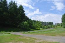
Pow Hill is a country park owned by Durham County Council and was one of the first five Dark Sky Discovery Sites to be designated in the North Pennines. Recognised for the quality of its dark night skies, set away from the nearby small settlements of Blanchland and Edmundbyers, this is a brilliant spot for astronomers to stargaze. Its position on the edge of Derwent Reservoir offers a large, uninterrupted view of the northern sky. Under a clear winter nights sky, the main stellar constellations can be seen and on good nights, the Milky Way can also be seen with the naked eye. Good quality surface in the car park and an easy access trail route (on the shore of the reservoir) offers the opportunities for disabled people to stargaze.
Location:
Located off the B6306 Blanchland road on the south shore of Derwent Reservoir - 1 mile north of Edmundbyers, signposted from the road.
Access:
Recreation opportunities:
Interests:
Link:
Dark Sky Discovery Sites
Download:
River South Tyne Cycle Route

Tracing the course of the River South Tyne downstream from Alston, this 16km cycle route provides an excellent short introductory ride to the area. It first heads out along the fell lanes on the eastern side of the river steadily gaining height to Barhaugh Hall then descending by Blackcleugh Burn to the banks of the River South Tyne. The river bank makes an excellent spot for a rest or a picnic after which the road bridge just south of Slaggyford allows the other side of he river to be reached. The return to Alston involves another climb to start with but once height is gained glorious views open up across the fells and down to the valley where you might just spot steam trains on the South Tynedale Railway, England's highest narrow-gauge railway. Originally published as Route 3 in the Biking around Alston: 5 do-in-a-day rides in the North Pennines AONB (2012).
Location:
Starting and finishing in Alston (NY718465 / CA9 3QN).
Distance:
16 km
Terrain:
On road sections, Steep sections
Access:
Facilities nearby
Recreation opportunities:
Interests:
Link:
Cycle Routes - Alston & the North Pennines
Download:
Rookhope: Fields and Fells

The town of Rookhope and its surrounding environs are littered with the remains of its once prosperous mining industry such as the Rookhope arch and Bolts Law engine house. This austere landscape inspired poet W H Auden to write some of his earliest work. Nowadays Rookhope supports fascinating upland flora and fauna and a small tourist industry as a stop off on the C2C cycle route. You can discover these and more interesting facets of Rookhope in this series of circular walks.
Location:
Starting from Rookhope Village Hall.
Distance:
8 km
Terrain:
Boggy ground, Off road sections, On road sections
Area:
Access:
Facilities nearby
Recreation opportunities:
Interests:
Download:
RSPB Geltsdale Walking Trails

Set in the beautiful North Pennines AONB, Geltsdale is home to black grouse, birds of prey and breeding wading birds and is ideal for walking. There are 4 way marked trails leading from the car park of Howgill. The Stagsike trail will take 1-2 hours to walk and the other trails a little longer. Stagsike Cottages are approximately a 40 minute walk from the parking area and provide an information point and toilets. Many of the trails are on existing tracks but boots are essential for much of the year and waterproofs are recommended. There is no general vehicle access to Stagsike Cottages but disabled access can be pre-arranged by phoning the reserve (01697 746717). Trails are open at all times and the information point is open between 9am and 5pm. Dogs are welcome but they should be kept on a lead as the reserve is a working farm. A bus services the village of Hallbankgate, which is approximately a mile away.
Location:
Starting from Clesketts car park (NY588584), near Hallbankgate.
Terrain:
Boggy ground, Off road sections, On road sections
Access:
Facilities nearby
Recreation opportunities:
Interests:
Link:
RSPB Geltsdale
Download:
Selset Reservoir Dark Sky Discovery Site
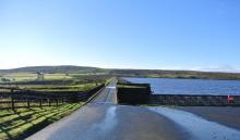
Designated as a Dark Sky Discovery Site, Selset Reservoir has been recognised for the outstanding quality of its dark skies. This is a great place for astronomers to stargaze in the North Pennines AONB. Access to Selset Reservoir is only available for stargazing during organised events (see www.northpennines.org.uk). Selset is also one of best wild brown trout fisheries in the country.
Location:
About 4 miles west of Middleton-in-Teesdale, along the B6276. The reservoir is signposted from the road.
Area:
Access:
Recreation opportunities:
Interests:
Link:
Dark Sky Discovery Sites
Sinderhope Pony Trekking Centre
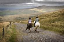
The Sinderhope Pony Trekking Centre is based on a traditional working hill farm in Northumberland which is surrounded by miles of beautiful moorland. The Centre offers treks of various lengths to suit all abilities, riding over moorland and through dales on our cobs and native type ponies. Lessons last 30 minutes or 50 minutes and they are taught in the indoor arena which provides a safe, enclosed and dry environment, with horses and ponies to provide a range of sizes, types and temperaments to suit everyone from the complete beginner to the competent rider. Canters are arranged for the more experienced rider, while basic instructions and support are offered to the nervous or novice rider. We also provide private trekking for individuals or groups if you would like to go out on your own with one of our guides, these sessions are subject to availability.
Location:
High Sinderhope, Sinderhope, Allendale, Northumberland, NE47 9SH.
Terrain:
Off road sections, On road sections
Area:
Access:
Facilities nearby
Recreation opportunities:
Interests:
St John's Chapel: Farming, Mining and Methodism
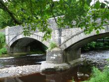
This walk traces the history of three neighbouring villages Daddry Shield, St Johns Chapel and Ireshopeburn. From their origins as farming settlements, through to the expansion of the mining industry in the mid 19th Century and the associated rises in population and conversion of locals to Methodism, this region has witnessed dramatic changes which have left their mark on the landscape of the upper dale. This walk tells the story of these developments while pointing out historic buildings and events associated with them.The walk was devised and described by volunteers of The Weardale Museum (www.weardalemuseum.co.uk), Ireshopeburn, where much more information can be found.
Location:
Starting from the Weardale Inn or St John Chapel Cattle Market car park.
Distance:
11 km
Terrain:
Boggy ground, Off road sections, On road sections, Steep sections
Area:
Access:
Recreation opportunities:
Interests:
Stanhope, St. John's Chapel & Rookhope: Electric Bike Route 12

This 32km road cycling routes starts in Stanhope and explores Upper Weardale and the Rookhope Valley. Note that this electric bike route was originally devised in 2015. It is still valid but some of the information (e.g. hire/charge points) may have changed.
Location:
This route starts and finishes in Stanhope, Weardale (NY998390 / DL13 2UE).
Distance:
32 km
Terrain:
On road sections
Area:
Access:
Facilities nearby
Recreation opportunities:
Interests:
Link:
North Pennines Electric Bike Network
Stanhope: Cycle Route 1

This 39km road route starts and finishes from the Durham Dales Centre in Stanhope. The publication describes four routes of various lengths. The four routes are designed as a series of loops of varying length radiating out from Stanhope. Each route provides a glimpse into the past, with remnants of the lead mining industry dotted around Weardale. Please note that the original leaflet was produced and printed in 2005. The routes are still valid but some of the information (e.g. refreshments and facilities) might be out of date.
Location:
Starting and finishing from the Durham Dales Centre in Stanhope, Weardale (NY996392 / DL13 2FJ).
Distance:
39 km
Terrain:
On road sections
Area:
Access:
Facilities nearby
Recreation opportunities:
Interests:
Link:
Cycling in the North Pennines
Download:
Stanhope: Cycle Route 2

This 30km road route starts and finishes from the Durham Dales Centre in Stanhope. The publication describes four routes of various lengths. The four routes are designed as a series of loops of varying length radiating out from Stanhope. Each route provides a glimpse into the past, with remnants of the lead mining industry dotted around Weardale. Please note that the original leaflet was produced and printed in 2005. The routes are still valid but some of the information (e.g. refreshments and facilities) might be out of date.
Location:
Starting and finishing in the Durham Dales Centre in Stanhope, Weardale (NY996392 / DL13 2FJ).
Distance:
30 km
Terrain:
On road sections, Steep sections
Area:
Access:
Facilities nearby
Recreation opportunities:
Interests:
Link:
Cycling in the North Pennines
Download:
Stanhope: Cycle Route 3

This 25km road route starts and finishes from the Durham Dales Centre in Stanhope. The publication describes four routes of various lengths. The four routes are designed as a series of loops of varying length radiating out from Stanhope. Each route provides a glimpse into the past, with remnants of the lead mining industry dotted around Weardale. Please note that the original leaflet was produced and printed in 2005. The routes are still valid but some of the information (e.g. refreshments and facilities) might be out of date.
Location:
Starting and finishing in the Durham Dales Centre in Stanhope (NY996392 / DL13 2FJ).
Distance:
25 km
Terrain:
On road sections
Area:
Access:
Facilities nearby
Recreation opportunities:
Interests:
Link:
Cycling in the North Pennines
Download:
Stanhope: Cycle Route 4

This 16km road route starts and finishes from the Durham Dales Centre in Stanhope. The publication describes four routes of various lengths. The four routes are designed as a series of loops of varying length radiating out from Stanhope. Each route provides a glimpse into the past, with remnants of the lead mining industry dotted around Weardale. Please note that the original leaflet was produced and printed in 2005. The routes are still valid but some of the information (e.g. refreshments and facilities) might be out of date.
Location:
Starting and finishing in the Durham Dales Centre in Stanhope, Weardale (NY996392 / DL13 2FJ).
Distance:
16 km
Terrain:
On road sections
Area:
Access:
Facilities nearby
Recreation opportunities:
Interests:
Link:
Cycling in the North Pennines
Download:
Tan Hill Inn Dark Sky Discovery Site
Tan Hill Inn was one of the first five Dark Sky Discovery Sites to be designated in the North Pennines AONB. It's famous for being the highest pub in Britain (at 528m above sea level). The Inn is found on the border between the North Pennines (to the north) and the Yorkshire Dales (to the south) - well away from any light pollution. The designation is official recognition that there are high quality dark night skies here with opportunities for astronomers to stargaze. The open moorland landscape provides fantastic horizon-wide views of the skies so that nearly all features in the northern hemisphere can be seen. In clear skies, all of the major constellations, including Orion, can be seen, and the Milky Way is visible to the naked eye. Tan Hill Inn also offers some warmth and a place to discuss the latest astronomical news and sightings following an evening’s stargazing - www.tanhillinn.co.uk
Location:
On the border between the North Pennines and the Yorkshire Dales border. It's signposted as ‘Tan Hill Inn’ off to the south of the A66 Bowes to Brough road. The nearest postcode is DL11 6ED.
Area:
Access:
Recreation opportunities:
Interests:
Link:
Dark Sky Discovery Sites
Taste Trails: Allendale to Whitfield Circular

This route takes you from Allendale Town past Allen Mill and through the nearby village of Catton before crossing the valley of the River East Allen to Whitfield. The walk then returns to Allendale along Isaac’s Tea Trail. The route includes riverside walking and takes you through pleasant farmland and scenic wooded valleys. The Allendale landscape has been shaped by a long history of farming, estate management and minerals extraction.
Location:
Starting from Allendale Town in the East Allen Valley
Distance:
18 km
Terrain:
Boggy ground, Off road sections, On road sections
Area:
Access:
Facilities nearby
Recreation opportunities:
Interests:
Teesdale Railway Path

This 10km route runs from Lonton west (near Middleton-in-Teesdale) to Cotherstone and provides an excellent way to discover Teesdale. The Tees Valley Railway was the remnant of a scheme for a line from Barnard Castle to Alston. It was opened in 1868 by an independent company and was taken over by the North East Railway in 1882. The line closed in 1964 and is now a fabulous way to explore Teesdale on foot, cycle or horseback. There are amazing views along the entire route, passing picturesque villages and a patchwork of fields, dry-stone walls and mature hedgerow.
Location:
The route runs between Lonton west (NY951245 / DL12 0PL - nearest) and Cotherstone (NZ011192 / DL12 9QU - nearest). The closest parking is in Middleton and Cotherstone, respectively.
Distance:
10 km
Terrain:
Off road sections
Area:
Facilities nearby
Recreation opportunities:
Interests:
Link:
Download:
The Chimneys and Dryburn Moor (Allen Valleys): North Pennine Birdwalks - Walk 4
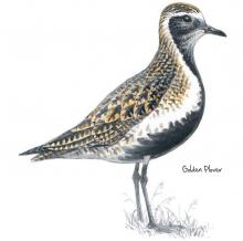
This walk epitomises much that is characteristic of the North Pennines Area of Outstanding Natural Beauty (AONB) and UNESCO Global Geopark. High peaty moorland, the sweet melancholy call of the golden plover and the towering remains of chimneys from the area’s lead mining past. All this is surrounded by sweeping views of the dales and settlements below and can be reached without a strenuous climb!
Location:
Starting from a small road side lay-by (NY807531)
Distance:
2 km
Terrain:
Boggy ground, Off road sections
Area:
Access:
Recreation opportunities:
Interests:
Link:
Birdwalks North Pennines
The National Trust - Allen Banks and Staward Gorge woodland walk

Set on the steep valley sides of the river Allen, a tributary of the south Tyne, explore the woods and see what wildlife you can spot on this gentle riverside walk. It's the largest area of ancient woodland in Northumberland and has been here since at least medieval times. This long history has helped make it a fantastic home for flora, fauna and fungi.
Location:
Starting from Allen Banks car park.
Distance:
4 km
Terrain:
Boggy ground, Off road sections, Steep sections
Area:
Access:
Facilities nearby
Recreation opportunities:
Interests:
Three Counties & Killhope Museum: Electric Bike Route 5

This 24km cycle route starts at Killhope Museum and takes you into Durham, Cumbria and Northumberland. Note that this electric bike route was originally devised in 2015. It is still valid but some of the information (e.g. hire/charge points) may have changed.
Location:
The route starts at Killhope Lead Mining Museum in Upper Weardale (NY825431 / DL13 1AR).
Distance:
24 km
Terrain:
On road sections, Steep sections
Area:
Access:
Facilities nearby
Recreation opportunities:
Interests:
Link:
North Pennines Electric Bike Network
Up on the ridge: Moor House-Upper Teesdale NNR
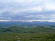
This walk takes you right up along the summit ridge of the Pennines. You’ll be able to see evidence of the area’s mining and quarrying history, take in some stunning views over the high Pennines, and look across the Eden Valley to the Lake District fells. On the backbone of England, around the headwaters of the River Tees, 8,800 hectares of upland country forms the Moor House–Upper Teesdale National Nature Reserve (NNR). The reserve encompasses an almost complete range of upland habitats typical of the North Pennines, from lower lying hay meadows, rough grazing and juniper woods to limestone grassland, blanket bogs and the summit heaths of the high fells. Nowhere else in Britain is there such a diversity of rare habitats in one location. The remote and dramatic landscape of the reserve can be enjoyed from the Pennine Way National Trail, the Public Rights of Way network and on Open Access land.
Location:
Start point at the end of the public road from Knock village, past Knock Christian Centre (NY686288).
Distance:
12 km
Terrain:
Boggy ground, Off road sections, Steep sections
Access:
Recreation opportunities:
Interests:
Upper Teesdale (Hanging Shaw): North Pennine Birdwalks Walk 12
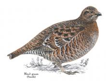
Upper Teesdale is one of the best places to see waders in the breeding season and black grouse throughout the year. The wide expanse of the upper dale offers stunning views of the meadows and allotments and the imposing fells of Cronkley Scar and Widdybank. The River Tees is always impressive and there’s a chance of seeing birds such as dipper, goosander and oystercatcher.
Location:
Starting from the car park at Hanging Shaw, Forest-in-Teesdale (NY867297).
Distance:
7 km
Terrain:
Boggy ground, Off road sections, On road sections, Steep sections
Area:
Access:
Facilities nearby
Recreation opportunities:
Interests:
Link:
Birdwalks North Pennines
Walking around Wolsingham

There are many interesting walks leading from the historic town of Wolsingham. These lead to quarries, farms, shafts, mills, and mark out an intricate pattern of journeys to work made over hundreds of years by generations of the people working in Weardale.
Location:
Starting from Wolsingham Railway Station.
Terrain:
Off road sections, On road sections
Area:
Access:
Facilities nearby
Recreation opportunities:
Interests:
Download:
Walks from Allendale Caravan Park

This set of 3 walks from Allendale Caravan Park showcase the distinct beauty and character of Allendale. On the walks you will pass through pretty hay meadows, see remnants of the areas lead mining past, encounter the abundant wildlife of the region and be exposed to the dramatic moorland landscapes on the fell above the town.
Location:
Starting from Allendale Caravan Park.
Terrain:
Boggy ground, Off road sections, On road sections
Area:
Access:
Facilities nearby
Recreation opportunities:
Interests:
Link:
Download:
Waskerley and Lanchester Way: Taste Trail

This route (walk, cycle, horse ride) follows the Lanchester Valley and Waskerley Way Railway Paths, climbing from the pleasant pastoral landscape near Durham to the rugged heather covered Stanhope Moor. The route is excellent for walkers, cyclists and riders, with its easy to follow, car-free sections. Wonderful wildlife, fascinating history and spectacular views are all on offer on this gem of a trail. You can approach this linear route starting in either direction and can tailor the length to suit your own requirements. In this leaflet we have made suggestions for three sections of varying lengths along the route. From Durham to Stanhope, this route starts at Broompark, near Neville’s Cross in Durham and follows mainly dedicated paths along old railway tracks for 22 miles to Parkhead above Stanhope, in Weardale. There are a number of great places along the way to stop for a bite to eat and a brew. Lanchester and Consett are also good places to join the route and it can be done in shorter sections. This route is accessible to all users.
Location:
Starting from the Durham County Council car park at Broompark (NZ250415), Durham.
Distance:
34 km
Terrain:
Off road sections, On road sections
Access:
Recreation opportunities:
Interests:
Link:
Waskerley Way Railway Path

The Waskerley Way is a 16km route running from Parkhead Station above Stanhope in Weardale to Lydgetts Junction, Consett (where is joins with the Lanchester Valley Railway Path, the Derwent Walk Railway Path and the Consett to Sunderland cycle route). It's a beautiful route passing through a varied landscape; from urban fringe through to upland sheep farms and then on to glorious heather moorland. It's suitable for walkers, cyclists, horse riders and wheelchair users. Hownsgill Viaduct towers 46m above the tree canopy of Knitsley and High House Woods near Lydgetts Junction. This is one of the most impressive railway structures in North East England. From further up the Railway Path there are stunning views across Smiddy Shaw, Waskerley and Hisehope Reservoirs.
Location:
The routes runs from Park Head Station, above Stanhope, Weardale (NZ002431 / DL13 2ES) to Lydgetts Junction, Consett (NZ098492 / DH8 9AA).
Distance:
16 km
Terrain:
On road sections
Area:
Access:
Facilities nearby
Recreation opportunities:
Interests:
Link:
Download:
Weardale Way - Stanhope to White Kirkley

Beginning in Stanhope the walk takes you across several burns and through a number of disused limestone quarries to reach the small hamlet of White Kirkley which sits above Frosterley. Limestone has been quarried from the valley sides around Frosterley since the 12th century but it was in the 1800s that the village became an important centre for limestone quarrying. Limestone has many uses - as a road stone, agricultural lime, for flux in the iron and steel industry and for cement. A special type of limestone is found in Frosterley; this fossil-rich stone, known as Frosterley marble, can be polished to a high shine. The most famous use of Frosterley marble is in Durham Cathedral. Here, the ceiling of the Chapel of the Nine Altars is supported by slender columns of this unusual stone.
Location:
Starting from the lay-by, near Unthank Farm, in Stanhope.
Distance:
7 km
Terrain:
Off road sections
Area:
Access:
Facilities nearby
Recreation opportunities:
Interests:
Link:
http://www.weardaleway.com/
Download:
Weardale Way - Westgate to Eastgate via Rookhope
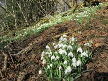
The second section of the Weardale Way involves a fairly steep climb up Heights Pasture, above Westgate, before dropping down into the old mining village of Rookhope. The famed poet WH Auden once visited Rookhope as a child and he drew inspiration for many of his works from the North Pennine landscape. From Rookhope the trail heads back down into the Wear Valley following the Rookhope Burn all the way to small village of Eastgate. Eastgate marks the boundary of the former woodland where the Prince Bishops of Durham hunted deer.
Location:
Starting from the car park at Haswicks in Westgate.
Distance:
13 km
Terrain:
Boggy ground, Off road sections, On road sections, Steep sections
Area:
Access:
Recreation opportunities:
Interests:
Link:
http://www.weardaleway.com/
Weardale Way - White Kirkley to Wolsingham
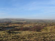
From White Kirkley the walk takes you above Harehope Quarry, which is now run as a workers co-operative offering environmental education and rural skills training. The path then climbs up over Harvey Hill to the edge of the grouse moors where you may see Red Grouse among the heather. The trail then drops down towards Wolsingham passing through a patch of ancient woodland at Ashes Beck. Note there are no facilities or parking spaces at White Kirkley, these are available in either Frosterley or Wolsingham.
Location:
Starting from White Kirkley.
Terrain:
Boggy ground, Off road sections, On road sections
Area:
Access:
Recreation opportunities:
Interests:
Link:
http://www.weardaleway.com/
Wellhope Moor (Nent Valley): North Pennine Birdwalks - Walk 9
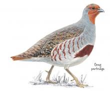
This walk offers both stunning views across the Nent Valley and the opportunity to experience a mix of typical North Pennines upland habitats: hay meadow, pasture and allotment, heather moorland, blanket bog and upland stream. Passing a derelict mine and many old mine shafts, it also typifies the historic lead mining landscape of the area.
Location:
Starting from a small road side lay-by (NY769453).
Distance:
5 km
Terrain:
Boggy ground, Off road sections, On road sections, Steep sections
Access:
Recreation opportunities:
Interests:
Link:
Birdwalks North Pennines
Widdybank Fell Nature Trail: Moor House-Upper Teesdale NNR
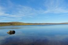
This walk takes you over Widdybank Fell, along the track to Cow Green dam and Cauldron Snout waterfall. The walk follows a tarmac track with 1 large kissing gate and 3 steep sections. Suitable for pushchairs and wheelchairs with strong pushers! However for the last 100m section, to view Cauldron Snout waterfall, the track is rocky and uneven. On the backbone of England, around the headwaters of the River Tees, 8,800 hectares of upland country forms the Moor House–Upper Teesdale National Nature Reserve (NNR). The reserve encompasses an almost complete range of upland habitats typical of the North Pennines, from lower lying hay meadows, rough grazing and juniper woods to limestone grassland, blanket bogs and the summit heaths of the high fells. Nowhere else in Britain is there such a diversity of rare habitats in one location. The remote and dramatic landscape of the reserve can be enjoyed from the Pennine Way National Trail, the Public Rights of Way network and on Open Access land.
Location:
Starting from the Cow Green Reservoir car park (NY811309)
Distance:
5 km
Terrain:
Off road sections, On road sections, Steep sections
Area:
Access:
Recreation opportunities:
Interests:
Wild Brown Trout - Cow Green Reservoir

Cow Green Reservoir in Teesdale is one of best wild brown trout fisheries in the country. It is full of fighting fit trout, providing excellent sport. Surrounded by the fantastic scenery of the North Pennines grouse moors, there are few more tranquil and relaxing ways to spend a day’s fishing than roaming the banks of these waters, and even fewer places where you can catch truly wild browns. The trout in these reservoirs are 100% native, having descended from the original upland brownies which lived in the streams before the dams were built. Lightning quick and very hard fighting with unique colours and markings, these fish are a joy to catch. Please note, from Wednesday 5 September 2012, day permits for Cow Green, Balderhead and Selset are available to buy in person from Grassholme Reservoir, by calling 0845 155 02366 or online at www.fishpal.com.
Location:
Starting from the Cow Green car park
Terrain:
Off road sections
Area:
Access:
Recreation opportunities:
Interests:
Link:
Download:
Windmore end

A long escarpment of quarried limestone, just about the road from Brough to Middleton-in-Teesdale. Routes from boulder problems up to 13 metres with a huge spread of climbing. Unfortunately there is no access to the left hand section, which is owned by Stainmore Parish Council. There is access to the central and righthand sections, for which climbers are very grateful. Local climber Peter Day climbed here in the 1960’s and together with other developments an initial guidebook was produced by Kelvin Neal in 1976, detailing 50 – 60 routes. Over the years all its sections have been developed. There are a total of 125 accessible routes with trad and bouldering grades in the ranges of Diff to E5 and V0 to V3 respectively.
Location:
Park at a layby towards the righthand end of the crag and approach through a gate further right again – do not climb over any walls!
Access:
Facilities nearby
Recreation opportunities:
Interests:


