Cycling

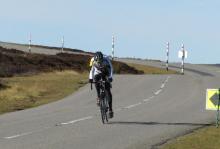
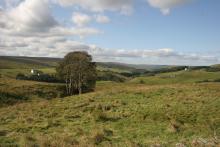
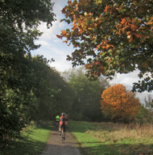
The North Pennines abounds in two-wheeled excitement and adventure! If your passion is moorland tracks beneath your wheels then look no further! Alternatively if road routes are more your style - the AONB has quiet country roads a plenty!   

The area has some of the country's best cycling. Quiet country roads, a range of traffic-free routes, unequalled scenery and a wide choice of places to stay make it a great destination! The C2C, Pennine Cycleway and Walney to Wear (and Whitby) National Cycle Routes all pass through the North Pennines.

In Hamsterley Forest you will find a variety of trails provided by the Forestry Commission ranging from leisurely forest roads to technical singletrack. The North Pennines is also home to the Roof of England Sportive and the Ride the Reservoir race.

Several businesses offer cycle hire including North Pennine Cycles in Nenthead, Pedal Pushers in Brampton and Wood 'N' Wheels in Hamsterley Forest.


Allendale to Allen Banks: Electric Bike Route 1

Allendale ©
A 20 mile circular route that takes you from the centre of Allendale, through rural Northumberland, to reach the spectacular ancient woodland at Allen Banks. Note that this electric bike route was originally devised in 2015. It is still valid but some of the information (e.g. hire/charge points) may have changed.
Location:
Circular route starting at Allendale Post Office (NY837558 / NE47 9BJ).
Terrain:
On road sections, Steep sections
Facilities nearby
Recreation opportunities:
Interests:

Allendale: Cycle Route 1

West Allen Valley © NPAP/Andy Lees
This 34-km cycle route is a circuit of the East and West Allen Valleys. It is best cycled anti-clockwise. The southern section is part of the C2C Cycle Route and provides an easy link to Allenheads. A shorter circuit is possible, diverting from the main route at Hartleycleugh and crossing Dryburn Moor and continuing down into Allendale. Along this route two chimneys can be seen which are remnants of Allendale's mining heritage. Flues and chimneys formed part of the condensing process, and took fumes from the smelt mills up the valley. Valuable deposits of lead collected within the flues, and periodically small boys were sent through to collect it - not a pleasant job! Please note that the original leaflet was produced and printed in 2005. The routes are still valid but some of the information (e.g. refreshments and facilities) might be out of date.
Location:
Starting and finishing in Allendale in the East Allen Valley (NY837558 / NE47 9BJ).
Distance:
34 km
Terrain:
On road sections, Steep sections
Recreation opportunities:
Interests:

Allendale: Cycle Route 2

Chimney on Dryburn Moor © NPAP
This 15-km route follows the upper valley roads but is generally less demanding than the other 3 Allendale routes, despite one very short and extremely steep hill at Acton Burn. This is followed by a series of generally upward undulations leading to a glorious descent back into Allendale. A longer alternative route takes in both Dryburn Moor and a part of the C2C Cycle Route across Swinhope Moor. The remains of an early 17th Century bastle house called Rowantree stob can be seen off the cycle route near Pry Hill Farm (NY839512). These fortified homes were built by landowners to protect their families and livestock from Border Reivers. You can visit the bastle ruins by following Isaacs Tea Trail - a public footpath. Please note that the original leaflet was produced and printed in 2005. The routes are still valid but some of the information (e.g. refreshments and facilities) might be out of date.
Location:
Starting and finishing in Allendale in the East Allen Valley (NY837558 / NE47 9BJ).
Distance:
15 km
Terrain:
On road sections, Steep sections
Recreation opportunities:
Interests:

Allendale: Cycle Route 3

Stobbs Cross above Allendale © NPAP/Rebecca Barrett
This 14km route is for the more adventurous cyclist, with a steep ascent and descent to cross the River East Allen at Oakpool. Several continuation options are available at Keenley. Nearby is Keenley Chapel the oldest Methodist Chapel in the Allendale area and it is one of the first to be purpose-built in the North East. It was built in 1750, rebuilt in 1875 and is still in use. Many Methodist chapels, some now converted for domestic or other uses, can be seen throughout the AONB. Please note that the original leaflet was produced and printed in 2005. The routes are still valid but some of the information (e.g. refreshments and facilities) might be out of date.
Location:
Starting and finishing in Allendale in the East Allen Valley (NY837558 / NE47 9BJ).
Distance:
14 km
Terrain:
On road sections
Recreation opportunities:
Interests:

Allendale: Cycle Route 4

Allendale ©
This 15km mountain bike route uses several sections of quiet minor roads as part of the itinerary. There are various options to extend or shorten the route according to time, energy and conditions. The route passes alongside several upland hay meadows which are a rare and internationally important habitat because of their high wildflower and grassland species diversity. Please note that the original leaflet was produced and printed in 2005. The routes are still valid but some of the information (e.g. refreshments and facilities) might be out of date.
Location:
Starting and finishing in Allendale in the East Allen Valley (NY837558 / NE47 9BJ).
Distance:
15 km
Terrain:
Boggy ground, Off road sections, On road sections, Steep sections
Recreation opportunities:
Interests:

Allenheads, Cowshill & Middlehope Moor: Electric Bike Route 10

Cottongrass on the moors above Allenheads © NPAP/Shane Harris
This 24km cycle route starts in Allenheads and takes you across to Weardale in a grand loop. Note that this electric bike route was originally devised in 2015. It is still valid but some of the information (e.g. hire/charge points) may have changed.
Location:
Starts and finishes in Allenheads in the East Allen Valley (NY859453 / NE47 9HJ)
Distance:
24 km
Terrain:
On road sections
Recreation opportunities:
Interests:

Alston & the South Tyne Valley: Electric Bike Route 6

The South Tyne Valley © Natural England/Charlie Hedley
This 32km cycle route starts in Alston and explores the glorious South Tyne Valley. Note that this electric bike route was originally devised in 2015. It is still valid but some of the information (e.g. hire/charge points) may have changed.
Location:
This route starts and finishes at the South Tynedale Railway/the Hub Museum in Alston (NY716467 / CA9 3HN).
Distance:
32 km
Terrain:
On road sections, Steep sections
Recreation opportunities:
Interests:

Alston Packhorse Trail - Mountain Biking
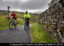
Alston Packhorse Trail © NPAP/Charlie Hedley
This 29km (912m of ascent) circular mountain biking route (30% off-road) starts and finishes in Nenthead. You’ll travel through a landscape rich with echoes of the area’s lead mining past. Passing through the small town of Alston and the villages of Nenthead and Garrigill, as well as over the high moors, it’s a route of contrasts.
Location:
Starts and finishes at Nenthead Mines car park (NY781436 / CA9 3NR - nearest).
Distance:
29 km
Terrain:
Boggy ground, Off road sections, On road sections, Steep sections
Facilities nearby
Recreation opportunities:

Alston, Garrigill & Nenthead: Electric Bike Route 7

South Tyne Valley © NPAP/Shane Harris
This 24km cycle route starts in Alston and is essentially a grand tour of the South Tyne and Nenthead Valleys. Note that this electric bike route was originally devised in 2015. It is still valid but some of the information (e.g. hire/charge points) may have changed.
Location:
The route starts and finishes at the South Tynedale Railway/the Hub Museum in Alston (NY716467 / CA9 3HN).
Distance:
24 km
Terrain:
On road sections
Recreation opportunities:
Interests:

Alston, Nenthead & Carrshield: Electric Bike Route 8

West Allen Valley © NPAP/Shane Harris
Starting from Alston this cycle route explores the West Allen Valley before returning along the Nent Valley to the start. Note that this electric bike route was originally devised in 2015. It is still valid but some of the information (e.g. hire/charge points) may have changed.
Location:
Starts and finishes at the South Tynedale Railway/the Hub Museum in Alston (NY716467 / CA9 3HN).
Distance:
32 km
Terrain:
On road sections
Recreation opportunities:
Interests:

Alston: Cycle Route 1

Alston © NPAP/Shane Harris
This major, 56km-long, road cycling circuit will take most people a full day to complete as it tackles a number of major hills and a good level of fitness is needed. With lots of steep ups and lots of steep downs on a route which offers fantastic panoramic views of the wild and wonderful North Pennines AONB and UNESCO Global Geopark. Strenuous grade requiring fitness and stamina but what a circuit! Alston developed at the cross roads of major trans-Pennine routes - as a service centre and busy lead mining town. Many of its cobbled streets and the market cross still survive. Distinctive ‘bastle’ derived houses can be seen throughout the town with stone steps up to first floor level. Today the parish of Alston Moor is a thriving community of 2,000 people. When it was at the heart of the world’s largest lead producing area, however, its population was five times greater! Please note that the original leaflet was produced and printed in 2005. The routes are still valid but some of the information (e.g. refreshments and facilities) might be out of date.
Location:
Starting from the centre of Alston (NY718465 / CA9 3QN) in the Cumbrian North Pennines.
Distance:
56 km
Terrain:
On road sections, Steep sections
Recreation opportunities:
Interests:

Alston: Cycle Route 2

Alston main street © NPAP/Elfie Warren
This 27km road route is an anti-clockwise circuit which joins the C2C Cycle Route at Leadgate and follows its road option to Nenthead. This involves the very steep ascent and descent of Flinty Fell for which walking the steepest section is often the best option! The return to Alston varies slightly from the latter stage of Alston Cycle Route 1. Alston to Garrigill has some uphill sections matched with descents; the last third being generally easy. Alston developed at the cross roads of major trans-Pennine routes - as a service centre and busy lead mining town. Many of its cobbled streets and the market cross still survive. Distinctive ‘bastle’ derived houses can be seen throughout the town with stone steps up to first floor level. Today the parish of Alston Moor is a thriving community of 2,000 people. When it was at the heart of the world’s largest lead producing area, however, its population was five times greater! Please note that the original leaflet was produced and printed in 2005. The routes are still valid but some of the information (e.g. refreshments and facilities) might be out of date.
Location:
Starting from the centre of Alston (NY718465 / CA9 3QN) in the Cumbrian North Pennines.
Distance:
27 km
Terrain:
On road sections, Steep sections
Recreation opportunities:
Interests:

Alston: Cycle Route 3

Above Garrigill in the South Tyne Valley © NPAP/Gearoid Murphy
This 28km mountain bike route is broadly an off-road version of Alston Cycle Route 2 as it shadows the circuit wherever there are suitable sections of off-road available. Fairly strenuous but with several alternatives to shorten. Alston developed at the cross roads of major trans-Pennine routes - as a service centre and busy lead mining town. Many of its cobbled streets and the market cross still survive. Distinctive ‘bastle’ derived houses can be seen throughout the town with stone steps up to first floor level. Today the parish of Alston Moor is a thriving community of 2,000 people. When it was at the heart of the world’s largest lead producing area, however, its population was five times greater! Please note that the original leaflet was produced and printed in 2005. The routes are still valid but some of the information (e.g. refreshments and facilities) might be out of date.
Location:
Starting from the centre of Alston (NY718465 / CA9 3QN) in the Cumbrian North Pennines.
Distance:
28 km
Terrain:
Boggy ground, Off road sections, On road sections, Steep sections
Recreation opportunities:
Interests:

Alston: Cycle Route 4

Above the West Allen Valley © NPAP/Shane Harris
This 29km mountain bike route links available off-road sections with quiet country roads (as well as one unavoidable stretch of the A686). This figure-8 route permits either loops to be used as a single circuit which together make up a superb tour of some of Alston’s historical access routes. It's a fairly strenuous ride but is always scenic! Alston developed at the cross roads of major trans-Pennine routes - as a service centre and busy lead mining town. Many of its cobbled streets and the market cross still survive. Distinctive ‘bastle’ derived houses can be seen throughout the town with stone steps up to first floor level. Today the parish of Alston Moor is a thriving community of 2,000 people. When it was at the heart of the world’s largest lead producing area, however, its population was five times greater! Please note that the original leaflet was produced and printed in 2005. The routes are still valid but some of the information (e.g. refreshments and facilities) might be out of date.
Location:
Starting from the centre of Alston (NY718465 / CA9 3QN) in the Cumbrian North Pennines.
Distance:
29 km
Terrain:
Off road sections, On road sections, Steep sections
Recreation opportunities:
Interests:

Arragon's Cycles

Cycling in the North Pennines © Gearoid Murphy/NPAP
Arragon's Cycle Centre is an established business, having traded for over 40 years. We believe our team is equipped with the skill & experience to assist with all things bikes in the most professional manner. Between us, we ride and own tandems, single speed fixed wheels, folding bikes, mountain bikes, racers, touring bikes, time trial bikes… Our workshop facility is open to view. The rest of the room is home to mechanical accessories and practical bits. The second of our showrooms displays clothing and accessories and our two cycle showrooms offer a full range of industry leading cross country and road bikes, family cycles, leisure, fitness and touring bikes. If you are cycling one of the many routes that pass by our shop call in for spares, a speedy 'pitstop' service or a chat and you will be made very welcome.
Location:
2 Brunswick Road, Penrith, Cumbria, CA11 7LU.
Facilities nearby
Recreation opportunities:

Baldersdale Packhorse Trail - Mountain Biking
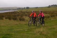
Baldersdale Packhorse Trail © NPAP/Charlie Hedley
This circular 18km (60% off-road) mountain biking trail has 370m of ascent and starts from the south side of Hury Reservoir. It initially follows the banks of Hury and Blackton Reservoirs in remote Baldersdale, before striking off over the moors on the Pennine Way.
Location:
Starts and finishes from the Northumbrian Water car park on the south side of Hury Reservoir (NY966192 / DL12 9UP - nearest).
Terrain:
Boggy ground, Off road sections, On road sections, Steep sections
Area:
Access:
Recreation opportunities:

Barnard Castle to Middleton-in-Teesdale: Taste Trail

Tees Railway path © NPAP/Shane Harris
This route (walk, cycle, horse ride) takes you along the old railway line that serviced the stone quarrying industry in Teesdale. The route start is close to Barnard Castle, although you can pick it up at a number of points along to way - splitting it into shorter sections. This guide has been written as a linear route but if you choose to walk it is possible to make shorter circular walks connecting up with other footpaths including the Teesdale Way. The majority of the path is along the old railway line. The section of the railway line from Barnard Castle to Middleton-in-Teesdale was built by the Tees Valley Railway company during 1868 with stops at Cotherstone, Mickleton and Romaldkirk. There are two major engineering features on the line the Lunedale and Baldersdale Viaducts, you will pass over both these on this route. The decline of this section of railway started in the late 1950s and the line was earmarked for closure as part of the Beeching cuts with the last train running in April 1965.
Location:
Starting from Deepdale aqueduct layby on the B6277 outside Barnard Castle.
Distance:
16 km
Terrain:
Off road sections, On road sections
Area:
Recreation opportunities:

BECKs Training at Deneholme

Deneholme © BECKs Training
Tony and Linda Beck run BECKs Training Ltd, headquartered at their outdoor activity centre and group accommodation venue Deneholme in Allendale. Traditional adventurous activities are delivered within the North Pennines Area of Outstanding Natural Beauty (AONB) and beyond in rural Northumberland. Activities are facilitated to groups of at least 8 people and they include ghyll scrambling and gorge walking, mine exploration, rock climbing and abseiling, canoeing and raft building. Mountain biking, bush craft orienteering and navigational fell walks, archery and high ropes activities. All activities are facilitated by experienced, local instructors who hold all the relevant NGB qualifications, are additionally in house and site specifically trained and have undergone all required checks to work with children and adults alike. They are passionate about their activity, knowledgeable and enthusiastic about passing on their skills. BECKs can provide transport and packed lunches, whilst always providing all relevant equipment – no prior experience is required.
Location:
Deneholme, Allendale in the East Allen Valley

Blanchland and Derwent Reservoir: Electric Bike Route 9
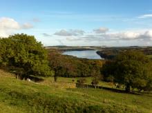
Derwent Reservoir © NPAP/Shane Harris
This 30km grand tour of Derwent Reservoir in the Upper Derwent Valley is a delight to ride. Note that this electric bike route was originally devised in 2015. It is still valid but some of the information (e.g. hire/charge points) may have changed.
Location:
Starts and finishes in Blanchland in the Upper Derwent Valley (NY965503 / DH8 9SP)
Distance:
30 km
Terrain:
On road sections, Steep sections
Facilities nearby
Recreation opportunities:
Interests:

Blanchland Packhorse Trail - Mountain Biking
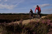
Blanchland Packhorse Trail © NPAP/Charlie Hedley
This 21km circular mountain biking route is 70% off-road and enjoys 1,027m of ascent. It starts at Baybridge, close to the village of Blanchland. You’ll follow the Carriers’ Way across Bulbeck Common, alive with the evocative calls of wading birds in the spring and early summer.
Location:
Starts and finishes in the Baybridge car park (NY957499 / DH8 9UB - nearest).
Distance:
21 km
Terrain:
Boggy ground, Off road sections, On road sections, Steep sections
Access:
Recreation opportunities:

Bowlees Visitor Centre

Bowlees Visitor Centre    © NPAP
Bowlees Visitor Centre, run by the North Pennines AONB Partnership, is a fantastic base for exploring Upper Teesdale, with footpath links to Low Force, High Force, Newbiggin and the Pennine Way. The Centre provides information and displays on the geology and landscape, wildlife and people of Upper Teesdale and the wider North Pennines. You'll find a delicious range of food and drinks and our shop stocks nature inspired gifts and books. You'll find a range of special events are running at the Centre throughout the year. You can also hire the venue for family get-togethers, parties and meetings. We have a range of outdoor cooking facilities which can be pre-booked. The Centre is dog-friendly and you'll find free Wi-Fi access, an iGlass (24-hour information touch screen) and an electric car-charging point. Follow the Richard Watson Trail from the Centre - a 2¾-mile circular route exploring the life and times of Richard Watson, Victorian lead miner and poet. The most popular walk is probably the High Force-Low Force Round. The Centre is also an official Dark Sky Discovery Site.
Location:
Newbiggin, Bowlees, Middleton-in-Teesdale, Co. Durham, DL12 0XE (grid ref - NY906281). 01833 622145.
Area:
Facilities nearby

Bowlees Visitor Centre, Middleton-in-Teesdale & Grassholme Reservoir: Electric Bike Route 11

Middleton-in-Teesdale © NPAP/Shane Harris
This 27km road route starts at Bowlees Visitor Centre and explores Upper Teesdale. Note that this electric bike route was originally devised in 2015. It is still valid but some of the information (e.g. hire/charge points) may have changed.
Location:
Starts and finishes at Bowlees Visitor Centre in Upper Teesdale (NY906282 / DL12 0XE)
Distance:
27 km
Terrain:
On road sections
Area:
Facilities nearby
Recreation opportunities:
Interests:

Bradley Burn to Hamsterley Forest: Electric Bike Route 13

Bradley Burn Farm Shop & Cafe ©
This 23km out and back route takes you from Bradley Burn in Weardale to Hamsterley Forest and back again. Note that this electric bike route was originally devised in 2015. It is still valid but some of the information (e.g. hire/charge points) may have changed.
Location:
This route starts and finishes at Bradley Burn Farm Shop and Cafe (NZ105363 / DL13 3PA).
Distance:
23 km
Terrain:
On road sections
Area:
Access:
Recreation opportunities:

Brampton and Haltwhistle Cycle Tour

Hadrian's Wall © NPAP/Gearoid Murphy
This cycle tour heads north from Alston exploiting the breach in the Pennines cut by the River South Tyne to explore the stretch of Hadrian's Wall between Brampton and Haltwhistle. It is a full on cycle tour that covers some busy sections of road as well as quiet fell lanes. The height gain and distance covered are fairly substantial, so to enjoy it you need to be an experienced cyclist. The rewards this challenging route are plentiful and range from outstanding views of classic Pennine landscapes, through to fascinating Roman Remains. Originally published as Route 1 in the Biking around Alston: 5 do-in-a-day rides in the North Pennines AONB (2012).
Location:
Starting from the centre of Alston (NY718465 / CA9 3QN) in the Cumbrian North Pennines.
Distance:
75 km
Terrain:
On road sections
Recreation opportunities:
Interests:

Cross Fell Mountain Bike Ride

View from the Pennine Way on the way to Cross Fell © NPAP/Gearoid Murphy
Cross Fell and its near neighbour Great Dun Fell are ringed by an amazing network of high level bridleways. They cross wild and exposed moorland and reach a considerable height making them the highest mountain biking routes in England outside of the Lake District. This route is not for the faint-hearted, particularly first timers to the area as it crosses high and exposed moorland and the distances and height gain involved are considerable. The best introduction to the style of riding they offer is to tackle the out and back ride up the bridleway that climbs the northern shoulder of Cross Fell from the Pennine village of Garrigill. There is a fair amount of height to gain on this route but it is achieved over 11 kilometres which gives most of the climbs a moderate and mostly cycle-able gradient. Originally published as Route 5 in the Biking around Alston: 5 do-in-a-day rides in the North Pennines AONB (2012).
Location:
Starting and finishing in Garrigill (NY744415 / CA9 3DS) in the South Tyne Valley.
Distance:
22 km
Terrain:
Boggy ground, Off road sections, On road sections, Steep sections
Facilities nearby
Recreation opportunities:
Interests:

Derwent Reservoir - Walks, rides and wildlife

Derwent Reservoir © NPAP/Shane Harris
Derwent Reservoir is within the North Pennines AONB and, after Kielder, is the second largest reservoir in the region. There is a multi-user path from Pow Hill Country Park (south shore) to the dam at the eastern end of the reservoir and then round the north shore to Millshield Picnic Area. You can find out more about the reservoir, its wildlife and its history as you go, on foot or by bike. Cyclists can make a longer circular route around the reservoir by combining the shore path with local roads.
Location:
Derwent Reservoir is in the north-eastern part of the North Pennines AONB, between Blanchland and Edmundbyers - the south shore is in County Durham and the north shore is in Northumberland. Start from Pow Hill Country Park (NZ011517 / DH8 9NU - nearest) or Millshield Picnic Area (NZ013532 / DH8 9PT - nearest).
Distance:
3 km
Facilities nearby
Interests:

Discover Mid Teesdale - routes to walk, cycle and ride

Walking the Tees Railway Path © NPAP/Shane Harris
Mid Teesdale sits between the two market towns of Middleton and Barnard Castle. The River Tees meanders its way through this beautiful dale, which is surrounded by the high moorland of the North Pennines. The area has a wealth of history and nature waiting to be explored, with attractive villages from which to base your visit. This publication will help you to discover the area and its main settlements at a leisurely pace, with six routes for walking, cycling and horse riding.
Location:
Routes starting from either Mickleton (NY967233 / DL12 0JN - nearest) and Middleton-in-Teesdale (NY947254 / DL12 0SH).
Terrain:
Boggy ground, Off road sections, On road sections
Area:
Facilities nearby
Recreation opportunities:

Dryburn Moor & East Allen: Electric Bike Route 3

West Allen Valley © NPAP/Shane Harris
This 33km route takes you from the mining village of Allenheads, over to the West Allen via the C2C and onto Dryburn Moor. From there you get stunning views of the East and West Allen, and looking north, the Scottish Boarders. Note that this electric bike route was originally devised in 2015. It is still valid but some of the information (e.g. hire/charge points) may have changed.
Location:
Circular route from The Hemmel Cafe, Allenheads (NY859453 / NE47 9HJ).
Distance:
33 km
Terrain:
On road sections
Recreation opportunities:
Interests:

East Allen Views: Electric Bike Route 2

Electric biking in the East Allen Valley © NPAP/Andy Lees
A short route that takes you out of Allendale Town where you can get some of the best views of the East Allen Valley. Note that this electric bike route was originally devised in 2015. It is still valid but some of the information (e.g. hire/charge points) may have changed.
Location:
Circular route starting from Allendale Post Office (NY837558 / NE47 9BA).
Distance:
12 km
Recreation opportunities:
Interests:

Hamsterley Forest

Hamsterley Forest © NPAP/Louise Taylor
County Durham's largest forest is a mixture of woodland, meadows and forest. There are excellent walking, cycling and horse riding trails for all abilities. The forest also has a childrens' adventure playground, tea room, cycle hire, shop and downhill mountain bike course.
Location:
Hamsterley Forest (NZ091312 / DL13 3QH).
Terrain:
Boggy ground, Off road sections, On road sections, Steep sections
Area:

Hamsterley Forest - Black Trail

 ©
This is the most strenuous and technically challenging waymarked mountain bike trail in Hamsterley Forest. It sports steep technical climbs, smooth contouring single track and some superb rooty descents. This character stays with the trail for its entire length and boasts some great natural riding that will challenge even the best cross country bikers. It starts from the forest drive just beyond the visitor centre.
Location:
Hamsterley Forest (NZ091312 / DL13 3QH).
Distance:
11 km
Terrain:
Boggy ground, Off road sections, On road sections, Steep sections
Area:
Recreation opportunities:

Hamsterley Forest - Blue Trail

Mountain biking in Hamsterley Forest © NPAP/Louise Taylor
This mountain bike trail provides you with the ideal opportunity to explore Hamsterley Forest at a leisurely pace. The first stretch to Grove House is on a wide, purpose built cycle trail, before joining the Forest Drive to Blackling Hole. This stretch and the return through the forest to the Grove, is all on loose surfaced forest road. Please exercise caution when cycling on forest roads as this is shared with other users, including timber lorries. The last two miles is on the tarmac section of the Forest Drive.
Location:
Hamsterley Forest (NZ091312 / DL13 3QH).
Distance:
14 km
Terrain:
Boggy ground, Off road sections, On road sections, Steep sections
Area:
Recreation opportunities:

Hamsterley Forest - Doctors Gate

Hamsterley Forest © NPAP/Louise Taylor
Doctors Gate is a 21.8 mile circular mountain bike route, starting from Hamsterley Forest, climbing 2821ft using quiet road sections to link the off road sections. The route should be tackled clockwise - start off by going along the Grove Link. There are more road miles on this route than ideal for a mountain bike ride but the blast down the Weardale Way and the descent into the forest make up for this.
Location:
Hamsterley Forest (NZ091312 / DL13 3QH).
Distance:
35 km
Terrain:
Boggy ground, Off road sections, On road sections, Steep sections
Area:
Recreation opportunities:
Interests:
Download GPX file:

Hamsterley Forest - Eggleston Moors

 ©
Starting in Hamsterley Forest this lollipop-shaped mountain bike route takes you across the moors to Eggleston and back. Best ridden on a dry day when there has been a dry spell beforehand!
Location:
Hamsterley Forest (NZ091312 / DL13 3QH).
Distance:
30 km
Terrain:
Boggy ground, Off road sections, On road sections, Steep sections
Area:
Recreation opportunities:
Interests:

Hamsterley Forest - Red Trail

 ©
A mountain bike trail for real adventurers who want to spend the day exploring the further reaches of Hamsterley Forest. The route follows the Blue Trail to the Grove before heading into the wider forest on a mixture of forest road and singletrack. Superb views await at the top of the forest overlooking Eggleston Moor before returning to the Grove via the Euden Beck on breathtaking stretches of singletrack.
Location:
Hamsterley Forest (NZ091312 / DL13 3QH).
Distance:
22 km
Terrain:
Boggy ground, Off road sections, On road sections, Steep sections
Area:
Recreation opportunities:
Interests:

Hamsterley Forest - Skills Loop

 ©
This is a purpose built mountain bike training loop. It is designed with skill development in mind to push your mountain biking to a new level. The Loop contains a multitude of features and riding options, some built in stone to mimic natural trails and others from timber in the North Shore style. Each feature has a skills tips board containing information to help perfect your technique. When you reach the bottom you can either exit The Loop or go back to the top via the climb trail. The training loop is aimed at anybody confident at riding Blue Grade trail or above, but beware it contains features of all grades from Blue to Black. The trail is not suitable for occasional/family cyclists and all riders are advised to wear suitable personal protective equipment.
Location:
Hamsterley Forest (NZ091312 / DL13 3QH).
Distance:
2 km
Terrain:
Boggy ground, Off road sections, On road sections, Steep sections
Area:
Recreation opportunities:

Hamsterley Half Century

Hamsterley Forest © NPAP/Louise Taylor
The Hamsterley Half Century is a 50km (31.1 miles) circular mountain biking route within Hamsterley Forest, boasting a lung/leg busting 1300m (4300ft) of climbing (and descending).
Location:
Hamsterley Forest (NZ091312 / DL13 3QH).
Distance:
50 km
Terrain:
Boggy ground, Off road sections, On road sections, Steep sections
Area:
Recreation opportunities:
Interests:
Download GPX file:

Hamsterley Packhorse Trail - Mountain Biking

Hamsterley Packhorse Trail © NPAP/Charlie Hedley
This 26km mountain biking route is 75% off-road and you'll climb 846m. It's a ride of contrasts - in the forest and out over the open moor. You’ll follow an old drove road on the return to the forest from Eggleston.
Location:
Starts and finishes from the Grove car park in Hamsterley Forest (NZ064297).
Distance:
26 km
Terrain:
Boggy ground, Off road sections, On road sections, Steep sections
Area:
Access:
Facilities nearby
Recreation opportunities:

Hamsterley Trail Guide

Deciding on a route in Hamsterley Forest © NPAP/Louise Taylor
Overview of the mountain bikes trails found in Hamsterley Forest: Blue (9 miles); Red (14 miles); Black (7 miles); Skills Loop (1 mile); Hamsterley Half Century (50km); Doctors Gate (22 Miles); and Eggleston Moors (19 miles).
Location:
Hamsterley Forest (NZ091312 / DL13 3QH).
Terrain:
Boggy ground, Off road sections, On road sections, Steep sections
Area:
Recreation opportunities:

Hartside Packhorse Trail - Mountain Biking
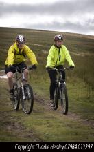
Hartside Packhorse Trail © NPAP/Charlie Hedley
This 11km mountain bike ride starts and finishes from Hartside Top Cafe - it's 75% off-road and packs in 458m of ascent! A dramatic ride from the Pennine escarpment down into the Eden Valley and back up to the top again!
Location:
Starts and finishes from Hartside Top car park (NY646418 / CA9 3BW - nearest).
Distance:
11 km
Terrain:
Boggy ground, Off road sections, On road sections, Steep sections
Facilities nearby
Recreation opportunities:

Mickleton - Romaldkirk Moor

Walking the Teesdale Railway Path © NPAP
This 11km circuit from Mickleton is suitable for walkers, cyclists and horse riders. It was published as route 5 in the Discover mid Teesdale leaflet (2007).
Location:
The route starts from the Mickleton Station car park (NY967233 / DL12 0JN).
Distance:
11 km
Terrain:
Boggy ground, Off road sections, On road sections, Steep sections
Area:
Access:
Facilities nearby
Recreation opportunities:
Interests:

Middleton-in-Teesdale: Cycle Route 1

Grassholme Reservoir © NPAP/Simon Wilson
This 24km route is the main circuit (on the leaflet) with a choice of two shorter variations which can be selected at the appropriate junction. Each variation is worth doing in its own right for the superb scenery, the magnificent views and the stunning descents. The area is shaped by a long history of farming, lead mining and quarrying. Traditional management means that Teesdale is still awash with flower-rich hay meadows. The whitewashed farm buildings of the Raby Estate are a distinctive feature in the upper dale. Be warned the roads are narrow in places with some sharp gravel-covered corners. Please note that the original leaflet was produced and printed in 2005. The routes are still valid but some of the information (e.g. refreshments and facilities) might be out of date.
Location:
Starting from the intersection between the Market Place and Bridge Street in Middleton-in-Teesdale (NY947254 / DL12 0QB).
Distance:
24 km
Terrain:
On road sections, Steep sections
Area:
Recreation opportunities:
Interests:

Middleton-in-Teesdale: Cycle Route 2

Hay meadow in Teesdale © NPAP/Shane Harris
This mountain bike route follows the first part of Middleton-in-Teesdale Cycle Route 1 but then follows an additional loop which can also be used to extend Route 1 which it re-joins. Route 2 then follows very narrow minor roads as well as off-road sections. It's memorable for its fine off-road sections although the narrow country lanes it otherwise uses are also a joy to cycle on. The gentle ascent from the valley, with the associated views and options, makes this route a good choice for a wide range of cyclists. The area is shaped by a long history of farming, lead mining and quarrying. Traditional management means that Teesdale is still awash with flower-rich hay meadows. The whitewashed farm buildings of the Raby Estate are a distinctive feature in the upper dale. Please note that the original leaflet was produced and printed in 2005. The routes are still valid but some of the information (e.g. refreshments and facilities) might be out of date.
Location:
Starting from the intersection between the Market Place and Bridge Street in Middleton-In-Teesdale (NY947254 / DL12 0QB).
Distance:
34 km
Terrain:
Off road sections, On road sections, Steep sections
Area:
Recreation opportunities:
Interests:

Middleton-in-Teesdale: Cycle Route 3

Holwick Scar © NPAP/Elizabeth Pickett
This 13km road route is a gently undulating ‘there and back’ linear ride along a quiet minor road parallel to the River Tees. The beautiful cliffs of Holwick Scar can be seen along this route. The area is shaped by a long history of farming, lead mining and quarrying. Traditional management means that Teesdale is still awash with flower-rich hay meadows. The whitewashed farm buildings of the Raby Estate are a distinctive feature in the upper dale. Please note that the original leaflet was produced and printed in 2005. The routes are still valid but some of the information (e.g. refreshments and facilities) might be out of date.
Location:
Starting from the intersection between the Market Place and Bridge Street in Middleton-In-Teesdale (NY947254 / DL12 0QB).
Distance:
13 km
Terrain:
On road sections
Area:
Recreation opportunities:
Interests:

Middleton-in-Teesdale: Cycle Route 4

Cycling in the North Pennines © NPAP/KGPhotography
This 10km route 4 follows a rectangle to the north of Middleton-in-Teesdale and is well worth doing for its scenery, views and descents - not to mention the heritage value! The area is shaped by a long history of farming, lead mining and quarrying. Traditional management means that Teesdale is still awash with flower-rich hay meadows. The whitewashed farm buildings of the Raby Estate are a distinctive feature in the upper dale. Please note that the original leaflet was produced and printed in 2005. The routes are still valid but some of the information (e.g. refreshments and facilities) might be out of date.
Location:
Starting from the intersection between the Market Place and Bridge Street in Middleton-In-Teesdale (NY947254 / DL12 0QB).
Distance:
10 km
Terrain:
On road sections, Steep sections
Area:
Recreation opportunities:
Interests:

Nenthead and Garrigill Cycle Route

Nent Valley © NPAP/Shane Harris
This 29km road and off-road cycle route provides a grand tour of the Nent and Upper South Tyne Valleys. The high rolling fells of Alston Moor are separated by two deep valleys, which hold the upper reaches of the River South Tyne and the waters of the River Nent. Both valleys display a classic North Pennine landscape that magical mixture of walled valley bottoms, pasture and hay meadows backed by rough open fell and interspersed by hamlets. They are both a delight to explore, particularly by bike, because they are endowed with quiet roads and lanes that traverse differing levels allowing intimate and far reaching views. Conveniently linking both valleys are ancient traffic free tracks. Originally published as Route 4 in the Biking around Alston: 5 do-in-a-day rides in the North Pennines AONB (2012).
Location:
Starting and Finishing at Nenthead Mines car park (NY780436 / CA9 3NR) in Nenthead.
Distance:
29 km
Terrain:
Off road sections, On road sections, Steep sections
Facilities nearby
Recreation opportunities:
Interests:

Newshield and West Allendale Cycle Route

Smallburns Moor in the West Allen Valley © NPAP/Shane Harris
This 36km road cycle route route climbs out of Alston and heads down to Nenthead before exploring the fascinating upper reaches of the West Allen Valley. It provides a solid days riding with a mix of valley lanes with some sizeable climbs on fell roads. On a misty or windy day the high points of Black Hill or Willyshaw Rigg will prove challenging to say the least, but given a blue sky and a fair breeze there can be few better spots to be on two wheels. As well as the stunning North Pennines landscape along the way there is plenty to see particularly if you are interested in industrial heritage. Originally published as Route 2 in the Biking around Alston: 5 do-in-a-day rides in the North Pennines AONB (2012).
Location:
Starting from the centre of Alston (NY718465 / CA9 3QN) in the Cumbrian North Pennines.
Distance:
36 km
Terrain:
On road sections, Steep sections
Recreation opportunities:
Interests:

Ninebanks & East Allen: Electric Bike Route 4

Electric biking in the Allen Valleys © NPAP/Andy Lees
Enjoy this 35km cycle along the West and East Allen. Note that this electric bike route was originally devised in 2015. It is still valid but some of the information (e.g. hire/charge points) may have changed.
Location:
Circular route in the West and East Allen Valleys.
Distance:
35 km
Terrain:
On road sections, Steep sections
Facilities nearby
Recreation opportunities:
Interests:

North Pennine Cycles

Cyclist in silhouette © K Gibson/NPAP
This bike shop has a fully equipped workshop and retail area. A variety of bikes are available to hire including mountain and kids bikes and tandems. The shop caters in particular for C2C Cycle Route riders and stocks a range of quality components and accessories including clothing, gel saddle covers, maps, guides, and essential cyclists’ drinks and nutrition. The shop is also ideal if you would like to upgrade parts or need a repair.
Location:
Nenthead, Alston, Cumbria, CA9 3PF (NY781437).
Facilities nearby
Recreation opportunities:

River South Tyne Cycle Route

South Tyne Valley © NPAP/Shane Harris
Tracing the course of the River South Tyne downstream from Alston, this 16km cycle route provides an excellent short introductory ride to the area. It first heads out along the fell lanes on the eastern side of the river steadily gaining height to Barhaugh Hall then descending by Blackcleugh Burn to the banks of the River South Tyne. The river bank makes an excellent spot for a rest or a picnic after which the road bridge just south of Slaggyford allows the other side of he river to be reached. The return to Alston involves another climb to start with but once height is gained glorious views open up across the fells and down to the valley where you might just spot steam trains on the South Tynedale Railway, England's highest narrow-gauge railway. Originally published as Route 3 in the Biking around Alston: 5 do-in-a-day rides in the North Pennines AONB (2012).
Location:
Starting and finishing in Alston (NY718465 / CA9 3QN).
Distance:
16 km
Terrain:
On road sections, Steep sections
Recreation opportunities:
Interests:
Download:

Stanhope, St. John's Chapel & Rookhope: Electric Bike Route 12

View of Stanhope in Upper Weardale © NPAP/Shane Harris
This 32km road cycling routes starts in Stanhope and explores Upper Weardale and the Rookhope Valley. Note that this electric bike route was originally devised in 2015. It is still valid but some of the information (e.g. hire/charge points) may have changed.
Location:
This route starts and finishes in Stanhope, Weardale (NY998390 / DL13 2UE).
Distance:
32 km
Terrain:
On road sections
Area:
Access:
Recreation opportunities:
Interests:

Stanhope: Cycle Route 1

Allenheads © NPAP/Elizabeth Pickett
This 39km road route starts and finishes from the Durham Dales Centre in Stanhope. The publication describes four routes of various lengths. The four routes are designed as a series of loops of varying length radiating out from Stanhope. Each route provides a glimpse into the past, with remnants of the lead mining industry dotted around Weardale. Please note that the original leaflet was produced and printed in 2005. The routes are still valid but some of the information (e.g. refreshments and facilities) might be out of date.
Location:
Starting and finishing from the Durham Dales Centre in Stanhope, Weardale (NY996392 / DL13 2FJ).
Distance:
39 km
Terrain:
On road sections
Area:
Recreation opportunities:
Interests:

Stanhope: Cycle Route 2

Rookhope Arch © Natural England/Charlie Hedley
This 30km road route starts and finishes from the Durham Dales Centre in Stanhope. The publication describes four routes of various lengths. The four routes are designed as a series of loops of varying length radiating out from Stanhope. Each route provides a glimpse into the past, with remnants of the lead mining industry dotted around Weardale. Please note that the original leaflet was produced and printed in 2005. The routes are still valid but some of the information (e.g. refreshments and facilities) might be out of date.
Location:
Starting and finishing in the Durham Dales Centre in Stanhope, Weardale (NY996392 / DL13 2FJ).
Distance:
30 km
Terrain:
On road sections, Steep sections
Area:
Recreation opportunities:
Interests:

Stanhope: Cycle Route 3

Church in Stanhope © NPAP/Shane Harris
This 25km road route starts and finishes from the Durham Dales Centre in Stanhope. The publication describes four routes of various lengths. The four routes are designed as a series of loops of varying length radiating out from Stanhope. Each route provides a glimpse into the past, with remnants of the lead mining industry dotted around Weardale. Please note that the original leaflet was produced and printed in 2005. The routes are still valid but some of the information (e.g. refreshments and facilities) might be out of date.
Location:
Starting and finishing in the Durham Dales Centre in Stanhope (NY996392 / DL13 2FJ).
Distance:
25 km
Terrain:
On road sections
Area:
Recreation opportunities:
Interests:

Stanhope: Cycle Route 4

Back road between Stanhope and Rookhope © NPAP/Shane Harris
This 16km road route starts and finishes from the Durham Dales Centre in Stanhope. The publication describes four routes of various lengths. The four routes are designed as a series of loops of varying length radiating out from Stanhope. Each route provides a glimpse into the past, with remnants of the lead mining industry dotted around Weardale. Please note that the original leaflet was produced and printed in 2005. The routes are still valid but some of the information (e.g. refreshments and facilities) might be out of date.
Location:
Starting and finishing in the Durham Dales Centre in Stanhope, Weardale (NY996392 / DL13 2FJ).
Distance:
16 km
Terrain:
On road sections
Area:
Recreation opportunities:
Interests:

Teesdale Railway Path

Walking the Teesdale Railway Path © NPAP/Shane Harris
This 10km route runs from Lonton west (near Middleton-in-Teesdale) to Cotherstone and provides an excellent way to discover Teesdale. The Tees Valley Railway was the remnant of a scheme for a line from Barnard Castle to Alston. It was opened in 1868 by an independent company and was taken over by the North East Railway in 1882. The line closed in 1964 and is now a fabulous way to explore Teesdale on foot, cycle or horseback. There are amazing views along the entire route, passing picturesque villages and a patchwork of fields, dry-stone walls and mature hedgerow.
Location:
The route runs between Lonton west (NY951245 / DL12 0PL - nearest) and Cotherstone (NZ011192 / DL12 9QU - nearest). The closest parking is in Middleton and Cotherstone, respectively.
Distance:
10 km
Terrain:
Off road sections
Area:
Recreation opportunities:
Interests:

The Lead Road Cycle Route

 ©
A 40-mile loop along the Tyne Valley, returning on the old Lead Road from Hexhamshire to Blaydon. Developed as part of the Dukesfield Smelters and Carriers Project (www.dukesfield.org.uk).
Location:
The cycle ride can be joined at Blaydon, Corbridge or Hexham.
Distance:
66 km
Terrain:
On road sections
Recreation opportunities:
Interests:

Three Counties & Killhope Museum: Electric Bike Route 5

Killhope Museum © Killhope Museum
This 24km cycle route starts at Killhope Museum and takes you into Durham, Cumbria and Northumberland. Note that this electric bike route was originally devised in 2015. It is still valid but some of the information (e.g. hire/charge points) may have changed.
Location:
The route starts at Killhope Lead Mining Museum in Upper Weardale (NY825431 / DL13 1AR).
Distance:
24 km
Terrain:
On road sections, Steep sections
Area:
Recreation opportunities:
Interests:

Waskerley and Lanchester Way: Taste Trail

Running on the Waskerley Way © Shane Harris
This route (walk, cycle, horse ride) follows the Lanchester Valley and Waskerley Way Railway Paths, climbing from the pleasant pastoral landscape near Durham to the rugged heather covered Stanhope Moor. The route is excellent for walkers, cyclists and riders, with its easy to follow, car-free sections. Wonderful wildlife, fascinating history and spectacular views are all on offer on this gem of a trail. You can approach this linear route starting in either direction and can tailor the length to suit your own requirements. In this leaflet we have made suggestions for three sections of varying lengths along the route. From Durham to Stanhope, this route starts at Broompark, near Neville’s Cross in Durham and follows mainly dedicated paths along old railway tracks for 22 miles to Parkhead above Stanhope, in Weardale. There are a number of great places along the way to stop for a bite to eat and a brew. Lanchester and Consett are also good places to join the route and it can be done in shorter sections. This route is accessible to all users.
Location:
Starting from the Durham County Council car park at Broompark (NZ250415), Durham.
Distance:
34 km
Terrain:
Off road sections, On road sections
Access:
Recreation opportunities:
Interests:

Waskerley Way Railway Path

Waskerley Reservoir © NPAP/Shane Harris
The Waskerley Way is a 16km route running from Parkhead Station above Stanhope in Weardale to Lydgetts Junction, Consett (where is joins with the Lanchester Valley Railway Path, the Derwent Walk Railway Path and the Consett to Sunderland cycle route). It's a beautiful route passing through a varied landscape; from urban fringe through to upland sheep farms and then on to glorious heather moorland. It's suitable for walkers, cyclists, horse riders and wheelchair users. Hownsgill Viaduct towers 46m above the tree canopy of Knitsley and High House Woods near Lydgetts Junction. This is one of the most impressive railway structures in North East England. From further up the Railway Path there are stunning views across Smiddy Shaw, Waskerley and Hisehope Reservoirs.
Location:
The routes runs from Park Head Station, above Stanhope, Weardale (NZ002431 / DL13 2ES) to Lydgetts Junction, Consett (NZ098492 / DH8 9AA).
Distance:
16 km
Terrain:
On road sections
Area:
Facilities nearby
Recreation opportunities:
Interests: