


Weardale
Weardale is a spectacular dale with historic settlements, great attractions and exhilarating landscapes to discover.
Discover more in Weardale
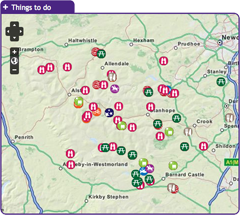
with the interactive map
Weardale has a fascinating history which is brought to life by two award winning museums: Killhope, the North of England Lead Mining Museum; and the Weardale Museum and High House Chapel. Hamsterley Forest is also on the doorstep, with 2,000 hectares of woodland's offering numerous mountain biking, walking and horse riding trails to suit all abilities. If you would rather sit back and enjoy the scenery then take a trip on the Weardale Railway which runs between Stanhope and Bishop Auckland. To discover what else Weardale has to offer click on the map and start exploring!

Here, for 70 years and more, hundreds of men toiled by hand with simple tools to dig the Great Limestone out of the Weardale fells, just a short distance from the centre of Stanhope. They left behind a huge, mile-long hole in the ground which today, over 60 years since they downed tools, nature is slowly reclaiming. This 2-mile circular route follows the paths the quarrymen would have once taken to work. It rewards a bit of a climb at the start with fantastic views over Stanhope and a fascinating insight into Weardale's industrial past.
Location:
Starting from the Durham Dales Centre car park in Stanhope (NY996392 / DL13 2FJ).
Distance:
3 km
Area:
Access:
Car parking, Cycle parking, Public transport
Accessible toilets, Cafe, Playground, Pub, Shop, Toilets
Recreation opportunity:
Nature watching, Picnicking, Walking
Interests:
Geology, Industrial heritage, Moorlands, Panoramic views, Wildlife
External link:
Walking in the North Pennines

This 23km out and back route takes you from Bradley Burn in Weardale to Hamsterley Forest and back again. Note that this electric bike route was originally devised in 2015. It is still valid but some of the information (e.g. hire/charge points) may have changed.
Location:
This route starts and finishes at Bradley Burn Farm Shop and Cafe (NZ105363 / DL13 3PA).
Distance:
23 km
Area:
Access:
Car parking
Accessible toilets, Cafe, Playground, Shop, Toilets
Recreation opportunity:
Cycling
External link:
North Pennines Electric Bike Network

Designated as a Dark Sky Discovery Site, Burnhope Reservoir has been recognised for the quality of the night time skies. This is a great place for professional and amateur astronomers to stargaze in the North Pennines AONB. Burnhope Reservoir is one of the smaller reservoirs in the area. It's found in Upper Weardale just west of Ireshopeburn. This is a quiet spot and great for wildlife. Permissive paths around the reservoir edge pass though plantations and woods with fantastic views across moorlands.
Location:
Follow the A689 westwards up Weardale. Take the second left hand turn in Ireshopeburn. After a mile, turn right down a gated lane
Area:
Access:
Car parking, Disabled, Pushchair
Recreation opportunity:
Stargazing
Interests:
Reservoirs
External link:
Dark Sky Discovery Sites

The pastures and allotments in Upper Weardale form a distinctive fringe around the edge of the heather moorland. Typically tussocky with clumps of rushes, these grasslands are an important nesting habitat for wading birds and large numbers can be seen and heard during the breeding season. The adjacent moorland is home to red grouse and golden plover and may sometimes be graced by the presence of a short-eared owl.
Location:
Starting from the car park at Cowshill (NY856406).
Distance:
2 km
Area:
Access:
Car parking, Public transport
Pub
Recreation opportunity:
Bird watching, Nature watching, Walking
Interests:
Hay meadows, Panoramic views, Wildlife
External link:
Birdwalks North Pennines

This walk is a natural extension to the Weardale Way. The trail weaves its way from the small village of Cowshill through scattered farms in the upper dale, typical of the miner-farmer landscape, before entering a conifer woodland surrounding the Killhope Lead Mining museum. Killhope Lead Mining Museum visitor centre is wheelchair accessible, has accessible toilets and a wheelchair accessible wildlife hide, a great spot to see Red Squirrels!
Location:
Starting from Cowshill or Killhope Lead Mining Museum.
Distance:
7 km
Area:
Access:
Car parking, Public transport
Accessible toilets, Cafe, Playground, Pub, Toilets
Recreation opportunity:
Walking

This guide provides information (and a map) on the many and varied and fascinating places in the North Pennines where signs of the area's industrial past can still be seen, including: Langley Smelt Mill Chimney, Nenthead, Killhope Museum, Allenheads, Rookhope Arch, Weardale Museum, Shildon Engine House, West Rigg Opencut and Eggleston Saddle House. An interesting map also shows the historical lead routes to Blaydon.
Location:
The leaflet details 14 locations across the North Pennines AONB.
Area:
Access:
Car parking
Recreation opportunity:
Walking
Interests:
Industrial heritage
External link:

Ellie keeps a small, varied flock of sheep, purely for their wool, at her smallholding high in Upper Weardale - hence the name 'Fleece with Altitude'. The smallholding is a former lead miner's smallholding. It is off-grid and powered entirely by renewable forms of energy - wind, sun and wood. All animals on the smallholding are loved and pampered and live out their natural lives in the haymeadow and pasture. Ellie has a workshop on the smallholding from where she makes felt and teaches workshops. In addition she has a beautiful attic studio in a 350 year old former manse house, The Hearth in Northumberland, from where she sells her work and also teaches workshops. Visitors to Ellie's workshop and studio are welcome.
Location:
Ellie is based at Slackhouse Farm in Upper Weradale. She also has a studio at the Hearth Arts Centre and Cafe in Horsley (NE15 0NT).
Area:
Access:
Car parking
Toilets
Recreation opportunity:
Arts and craft
External link:

These three walks (2, 5 and 7.5km) look at some of the old quarrying remains of Frosterley and their effects on the landscape here in Weardale. Each walk follows the same outward journey from Frosterley Station on the Weardale Railway.
Location:
Starting from the railway station in Frosterley, Weardale
Area:
Access:
Car parking, Public transport
Cafe, Pub, Shop, Toilets
Recreation opportunity:
Walking
Interests:
Geology

Historic Methodist Chapel - High House Chapel, Ireshopeburn, is the oldest purpose built Methodist chapel in the world to have been in continuous weekly use since it was built in 1760. Writing in his book England’s Thousand Best Churches Simon Jenkins said “This is the country where the fires of Methodism took hold, fanned by an absentee Anglicanism. There are many chapels in these parts, many are early and handsome and Ireshopeburn is the best.” His chapel and society in Weardale became one of John Wesley’s favourites and the story of Methodism is well told in the folk museum next door. The chapel is open to the public during museum hours 2-5pm, Wed-Sunday, May 1st - October 31st and every afternoon in August. Also Easter and bank holidays. Services are held every Sunday at 10.45am
Location:
Ireshopeburn, Co. Durham, DL131HD.
Area:
Access:
Car parking, Cycle parking, Disabled, Public transport, Pushchair
Accessible toilets, Toilets
Recreation opportunity:
Culture
Interests:
Built heritage
External link:

Passing through grassland and up onto heather moorland, this walk provides splendid views across the open uplands and down to the Bollihope Burn. It is a fine area to watch wading birds during the breeding season when the air is filled with their songs and displays. Redstart, great spotted woodpecker, tits and warblers can also be seen or heard in the riverside woodland.
Location:
Starting on short turf at roadside beside the Bollihope Burn (NZ005349).
Distance:
3 km
Area:
Access:
Car parking
Recreation opportunity:
Bird watching, Nature watching, Walking
Interests:
Built heritage, Moorlands, Panoramic views, Reservoirs, Rivers, Wildlife
External link:
Birdwalks North Pennines

Take a 2 hour walk in Weardale, a landscape that has been farmed and mined for centuries. This five kilometre walk close to Ireshopeburn crosses some beautiful meadows, with superb views of the surrounding moorland and villages in the dale below. The best time to go is between April and August to catch the wildflowers in full bloom. It is still a worthwhile walk outside of these times due to presence of late blooming flowers can be seen in mid Autumn and wading birds in the Spring.
Location:
The walk starts in the village of Ireshopeburn in Weardale (NY866386).
Distance:
5 km
Area:
Access:
Car parking, Public transport
Recreation opportunity:
Bird watching, Nature watching, Walking
Interests:
Built heritage, Hay meadows, Moorlands, Panoramic views, Rivers, Wildlife, Woods
External link:
Hay meadows

A visit to Killhope, the award winning North of England Lead Mining Museum, is a unique and unforgettable experience. Killhope is a fully restored nineteenth century Victorian lead mine, where you can experience for yourself the life and work of the lead mining families of the Pennine dales. Our enthusiastic and knowledgeable staff are here to help you get the most from your visit; they are what make Killhope a multi award wining venue. Killhope is famous for its huge working waterwheel, but there is much more to Killhope. You can experience the mineshop where miners lived. You can work as a 'washerboy' looking for minerals and galena (which is the lead ore). You can see the working machinery (which Fred Dibnah admired so much) in the 'jigger house'. But above all, Killhope's award-winning mine tour is unique. From the moment you put on your hard hats, cap-lamps and wellingtons, your visit becomes an unforgettable adventure! Killhope holds the largest collection of Spar Boxes which sits alongside Magnificent Minerals and the Pennine Jewels. Two permanent commissions, Letters of Lead and Language of Lead, part of museumaker, a prestigious national project. We also have an array of art works and installations which adorn our visitor centre and site. You can stroll round Killhope's woodland paths (maybe with a nature backpack). You will see some wildlife and red squirrels. Take a break in Killhope Cafe and sample our wonderful home made soups, pasties and cakes. Our gift shop stocks a wide range of books, maps, keepsakes and souvenirs. Killhope - a great day out in the country for all the family!
Location:
Near Cowshill, Upper Weardale, Co. Durham, DL13 1AR.
Area:
Access:
Car parking, Cycle parking, Disabled, Pushchair
Accessible toilets, Cafe, Playground, Shop, Toilets
Recreation opportunity:
Arts and craft, Culture, Information points, Nature watching, Picnicking
Interests:
Built heritage, Geology, Industrial heritage, Wildlife, Woods
External link:

Low Barns is a valuable wetland reserve and one of County Durham’s most important wildlife sites, located adjacent to the River Wear. The reserve has become important for wildlife due to the wide range of habitats including wet woodland, grassland, open water and river side, which are home to many different types of birds, mammals, plants and insects. However, Low Barns has not always been a haven for local wildlife. Originally farmland, the site underwent sand and gravel extraction until 1964 when the area was given to Durham Wildlife Trust and restored as a nature reserve. In 2003 a redundant sewage treatment works on the site was replaced with a new reedbed habitat and a boardwalk which enabled public access with minimal disturbance to wildlife. The site’s flat terrain and large accessible bird hides make it an ideal place to visit for everyone. The Visitor Centre has a coffee shop that sells light refreshments, books, gifts, locally made bird boxes and a full range of bird food and feeders from the award winning Vine House Farms. The centre and bird hides provide a wealth of information on how Low Barns was created and the wildlife it supports. Screens in the centre show images from the bird feeding station and bird boxes around the site, and there is a display of wildlife photography provided by the Low Barns Photography Group.
Location:
Durham Wildlife Trust, Low Barns Nature Reserve, Witton-le-Wear, Bishop Auckland, County Durham DL14 0AG.
Area:
Access:
Car parking, Cycle parking, Disabled, Pushchair
Accessible toilets, Cafe, Shop, Toilets
Recreation opportunity:
Bird watching, Information points, Nature watching
Interests:
Hay meadows, Wildlife, Woods
External link:

This easy circular walk starts and finishes in Wolsingham, Weardale. If you’re a fan of stiles, this is the walk for you. This relatively simple, four mile walk takes you out to the farm at Newlands Hall and brings you back across farmland where evidence of the medieval strip farming system can still be seen. The route is known locally as the ‘Miles of Stiles.’ We’ve counted thirteen stiles and ladder stiles along the route with ten of them appearing in quick succession along the ‘Miles of Stiles.’
Location:
Starts and finishes in Wolsingham from the Demesne Mill Picnic Area (nearest postcode DL13 3DB).
Distance:
7 km
Area:
Access:
Car parking, Cycle parking, Public transport
Cafe, Playground, Pub, Shop, Toilets
Recreation opportunity:
Walking
External link:
Wolsingham Wayfarers

Parkhead station was one of the first five Dark Sky Discovery Sites in the North Pennines AONB to be designated. It has been recognised as a great place for amateur and professional astronomers to stargaze. With wide open views of the horizon and a location away from towns and cities, the skies are incredibly dark. Under a clear night sky, the major constellations can be seen and the Milky Way is also visible to the naked eye. The café is a converted railway station with a rich industrial history - www.parkheadstation.co.uk. Now it is a feature along a traffic free section of the Waskerley Way, just off the C2C Cycle Route which means astronomers are not going to be disturbed or interrupted by the glare of headlights from passing vehicles. During organised stargazing events, the café offers warmth and sustenance and a place to discuss recent astronomical news and sightings.
Location:
Located on the B6278, 3 miles north of Stanhope, 10 miles from Consett.
Area:
Access:
Car parking, Disabled, Pushchair
Accessible toilets, Cafe, Toilets
Recreation opportunity:
Stargazing
Interests:
Panoramic views
External link:
Dark Sky Discovery Sites

Fishing for brown trout, sea trout and salmon between Eastgate and Stanhope Guaging Station is available with a day ticket from the Weardale Fly Fishers Club. Permits from Stanhope Newsagents, Stanhope, Weardale.
Don't forget your Environment Agency rod licence.
Location:
Stanhope
Area:
Access:
Car parking
Recreation opportunity:
Fishing
Interests:
Rivers

The town of Rookhope and its surrounding environs are littered with the remains of its once prosperous mining industry such as the Rookhope arch and Bolts Law engine house. This austere landscape inspired poet W H Auden to write some of his earliest work. Nowadays Rookhope supports fascinating upland flora and fauna and a small tourist industry as a stop off on the C2C cycle route. You can discover these and more interesting facets of Rookhope in this series of circular walks.
Location:
Starting from Rookhope Village Hall.
Distance:
8 km
Area:
Access:
Car parking
Accessible toilets, Pub, Toilets
Recreation opportunity:
Walking
Interests:
Industrial heritage, Moorlands, Panoramic views, Wildlife

This route reveals much about the area’s geology, which is strongly linked to this little valley’s industrial past. You will see where lead and iron ores were mined and processed and how the ores were transported out of the valley. Slitt Wood and West Rigg Opencut are legally protected as Sites of Special Scientific Interest (SSSI). Slitt Wood is designated for its variety of habitats including woodland, lime-rich grassland, fen, open water and the revegetated workings of Slitt and Middlehope Mines. Many different types of plants and birds can be spotted at different times of year, including metal tolerant plants known as metallophytes. West Rigg is designated for its geological importance. It provides an excellent illustration of the formation of iron ore and the opencast ironstone workings which expose the structure of a lead vein. Many of the industrial remains also have legal protection as scheduled monuments of national archaeological importance.
Location:
Starting from the lay-by in Westgate.
Distance:
5 km
Area:
Access:
Car parking, Public transport
Pub
Recreation opportunity:
Bird watching, Nature watching, Walking
Interests:
Geology, Industrial heritage, Rivers, Wildlife, Woods

This walk traces the history of three neighbouring villages Daddry Shield, St Johns Chapel and Ireshopeburn. From their origins as farming settlements, through to the expansion of the mining industry in the mid 19th Century and the associated rises in population and conversion of locals to Methodism, this region has witnessed dramatic changes which have left their mark on the landscape of the upper dale. This walk tells the story of these developments while pointing out historic buildings and events associated with them.The walk was devised and described by volunteers of The Weardale Museum (www.weardalemuseum.co.uk), Ireshopeburn, where much more information can be found.
Location:
Starting from the Weardale Inn or St John Chapel Cattle Market car park.
Distance:
11 km
Area:
Access:
Car parking, Cycle parking, Public transport
Pub, Shop, Toilets
Recreation opportunity:
Walking
Interests:
Built heritage, Geology, Industrial heritage, Moorlands, Panoramic views, Rivers, Woods
External link:

This 32km road cycling routes starts in Stanhope and explores Upper Weardale and the Rookhope Valley. Note that this electric bike route was originally devised in 2015. It is still valid but some of the information (e.g. hire/charge points) may have changed.
Location:
This route starts and finishes in Stanhope, Weardale (NY998390 / DL13 2UE).
Distance:
32 km
Area:
Access:
Car parking
Accessible toilets, Cafe, Playground, Pub, Shop, Toilets
Recreation opportunity:
Cycling
Interests:
Panoramic views
External link:
North Pennines Electric Bike Network

This 39km road route starts and finishes from the Durham Dales Centre in Stanhope. The publication describes four routes of various lengths. The four routes are designed as a series of loops of varying length radiating out from Stanhope. Each route provides a glimpse into the past, with remnants of the lead mining industry dotted around Weardale. Please note that the original leaflet was produced and printed in 2005. The routes are still valid but some of the information (e.g. refreshments and facilities) might be out of date.
Location:
Starting and finishing from the Durham Dales Centre in Stanhope, Weardale (NY996392 / DL13 2FJ).
Distance:
39 km
Area:
Access:
Car parking, Cycle parking, Public transport
Accessible toilets, Cafe, Playground, Pub, Shop, Toilets
Recreation opportunity:
Cycling
Interests:
Panoramic views
External link:
Cycling in the North Pennines

This 30km road route starts and finishes from the Durham Dales Centre in Stanhope. The publication describes four routes of various lengths. The four routes are designed as a series of loops of varying length radiating out from Stanhope. Each route provides a glimpse into the past, with remnants of the lead mining industry dotted around Weardale. Please note that the original leaflet was produced and printed in 2005. The routes are still valid but some of the information (e.g. refreshments and facilities) might be out of date.
Location:
Starting and finishing in the Durham Dales Centre in Stanhope, Weardale (NY996392 / DL13 2FJ).
Distance:
30 km
Area:
Access:
Car parking, Cycle parking, Public transport
Accessible toilets, Cafe, Playground, Pub, Shop, Toilets
Recreation opportunity:
Cycling
Interests:
Panoramic views
External link:
Cycling in the North Pennines

This 25km road route starts and finishes from the Durham Dales Centre in Stanhope. The publication describes four routes of various lengths. The four routes are designed as a series of loops of varying length radiating out from Stanhope. Each route provides a glimpse into the past, with remnants of the lead mining industry dotted around Weardale. Please note that the original leaflet was produced and printed in 2005. The routes are still valid but some of the information (e.g. refreshments and facilities) might be out of date.
Location:
Starting and finishing in the Durham Dales Centre in Stanhope (NY996392 / DL13 2FJ).
Distance:
25 km
Area:
Access:
Car parking, Cycle parking, Public transport
Accessible toilets, Cafe, Playground, Pub, Shop, Toilets
Recreation opportunity:
Cycling
Interests:
Panoramic views
External link:
Cycling in the North Pennines

This 16km road route starts and finishes from the Durham Dales Centre in Stanhope. The publication describes four routes of various lengths. The four routes are designed as a series of loops of varying length radiating out from Stanhope. Each route provides a glimpse into the past, with remnants of the lead mining industry dotted around Weardale. Please note that the original leaflet was produced and printed in 2005. The routes are still valid but some of the information (e.g. refreshments and facilities) might be out of date.
Location:
Starting and finishing in the Durham Dales Centre in Stanhope, Weardale (NY996392 / DL13 2FJ).
Distance:
16 km
Area:
Access:
Car parking, Cycle parking, Public transport
Accessible toilets, Cafe, Playground, Pub, Shop, Toilets
Recreation opportunity:
Cycling
Interests:
Panoramic views
External link:
Cycling in the North Pennines

Lead mining was the dominant industry in Stanhope for over two hundred years. It created the employment and wealth to form a well-to-do small market town with a thriving parish church with ‘the richest living in England’ due to the tithes (rent) paid to the Rectors of Stanhope in return for the rights to explore and dig for lead. Stanhope owes most of its former wealth to the lead mining era with quarrying and coal mining making significant contributions to the employment opportunities. These three short walks around Stanhope will explore this mining legacy
Location:
Starting from the Durham Dales Centre car park in Stanhope.
Area:
Access:
Car parking, Public transport
Accessible toilets, Cafe, Playground, Pub, Shop, Toilets
Recreation opportunity:
Walking

This walking route is a linear trail that takes you along the course of the River Wear. You can return to the starting point using the bus. The route is an excellent way to experience the beauty of the dale that nestles below the open moors of the North Pennines Area of Outstanding Natural Beauty (AONB) and UNESCO Global Geopark, while indulging in some great local food. Along the way you will pass through the pastoral lamb and cattle producing farmland of the dale. Remnants of the quarrying and mining heritage of the area are all around you as you follow the river upstream. This route starts at Bradley Burn Farm Shop and Café, near Wolsingham and follows rights of way alongside the Weardale Railway and the River Wear. There are a number of great places along the way to stop for a bite to eat and a brew. Stanhope, Frosterley and Wolsingham are also good places to join the route and it can be done in shorter sections.
Location:
Starting from Bradley Burn Farm Shop.
Distance:
15 km
Area:
Access:
Car parking, Public transport
Accessible toilets, Cafe, Playground, Pub, Shop, Toilets
Recreation opportunity:
Food trails, Walking

The Durham Dales Centre is a visitor centre in Weardale with a tearoom specialising in home baking and with a well stocked information centre and gift shop. Other shops are set within a courtyard offering a wide range of cards, chocolate, gifts and crafts. On site facilities include the Durham Dales garden, with interpretation panels throughout the grounds. Coaches welcome.
Location:
Castle Gardens, Stanhope, Bishop Auckland, Co. Durham, DL13 2FJ.
Area:
Access:
Car parking, Cycle parking, Public transport, Pushchair
Accessible toilets, Cafe, Disabled toilets, Playground, Pub, Shop, Toilets
Recreation opportunity:
Arts and craft, Information points
External link:

The Harehope Quarry Project promotes a more sustainable way of living and is a Gold Award holder in the Green Tourism Business Scheme (GTBS). Within a former limestone quarry, the project has developed a fish farm and smallholding, a nature reserve with public access and an eco-classroom built entirely by volunteers. The project has a community events programme and delivers environmental education, field studies and education for sustainable development. The eco-classroom can also be booked for meetings, green birthday parties and other events. In addition there walks ranging from 1km to 4km using permissive paths and Rights of Way around the quarry. Story walk leaflets are available as well as information about the Harehope Quarry Project. Note on site parking is limited, however the quarry is a short walk from Frosterley where additional parking is available.
Location:
Frosterley, Bishop Auckland, Co. Durham, DL13 2SG.
Area:
Access:
Car parking, Cycle parking, Disabled, Public transport
Recreation opportunity:
Bushcraft and adventure, Nature watching, Outdoor education
Interests:
Geology, Industrial heritage, Wildlife
External link:

This 24km cycle route starts at Killhope Museum and takes you into Durham, Cumbria and Northumberland. Note that this electric bike route was originally devised in 2015. It is still valid but some of the information (e.g. hire/charge points) may have changed.
Location:
The route starts at Killhope Lead Mining Museum in Upper Weardale (NY825431 / DL13 1AR).
Distance:
24 km
Area:
Access:
Car parking, Cycle parking
Accessible toilets, Cafe, Playground, Shop, Toilets
Recreation opportunity:
Cycling
Interests:
Panoramic views
External link:
North Pennines Electric Bike Network

The walk starts from the track through Barracks Farm (probably the oldest building in Tow Law), following tracks, over fields and pasture and crossing stiles and gates along the way. The route descends gradually from 1000ft above sea level at Tow Law to 400ft at Low Harperley where it links up with the Weardale Way.
Location:
Starting from Barracks Farm in Tow Law.
Distance:
5 km
Area:
Access:
Public transport
Accessible toilets, Cafe, Pub, Shop, Toilets
Recreation opportunity:
Walking
Interests:
Built heritage, Wildlife

Tunstall reservoir is located within the North Pennines Area of Outstanding Natural Beauty and has an excellent walk along its eastern edge through a semi-natural ancient broadleaved woodland, known as Blackstone Wood. The Tunstall reservoir walk is not only a very scenic and relaxing walk but once in the woodland offers the chance to view a variety of wildlife, including several species of waterfowl and butterflies.
Location:
At the picnic site on Leazes Lane on the western side of the reservoir.
Distance:
3 km
Area:
Access:
Car parking
Toilets
Recreation opportunity:
Bird watching, Nature watching, Picnicking, Walking
Interests:
Reservoirs, Wildlife, Woods
External link:

A beautiful walk through the Tunstall Valley following in the footsteps of the Prince Bishops. The walk from Wolsingham to the Tunstall Reservoir has long been a favourite of locals and visitors alike. The walk offers plenty of variety and interest, plus a few short cuts for those that might prefer them. The ascent up to the ruin of Park Wall Farm is handsomely rewarded with a stunning view back towards Wolsingham and the viewpoint after the steep climb up Blackstone Bank will take your breath away. The reservoir offers a wonderful setting for a break to enjoy refreshments at the half way point.
Location:
The walk starts from the Demesne Mill Picnic Site (nearest postcode DL13 3DB) off the B6296 (Wolsingham to Tow Law Road).
Distance:
12 km
Area:
Access:
Car parking, Cycle parking, Public transport
Cafe, Playground, Pub, Shop, Toilets
Recreation opportunity:
Walking
External link:
Wolsingham Wayfarers

There are many interesting walks leading from the historic town of Wolsingham. These lead to quarries, farms, shafts, mills, and mark out an intricate pattern of journeys to work made over hundreds of years by generations of the people working in Weardale.
Location:
Starting from Wolsingham Railway Station.
Area:
Access:
Car parking, Public transport
Accessible toilets, Cafe, Pub, Shop, Toilets
Recreation opportunity:
Walking
Interests:
Built heritage, Industrial heritage, Panoramic views, Rivers

The Waskerley Way is a 16km route running from Parkhead Station above Stanhope in Weardale to Lydgetts Junction, Consett (where is joins with the Lanchester Valley Railway Path, the Derwent Walk Railway Path and the Consett to Sunderland cycle route). It's a beautiful route passing through a varied landscape; from urban fringe through to upland sheep farms and then on to glorious heather moorland. It's suitable for walkers, cyclists, horse riders and wheelchair users. Hownsgill Viaduct towers 46m above the tree canopy of Knitsley and High House Woods near Lydgetts Junction. This is one of the most impressive railway structures in North East England. From further up the Railway Path there are stunning views across Smiddy Shaw, Waskerley and Hisehope Reservoirs.
Location:
The routes runs from Park Head Station, above Stanhope, Weardale (NZ002431 / DL13 2ES) to Lydgetts Junction, Consett (NZ098492 / DH8 9AA).
Distance:
16 km
Area:
Access:
Car parking, Disabled, Pushchair
Cafe
Recreation opportunity:
Cycling, Horse riding, Picnicking, Running, Walking
Interests:
Panoramic views
External link:

The Centre – Functioning around a 80-bed, fully catered residential centre, Weardale Adventure Centre offers a multitude of high-quality, outdoor and adventure education, activities. Founded in 1978, the centre has been an integral part of the local community and as such utilises local venues alongside on-site activities to provide groups with a thoroughly enjoyable experience. As such, the centre regularly welcomes back groups that have been utilising the facilities, in some cases for over 20 years!
The centre can cater for just about any group, with any needs, however we tend to spend much of our time delivering high quality educational programmes to school groups between the ages of 8 and 18. Whilst these groups may be the staple of centre life, we have a wealth of experience delivering activities to just about any range of clients. We offer a multitude of activities and packages as well as being in the fortunate position of being able to offer bespoke and custom programmes to prospective clients, these can take place on-site, locally within the Weardale area, or further afield.
Location:
Ireshopeburn, Co. Durham, DL131HB.
Area:
Access:
Car parking, Cycle parking, Public transport
Playground, Toilets
Recreation opportunity:
Bushcraft and adventure, Canoeing and kayaking, Climbing, Outdoor education, Walking
Interests:
Geology, Industrial heritage, Rivers
External link:

“Outstanding Volunteer Run Museum” – but don’t take our word for it, this is the verdict of Renaissance North East and the Arts Council for England who have also awarded the museum full accreditation. This small folk museum is packed with fascinating stories from the past including a hands on lead-miner’s kitchen and The Weardale Tapestry, a beautiful 16 foot free-style embroidery depicting Weardale’s history. The Museum houses a truly amazing genealogy resource which can print out family trees for those with Weardale ancestry. Visit also the historic and beautiful High House Chapel, the oldest Methodist Chapel to have held continuous weekly services since it was built in 1760, and one of John Wesley’s favourite chapels. Open 2-5pm, Wed-Sunday, May 1st - October 31st and every afternoon in August. Also Easter and bank holidays.
Location:
Ireshopeburn, Co. Durham, DL13 1HD.
Area:
Access:
Car parking, Cycle parking, Disabled, Public transport, Pushchair
Accessible toilets, Shop, Toilets
Recreation opportunity:
Culture
Interests:
Built heritage, Geology
External link:

The Weardale Railway runs from Stanhope to Bishop Auckland and stations in between. The railway runs a heritage timetable and has a number of special events through the year, including steam services. There is a ticket office, café and shop at Stanhope Station.
Location:
Stanhope
Area:
Access:
Car parking, Disabled, Public transport, Pushchair
Accessible toilets, Cafe, Disabled toilets, Shop, Toilets
Recreation opportunity:
Culture
Interests:
Built heritage, Industrial heritage
External link:

With 2 Poma ski lifts serving 6 pisted runs and a large club hut, the Weardale Ski Club on Swinhope Fell above Westgate in Weardale is a great North Pennines venue for skiing and snowboarding. Day membership is available on week days.
Location:
Westgate
Area:
Access:
Car parking
Toilets
Recreation opportunity:
Winter sports
External link:

This walk starts in high North Pennine village of Cowshill and travels down Weardale to Westgate following the course of the River Wear. Along the way you will pass the pretty villages of Wearhead, Ireshopeburn, St Johns Chapel and Daddry Shield. Some of the highlights of the walk include Coronation Bridge, built to commemorate the crowning of Queen Victoria, and the upland hay meadows at East Blackdene.
Location:
Starting from the car park at Cowshill.
Distance:
8 km
Area:
Access:
Car parking, Public transport
Pub, Shop, Toilets
Recreation opportunity:
Walking
Interests:
Rivers
External link:
http://www.weardaleway.com/

This is a short walk which is sandwiched between the Weardale Railway line and the River Wear. If you are not pressed for time the walk could be extended by doing a loop of Ashes Quarry which has commanding views of Stanhope. Also of interest is the fossilised remains of an ancient tree which can be found in front of St Thomas's Church in Stanhope. The tree was brought to Stanhope in 1962 from a quarry in Edmundbyers and it is believed to be 320 million years old.
Location:
Starting at crossroads in Eastgate.
Distance:
4 km
Area:
Access:
Car parking, Public transport
Accessible toilets, Cafe, Playground, Pub, Shop, Toilets
Recreation opportunity:
Walking
Interests:
Rivers
External link:
http://www.weardaleway.com/

Beginning in Stanhope the walk takes you across several burns and through a number of disused limestone quarries to reach the small hamlet of White Kirkley which sits above Frosterley. Limestone has been quarried from the valley sides around Frosterley since the 12th century but it was in the 1800s that the village became an important centre for limestone quarrying. Limestone has many uses - as a road stone, agricultural lime, for flux in the iron and steel industry and for cement. A special type of limestone is found in Frosterley; this fossil-rich stone, known as Frosterley marble, can be polished to a high shine. The most famous use of Frosterley marble is in Durham Cathedral. Here, the ceiling of the Chapel of the Nine Altars is supported by slender columns of this unusual stone.
Location:
Starting from the lay-by, near Unthank Farm, in Stanhope.
Distance:
7 km
Area:
Access:
Car parking, Public transport
Accessible toilets, Cafe, Playground, Pub, Shop, Toilets
Recreation opportunity:
Walking
Interests:
Geology, Industrial heritage, Moorlands, Panoramic views, Rivers
External link:
http://www.weardaleway.com/

The second section of the Weardale Way involves a fairly steep climb up Heights Pasture, above Westgate, before dropping down into the old mining village of Rookhope. The famed poet WH Auden once visited Rookhope as a child and he drew inspiration for many of his works from the North Pennine landscape. From Rookhope the trail heads back down into the Wear Valley following the Rookhope Burn all the way to small village of Eastgate. Eastgate marks the boundary of the former woodland where the Prince Bishops of Durham hunted deer.
Location:
Starting from the car park at Haswicks in Westgate.
Distance:
13 km
Area:
Access:
Car parking, Public transport
Pub, Toilets
Recreation opportunity:
Walking
Interests:
Moorlands, Panoramic views, Rivers
External link:
http://www.weardaleway.com/

From White Kirkley the walk takes you above Harehope Quarry, which is now run as a workers co-operative offering environmental education and rural skills training. The path then climbs up over Harvey Hill to the edge of the grouse moors where you may see Red Grouse among the heather. The trail then drops down towards Wolsingham passing through a patch of ancient woodland at Ashes Beck. Note there are no facilities or parking spaces at White Kirkley, these are available in either Frosterley or Wolsingham.
Location:
Starting from White Kirkley.
Area:
Access:
Car parking, Public transport
Cafe, Pub, Shop, Toilets
Recreation opportunity:
Walking
Interests:
Industrial heritage, Moorlands, Panoramic views, Rivers, Wildlife, Woods
External link:
http://www.weardaleway.com/

Wearhead sits at the confluence of Burnhope Burn and Killhope Burn, which combine to create the River Wear. The first people here were probably farmers who leased their land from the Prince Bishops of Durham and as the century's past more families moved into the area to mine the rich seams of lead ore, creating the modern village. This walk takes you around this pretty part of Weardale and it can be extended, if you wish, by doing a loop around Burnhope Reservoir.
Location:
Starting from Wearhead Bridge.
Distance:
1 km
Area:
Access:
Car parking, Public transport
Playground, Pub, Shop, Toilets
Recreation opportunity:
Walking
Interests:
Geology, Reservoirs, Rivers, Wildlife

Activities centred on discovery and exploration of the natural world. We offer bushcraft and survival skills (30 years experience and qualified to teach bushcrafts to groups through the Institute for Outdoor Learning), wild food foraging (as seen on TV with Robson Green), bird watching tours, wildlife & nature exploration activities including animal tracking, pond dipping and minibeast hunts for families, and greenwood crafts including pole lathe and willow basket weaving. Activities can be booked for a half or full day for two or more people either adult or family groups. Weekend and full week activities are also available.
Location:
Harehope Quarry Project - near Frosterley in Weardale. Activities are available at other sites in Weardale and Teesdale - see website for details
Area:
Access:
Car parking, Cycle parking
Recreation opportunity:
Arts and craft, Bird watching, Bushcraft and adventure, Nature watching, Walking
Interests:
Hay meadows, Moorlands, Reservoirs, Rivers, Wildlife, Woods
External link:
Wild North Discovery

There truly is something for everyone on this circular walk, perfectly summing up why Wolsingham is such a wonderful place to roam. The early climb uphill towards High Wisely Farm is quickly rewarded with a beautifulview back towards the village. The traverse to Crowsfield paints a picture of the disappearing past of the area, followed by a breathtaking view at the trig point on Knitsley Fell. The journey home takes us through the woodlandof the Black Banks Plantation and along thebans of the River Wear.
Location:
Circular walk from Wolsingham. Starts from Demesne Mill Picnic Area (nearest postcode DL13 3DB).
Distance:
9 km
Area:
Access:
Car parking, Cycle parking, Public transport
Cafe, Playground, Pub, Shop, Toilets
Recreation opportunity:
Walking
External link:
Wolsingham Wayfarers

This 1.5-mile circular walk has been devised by the Wolsingham Wayfarers, to provide a route around Wolsingham that can be enjoyed by all. The walk is entirely on surfaced footpath, upgraded to be accessible for pushchairs and wheelchairs.
Location:
Starts from the recreation ground (off the A689 Stanhope road)
Distance:
2 km
Area:
Access:
Car parking, Disabled, Public transport, Pushchair
Cafe, Playground, Pub, Shop, Toilets
Recreation opportunity:
Walking
External link:
Wolsingham Wayfarers

A circular walk between the Wolsingham and Thornley War Memorials. The Wolsingham Wayfarers first traversed the route between the Wolsingham and Thornley war memorials in May 1995 on the 50th anniversary of World War II. Wolsingham is also home to the first memorial to the First World War. In March 1918 Wolsingham Grammar School planted eighteen oak trees lining the playing field, one for each student killed in the First World War. The route showcases the best of everything Weardale has to offer. Enchanting riverside woodland, large expanses of farmland, picturesque cottages and stunning views across the valley.
Location:
The walk starts from the war memorial in Wolsingham Market Place. Parking is available in the Demesne Mill Picnic Area (nearest postcode DL13 3DB)
Distance:
11 km
Area:
Access:
Car parking, Cycle parking, Public transport
Cafe, Playground, Pub, Shop, Toilets
Recreation opportunity:
Walking
External link:
Wolsingham Wayfarers