Hay meadows

Over 40% of the UK's upland hay meadows are found in the North Pennines AONB! his is now a rare habitat throughout Europe and recognised as of European Importance.

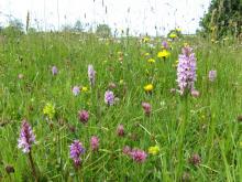
The best upland hay meadows are very species-rich and differ from lowland hay meadows in having several characteristic northern species such as wood cranes-bill, globeflower, marsh hawks-beard and melancholy thistle. A special group of upland hay meadow plants called Lady's mantles are also found here, six of which are rare and three of which are found nowhere else in the UK.

Upland hay meadows are very important to breeding birds like yellow wagtail, redshank and lapwing and a feeding area for black grouse. The best upland hay meadows are now scattered across the dales in the AONB. The best examples are found in the upper parts of Teesdale, Weardale, and the South Tyne Valley, as well as parts of Lunedale, Baldersdale and East Allendale.


Allendale: Hay Time Walk 1

Great burnet © NPAP/Rebecca Barrett
Take a 2 hour walk around South Wooley Farm in Allendale and get close to one of the world’s rarest and most endangered habitats, Upland Hay Meadows. There are only about 11 square kilometres of upland hay meadows left in the whole of the UK. Just under half of these are here in the North Pennines Area of Oiutstanding Natural Beauty (AONB) and UNESCO Global Geopark. This walk takes you along country lanes and public footpaths through, or alongside, several hay meadows on the farm. Please keep to the paths, leave gates as you find them and keep dogs under close control, preferably on a short lead.
Location:
Starting from the car park in Allendale Town (NY837558).
Distance:
5 km
Terrain:
Boggy ground, Off road sections, On road sections
Recreation opportunities:

Baldersdale: Hay Time Walk 3

Species rich meadow © NPAP/Rebecca Barrett
This short walk in Baldersdale visits some of the most spectacular hay meadows in the North Pennines. It also passes close to Hury Reservoir, a popular site for over-wintering wildfowl such as mallard, teal, tufted duck and goosander. The best time to see the flowers is between April and August. Meadows are great for water voles as they favour stream sides with a wide range of flowering plants. The North Pennines is one of their last strongholds
Location:
Starting from the small car park at Fiddler House (NY971189).
Distance:
6 km
Terrain:
Boggy ground, Off road sections, On road sections
Area:
Access:
Facilities nearby
Recreation opportunities:

Blackton Reservoir: North Pennine Birdwalks - Walk 14
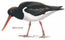
Oystercatcher © NPAP
The meadows, pastures and allotments of Baldersdale support large numbers of breeding waders which make an impressive sight during the spring and summer months. Like all areas of open water in the North Pennines, Blackton Reservoir also provides a refuge for wildfowl during the harsh winter months. This area is therefore worth a visit at any time of year.
Location:
Starting from the small car park at the road end (NY935176).
Distance:
6 km
Terrain:
Boggy ground, Off road sections, On road sections
Area:
Access:
Recreation opportunities:

Bowlees Visitor Centre

Bowlees Visitor Centre    © NPAP
Bowlees Visitor Centre, run by the North Pennines AONB Partnership, is a fantastic base for exploring Upper Teesdale, with footpath links to Low Force, High Force, Newbiggin and the Pennine Way. The Centre provides information and displays on the geology and landscape, wildlife and people of Upper Teesdale and the wider North Pennines. You'll find a delicious range of food and drinks and our shop stocks nature inspired gifts and books. You'll find a range of special events are running at the Centre throughout the year. You can also hire the venue for family get-togethers, parties and meetings. We have a range of outdoor cooking facilities which can be pre-booked. The Centre is dog-friendly and you'll find free Wi-Fi access, an iGlass (24-hour information touch screen) and an electric car-charging point. Follow the Richard Watson Trail from the Centre - a 2¾-mile circular route exploring the life and times of Richard Watson, Victorian lead miner and poet. The most popular walk is probably the High Force-Low Force Round. The Centre is also an official Dark Sky Discovery Site.
Location:
Newbiggin, Bowlees, Middleton-in-Teesdale, Co. Durham, DL12 0XE (grid ref - NY906281). 01833 622145.
Area:
Facilities nearby

Cowshill (Weardale): North Pennine Birdwalks - Walk 8
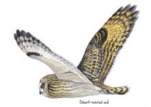
Short-eared owl © NPAP
The pastures and allotments in Upper Weardale form a distinctive fringe around the edge of the heather moorland. Typically tussocky with clumps of rushes, these grasslands are an important nesting habitat for wading birds and large numbers can be seen and heard during the breeding season. The adjacent moorland is home to red grouse and golden plover and may sometimes be graced by the presence of a short-eared owl.
Location:
Starting from the car park at Cowshill (NY856406).
Distance:
2 km
Terrain:
Boggy ground, Off road sections, On road sections
Area:
Facilities nearby
Recreation opportunities:

East Allen Valley Wildflower Walk

Allenheads © © NPAP & Elizabeth Pickett
A lovely 5.5 mile (9km) walk from Allenheads exploring the wonderful wildlife of wildflowers in the East Allen Valley. This circular walk will introduce you to some of the special plants of the North Pennines and the creatures that depend on them. Along the way you'll discover plants that are adapted to the harsh conditions of the area and get a bee's-eye view of finding food.
Location:
Allenheads parking area
Distance:
9 km
Terrain:
Boggy ground, Off road sections, On road sections
Facilities nearby
Recreation opportunities:

Eden Outdoor Adventures

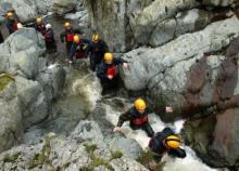
Gyhll scrambling © Eden Outdoor Adventures
Eden Outdoor Adventures is a small, friendly, family company run by Ian and Melanie. We provide tailor made courses for individuals, families and groups. We believe that by tailor making your course we can offer quality instruction and guiding with the personal touch, allowing people to get the most out of their time with us. We work hard to understand your needs and to design days to offer a challenge and to make your dreams come true. To help do this, Eden Outdoor Adventures draw upon a great deal of knowledge and experience from working in the outdoors and the areas in which we operate. They also hold National Qualifications in the activities we offer to ensure you the highest standards. We offer half day to multiple day trips in the Lake District, Eden Valley, Northern Pennines, Scotland and Wales as well as further afield. From guided tours, low level family walks through wooded valleys, introductory climbing and canoeing to demanding mountain and river trips in wild places. Wherever your dreams take you, let Eden Outdoor Adventures help make them come true.
Location:
Ousby, Penrith, Cumbria.

Hannah's Meadow Nature Reserve

Hannah's Meadow © NPAP/Shane Harris
Hannah's Meadow Nature Reserve has some of the least improved and species rich upland hay meadows in upper Durham. The meadows were previously farmed by Hannah Hauxwell, who managed the meadows using traditional methods that avoided adding artificial fertilizers or reseeding. By doing so the species rich habitat hay meadow habitat that evolved over centuries was maintained. When Hannah retired in 1988 Durham Wildlife Trust purchased her farm and they now manage it as a nature reserve. An unmanned visitor centre at the site provides information about Hannah and her special meadows. Note facilities are located at Balderhead Reservoir car park.
Location:
From Barnard Castle follow the B6277 to Romaldkirk and then follow the Balderhead road via Hunderthwaite. The reserve is adjacent to the public road a 1.5 mile east of the Balderhead Reservoir car park. The Pennine Way footpath runs through the reserve. The grid reference refers to the Balderhead Reservoir car park.
Distance:
2 km
Terrain:
Off road sections, On road sections
Area:
Access:
Recreation opportunities:

Harwood Beck and Widdybank: North Pennine Birdwalks - Site 3
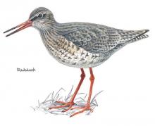
Redshank © NPAP
The meadows and pastures around Harwood Beck and Widdybank are some of the best places to see breeding waders and black grouse. If you sit quietly in your car you may be rewarded with the sight of a snipe shepherding its chicks through the vegetation or a precocious young lapwing chick pecking for food in the short turf.
Location:
Static viewing from a grassy verge on the road to Cow Green Reservoir.
Terrain:
On road sections
Area:
Facilities nearby
Recreation opportunities:

High Force and Bowlees Geotrail

High Force ©
This 8km circular walk, from Bowlees Visitor Centre or High Force car park, will introduce you to some of the special features of the landscape around High Force and Low Force waterfalls. You'll discover rocks with dramatic origins, ice age features, ancient settlements, lead mining heritage and wonderful wildlife.
Location:
Circular walk which can be started from Bowlees Visitor Centre (NY906282 / DL12 0XE) or High Force car park (NY885286 / DL12 0XH) in Upper Teesdale.
Distance:
8 km
Terrain:
Off road sections, Steep sections
Area:
Facilities nearby
Recreation opportunities:

Ireshopeburn (Weardale): Hay Time Walk 2
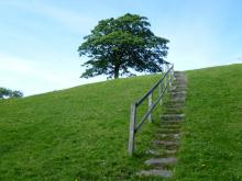
Path to the hay meadows in Ireshopeburn © NPAP/Gearoid Murphy
Take a 2 hour walk in Weardale, a landscape that has been farmed and mined for centuries. This five kilometre walk close to Ireshopeburn crosses some beautiful meadows, with superb views of the surrounding moorland and villages in the dale below. The best time to go is between April and August to catch the wildflowers in full bloom. It is still a worthwhile walk outside of these times due to presence of late blooming flowers can be seen in mid Autumn and wading birds in the Spring.
Location:
The walk starts in the village of Ireshopeburn in Weardale (NY866386).
Distance:
5 km
Terrain:
Boggy ground, Off road sections, On road sections
Area:
Recreation opportunities:

Low Barns Nature Reserve

Red Kite © www.brianraffertywildlifephotographer/blogspot.com
Low Barns is a valuable wetland reserve and one of County Durham’s most important wildlife sites, located adjacent to the River Wear. The reserve has become important for wildlife due to the wide range of habitats including wet woodland, grassland, open water and river side, which are home to many different types of birds, mammals, plants and insects. However, Low Barns has not always been a haven for local wildlife. Originally farmland, the site underwent sand and gravel extraction until 1964 when the area was given to Durham Wildlife Trust and restored as a nature reserve. In 2003 a redundant sewage treatment works on the site was replaced with a new reedbed habitat and a boardwalk which enabled public access with minimal disturbance to wildlife. The site’s flat terrain and large accessible bird hides make it an ideal place to visit for everyone. The Visitor Centre has a coffee shop that sells light refreshments, books, gifts, locally made bird boxes and a full range of bird food and feeders from the award winning Vine House Farms. The centre and bird hides provide a wealth of information on how Low Barns was created and the wildlife it supports. Screens in the centre show images from the bird feeding station and bird boxes around the site, and there is a display of wildlife photography provided by the Low Barns Photography Group.
Location:
Durham Wildlife Trust, Low Barns Nature Reserve, Witton-le-Wear, Bishop Auckland, County Durham DL14 0AG.
Terrain:
Off road sections
Area:
Facilities nearby
Recreation opportunities:
Interests:

Low Force Geotrail

Low Force in Teesdale © NPAP/Simon Wilson
A 2 ½ mile (4km) walk exploring landscape, rocks, fossils and mines in Upper Teesdale. This landscape, which has been 300 million years in the making, has been shaped by tropical seas, molten rock, glacial movement and more recently by people. This circular walk will introduce you to some of the special features of this landscape associated with these processes. By spotting clues in the fields, walls, crags and River Tees you'll find out how to read the landscape and discover more about its fascinating past.
Location:
Starting from Bowlees Visitor Centre (NY906282 / DL12 0XE) in Upper Teesdale
Distance:
4 km
Terrain:
Off road sections, On road sections
Area:
Access:
Facilities nearby
Recreation opportunities:
Download:

Mickleton to Middleton

River Tees © NPAP
This 8.5km circular walk is a great circuit from Mickleton in Teesdale, using the Teesdale Railway Path. It was published as route 2 in the Discover mid Teesdale leaflet (2007).
Location:
The route starts from the Mickleton Station car park (NY967233 / DL12 0JN).
Distance:
9 km
Terrain:
Boggy ground, Off road sections, On road sections, Steep sections
Area:
Access:
Facilities nearby
Recreation opportunities:

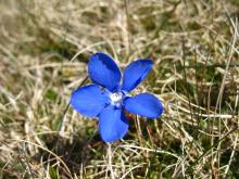
Spring Gentian

Spring gentian © NPAP/Elizabeth Pickett
Teesdale is a botanist’s paradise, but one plant stands out: the spring gentian. Spring gentians are best seen on warm, bright days, from April to early June. A sun worshipper, this little flower closes as the weather becomes dull, leaving nothing to see but small, dark-blue spikes. However the flowers quickly open again when the sun emerges from behind the clouds. Hidden among the short vegetation, spring gentians often go unnoticed, but when you do find them they stop you in your tracks with their startling deep-blue flowers. The flowers are typically 15 to 30mm across. Look out for a delicate plant with a solitary, intense-blue flower, like a tiny, five-pointed star. It is surprisingly small for a flower with such a big reputation! You can see gentians in flower from many public footpaths in Upper Teesdale. Please stick to the paths to protect these and other rare plants.
Location:
Car park at Forest-in-Teesdale.
Distance:
11 km
Terrain:
Boggy ground, Off road sections, On road sections
Area:
Access:
Facilities nearby
Recreation opportunities:
Download:

Tees Bank Flowers: Flowers and Ferns Holwick Head Bridge to High Force

This 0.45km (1/4 mile) walk beside the River Tees enters the Upper Teesdale National Nature Reserve and has a wealth of wildlife, including numerous plant species. Many are common British species and some belong to the ‘Teesdale Assemblage’ – a uniquely rich association of plants for which Upper Teesdale is famous. The plants included here are the larger flowering ones, trees and ferns that can be seen, at the appropriate time of the year (when they are flowering), from this well-used path. Not all will be in flower on one visit. The flowering times indicated are for the peak period. To prevent trampling on inconspicuous and perhaps rare plants it is advisable to keep to the path and already trampled areas; please do not extend them.
Location:
Starting from Bowlees Visitor Centre.
Distance:
0 km
Area:
Facilities nearby
Recreation opportunities:
Interests:

Tees Bank Flowers: Flowers and Ferns Wynch Bridge to Scorberry Bridge

This 0.9km (1/2 mile) walk beside the River Tees has a wealth of wildlife, including over 200 plant species. Many are common British species and twelve belong to the ‘Teesdale Assemblage’ — a uniquely rich association of plants for which Teesdale is famous. The plants included here are the larger flowering ones, trees and ferns that can be seen, at the appropriate time of the year (when they are flowering), from this well used path. Not all will be in flower on one visit. The flowering times indicated are for the peak period. To prevent trampling on inconspicuous and perhaps rare plants it is advisable to keep to the path and already trampled areas; please do not extend them.
Location:
Starting from Bowlees Visitor Centre.
Distance:
1 km
Terrain:
Off road sections, On road sections
Area:
Facilities nearby
Recreation opportunities:
Interests:

Tees Bank Flowers: Flowers between Wynch Bridge and Holwick Head Bridge

This 1.6km (1 mile) walk beside the River Tees has a wealth of wildlife, including over 200 plant species. Many are common British species and twelve belong to the ‘Teesdale Assemblage’ — a uniquely rich association of plants for which Upper Teesdale is famous. The plants included here are the larger flowering ones which can be seen, at the appropriate time of year (when they are flowering), from this well used path. Not all will be in flower on one visit. The flowering times indicated are for the peak period. To prevent trampling on inconspicuous and perhaps rareplants it is advisable to keep to the path and already trampled areas; please do not extend them.
Location:
Starting from Bowlees Visitor Centre.
Distance:
2 km
Terrain:
Off road sections, On road sections
Area:
Access:
Recreation opportunities:
Interests:

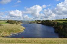
Teesdale Reservoir Walk

Hury Reservoir © NPAP/Beck Baker
This interesting walk takes in 3 of Northumbrian Waters reservoirs in Teesdale, with the opportunity to view another 3 reservoirs from the walks highpoint. The walk follows the Pennine Way from Grassholme Reservoir over moorland to reach the rocky flat-topped summit of Goldsborough Hill. Afterward you will descend to follow the shores of Hury and Blackton Reservoirs where you may see wigeon, common sandpiper and tufted duck. You will also pass by Meres beck meadow and Hannah’s meadow, which during the summer will be filled with beautiful wildflowers.
Location:
Car parks at the Northern end of the Balderhead Reservoir dam wall.
Distance:
13 km
Terrain:
Boggy ground, Off road sections, On road sections
Area:
Access:
Facilities nearby
Recreation opportunities:

Upper Teesdale (Hanging Shaw): North Pennine Birdwalks Walk 12
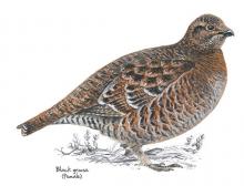
Black grouse © NPAP
Upper Teesdale is one of the best places to see waders in the breeding season and black grouse throughout the year. The wide expanse of the upper dale offers stunning views of the meadows and allotments and the imposing fells of Cronkley Scar and Widdybank. The River Tees is always impressive and there’s a chance of seeing birds such as dipper, goosander and oystercatcher.
Location:
Starting from the car park at Hanging Shaw, Forest-in-Teesdale (NY867297).
Distance:
7 km
Terrain:
Boggy ground, Off road sections, On road sections, Steep sections
Area:
Facilities nearby
Recreation opportunities:

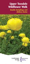
Upper Teesdale Wildflower Walk

Upper Teesdale walk  © The North Pennines AONB Partnership
A beautifully capturing circular walk from the parking area at Hanging Shaw will introduce you to some of the special plants of Teesdale in the North Pennines AONB and UNESCO Global Geopark and the wildlife that depend on them. Along the way you will discover plants that dance and others that keep insects captive. You might even see rare bees and long-distance visitors from Africa. The spring and summer months are the best time to enjoy this walk. May and June are the time of peak activity for wading birds with June to August being the prime time for wild Flowers.
Location:
The Start and finish is the Hanging Shaw Parking area in Upper Teesdale (NY867297).
Distance:
6 km
Terrain:
Off road sections
Area:
Access:
Recreation opportunities:
Interests:

Walks from Allendale Caravan Park

River East Allen © NPAP/Shane Harris
This set of 3 walks from Allendale Caravan Park showcase the distinct beauty and character of Allendale. On the walks you will pass through pretty hay meadows, see remnants of the areas lead mining past, encounter the abundant wildlife of the region and be exposed to the dramatic moorland landscapes on the fell above the town.
Location:
Starting from Allendale Caravan Park.
Terrain:
Boggy ground, Off road sections, On road sections
Recreation opportunities:

Wild North Discovery

Wild North Discovery © Wild North Discovery
Activities centred on discovery and exploration of the natural world. We offer bushcraft and survival skills (30 years experience and qualified to teach bushcrafts to groups through the Institute for Outdoor Learning), wild food foraging (as seen on TV with Robson Green), bird watching tours, wildlife & nature exploration activities including animal tracking, pond dipping and minibeast hunts for families, and greenwood crafts including pole lathe and willow basket weaving. Activities can be booked for a half or full day for two or more people either adult or family groups. Weekend and full week activities are also available.
Location:
Harehope Quarry Project - near Frosterley in Weardale. Activities are available at other sites in Weardale and Teesdale - see website for details
Terrain:
Boggy ground, Off road sections, Steep sections
Area: