Built heritage
People have been leaving their mark on the North Pennines landscape since the first inhabitants arrived approximately 10,000 years ago; most visibly through the construction of buildings and other structures.
This built heritage is important from a cultural and historical standpoint because it illustrates how our society has changed and evolved. There are many examples of built heritage that can be seen throughout the North Pennines AONB dating from the Bronze Age to the present. Some of our most impressive built heritage includes Epiacum Roman Fort, Muggleswick Grange and the village of Blanchland, which is built on the site of a medieval abbey.
Allen Banks & Staward Gorge: North Pennine Birdwalks - Walk 3
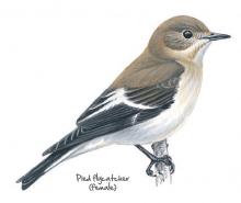
In spring and early summer the ancient woodland at Allen Banks and Staward Gorge bursts with the songs of birds such as the wood warbler and willow warbler, song thrush and wren. At quieter times of year these woods are still well worth a visit. In autumn the trees are a blaze of orange and yellow while rich clusters of fungi decorate the woodland floor. Even in winter, the activity of resident woodland birds provides a welcome contrast to the comparative quiet of the surrounding countryside.
Location:
The National Trust car park at Allen Banks and Staward Gorge (NY797641).
Distance:
5 km
Terrain:
Off road sections, Steep sections
Area:
Access:
Facilities nearby
Recreation opportunities:
Interests:
Link:
Allenheads Geotrail
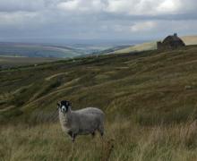
The landscape around Allenheads has been over 300 million years in the making. From tropical seas and deltas to minerals and miners – all have played their part in shaping this beautiful landscape. This 5km circular walk will introduce you to some of the special features of the landscape around Allenheads. By spotting clues in the moors, fields and buildings you’ll find out how to read the landscape and discover more about its fascinating past.
Location:
Starting from Allenheads car park (NY859453 / NE47 9HJ) in the East Allen Valley.
Distance:
5 km
Terrain:
Boggy ground, Off road sections, On road sections
Area:
Access:
Facilities nearby
Recreation opportunities:
Interests:
Link:
Download:
Blanchland
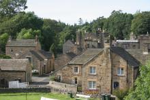
The small village of Blanchland, with its honey-coloured cottages, is perhaps the most attractive settlement in the North Pennines. Blanchland means 'white lands' - almost certainly a reference to the white habits (cloaks) of the Premonstratesian monks of the Abbey. The village has a tea room, shop, pub, childrens' playground and easy access walks.
Location:
Blanchland in the Upper Derwent Valley (NY966504).
Access:
Facilities nearby
Recreation opportunities:
Interests:
Link:
Blanchland Geotrail
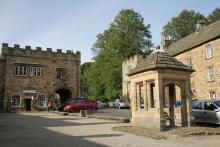
The landscape around Blanchland has been over 300 million years in the making. From tropical seas and deltas to glaciers, minerals and miners – all have played their part in shaping this beautiful landscape. This 6km circular walk will introduce you to some of the special features of the landscape around Blanchland. By spotting clues in the moors, fields and buildings you’ll find out how to ‘read’ the landscape and discover more about its fascinating past. The sections opposite give some background information about how the local rocks and minerals formed, and tell you a bit about the area’s mining heritage.
Location:
Starting from Blanchland car park (NY964504 / DH8 9TA - nearest).
Distance:
6 km
Terrain:
Boggy ground, Off road sections, On road sections, Steep sections
Access:
Facilities nearby
Recreation opportunities:
Interests:
Link:
Download:
Blanchland: Along the river bank (A trail of three tails!)
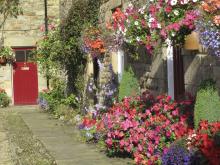
This short walk takes you from the village of Blanchland along the River Derwent to the hamlet of Baybridge and back. You'll walk back to Blanchland through lovely mixed woodlands and perhaps get a glimpse of the elusive Water Vole - if you're really, really lucky! The path may be wet and muddy in places and you will come across exposed tree roots.
Location:
Staring from Blanchland car park (NY964505).
Distance:
2 km
Terrain:
Boggy ground, Off road sections, On road sections
Access:
Facilities nearby
Recreation opportunities:
Interests:
Link:
Blanchland: North Pennine Birdwalks - Walk 5

This short walk from the attractive and historic village of Blanchland combines both woodland and river habitats. Birds such as coal tit, goldcrest and dipper are active throughout the year. During the breeding season, more elusive species such as the pied flycatcher and spotted flycatcher can also be seen. Blanchland is sited within the remains of a monastery founded by Premonstratensian Monks in the 12th century. The Lord Crewe Arms hotel was originally built as the Abbot’s lodge, guest house and kitchens of the Abbey.
Location:
Starting from the car park in Blanchland (NY964505).
Distance:
3 km
Terrain:
Boggy ground, Off road sections, On road sections
Access:
Facilities nearby
Recreation opportunities:
Interests:
Link:
Cardunneth Pike Open Access Walk
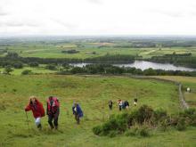
A classic ridge walk following the spine of Cumrew Fell, taking in two of the best viewpoints in the area. The route uses low level right of way for the outward journey, with a range of occupational tracks and desire lines tracks being used for the high level return leg. Part of return leg crosses open access land on a managed grouse moor, over which dogs are not allowed.
Location:
Starting from Castle Carrock village in the vicinity of The Weary Inn.
Distance:
18 km
Terrain:
Boggy ground, Off road sections
Access:
Recreation opportunities:
Interests:
Download GPX file:
East Allen Valley Wildflower Walk
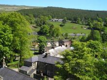
A lovely 5.5 mile (9km) walk from Allenheads exploring the wonderful wildlife of wildflowers in the East Allen Valley. This circular walk will introduce you to some of the special plants of the North Pennines and the creatures that depend on them. Along the way you'll discover plants that are adapted to the harsh conditions of the area and get a bee's-eye view of finding food.
Location:
Allenheads parking area
Distance:
9 km
Terrain:
Boggy ground, Off road sections, On road sections
Area:
Access:
Facilities nearby
Recreation opportunities:
Interests:
Link:
Download:
Eden Outdoor Adventures
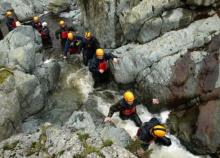
Eden Outdoor Adventures is a small, friendly, family company run by Ian and Melanie. We provide tailor made courses for individuals, families and groups. We believe that by tailor making your course we can offer quality instruction and guiding with the personal touch, allowing people to get the most out of their time with us.
We work hard to understand your needs and to design days to offer a challenge and to make your dreams come true. To help do this, Eden Outdoor Adventures draw upon a great deal of knowledge and experience from working in the outdoors and the areas in which we operate. They also hold National Qualifications in the activities we offer to ensure you the highest standards. We offer half day to multiple day trips in the Lake District, Eden Valley, Northern Pennines, Scotland and Wales as well as further afield. From guided tours, low level family walks through wooded valleys, introductory climbing and canoeing to demanding mountain and river trips in wild places. Wherever your dreams take you, let Eden Outdoor Adventures help make them come true.
Location:
Ousby, Penrith, Cumbria.
Recreation opportunities:
Interests:
Link:
Epiacum Roman Fort
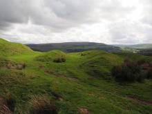
At 330m (1050ft) above sea level, Epiacum (Whitley Castle) is the highest stone-built Roman fort in Britain. It housed a garrison of about 500 men, and was probably built to control mining for lead and silver. Although we have yet to discover evidence for Roman mining in the North Pennines, archaeologists agree that it must have taken place here. The Roman road known as the Maiden Way (between the forts at Kirkby Thore, in the Eden Valley, and Carvoran, on Hadrian’s Wall) passes close by the Fort. A trail leaflet is available at the car park (1 hour, rough terrain)
Location:
Epiacum Roman Fort is in the South Tyne Valley three miles north of Alston / 3 miles south of Slaggyford. It can be accessed either from the Pennine Way which passes alongside it or from a small car parking area (honesty box donations) below the Fort on the A689.
Terrain:
Off road sections, Steep sections
Access:
Recreation opportunities:
Interests:
Link:
Epiacum Roman Fort (aka Whitley Castle): Alston through the ages
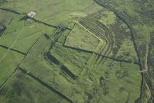
This historic walk takes you from Alston along the Pennine Way up to the Roman Fort at Whitley Castle (Epiacum Roman Fort). If you are keen to walk and discover more, the route continues past Kirkhaugh church to Alston. After the church you can: Carry on the full route to Alston. Go back to Kirkhaugh station and walk back along the railway; Have a cup of tea on board and ride the train to Alston
Location:
Starting from the South Tynedale railway car park in Alston (NY716467).
Distance:
12 km
Terrain:
Off road sections, On road sections
Access:
Facilities nearby
Recreation opportunities:
Interests:
Link:
Download:
Garrigill Round
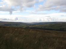
This is an easy circular afternoon walk along the banks of the River South Tyne between the small village of Garrigill and the market town of Alston in the North Pennines Area of Outstanding Natural Beauty. The area is rich in mineral and in particular lead deposits, and mining over the centuries has heavily influenced the landscape. At its peak Garrigill was home to 1000 people mainly employed in the lead mining industry. Now its population is around 200. The village name was originally Gerard’s Gill (gill being the Norse word for a steep sided valley).
Location:
Starting from the green in Garrigill.
Distance:
14 km
Terrain:
Boggy ground, Off road sections, On road sections
Access:
Facilities nearby
Recreation opportunities:
Interests:
Download:
Garrigill: North Pennine Birdwalks - Walk 10
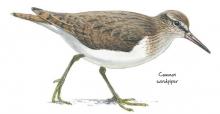
The South Tyne is a narrow, fast flowing river as it tumbles north from the village of Garrigill. Travelling along its bank, this walk offers you the chance to see species such as common sandpiper, oystercatcher and grey wagtail. The surrounding fields abound with breeding waders during spring and summer and during winter large flocks of fieldfare and redwing may be seen.
Location:
Starting from a small parking area in Garrigill next to the red phone box (NY745416)
Distance:
9 km
Terrain:
Boggy ground, Off road sections, On road sections
Access:
Recreation opportunities:
Interests:
Link:
Hannah's Meadow Nature Reserve
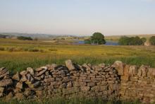
Hannah's Meadow Nature Reserve has some of the least improved and species rich upland hay meadows in upper Durham. The meadows were previously farmed by Hannah Hauxwell, who managed the meadows using traditional methods that avoided adding artificial fertilizers or reseeding. By doing so the species rich habitat hay meadow habitat that evolved over centuries was maintained. When Hannah retired in 1988 Durham Wildlife Trust purchased her farm and they now manage it as a nature reserve. An unmanned visitor centre at the site provides information about Hannah and her special meadows. Note facilities are located at Balderhead Reservoir car park.
Location:
From Barnard Castle follow the B6277 to Romaldkirk and then follow the Balderhead road via Hunderthwaite. The reserve is adjacent to the public road a 1.5 mile east of the Balderhead Reservoir car park. The Pennine Way footpath runs through the reserve. The grid reference refers to the Balderhead Reservoir car park.
Distance:
2 km
Terrain:
Off road sections, On road sections
Area:
Access:
Recreation opportunities:
Interests:
High House Chapel
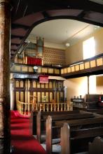
Historic Methodist Chapel - High House Chapel, Ireshopeburn, is the oldest purpose built Methodist chapel in the world to have been in continuous weekly use since it was built in 1760. Writing in his book England’s Thousand Best Churches Simon Jenkins said “This is the country where the fires of Methodism took hold, fanned by an absentee Anglicanism. There are many chapels in these parts, many are early and handsome and Ireshopeburn is the best.” His chapel and society in Weardale became one of John Wesley’s favourites and the story of Methodism is well told in the folk museum next door. The chapel is open to the public during museum hours 2-5pm, Wed-Sunday, May 1st - October 31st and every afternoon in August. Also Easter and bank holidays. Services are held every Sunday at 10.45am
Location:
Ireshopeburn, Co. Durham, DL131HD.
Area:
Access:
Facilities nearby
Recreation opportunities:
Interests:
Howden Burn (Weardale): North Pennine Birdwalks - Walk 13
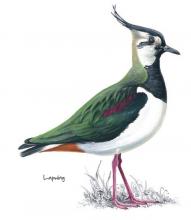
Passing through grassland and up onto heather moorland, this walk provides splendid views across the open uplands and down to the Bollihope Burn. It is a fine area to watch wading birds during the breeding season when the air is filled with their songs and displays. Redstart, great spotted woodpecker, tits and warblers can also be seen or heard in the riverside woodland.
Location:
Starting on short turf at roadside beside the Bollihope Burn (NZ005349).
Distance:
3 km
Terrain:
Boggy ground, Off road sections, On road sections
Area:
Access:
Recreation opportunities:
Interests:
Link:
Ireshopeburn (Weardale): Hay Time Walk 2
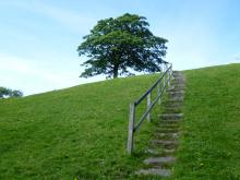
Take a 2 hour walk in Weardale, a landscape that has been farmed and mined for centuries. This five kilometre walk close to Ireshopeburn crosses some beautiful meadows, with superb views of the surrounding moorland and villages in the dale below. The best time to go is between April and August to catch the wildflowers in full bloom. It is still a worthwhile walk outside of these times due to presence of late blooming flowers can be seen in mid Autumn and wading birds in the Spring.
Location:
The walk starts in the village of Ireshopeburn in Weardale (NY866386).
Distance:
5 km
Terrain:
Boggy ground, Off road sections, On road sections
Area:
Access:
Recreation opportunities:
Interests:
Link:
Killhope Lead Mining Museum
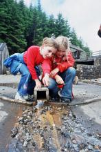
A visit to Killhope, the award winning North of England Lead Mining Museum, is a unique and unforgettable experience. Killhope is a fully restored nineteenth century Victorian lead mine, where you can experience for yourself the life and work of the lead mining families of the Pennine dales. Our enthusiastic and knowledgeable staff are here to help you get the most from your visit; they are what make Killhope a multi award wining venue. Killhope is famous for its huge working waterwheel, but there is much more to Killhope. You can experience the mineshop where miners lived. You can work as a 'washerboy' looking for minerals and galena (which is the lead ore). You can see the working machinery (which Fred Dibnah admired so much) in the 'jigger house'. But above all, Killhope's award-winning mine tour is unique. From the moment you put on your hard hats, cap-lamps and wellingtons, your visit becomes an unforgettable adventure! Killhope holds the largest collection of Spar Boxes which sits alongside Magnificent Minerals and the Pennine Jewels. Two permanent commissions, Letters of Lead and Language of Lead, part of museumaker, a prestigious national project. We also have an array of art works and installations which adorn our visitor centre and site. You can stroll round Killhope's woodland paths (maybe with a nature backpack). You will see some wildlife and red squirrels. Take a break in Killhope Cafe and sample our wonderful home made soups, pasties and cakes. Our gift shop stocks a wide range of books, maps, keepsakes and souvenirs. Killhope - a great day out in the country for all the family!
Location:
Near Cowshill, Upper Weardale, Co. Durham, DL13 1AR.
Terrain:
Steep sections
Area:
Access:
Facilities nearby
Recreation opportunities:
Interests:
Nenthead Mines
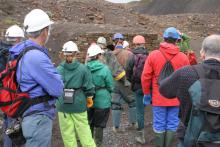
Nenthead Mines is an important historic place at Nenthead, near Alston, in Cumbria, UK. This remote valley is covered by remains from the lead and zinc mining industry of the North Pennines, including mine entrances, dumps and old buildings. The site includes a geology Site of Special Scientific Importance and is notable for rare lichens and plants growing on the metal-rich mine dumps. Most of the valley is a National Ancient Monument. The conserved buildings on the site include a small museum and interpretation display and there is a network of paths and trackways. Carrs Mine is an old lead and zinc mine which is open to visitors on special days. Guided trips into the mine are arranged on Open Days. The Nenthead Mines Conservation Society is working with Cumbria County Council to care for, manage and maintain this historic site. Most of the valley is owned by Cumbria County Council and is managed on their behalf by the Society.
Location:
Nenthead Mines is located in the village of Nenthead in the Cumbrian North Pennines
Terrain:
Boggy ground, Off road sections, Steep sections
Access:
Facilities nearby
Recreation opportunities:
Interests:
Link:
Newbiggin and the Carriers’ Way
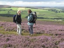
This leaflet is one of a series designed to help you discover the treasures of Blanchland - both natural and man-made. This attractive walk takes you from Blanchland, along the River Derwent, up on to open moorland. The moorland is exposed and can experience harsh weather. The wild landscape surrounding Blanchland bustles with evidence of people, from Mesolithic hunters to lead miners and modern land managers. Everywhere you look you see the imprint of our ancestors. Many landscape scars have been hidden by nature and it is hard to believe that in the not-so-distant past this quiet landscape was once home to major industry.
Location:
The walk starts from Blanchland car park (NY964505)
Distance:
14 km
Terrain:
Boggy ground, Off road sections, On road sections
Access:
Facilities nearby
Recreation opportunities:
Interests:
Download:
Ninebanks Tower
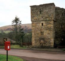
The turbulent days of the Border Reivers are evoked by Ninebanks Tower. The sandstone tower is all that remains above ground of a large medieval house, to which the tower seems to have been added in about 1520. The four storey tower has inverted shields on a second floor window lintel which possibly relate to Sir Thomas Dacre (1515 – 1526), the ruler of Hexhamshire. Ninebanks is not classed as a defensible structure because the walls are considered too thin; it may have served as a lookout.
Location:
Ninebanks village.
Terrain:
On road sections
Access:
Recreation opportunities:
Interests:
Open access walks in Cumbria: Cold Fell
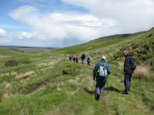
Marking the northern end of the Pennine Chain, the aptly named Cold Fell is also the most northerly mountain in Cumbria. Although this route is relatively short, it is a serious undertaking with a steep ascent and descent, coupled with terrain that is usually wet and hard going throughout the year. Nevertheless it’s still a fine walk which is full of interest with excellent views across the Border region.
Location:
Starting from car park beyond Clesketts near Hallbankgate.
Distance:
11 km
Terrain:
Boggy ground, Off road sections, On road sections, Steep sections
Access:
Recreation opportunities:
Interests:
Download GPX file:
Open access walks in Cumbria: Geltsdale
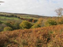
A good walk for days when the cloud is low, favouring a lower level circuit of the picturesque Geltsdale without the need to venture too high up. Discover remnants of the valley’s industrial past, whilst savouring the delights of her wildlife and scenery of this now tranquil Valley.
Location:
Starting from the parking verge at Jockey Shield near Castle Carrock.
Distance:
10 km
Terrain:
Off road sections
Access:
Recreation opportunities:
Interests:
Download GPX file:
Open access walks in Cumbria: North Pennine Ridge (Northern Section)
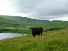
A classic moorland traverse across wild terrain with hardly a discernable path for most of the way makes this a true wilderness experience. The ridge-top fence serves as a comforting navigational aid whilst you savour the solitude, tranquillity and open grandeur of this seldom frequented part of the county. This linear route is a serious undertaking in any weather, and to help with navigation it is described in both directions.
Location:
Starting from Hartside Café off the A686 between Alston and Melmerby.
Distance:
21 km
Terrain:
Boggy ground, Off road sections
Access:
Recreation opportunities:
Interests:
Download GPX file:
Open access walks in Cumbria: Talkin Fell
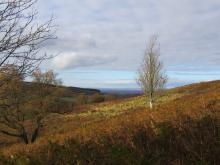
This short walk is ideal for those with a few hours to spare, and serves as a perfect introduction to open access. The route follows excellent public rights of way, and distinct desire lines once you venture onto the access land. On a clear day the panorama from the top of Talkin Fell is probably one of the best you’ll get for the effort involved in getting there.
Location:
Starting from the parking verge at Jockey Shield near Castle Carrock.
Distance:
7 km
Terrain:
Off road sections
Access:
Recreation opportunities:
Interests:
Download GPX file:
Open access walks in Cumbria: Thack Moor and Black Fell
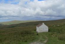
One of the more serious undertakings, this routes ventures onto the main North Pennine ridge, via the outlying top of Thack Moor. Tranquillity, solitude and a sense of moorland grandeur is guaranteed on the first section. A much deserved break at Hartside Café is recommended, before the return leg to Renwick following public rights of way on good tracks and paths.
Location:
Starting from Townhead, at the northern end of Renwick village towards the parish church. Roadside parking is available at the church.
Distance:
17 km
Terrain:
Boggy ground, Off road sections, On road sections
Access:
Recreation opportunities:
Interests:
Download GPX file:
Over the hill to Cowbyre Farm
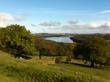
This is a varied walk that begins with a climb up from the village of Blanchland. The walk passes through woodland and pasture with magnificent views of the Derwent Valley and Edmundbyers Common, finally dropping down to the river and returning to the village.
Location:
Staring from Blanchland car park.
Distance:
6 km
Terrain:
Off road sections, On road sections
Access:
Facilities nearby
Recreation opportunities:
Interests:
Download:
Raby Castle
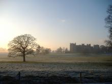
Home to Lord Barnard's family since 1626, Raby is one of the finest medieval Castles in England. Built by the mighty Nevill family in the 14th Century, Raby remained in the Nevill family until 1569 when after the failure of the Rising of the North, the Castle and its lands were forfeited to the Crown. In 1626, Sir Henry Vane the Elder purchased Raby and the Castle has remained in the Vane family ever since. Highlights include an impressive gateway, a vast hall, a medieval kitchen and a Victorian octagonal drawing room. The rooms display fine furniture, artworks and elaborate architecture. Enjoy the deer park, walled gardens and carriage collection. Sample the menu in the stable tearooms. Events take place throughout the summer.
Location:
Staindrop, Barnard Castle, Co. Durham, DL2 3AH
Area:
Access:
Recreation opportunities:
Interests:
Link:
RSPB Geltsdale Walking Trails
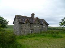
Set in the beautiful North Pennines AONB, Geltsdale is home to black grouse, birds of prey and breeding wading birds and is ideal for walking. There are 4 way marked trails leading from the car park of Howgill. The Stagsike trail will take 1-2 hours to walk and the other trails a little longer. Stagsike Cottages are approximately a 40 minute walk from the parking area and provide an information point and toilets. Many of the trails are on existing tracks but boots are essential for much of the year and waterproofs are recommended. There is no general vehicle access to Stagsike Cottages but disabled access can be pre-arranged by phoning the reserve (01697 746717). Trails are open at all times and the information point is open between 9am and 5pm. Dogs are welcome but they should be kept on a lead as the reserve is a working farm. A bus services the village of Hallbankgate, which is approximately a mile away.
Location:
Starting from Clesketts car park (NY588584), near Hallbankgate.
Terrain:
Boggy ground, Off road sections, On road sections
Access:
Facilities nearby
Recreation opportunities:
Interests:
Link:
Download:
St John's Chapel: Farming, Mining and Methodism
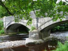
This walk traces the history of three neighbouring villages Daddry Shield, St Johns Chapel and Ireshopeburn. From their origins as farming settlements, through to the expansion of the mining industry in the mid 19th Century and the associated rises in population and conversion of locals to Methodism, this region has witnessed dramatic changes which have left their mark on the landscape of the upper dale. This walk tells the story of these developments while pointing out historic buildings and events associated with them.The walk was devised and described by volunteers of The Weardale Museum (www.weardalemuseum.co.uk), Ireshopeburn, where much more information can be found.
Location:
Starting from the Weardale Inn or St John Chapel Cattle Market car park.
Distance:
11 km
Terrain:
Boggy ground, Off road sections, On road sections, Steep sections
Area:
Access:
Recreation opportunities:
Interests:
Take a walk in the woods…
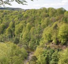
The North Pennines conjures up images of purple heather covered moors, lead mining remains and remote dales where traditional ways of farming still survive. But there are delightful pockets of woodland to explore too. At the National Trust property at Allen Banks and Staward Gorge you’ll find the largest concentration of woodlands in the North Pennines AONB. This woodland has 5 trails of varying length allowing you to experience the wonders of this woodland whatever your level of fitness.
Location:
Starting from either the National Trust car park at Allen Banks or Haydon Bridge.
Terrain:
Off road sections, On road sections, Steep sections
Area:
Access:
Facilities nearby
Recreation opportunities:
Interests:
Download:
The Garden Station
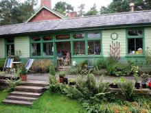
Originally a country railway station on a line running through the Langley woods, this garden is a beautiful and tranquil place. The Garden Station sells perennial plants throughout the summer. There are also artwork displays inside and outside the station and a wonderful fairtrade café. A woodland walk was created in 2003 along the old railway track between two arched bridges and it is bordered by plants which thrive in woodland conditions. A wide range of art and craft and sustainable living courses are available from the station throughout the year.
Location:
Langley on Tyne, Hexham, Northumberland, NE47 5LA
Terrain:
Off road sections
Area:
Access:
Recreation opportunities:
Interests:
Link:
Tow Law, Thornley & Harperley
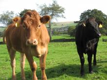
The walk starts from the track through Barracks Farm (probably the oldest building in Tow Law), following tracks, over fields and pasture and crossing stiles and gates along the way. The route descends gradually from 1000ft above sea level at Tow Law to 400ft at Low Harperley where it links up with the Weardale Way.
Location:
Starting from Barracks Farm in Tow Law.
Distance:
5 km
Terrain:
Off road sections, On road sections
Area:
Access:
Facilities nearby
Recreation opportunities:
Interests:
Download:
Tyne Train Trails -Corbridge to Hexham
This 9km walk between the stations of Corbridge and Hexham is along riverside and woodland paths and tracks, with some road walking mainly in Hexham. The walk crosses the railway line and is not boarded. Please take care! Note Corbridge town centre is over the bridge across the River Tyne.
Location:
Starting from Corbridge train station.
Distance:
9 km
Terrain:
Off road sections, On road sections
Access:
Facilities nearby
Recreation opportunities:
Interests:
Download:
Tyne Train Trails: Hexham to Haydon Bridge
This 17km walk between the stations of Hexham and Haydon Bridge includes field and woodland paths with some sections on minor roads. This is a long walk with some steep climbs. Hexham has a full range of shops and services while Haydon Bridge has some shops, a post office and pubs.
Location:
Starting from Hexham train station.
Distance:
17 km
Terrain:
Off road sections, On road sections, Steep sections
Access:
Facilities nearby
Recreation opportunities:
Interests:
Walking around Wolsingham
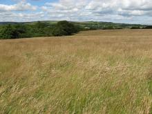
There are many interesting walks leading from the historic town of Wolsingham. These lead to quarries, farms, shafts, mills, and mark out an intricate pattern of journeys to work made over hundreds of years by generations of the people working in Weardale.
Location:
Starting from Wolsingham Railway Station.
Terrain:
Off road sections, On road sections
Area:
Access:
Facilities nearby
Recreation opportunities:
Interests:
Download:
Waterfalls and wildlife walk: Moor House-Upper Teesdale NNR
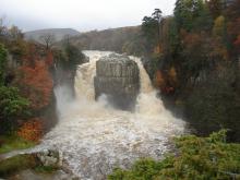
This walk follows the banks of the River Tees from Low Force, through the juniper woods up to High Force waterfall. Here you can turn round and follow the same route back or continue further upriver and follow the lower slopes of Holwick Fell to return. On the backbone of England, around the headwaters of the River Tees, 8,800 hectares of upland country forms the Moor House–Upper Teesdale National nature Reserve (NNR). The reserve encompasses an almost complete range of upland habitats typical of the North Pennines, from lower lying hay meadows, rough grazing and juniper woods to limestone grassland, blanket bogs and the summit heaths of the high fells. Nowhere else in Britain is there such a diversity of rare habitats in one location. The remote and dramatic landscape of the reserve can be enjoyed from the Pennine Way National Trail, the Public Rights of Way network and on Open Access land.
Location:
Starting from Bowlees Visitor Centre car park (NY906282) in Upper Teesdale.
Terrain:
Off road sections, On road sections, Steep sections
Area:
Access:
Facilities nearby
Recreation opportunities:
Weardale Museum
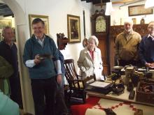
“Outstanding Volunteer Run Museum” – but don’t take our word for it, this is the verdict of Renaissance North East and the Arts Council for England who have also awarded the museum full accreditation. This small folk museum is packed with fascinating stories from the past including a hands on lead-miner’s kitchen and The Weardale Tapestry, a beautiful 16 foot free-style embroidery depicting Weardale’s history. The Museum houses a truly amazing genealogy resource which can print out family trees for those with Weardale ancestry. Visit also the historic and beautiful High House Chapel, the oldest Methodist Chapel to have held continuous weekly services since it was built in 1760, and one of John Wesley’s favourite chapels. Open 2-5pm, Wed-Sunday, May 1st - October 31st and every afternoon in August. Also Easter and bank holidays.
Location:
Ireshopeburn, Co. Durham, DL13 1HD.
Area:
Access:
Facilities nearby
Recreation opportunities:
Interests:
Link:
Weardale Railway
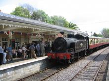
The Weardale Railway runs from Stanhope to Bishop Auckland and stations in between. The railway runs a heritage timetable and has a number of special events through the year, including steam services. There is a ticket office, café and shop at Stanhope Station.
Location:
Stanhope
Area:
Access:
Facilities nearby
Recreation opportunities:
Interests:
Link:


