Horse riding

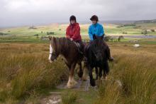
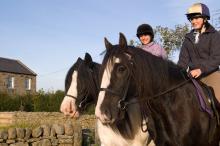
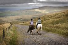
The North Pennines offers a range of opportunities for horse riding, from leisurely guided pony rides for beginners, to technical upland hacks across historic packhorse trails for the more experienced.   

Discover our networks of bridleways and quiet lanes rom the saddle. One of the best ways to enjoy horse riding in the North Pennines is through one of the area's six riding centres. These centres offer riding lessons and pony and horse trekking.

Our five 'do in a day' Packhorse Trail routes are ideal if you want to ride with confidence in the exhilarating landscapes of the North Pennines. The routes have been developed to help you to explore the area on horseback along some of our oldest networks, including improvements in surfacing, water crossings and gates, with horse riders in mind. The Packhorse Trails guidebook can be bought from the AONB Partnership office.


Alston Packhorse Trail - Horse
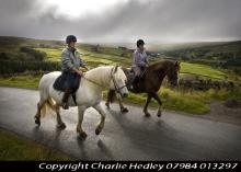
Riding the Alston Packhorse Trail © NPAP/Charlie Hedley
This 29km (912m of ascent) circular horse riding route (30% off-road) starts and finishes in Nenthead. You’ll travel through a landscape rich with echoes of the area’s lead mining past. Passing through the small town of Alston and the villages of Nenthead and Garrigill, as well as over the high moors, it’s a route of contrasts.
Location:
Starts and finishes at Nenthead Mines car park (NY781436 / CA9 3NR - nearest).
Distance:
29 km
Terrain:
Boggy ground, Off road sections, On road sections, Steep sections
Facilities nearby
Recreation opportunities:

Baldersdale Packhorse Trail - Horse

Baldersdale Packhorse Trail © Natural England/Charlie Hedley
This circular 18km (60% off-road) horse riding trail has 370m of ascent and starts from the south side of Hury Reservoir. It initially follows the banks of Hury and Blackton Reservoirs in remote Baldersdale, before striking off over the moors on the Pennine Way.
Location:
Starts and finishes from the Northumbrian Water car park on the south side of Hury Reservoir (NY966192 / DL12 9UP - nearest).
Distance:
18 km
Terrain:
Boggy ground, Off road sections, On road sections, Steep sections
Area:
Access:
Recreation opportunities:

Barnard Castle to Middleton-in-Teesdale: Taste Trail

Tees Railway path © NPAP/Shane Harris
This route (walk, cycle, horse ride) takes you along the old railway line that serviced the stone quarrying industry in Teesdale. The route start is close to Barnard Castle, although you can pick it up at a number of points along to way - splitting it into shorter sections. This guide has been written as a linear route but if you choose to walk it is possible to make shorter circular walks connecting up with other footpaths including the Teesdale Way. The majority of the path is along the old railway line. The section of the railway line from Barnard Castle to Middleton-in-Teesdale was built by the Tees Valley Railway company during 1868 with stops at Cotherstone, Mickleton and Romaldkirk. There are two major engineering features on the line the Lunedale and Baldersdale Viaducts, you will pass over both these on this route. The decline of this section of railway started in the late 1950s and the line was earmarked for closure as part of the Beeching cuts with the last train running in April 1965.
Location:
Starting from Deepdale aqueduct layby on the B6277 outside Barnard Castle.
Distance:
16 km
Terrain:
Off road sections, On road sections
Area:
Recreation opportunities:

Blanchland Packhorse Trail - Horse

Blanchland Packhorse Trail © NPAP/Charlie Hedley
This 21km circular horse riding route is 70% off-road and enjoys 1,027m of ascent. It starts at Baybridge, close to the village of Blanchland. You’ll follow the Carriers’ Way across Bulbeck Common, alive with the evocative calls of wading birds in the spring and early summer.
Location:
Starts and finishes in the Baybridge car park (NY957499 / DH8 9UB - nearest).
Distance:
21 km
Terrain:
Boggy ground, Off road sections, On road sections, Steep sections
Access:
Recreation opportunities:

Derwent Reservoir - Walks, rides and wildlife

Derwent Reservoir © NPAP/Shane Harris
Derwent Reservoir is within the North Pennines AONB and, after Kielder, is the second largest reservoir in the region. There is a multi-user path from Pow Hill Country Park (south shore) to the dam at the eastern end of the reservoir and then round the north shore to Millshield Picnic Area. You can find out more about the reservoir, its wildlife and its history as you go, on foot or by bike. Cyclists can make a longer circular route around the reservoir by combining the shore path with local roads.
Location:
Derwent Reservoir is in the north-eastern part of the North Pennines AONB, between Blanchland and Edmundbyers - the south shore is in County Durham and the north shore is in Northumberland. Start from Pow Hill Country Park (NZ011517 / DH8 9NU - nearest) or Millshield Picnic Area (NZ013532 / DH8 9PT - nearest).
Distance:
3 km
Facilities nearby
Interests:

Discover Mid Teesdale - routes to walk, cycle and ride

Walking the Tees Railway Path © NPAP/Shane Harris
Mid Teesdale sits between the two market towns of Middleton and Barnard Castle. The River Tees meanders its way through this beautiful dale, which is surrounded by the high moorland of the North Pennines. The area has a wealth of history and nature waiting to be explored, with attractive villages from which to base your visit. This publication will help you to discover the area and its main settlements at a leisurely pace, with six routes for walking, cycling and horse riding.
Location:
Routes starting from either Mickleton (NY967233 / DL12 0JN - nearest) and Middleton-in-Teesdale (NY947254 / DL12 0SH).
Terrain:
Boggy ground, Off road sections, On road sections
Area:
Facilities nearby
Recreation opportunities:

Hamsterley Forest

Hamsterley Forest © NPAP/Louise Taylor
County Durham's largest forest is a mixture of woodland, meadows and forest. There are excellent walking, cycling and horse riding trails for all abilities. The forest also has a childrens' adventure playground, tea room, cycle hire, shop and downhill mountain bike course.
Location:
Hamsterley Forest (NZ091312 / DL13 3QH).
Terrain:
Boggy ground, Off road sections, On road sections, Steep sections
Area:

Hamsterley Packhorse Trail - Horse

Hamsterley Packhorse Trail © NPAP/Charlie Hedley
This 26km horse riding route is 75% off-road and you'll climb 846m. It's a ride of contrasts - in the forest and out over the open moor. You’ll follow an old drove road on the return to the forest from Eggleston.
Location:
Starts and finishes from the Grove car park in Hamsterley Forest (NZ064297).
Distance:
26 km
Terrain:
Boggy ground, Off road sections, On road sections, Steep sections
Area:
Access:
Facilities nearby
Recreation opportunities:

Hartside Packhorse Trail - Horse Riding
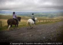
Hartside Packhorse Trail © NPAP/Charlie Hedley
This 11km horse riding route starts and finishes from Hartside Top Cafe - it's 75% off-road and packs in 458m of ascent! A dramatic ride from the Pennine escarpment down into the Eden Valley and back up to the top again!
Location:
Starts and finishes from Hartside Top car park (NY646418 / CA9 3BW - nearest).
Distance:
11 km
Terrain:
Boggy ground, Off road sections, On road sections, Steep sections
Access:
Facilities nearby
Recreation opportunities:

Mickleton - Romaldkirk Moor

Walking the Teesdale Railway Path © NPAP
This 11km circuit from Mickleton is suitable for walkers, cyclists and horse riders. It was published as route 5 in the Discover mid Teesdale leaflet (2007).
Location:
The route starts from the Mickleton Station car park (NY967233 / DL12 0JN).
Distance:
11 km
Terrain:
Boggy ground, Off road sections, On road sections, Steep sections
Area:
Access:
Facilities nearby
Recreation opportunities:
Interests:

Sinderhope Pony Trekking Centre

Sinderhope Pony Trekking © NPAP/Charlie Headley
The Sinderhope Pony Trekking Centre is based on a traditional working hill farm in Northumberland which is surrounded by miles of beautiful moorland. The Centre offers treks of various lengths to suit all abilities, riding over moorland and through dales on our cobs and native type ponies. Lessons last 30 minutes or 50 minutes and they are taught in the indoor arena which provides a safe, enclosed and dry environment, with horses and ponies to provide a range of sizes, types and temperaments to suit everyone from the complete beginner to the competent rider. Canters are arranged for the more experienced rider, while basic instructions and support are offered to the nervous or novice rider. We also provide private trekking for individuals or groups if you would like to go out on your own with one of our guides, these sessions are subject to availability.
Location:
High Sinderhope, Sinderhope, Allendale, Northumberland, NE47 9SH.
Terrain:
Off road sections, On road sections
Facilities nearby
Recreation opportunities:
Interests:

Teesdale Railway Path

Walking the Teesdale Railway Path © NPAP/Shane Harris
This 10km route runs from Lonton west (near Middleton-in-Teesdale) to Cotherstone and provides an excellent way to discover Teesdale. The Tees Valley Railway was the remnant of a scheme for a line from Barnard Castle to Alston. It was opened in 1868 by an independent company and was taken over by the North East Railway in 1882. The line closed in 1964 and is now a fabulous way to explore Teesdale on foot, cycle or horseback. There are amazing views along the entire route, passing picturesque villages and a patchwork of fields, dry-stone walls and mature hedgerow.
Location:
The route runs between Lonton west (NY951245 / DL12 0PL - nearest) and Cotherstone (NZ011192 / DL12 9QU - nearest). The closest parking is in Middleton and Cotherstone, respectively.
Distance:
10 km
Terrain:
Off road sections
Area:
Recreation opportunities:
Interests:

Waskerley and Lanchester Way: Taste Trail

Running on the Waskerley Way © Shane Harris
This route (walk, cycle, horse ride) follows the Lanchester Valley and Waskerley Way Railway Paths, climbing from the pleasant pastoral landscape near Durham to the rugged heather covered Stanhope Moor. The route is excellent for walkers, cyclists and riders, with its easy to follow, car-free sections. Wonderful wildlife, fascinating history and spectacular views are all on offer on this gem of a trail. You can approach this linear route starting in either direction and can tailor the length to suit your own requirements. In this leaflet we have made suggestions for three sections of varying lengths along the route. From Durham to Stanhope, this route starts at Broompark, near Neville’s Cross in Durham and follows mainly dedicated paths along old railway tracks for 22 miles to Parkhead above Stanhope, in Weardale. There are a number of great places along the way to stop for a bite to eat and a brew. Lanchester and Consett are also good places to join the route and it can be done in shorter sections. This route is accessible to all users.
Location:
Starting from the Durham County Council car park at Broompark (NZ250415), Durham.
Distance:
34 km
Terrain:
Off road sections, On road sections
Access:
Recreation opportunities:
Interests:

Waskerley Way Railway Path

Waskerley Reservoir © NPAP/Shane Harris
The Waskerley Way is a 16km route running from Parkhead Station above Stanhope in Weardale to Lydgetts Junction, Consett (where is joins with the Lanchester Valley Railway Path, the Derwent Walk Railway Path and the Consett to Sunderland cycle route). It's a beautiful route passing through a varied landscape; from urban fringe through to upland sheep farms and then on to glorious heather moorland. It's suitable for walkers, cyclists, horse riders and wheelchair users. Hownsgill Viaduct towers 46m above the tree canopy of Knitsley and High House Woods near Lydgetts Junction. This is one of the most impressive railway structures in North East England. From further up the Railway Path there are stunning views across Smiddy Shaw, Waskerley and Hisehope Reservoirs.
Location:
The routes runs from Park Head Station, above Stanhope, Weardale (NZ002431 / DL13 2ES) to Lydgetts Junction, Consett (NZ098492 / DH8 9AA).
Distance:
16 km
Terrain:
On road sections
Area:
Facilities nearby
Recreation opportunities:
Interests: