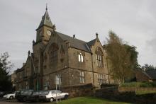
This major, 56km-long, road cycling circuit will take most people a full day to complete as it tackles a number of major hills and a good level of fitness is needed. With lots of steep ups and lots of steep downs on a route which offers fantastic panoramic views of the wild and wonderful North Pennines AONB and UNESCO Global Geopark. Strenuous grade requiring fitness and stamina but what a circuit! Alston developed at the cross roads of major trans-Pennine routes - as a service centre and busy lead mining town. Many of its cobbled streets and the market cross still survive. Distinctive ‘bastle’ derived houses can be seen throughout the town with stone steps up to first floor level. Today the parish of Alston Moor is a thriving community of 2,000 people. When it was at the heart of the world’s largest lead producing area, however, its population was five times greater! Please note that the original leaflet was produced and printed in 2005. The routes are still valid but some of the information (e.g. refreshments and facilities) might be out of date.

Location:
Starting from the centre of Alston (NY718465 / CA9 3QN) in the Cumbrian North Pennines.
Distance:
56 km
Terrain:
- On road sections
- Steep sections
Area:
Access:
- Car parking
- Cycle parking
- Public transport
Interests:
Facilities nearby:
- Accessible toilets
- Cafe
- Playground
- Pub
- Shop
- Toilets


